MA012-alb-AffectedPop-20100112-A3-v2-300dpi.jpg
From the dataset abstract
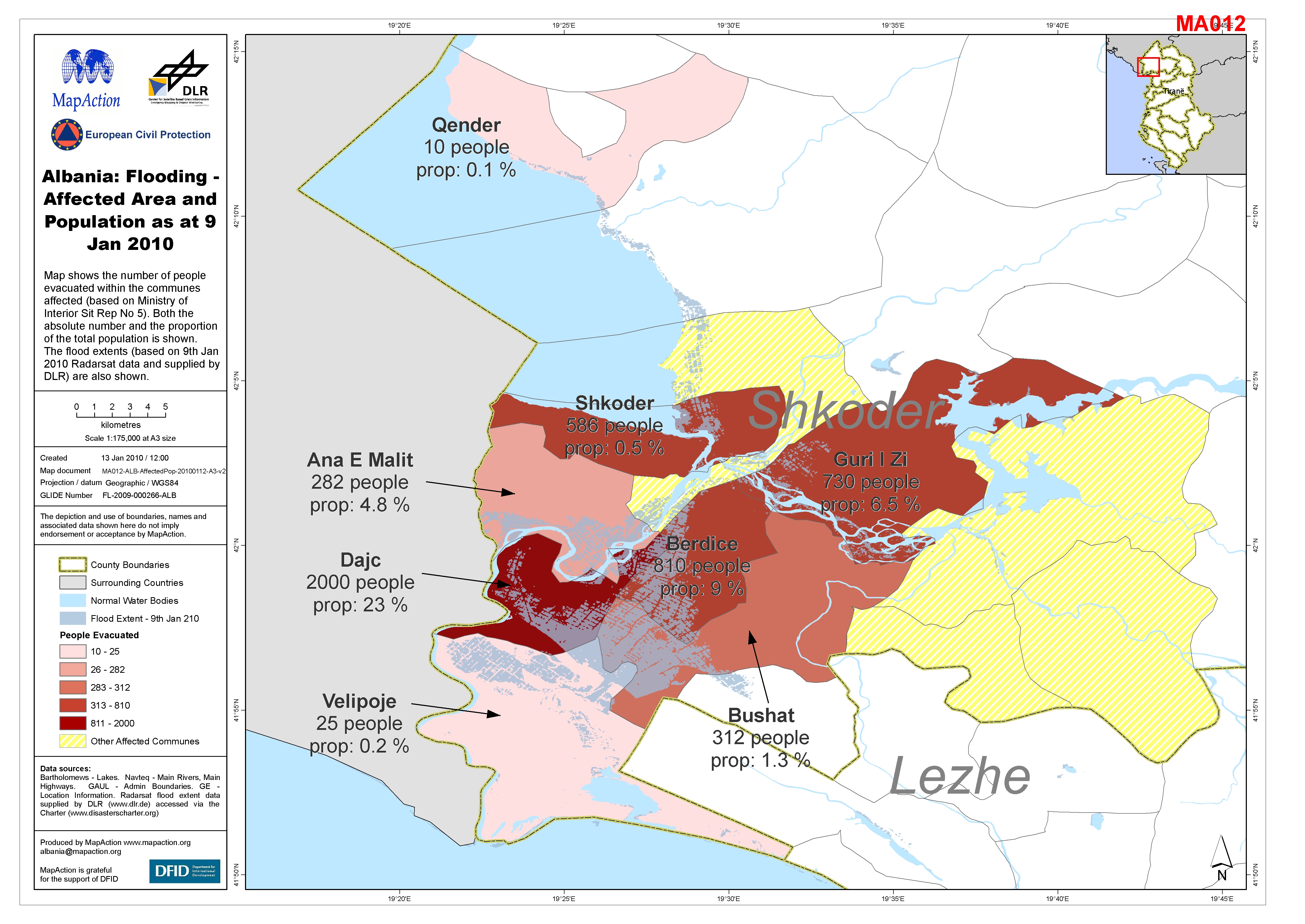
Map shows the number of people evacuated within the communes affected (based on Ministry of Interior Sit Rep No 5). Both the absolute number and the proportion of the total population is...
Source: Albania: Flooding - Affected Area and Population as at 9 Jan 2010
Additional Information
| Field | Value |
|---|---|
| Data last updated | July 4, 2016 |
| Metadata last updated | July 4, 2016 |
| Created | July 4, 2016 |
| Format | JPEG |
| License | License not specified |
| Has views | True |
| Id | dd4afd7b-31c4-43fe-ba79-617da009c6a3 |
| On same domain | True |
| Package id | 210c2e49-0950-41a9-a781-9168da468cc5 |
| Revision id | a9d38204-7c01-4ad9-9819-0c48838f70a3 |
| State | active |
| Url type | upload |