thumbnail.png
From the dataset abstract
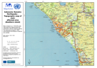
Map is based on a 1:250,000 scale sheet from Bakosurtenal the Indonesian national mapping agency. The map was surveyed in 1981. Administrative boundaries of districts are overlaid.
Source: Indonesia: Sumatra Earthquake - Topographic map of main affected area (Southern Sheet)
Additional Information
| Field | Value |
|---|---|
| Data last updated | July 28, 2016 |
| Metadata last updated | July 28, 2016 |
| Created | July 28, 2016 |
| Format | PNG |
| License | License not specified |
| Has views | True |
| Id | 8d8fe492-1a4a-4395-b70a-32384177c676 |
| On same domain | True |
| Package id | 0b5495e1-a5c8-4754-bf9f-d90bd4d4ea28 |
| Position | 2 |
| Revision id | 7dabd99b-87c3-4ad4-a9d4-6ceeffa9c482 |
| State | active |
| Url type | upload |