thumbnail.png
From the dataset abstract
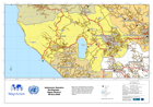
Map shows administrative boundaries within Sumatera Barat (West Sumatra) province. Place codes (p-codes) are shown in labels and should be used when referring to districts and sub-districts.
Source: Indonesia: Sumatra Earthquake - Agam District 06-Oct-2009
Additional Information
| Field | Value |
|---|---|
| Data last updated | July 28, 2016 |
| Metadata last updated | July 28, 2016 |
| Created | July 28, 2016 |
| Format | PNG |
| License | License not specified |
| Has views | True |
| Id | 274ba2ed-f119-435e-b1a5-1076f47b9fce |
| On same domain | True |
| Package id | 9172993f-cdae-415b-949c-0c2330ca0b1e |
| Position | 2 |
| Revision id | e7f9074e-7540-48aa-9c63-4e912d567697 |
| State | active |
| Url type | upload |