-

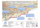
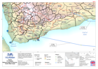
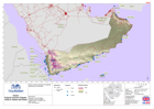
Yemen: Cyclone Chapala -NFI Transportation(as of 16 Nov 2015)
Map shows Non-Food Item (NFI) transportation to Shabwah and Al Mukalla by the Logistic Cluster. Data from OCHA Flash Report (16 Nov) -
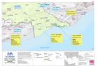
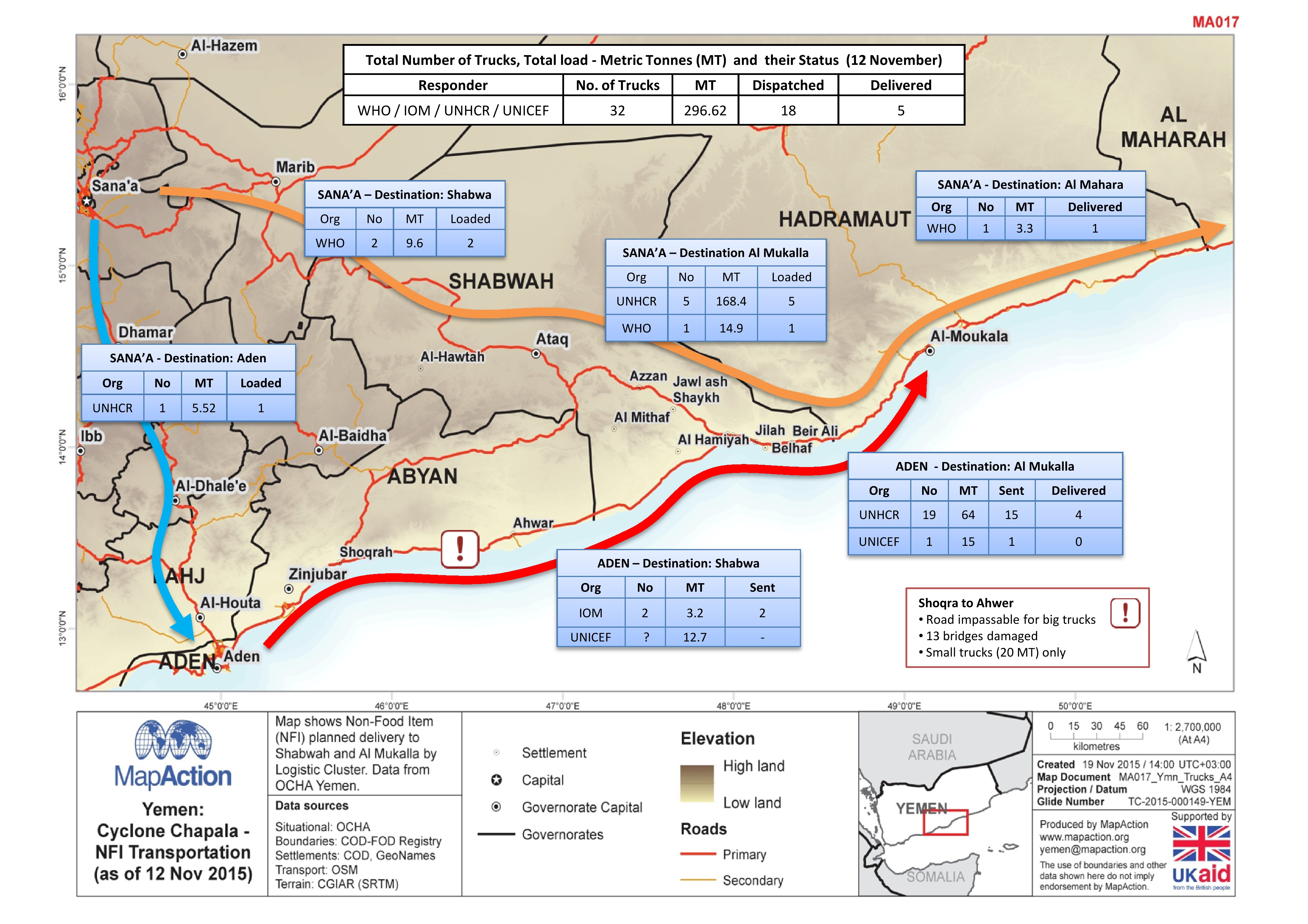
Yemen: Cyclone Chapala -NFI Transportation (as of 12 Nov 2015)
Map shows Non Food Item (NFI) planned delivery to Shabwah and Al Mukalla by Logistic cluster. Data from OCHA Yemen. -
Yemen: TC Chapala - Water Trucking (as of 16 November)
This map shows water distribution for existing programs in Mayfa'a and Zingibar Districts. It also reports on response water trucking in Zingibar. Data provided from OCHA... -
Yemen: TC Chapala - HEB Distribution (as of 16 Nov 2015)
Map shows High Energy Biscuit (HEB) distribution in Hadramaut and Shabwah (3 - 16 Nov 2015) -
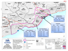
Yemen: TC Chapala - HEB Distribution (as of 11 Nov 2015)
This map shows High Energy Buiscuit distribution in Hadramaut and Shabwah (3-11 Nov 2015). -
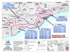
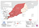
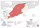
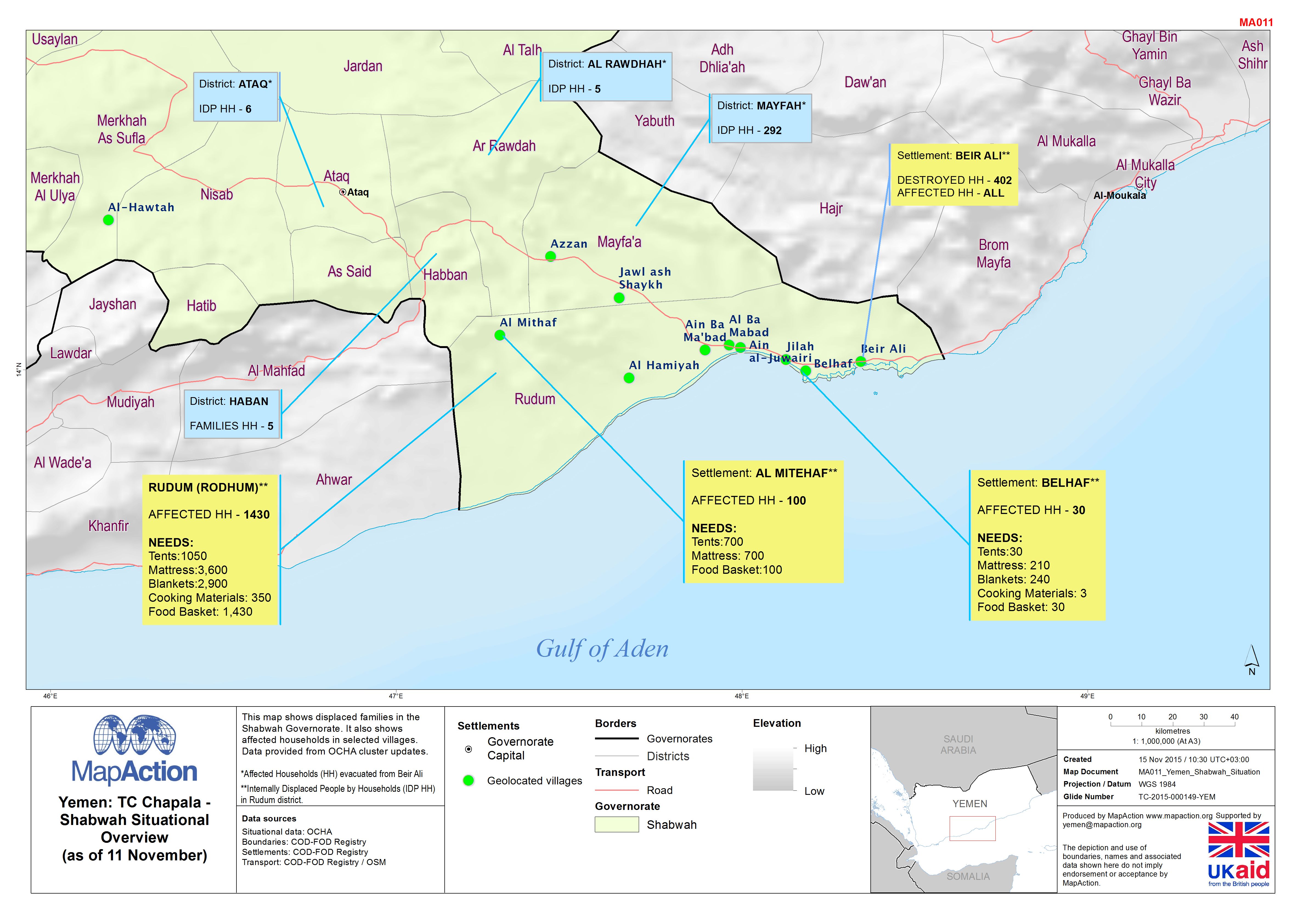
Yemen: TC Chapala - Shabwah situational overview (as of 11 Nov 2015)
This map shows displaced families in the Shabwah Governorate. It also shows affected households in selected villages. Data provided from OCHA cluster updates. -

Yemen: Cyclone Chapala and Megh - Socotra - Situational Overview (as of 12 No...
The map shows the situational overview for Socotra. Data was complied by OCHA Yemen from various sources. Estimated displacement (IDP) figures were supplied by IOM. -
Yemen: TC Chapala - Reports of casualties in affected areas (as of 14 Nov 2015)
The map shows casualties in the three affected Governates and the Mukalla City District. It also reports on some health facilities affected by cyclone Chapala. -
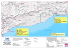
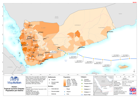
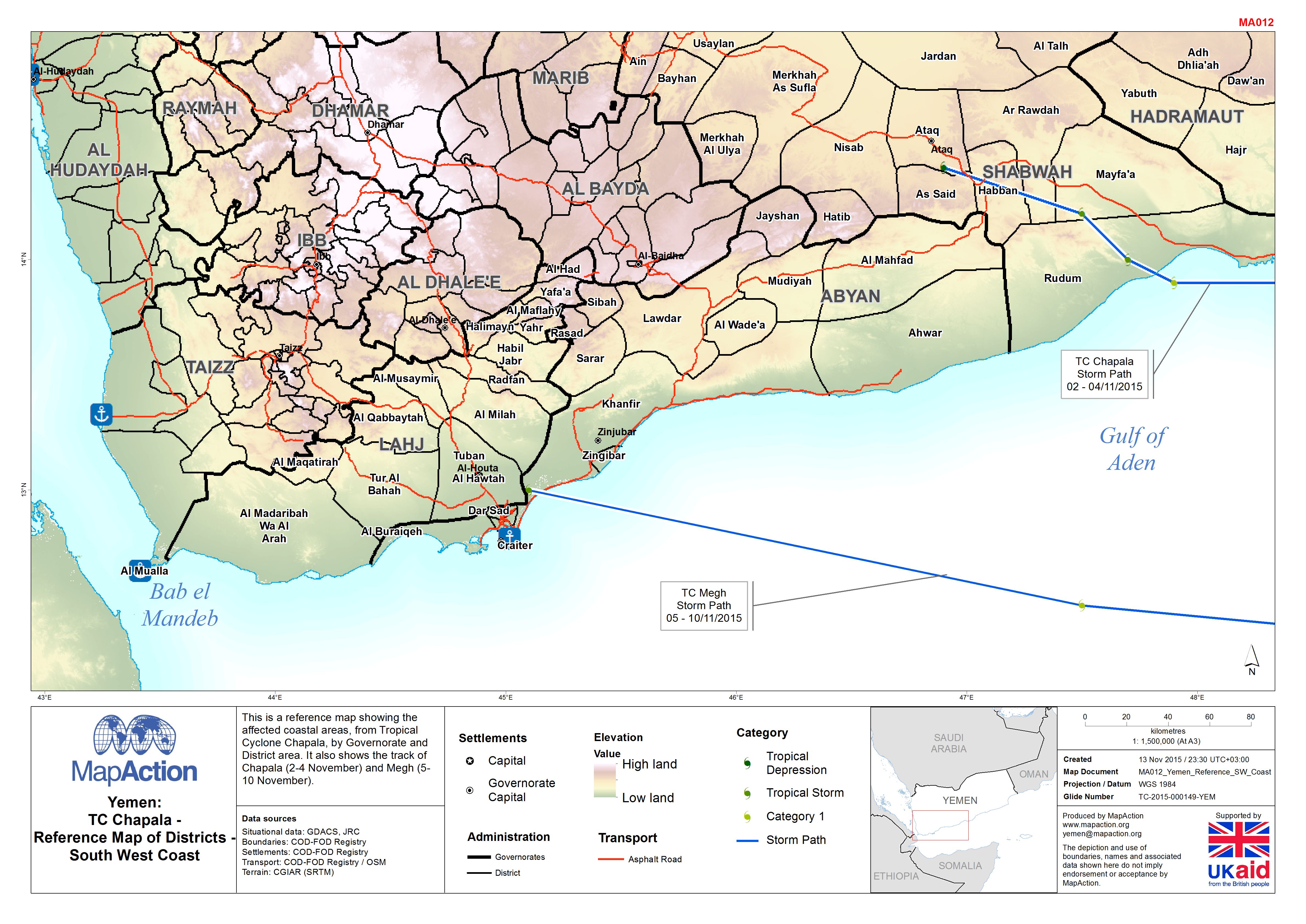
Yemen: TC Chapala - Reference Map of Districts - South West Coast
This is a reference map showing the affected coastal areas, from Tropical Cyclone Chapala, by Governorate and District area. It also shows the track of Chapala (2-4 November)... -

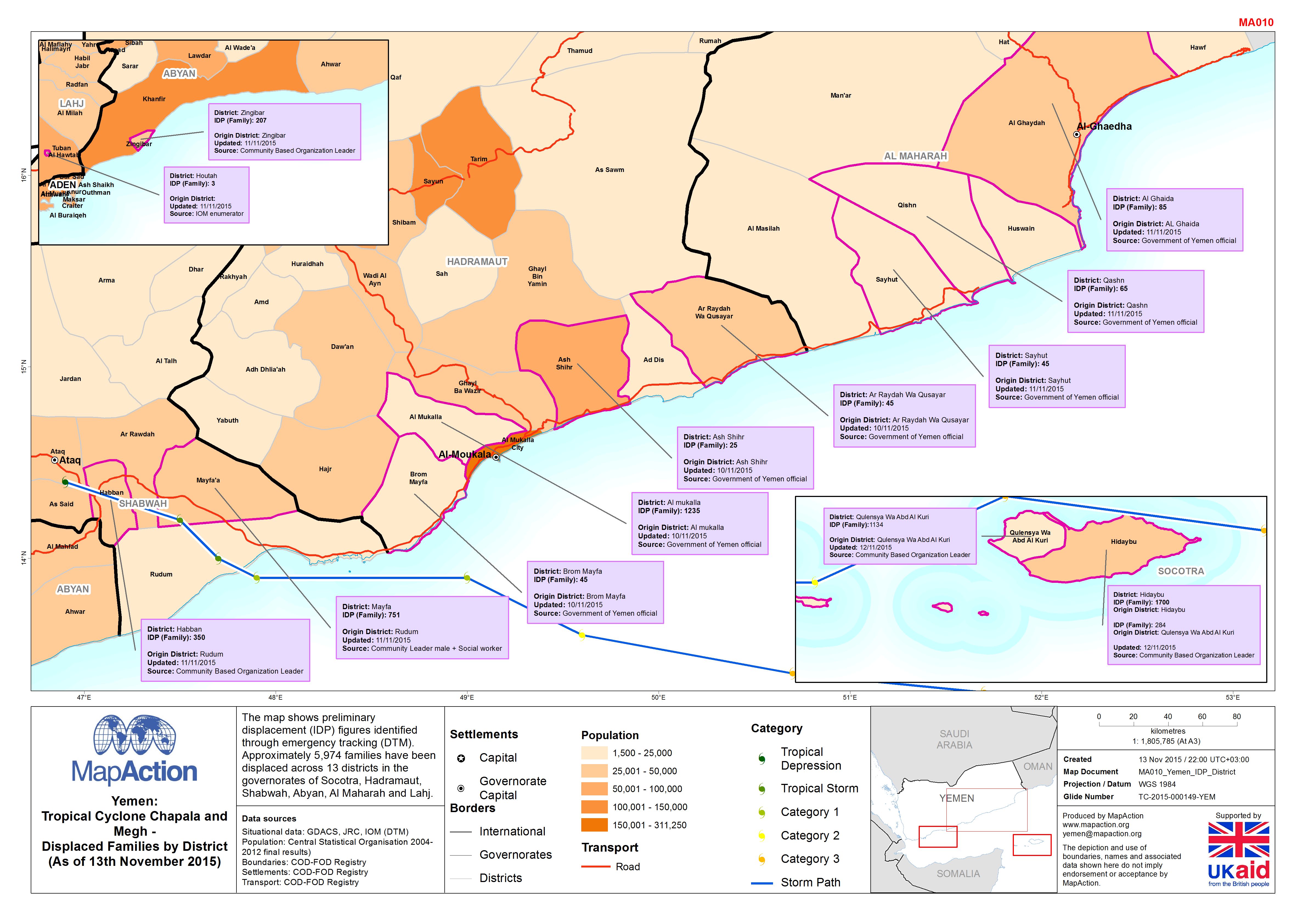
Yemen: Tropical Cyclone Chapala and Megh - Displaced families by district (as...
The map shows preliminary displacement (IDP) figures identified through emergency tracking (DTM). Approximately 5,974 families have been displaced across 13 districts in the... -

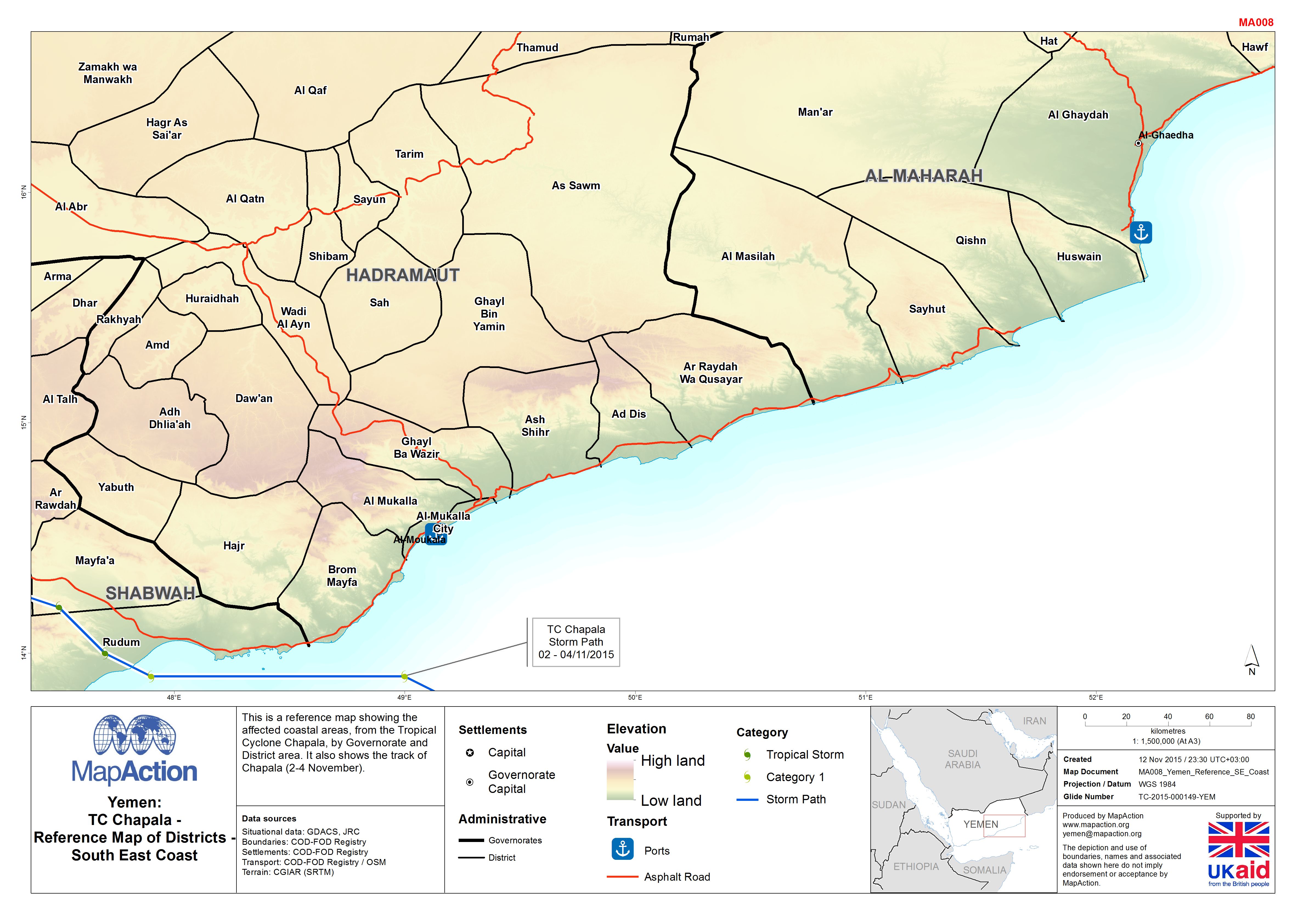
Yemen: TC Chapala - Reference Map of Districts - South East Coast
This is a reference map showing the affected coastal areas, from Tropical Cyclone Chapala, by Governorate and District area. It also shows the track of Chapala (2-4 November). -
Yemen: TC Chapala -The map shows reports on casualties in affected areas.
This dataset has no description
-
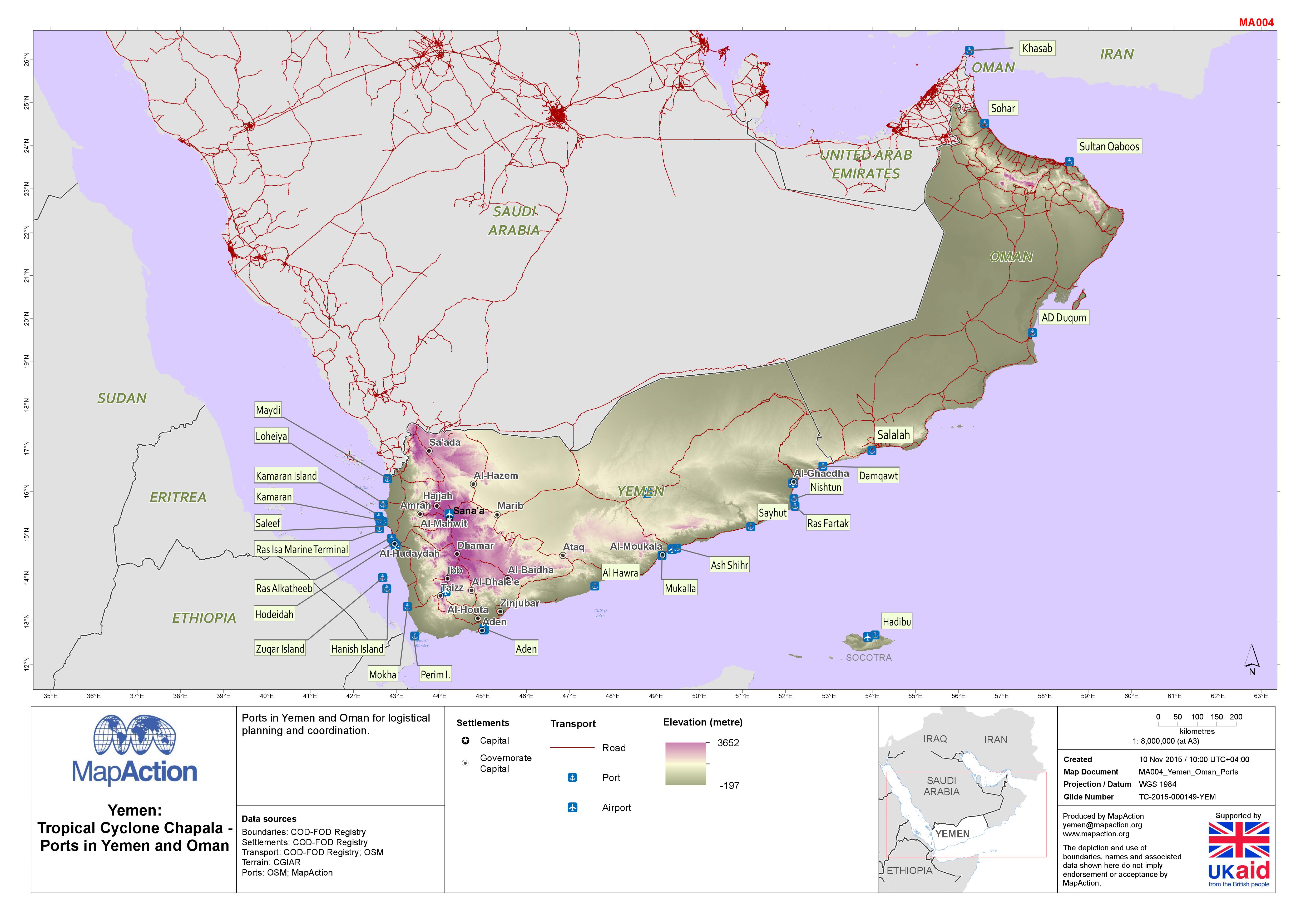
Yemen: Tropical Cyclone Chapala - Ports in Yemen and Oman
Map shows coastal ports in Yemen and Oman together with the land terrain and major roads. -

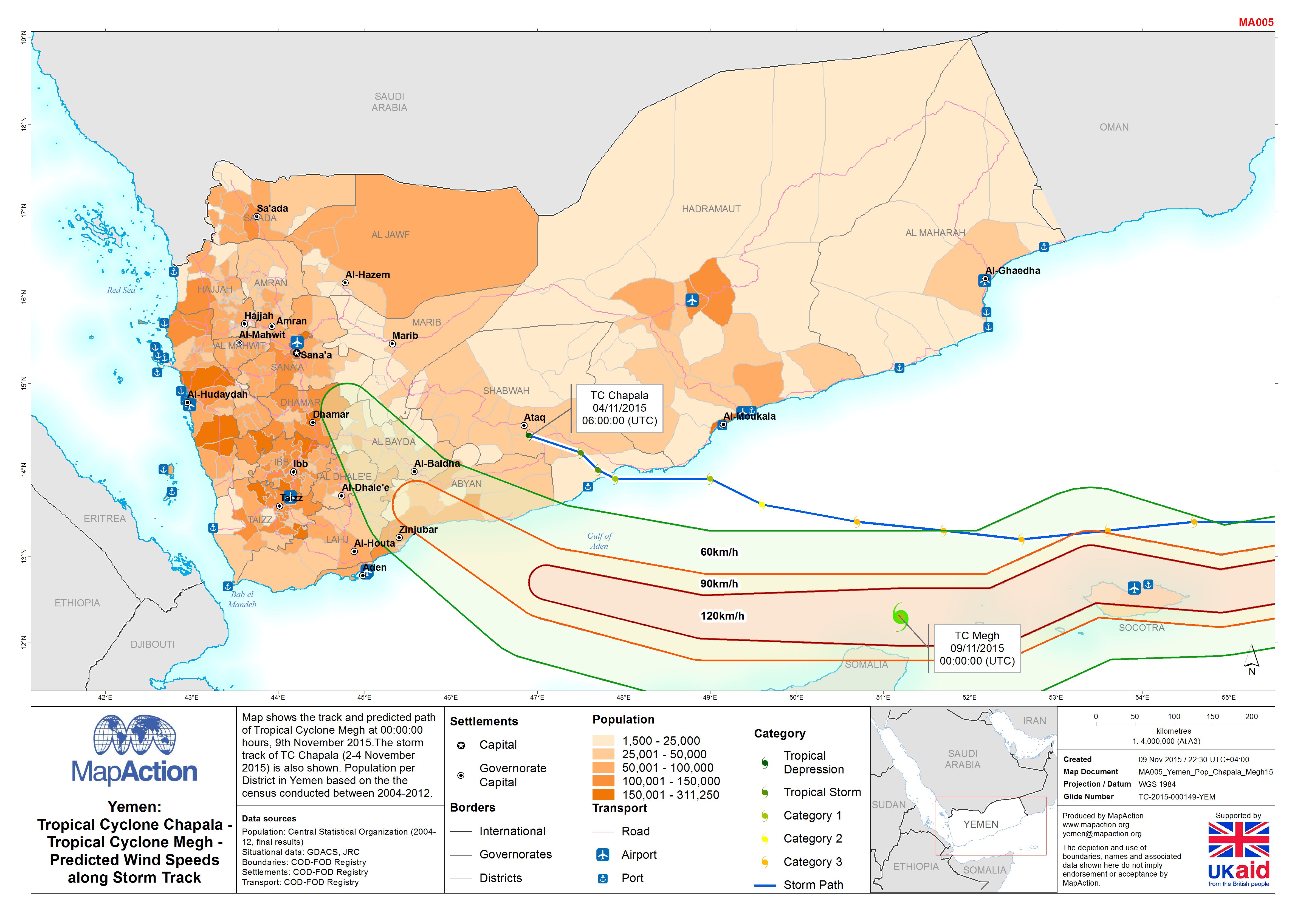
Yemen: Tropical Cyclone Chapala - Tropical Cyclone Megh - Predicted Wind Spee...
Map shows the track and predicted path of Tropical Cyclone Megh at 00:00:00 hours, 9th November 2015. The storm track of TC Chapala (2-4 November 2015) is also shown. Population... -
Yemen: Tropical Cyclone Chapala - Population per District
Map shows the population per District in Yemen based on the final results from the census conducted between 2004 - 2012. The storm track of Tropical Cyclone Chapala between the... -

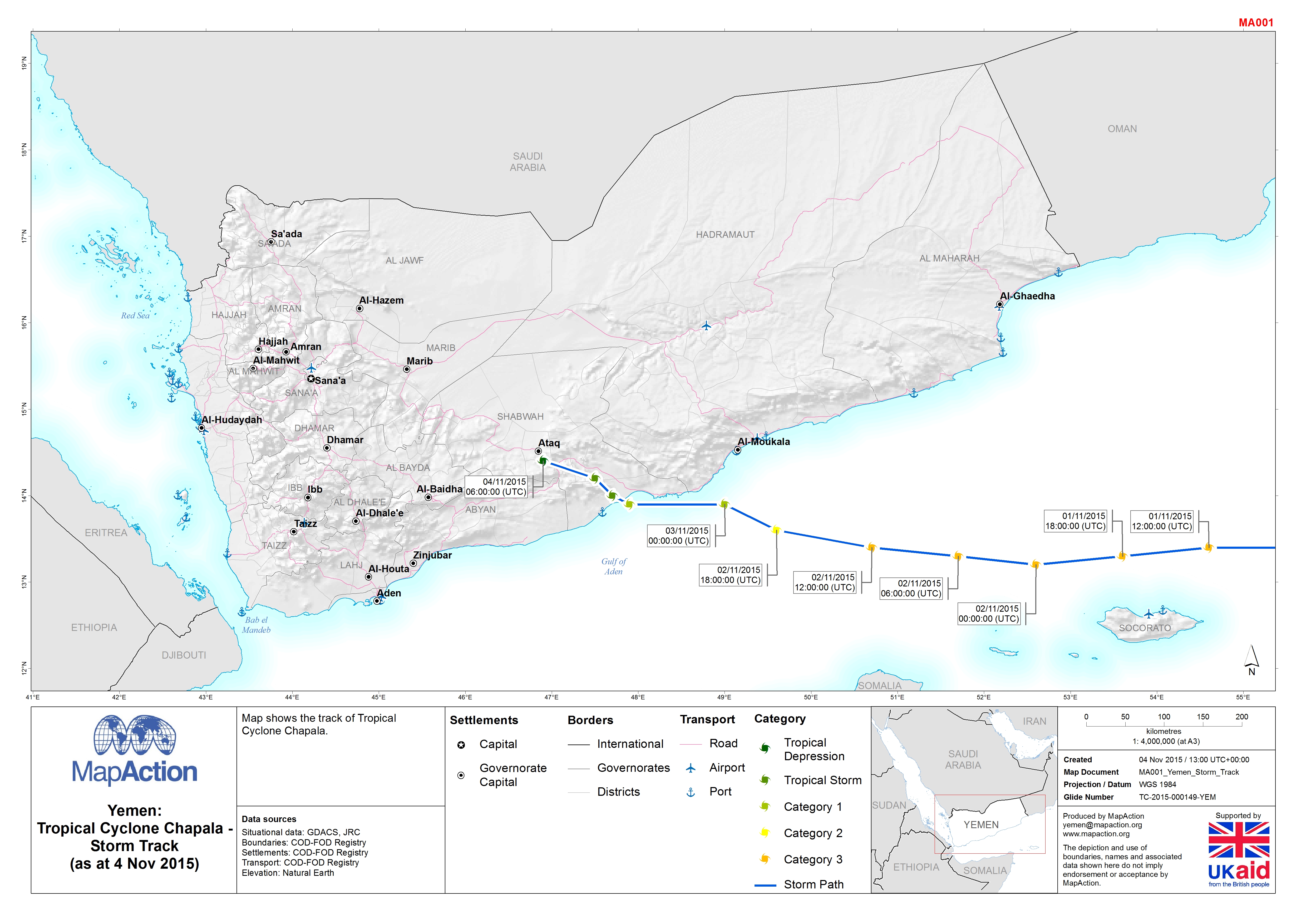
Yemen: Tropical Cyclone Chapala - Storm Track (as of 4 Nov 2015)
This dataset has no description
-

Yemen: Tropical Cyclone Chapala - Rainfall Accumulation (mm) (27 Oct - 4 Nov ...
Map shows the total rainfall accumulation in millimetres (mm) between 27 October and 4 November 2015 and the track of Tropical Storm Chapala -
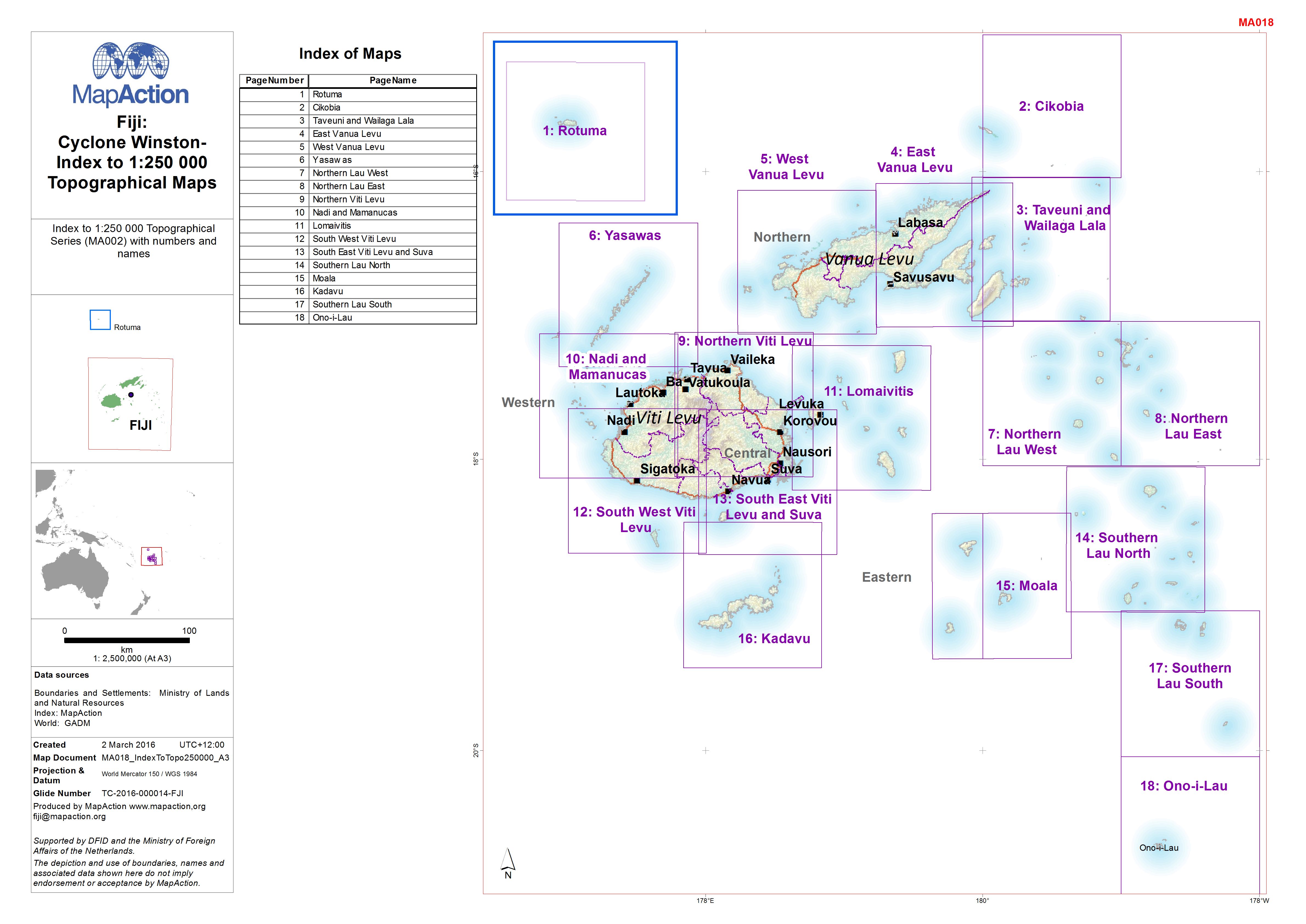
Fiji:Cyclone Winston-Index to 1:250 000 Topographical Maps
Index to 1:250 000 Topographical Series (MA002) with numbers and names -
Fiji: Cyclone Winston - Index to 1:100 000 Topographical Maps
Index to 1:100 000 Topographical Series (MA003) with numbers and names -

Fiji: Cyclone Winston - Health Facility Status as of 2/3/2016 - Overview
Overview of damage status and functionality of Health Facilities as of 02/03/2016 against the storm track.