-
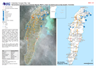
Colombia: Herramienta de Evaluación Ambiental Rápida (FEAT) y datos de destru...
Herramienta de Evaluación Ambiental Rápida (FEAT) y datos de destrucción en San Andrés, Colombia -
-

-
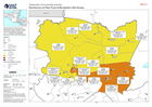
Guatemala: Food Security and Flood Threat by Municipality in Alta Verapaz
Map showing the food security classification (as of October 2020), as well as landslide threat (as of 16/11/2020) and population figures (2018) in each Municipality. -
Guatemala: Food Security and Landslide Threat in Alta Verapaz
Map showing the food security classification (as of October 2020), as well as landslide threat (as of 16/11/2020) and population figures (2018) in each Municipality. -

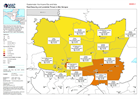
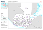
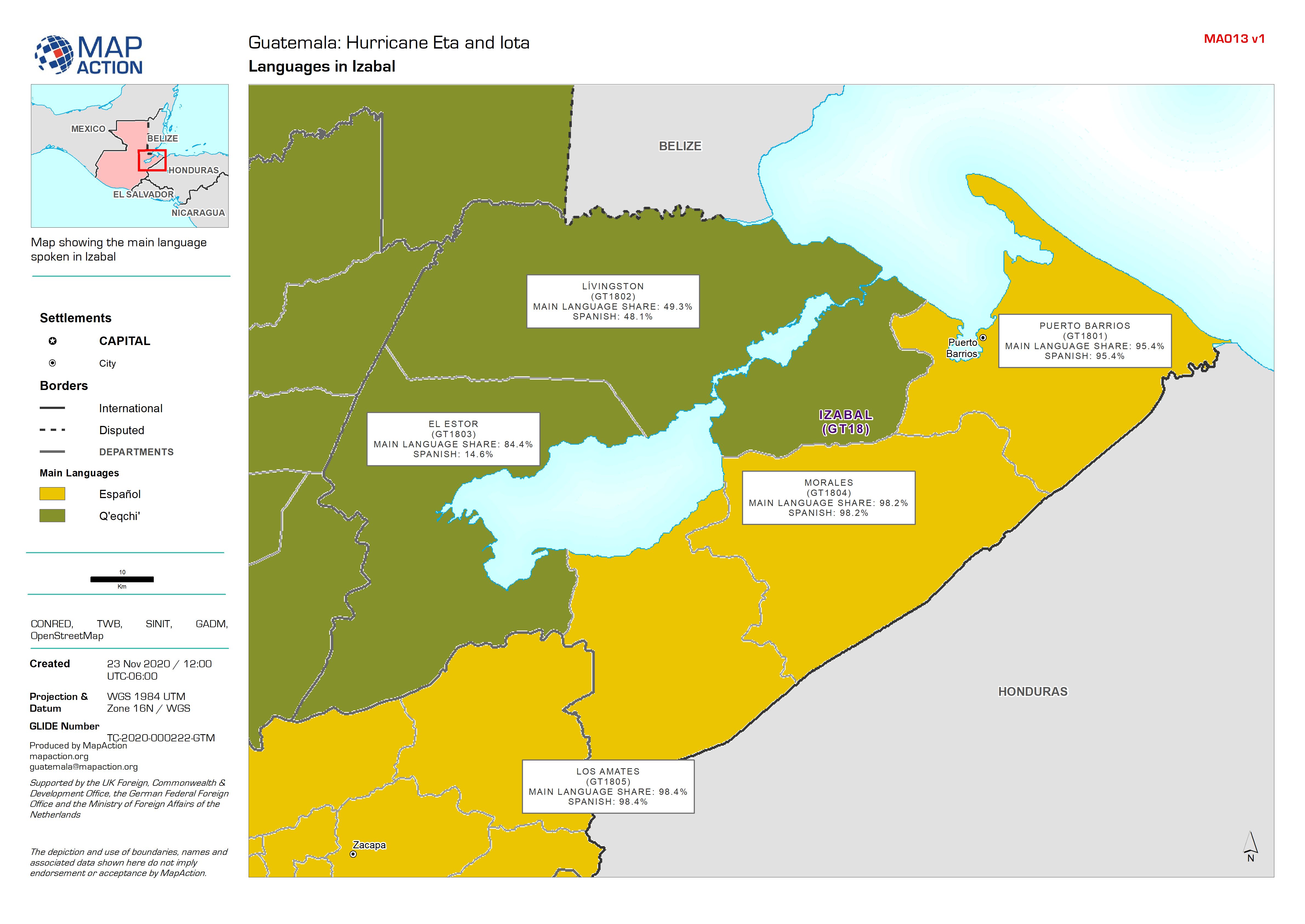
Guatemala: Population Figures (2018) by Municipality in Izabal
Map showing population figures (2018), Department (Admin 1) and Municipality (Admin 2) boundaries, and Pcodes. -

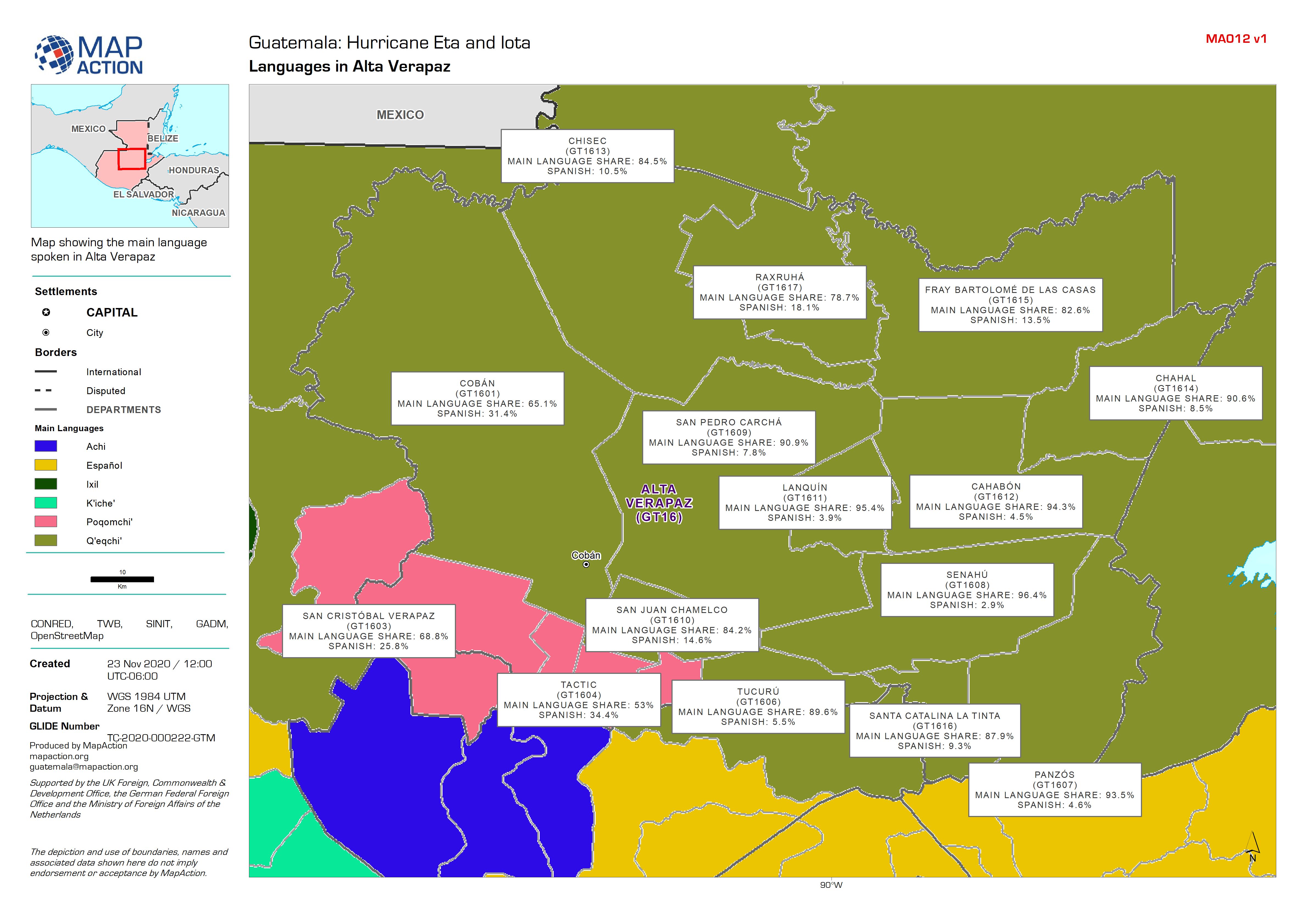
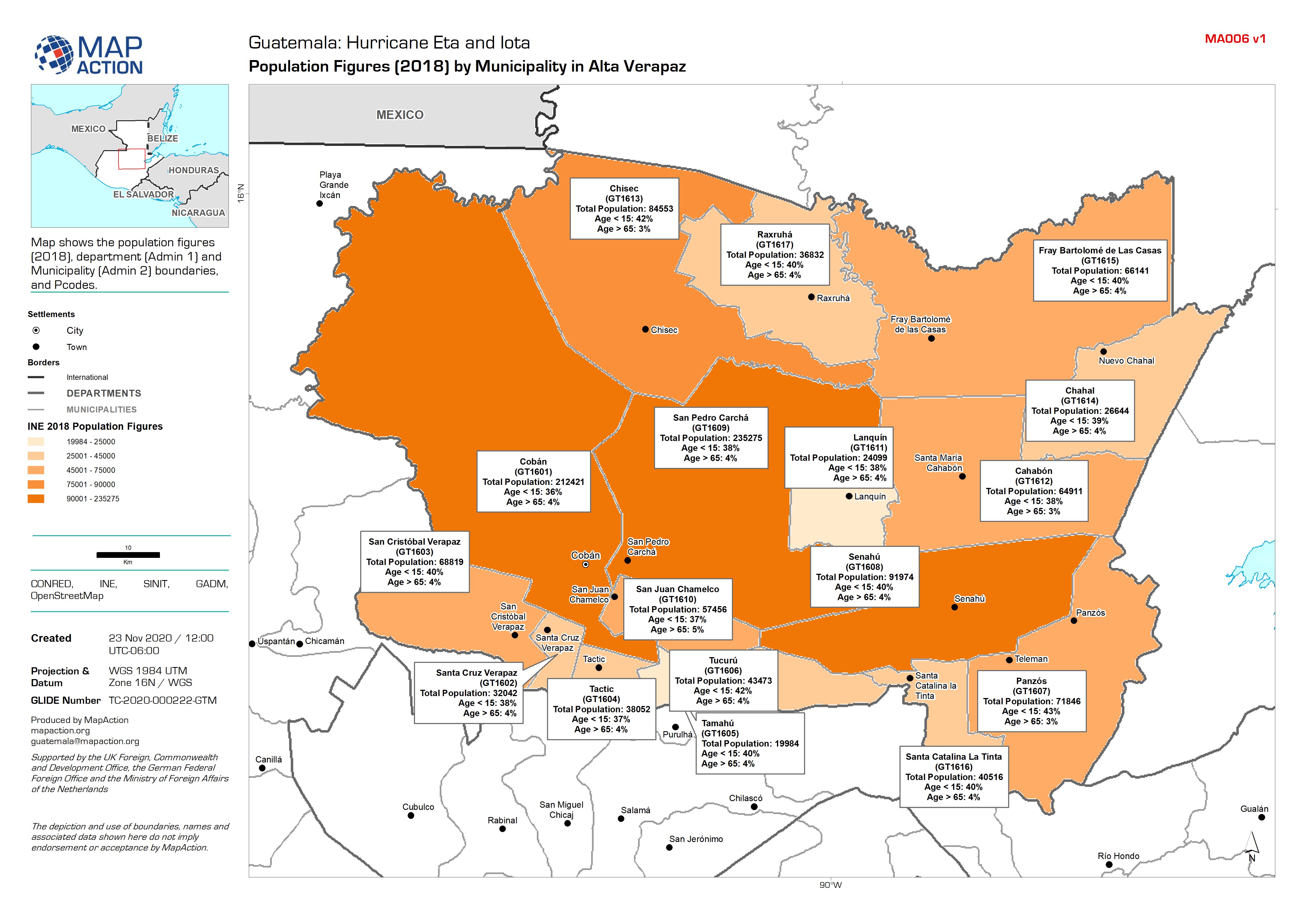
Guatemala: Population Figures (2018) by Municipality in Alta Verapaz
Map shows the population figures (2018), department (Admin 1) and Municipality (Admin 2) boundaries, and Pcodes. -

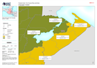
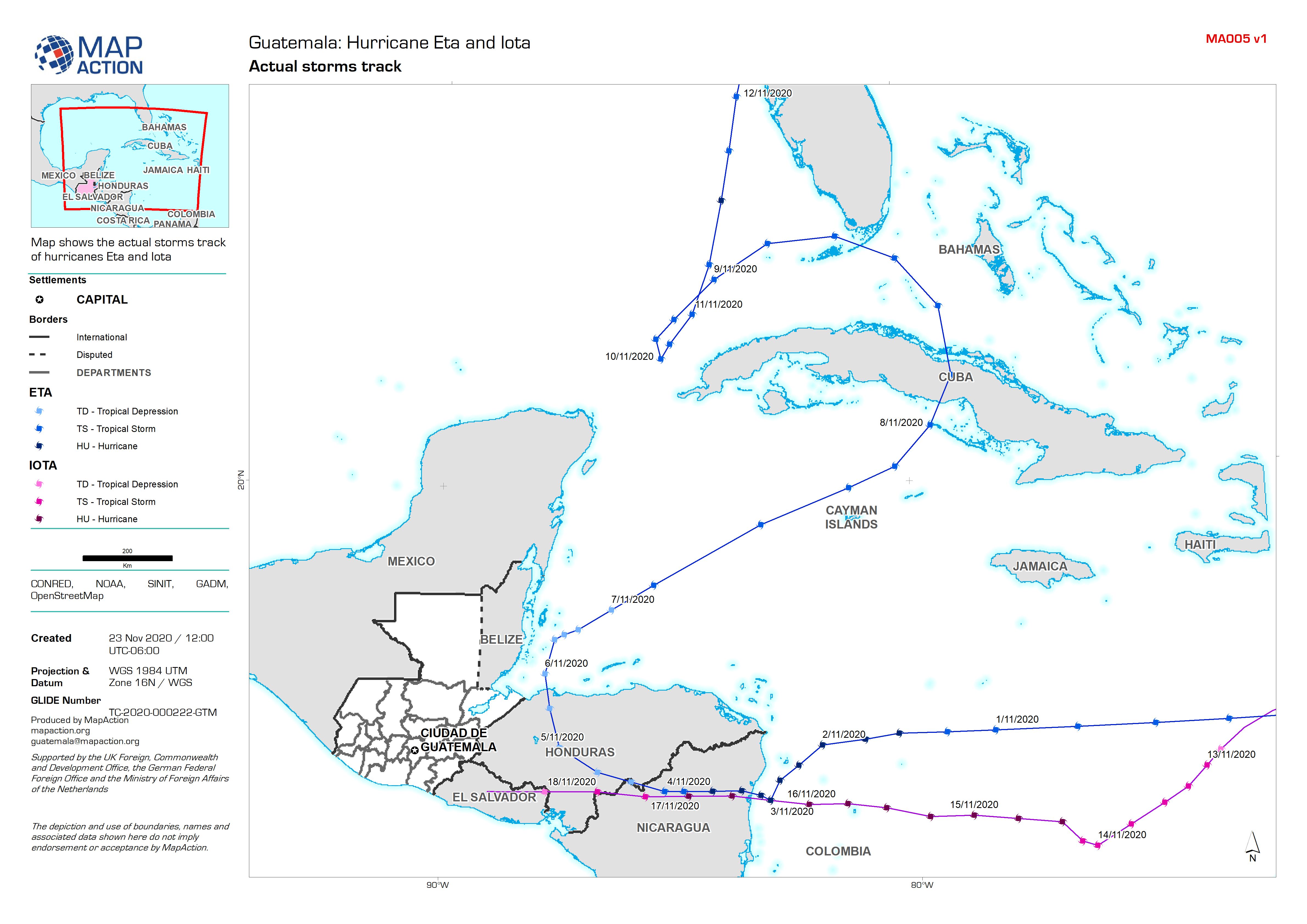
Guatemala: Actual storm tracks
Map shows the actual storms track of hurricanes Eta and Iota -
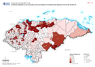
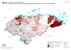
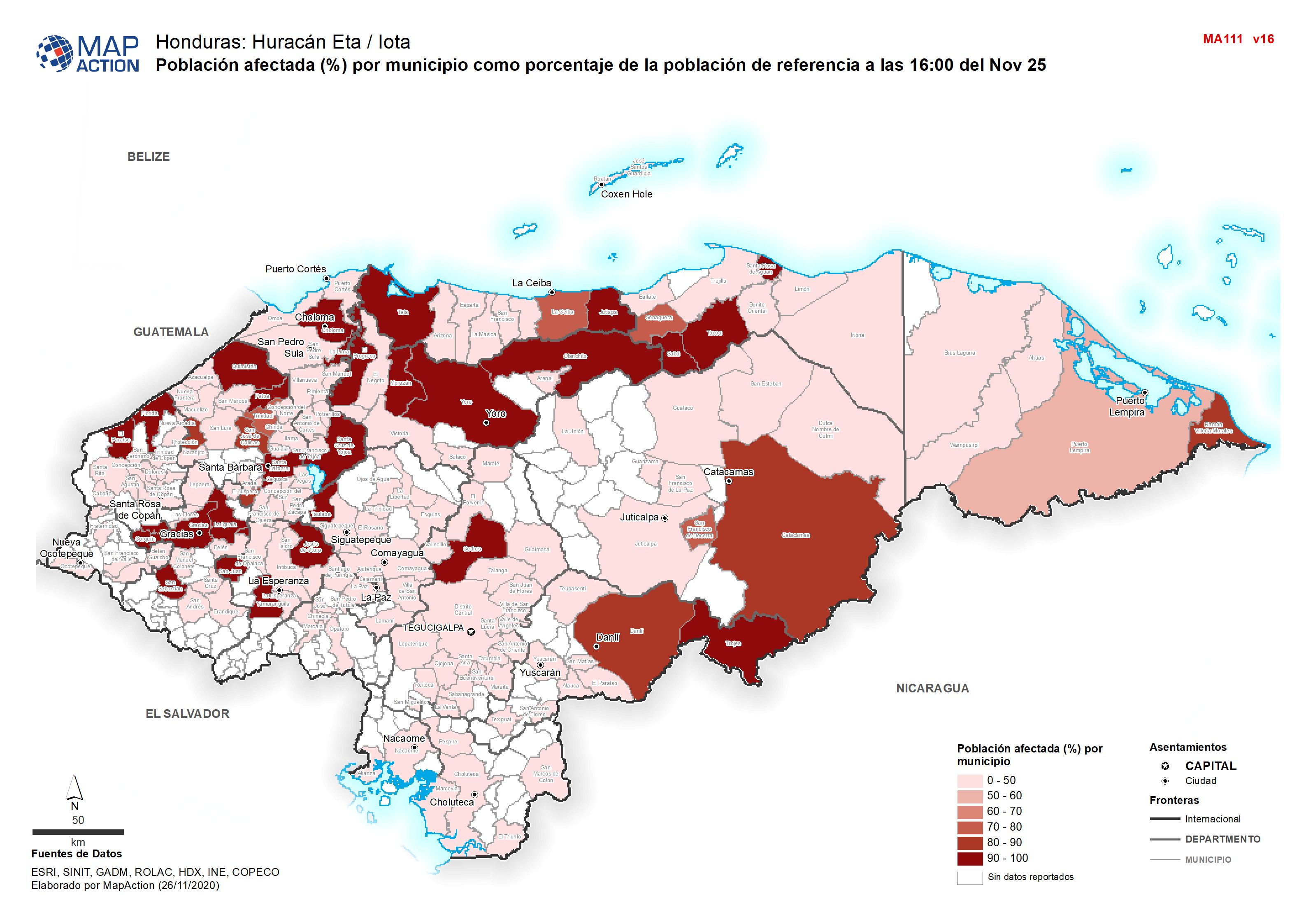
Honduras: Población afectada (%) por municipio como porcentaje de la població...
Población afectada (%) por municipio como porcentaje de la población de referencia a las 16:00 del Nov 25 -

Honduras: Evacuated Persons and number of Evacuation Centres per Municipality...
Map shows evacuated persons and number of evacuation centres per Municipality (as at 19:00 on 23rd Nov 2020) -

Honduras: Humanitarian Presence Overview by Department (as at 1800 on 24th No...
Map shows the number of reported activities per Sector per Department in Honduras. Critical and High priority response areas are also shown. -
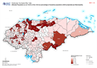
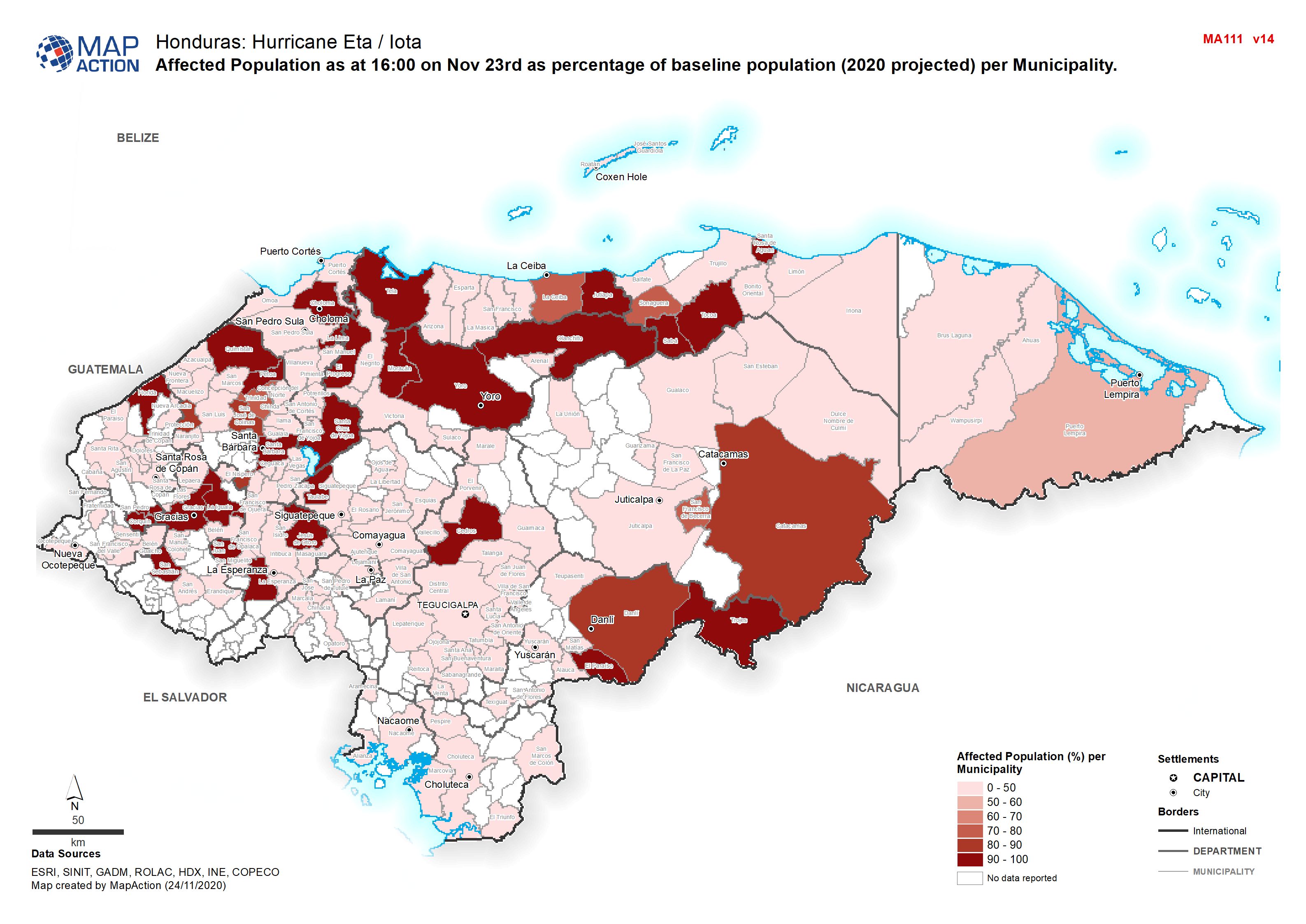
Honduras: Affected Population as at 16:00 on Nov 23rd as percentage of baseli...
Map shows affected population as at 16:00 on Nov 23rd as percentage of baseline population (2020 projected) per Municipality. -
-

Humanitarian Presence Overview by Department (as at 1800 on 23 Nov 2020)
Map shows the number of reported activities per Sector per Department in Honduras. Critical and High priority response areas are also shown. -
Honduras: Evacuated Persons and number of Evacuation Centres per Municipality...
Map shows evacuated persons and number of evacuation centres per Municipality (as at 16:00 on 23rd Nov 2020) -

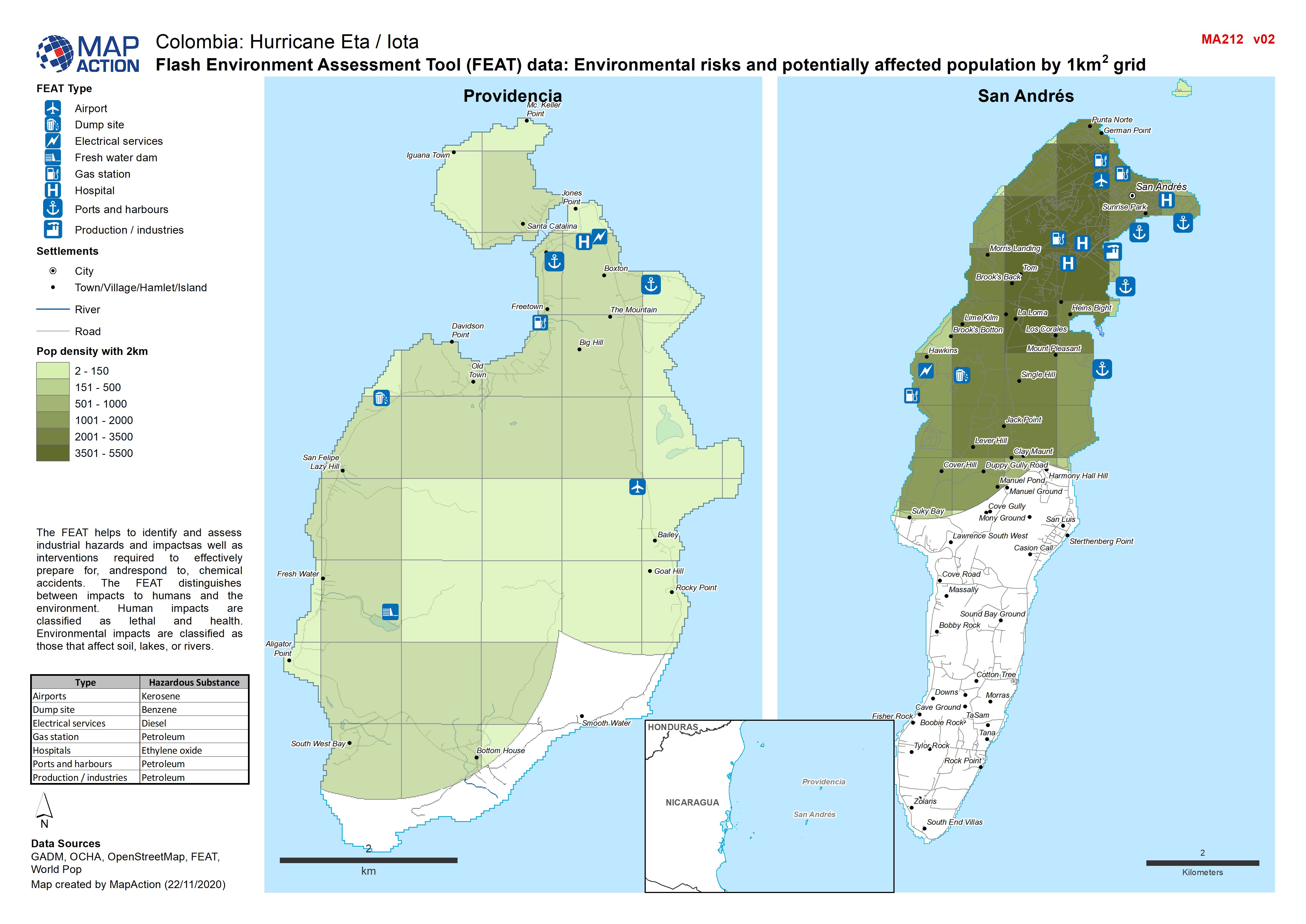
Colombia: Flash Environment Assessment Tool (FEAT) data, Environmental risks ...
Flash Environment Assessment Tool (FEAT) data: Overview of San Andrés and Providencia -

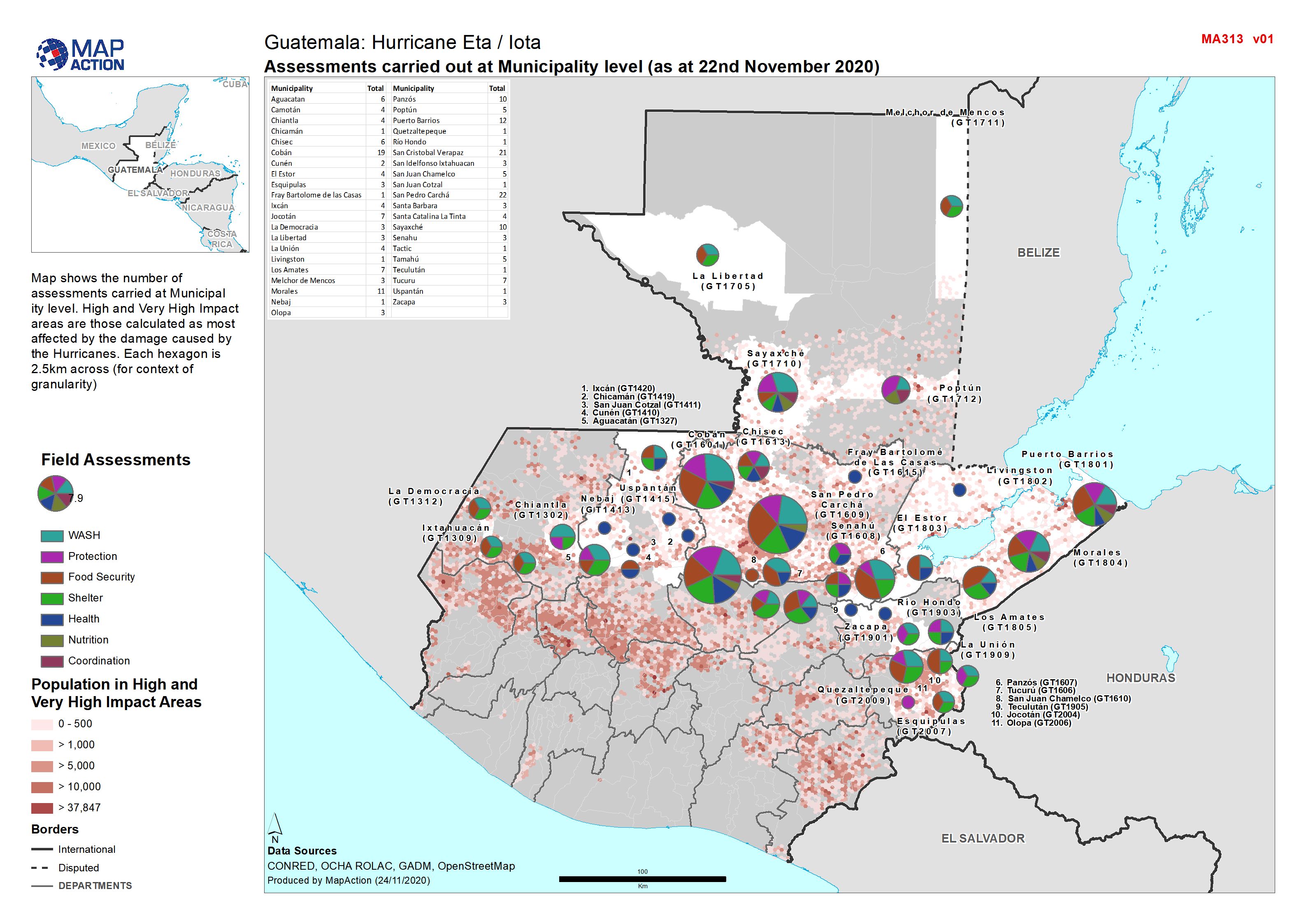
Assessments carried out at Municipality level (as at 22nd November 2020)
Map shows the number of assessments carried at Municipal ity level. High and Very High Impact areas are those calculated as most affected by the damage caused by the Hurricanes.... -

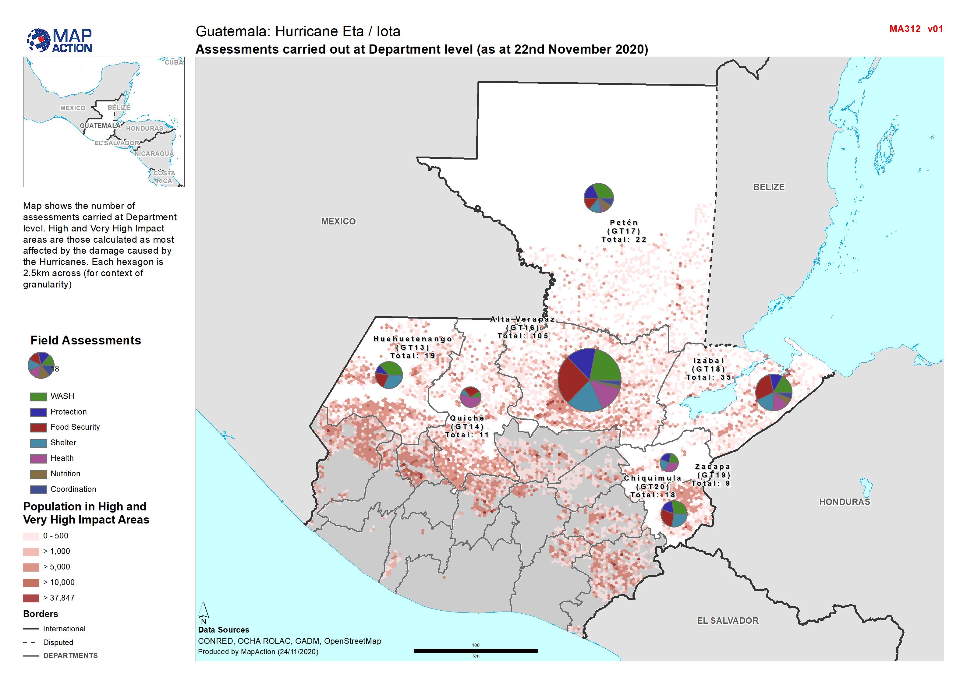
Guatemala: Assessments carried out at Department level (as at 22nd November 2...
Map shows the number of assessments carried at Department level. High and Very High Impact areas are those calculated as most affected by the damage caused by the Hurricanes.... -

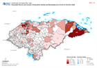
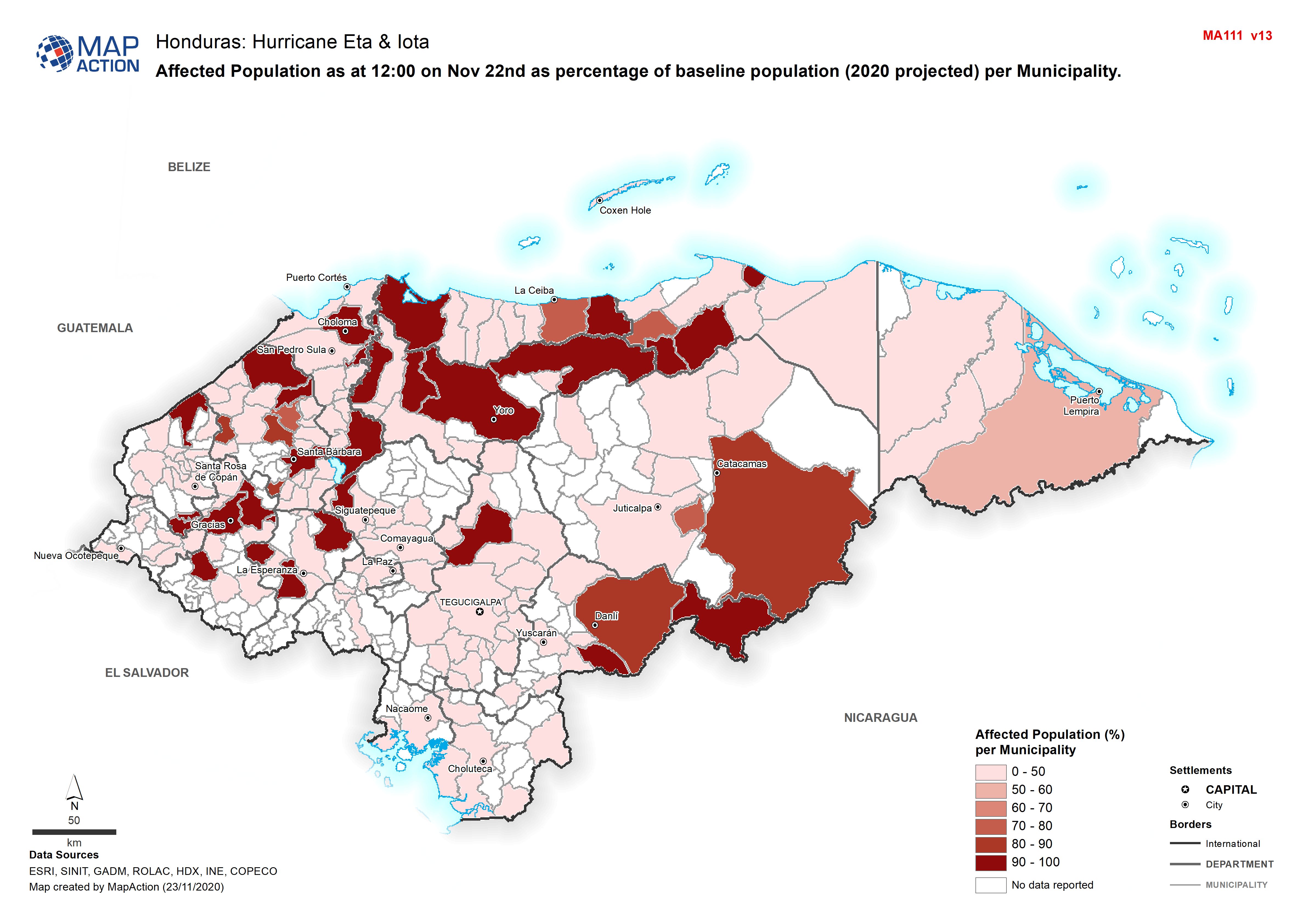
Honduras: Affected Population as at 12:00 on Nov 22nd as percentage of baseli...
Map shows affected population as at 12:00 on Nov 22nd as percentage of baseline population (2020 projected) per Municipality. -
Honduras: Evacuated Persons and number of Evacuation Centres per Municipality...
Map shows evacuated persons and number of evacuation centres per Municipality (as at 12:00 on 22nd Nov 2020)