-

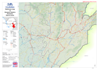
Reference map of Kambia District, Northern Province, Sierra Leone
This dataset has no description
-

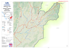
Reference map of Bombali District, Northern Province, Sierra Leone
This dataset has no description
-

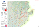
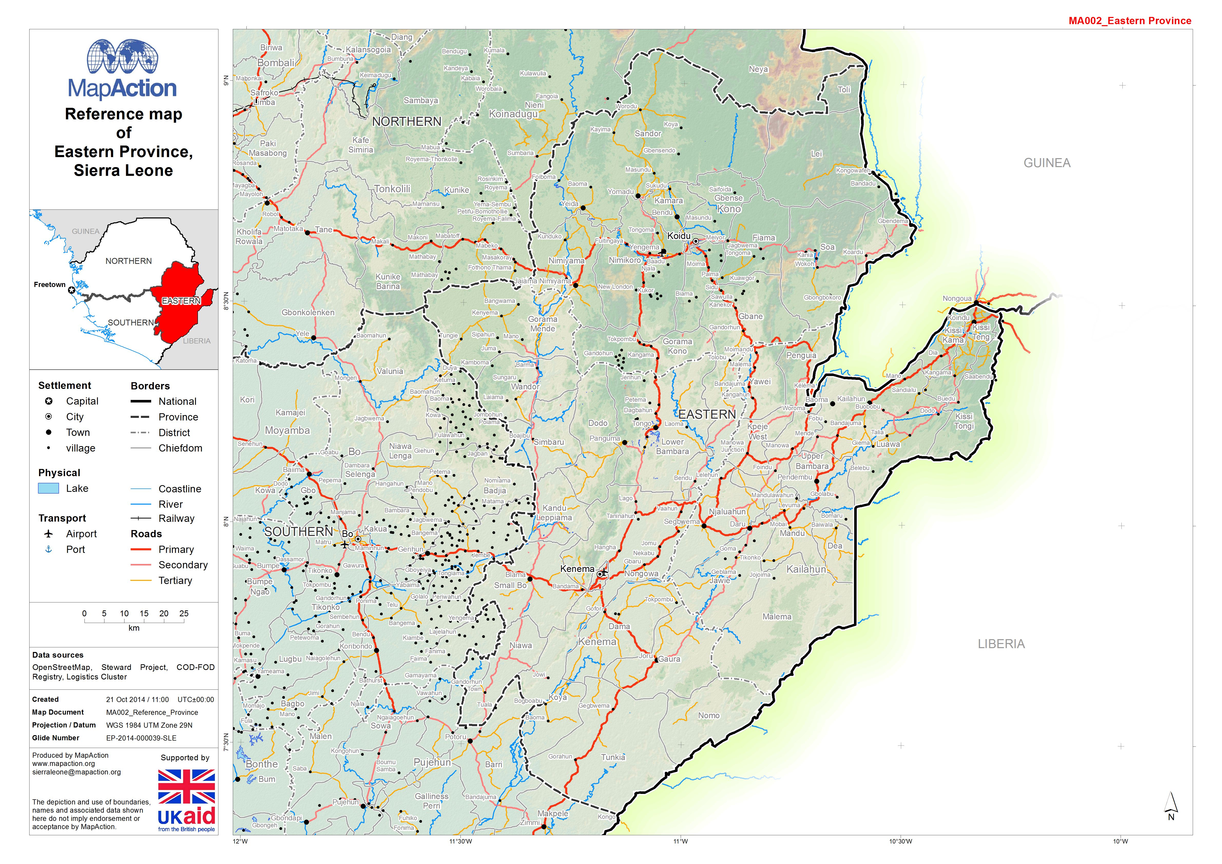
Reference map of Kono District, Eastern Province, Sierra Leone
This dataset has no description
-
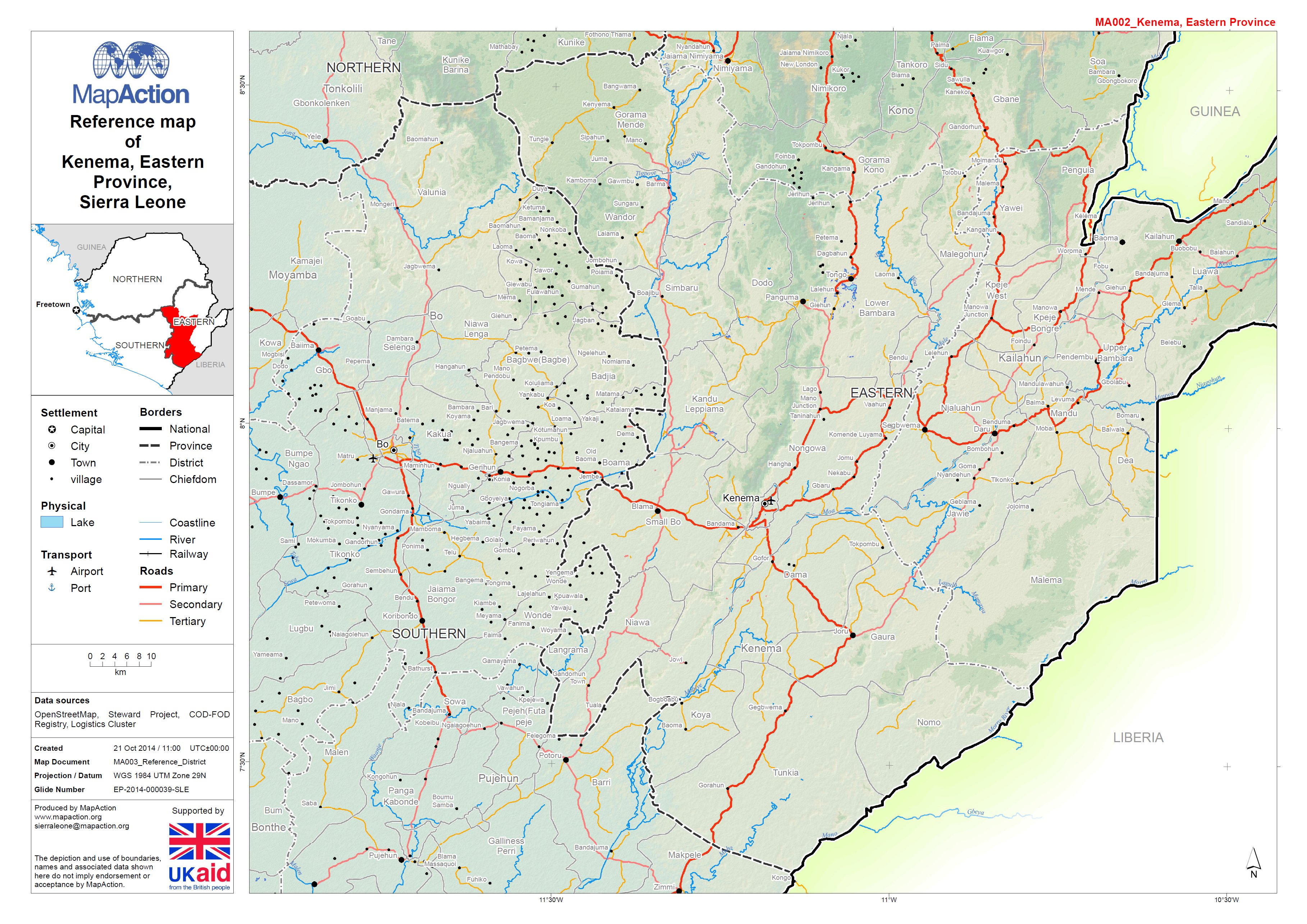
Reference map of Kenema District, Northern Province, Sierra Leone
This dataset has no description
-
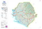
Reference map of Kailahun District, Eastern Province, Sierra Leone
This dataset has no description
-

-

-

-
-
-

Liberia: Ebola Outbreak - Summary of cases reported on 30 Sep 2014
Summary maps of the Ebola Outbreak reported at County Level on 30 September 2014. -
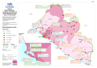
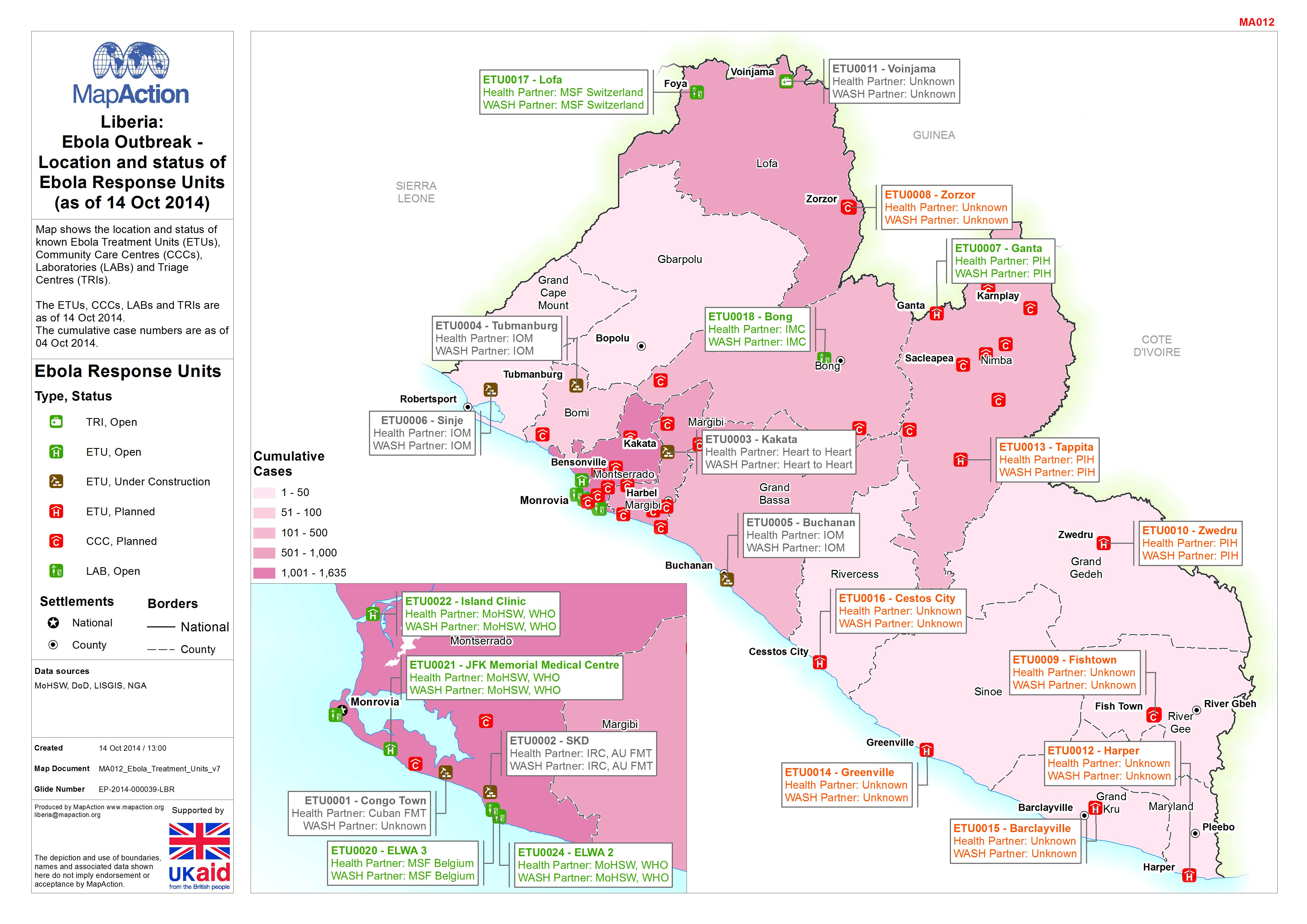
Liberia: Ebola Outbreak - Location and status of Ebola Response Units (as of ...
Map shows the location and status of known Ebola Treatment Units (ETUs), Community Care Centres (CCCs), Laboratories (LABs) and Triage Centres (TRIs). The ETUs, CCCs, LABs and... -
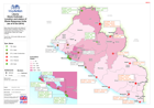
Liberia: Ebola Outbreak - Location and status of Ebola Response Units (as of ...
This dataset has no description
-

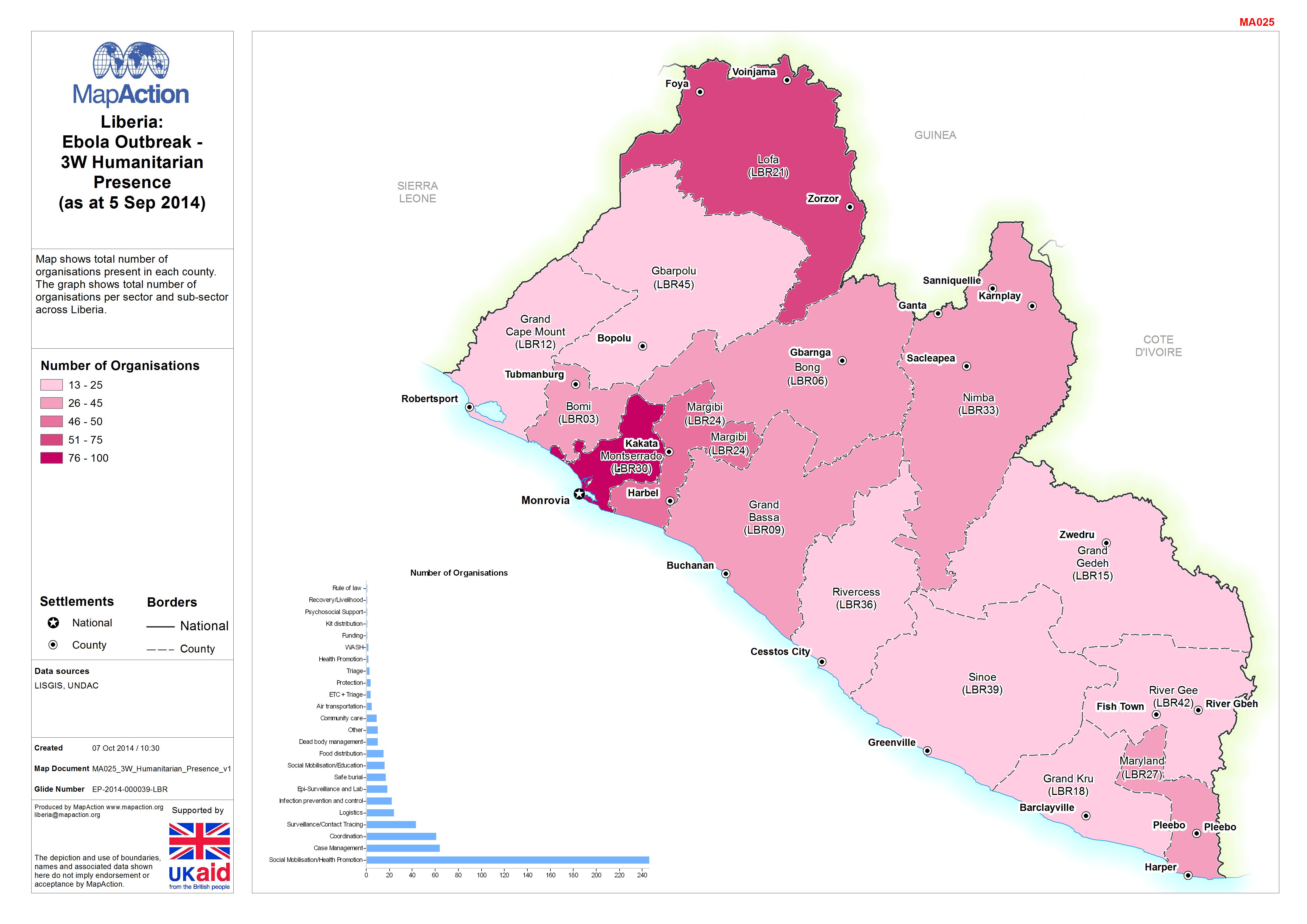
Liberia: Ebola Outbreak - 3W Humanitarian Presence(as at 5 Sep 2014)
Map shows total number of organisations present in each county. The graph shows total number of organisations per sector and sub-sector across Liberia. -
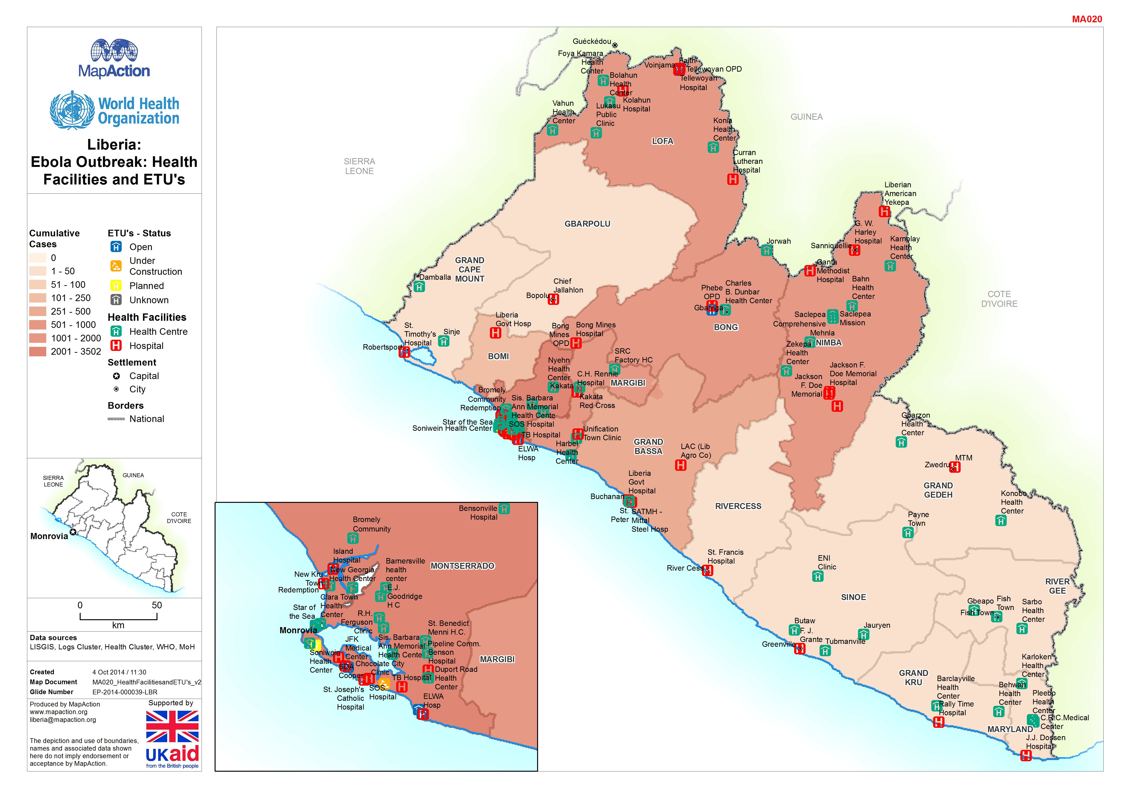
Liberia: Ebola Outbreak: Health Facilities and ETU's in Greater Monrovia(as o...
Map shows health facilities and ETU's in Greater Monrovia (as of 05 Oct). -

-
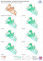
Liberia: Ebola Outbreak - Cumulative Case History (30 Sep 2014)
This shows the cumulative Ebola cases between 23-30 September 2014 at county level. -

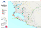
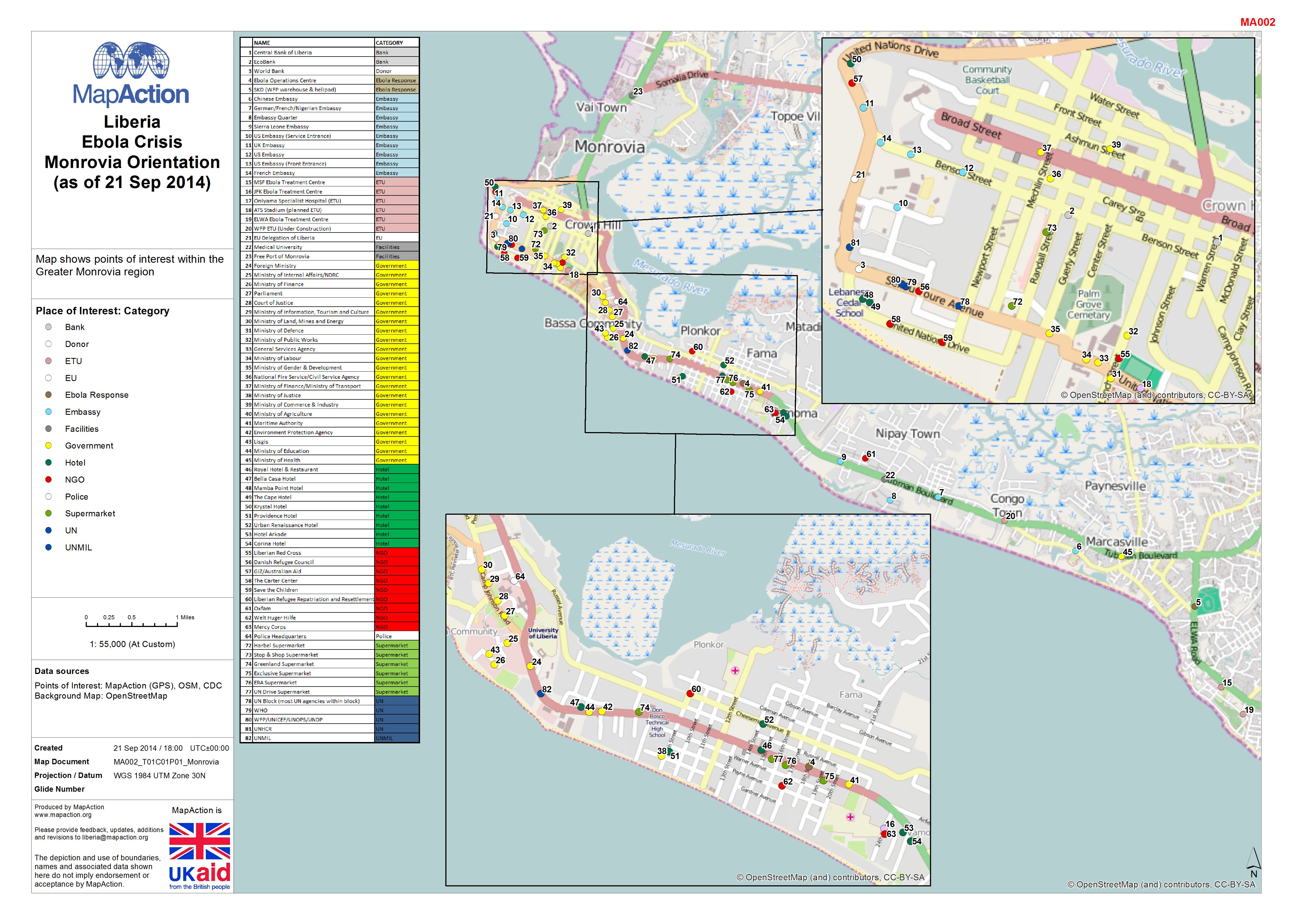
Liberia: Ebola Outbreak - Monrovia Orientation (as of 21 Sep 2014)
Map shows points of interest within the Greater Monrovia region -
Liberia: Ebola Outbreak - Radio Coverage and Population Density
Map shows the Radio Stations in operation across the country, also displayed is population density by District so shows areas potentially not covered. -

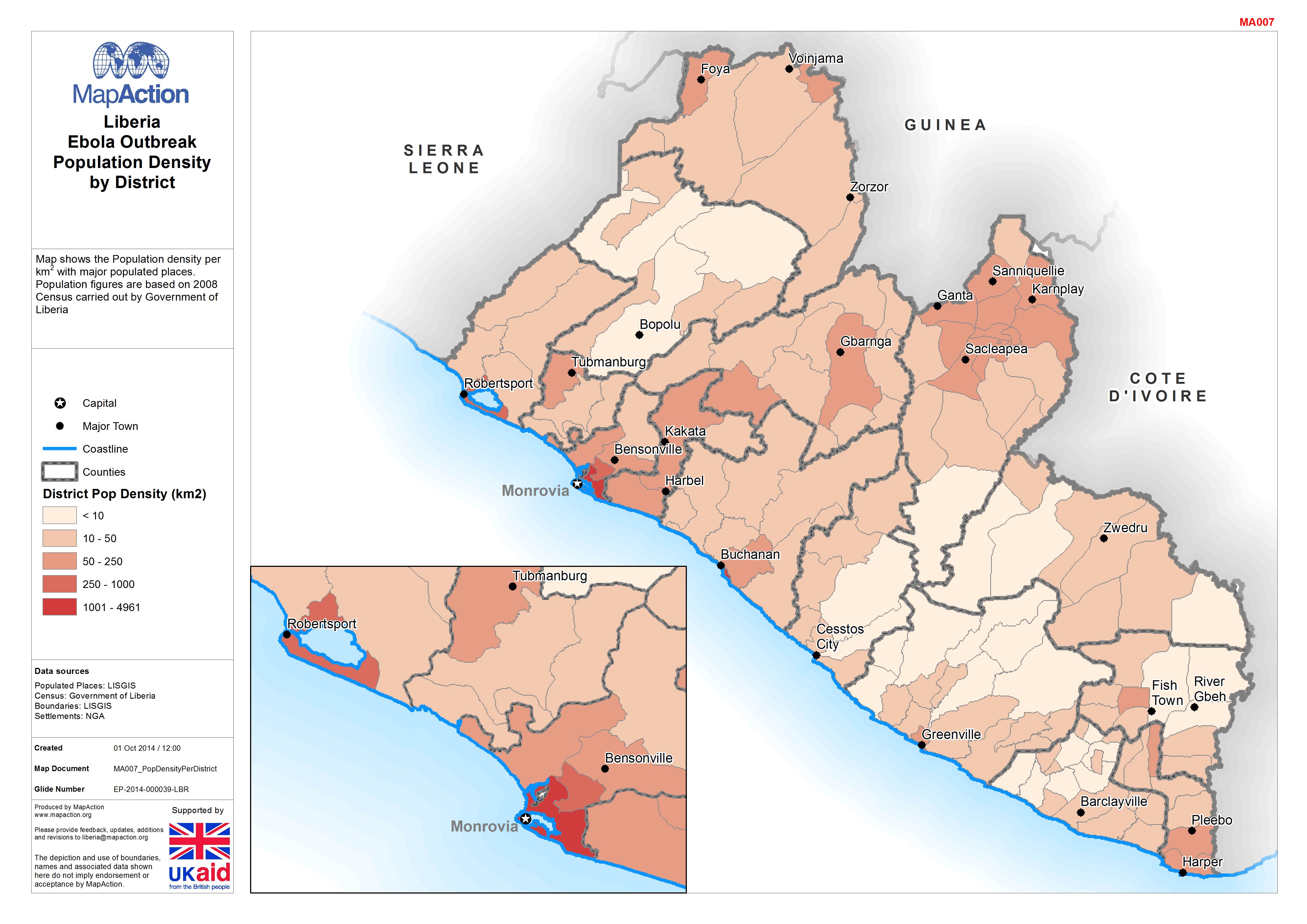
Liberia: Ebola Outbreak - Population Density by District
Map shows the Population density per km2 with major populated places. Population figures are based on 2008 Census carried out by Government of Liberia