-

Honduras: Hazardous sites and potential extent of water contamination: Valle ...
Honduras - Environmental Impact Zones (water) from FEAT: Valle de Sula region (FEAT - Flash Environmental Assessment Tool) -

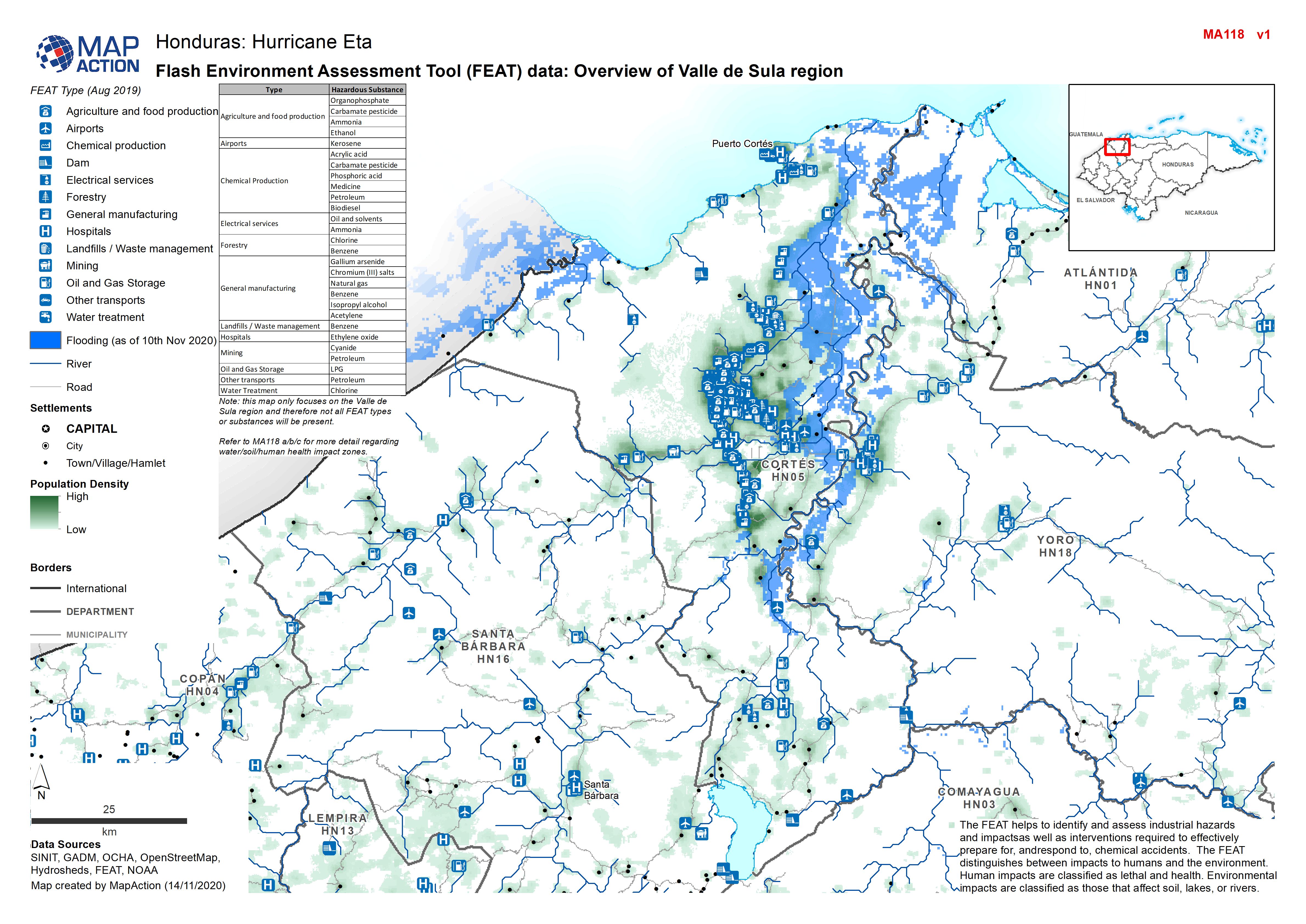
Honduras: Flash Environment Assessment Tool (FEAT) data: Overview of Valle de...
Flash Environment Assessment Tool (FEAT) data: Overview of Valle de Sula region -

Honduras: Damaged Infrastructure in each Municipality - Department (as at 13 ...
Honduras, Damaged Infrastructure as of 13th Nov 2020 (Displayed per Admin 1 / Department) -
Honduras: Destroyed & Damaged Houses in each Municipality - Department (as at...
Honduras, Destroyed & Damaged Houses per Municipality as of 13th Nov 2020 -
Honduras: Evacuated Persons and number of Evacuation Centres per Municipality...
Map shows evacuated persons and number of evacuation centres per Municipality (as at 13th Nov 2020) -

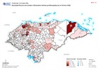
Honduras: Affected Population as at Nov 13th as percentage of baseline popula...
Map shows affected population as at Nov 13th as percentage of baseline population (2020 projected) per Municipality. -
Honduras: Damaged Infrastructure in each Municipality - Department (as at 12 ...
Honduras, Damaged Infrastructure as of 12th Nov 2020 (Displayed per Admin 1 / Department) -
Honduras: Destroyed & Damaged Houses in each Municipality - Department (as at...
Honduras, Destroyed & Damaged Houses per Municipality as of 12th Nov 2020 -
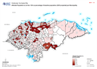
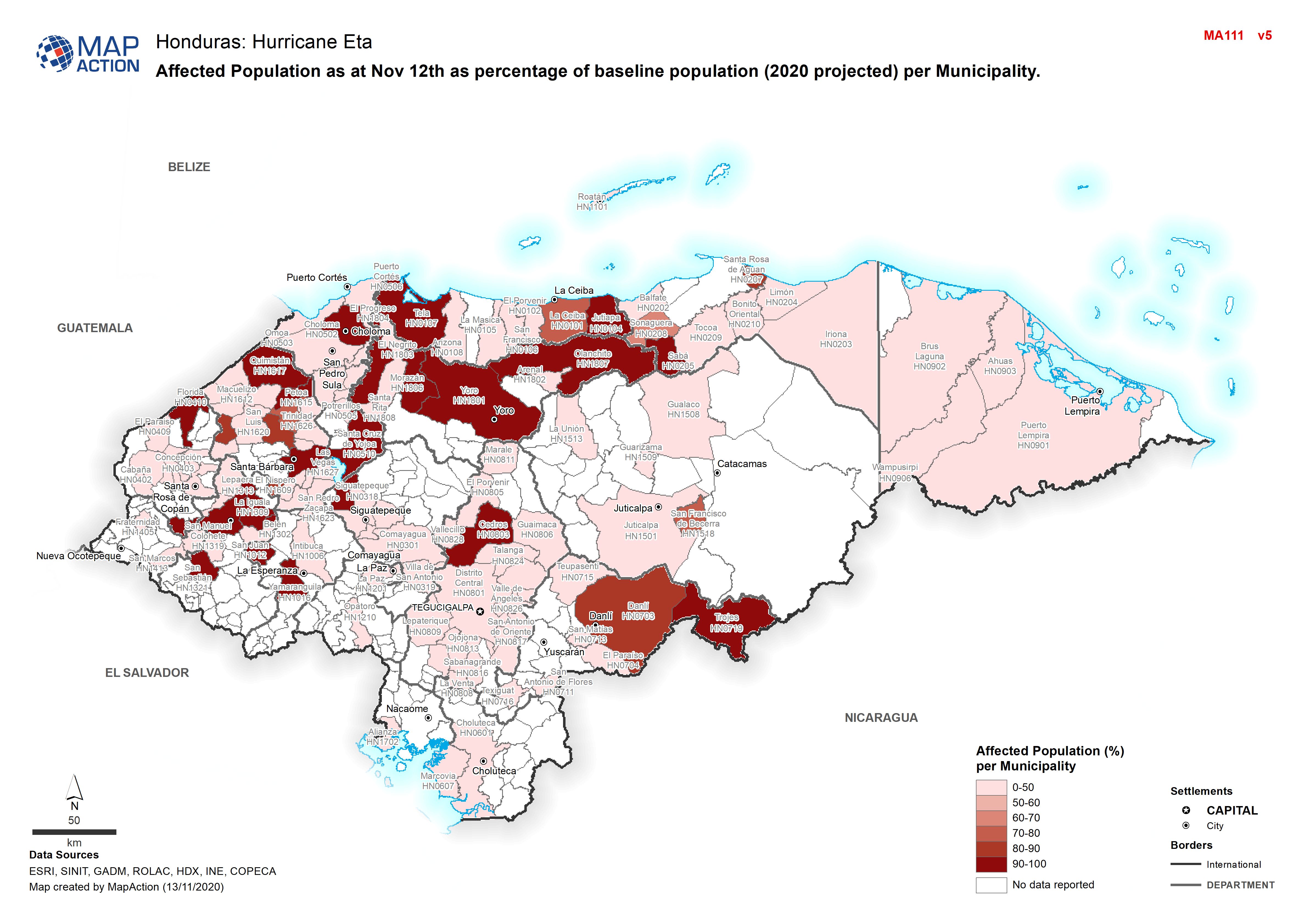
Honduras: Affected Population as at Nov 12th as percentage of baseline popula...
Map shows affected population as at Nov 12th as percentage of baseline population (2020 projected) per Municipality. -
Honduras: Evacuated Persons and number of Evacuation Centres per Municipality...
Map shows evacuated persons and number of evacuation centres per Municipality (as at 12th Nov 2020) -
Honduras: Damaged Infrastructure in each Municipality - Department (as at 11...
Honduras, Damaged Infrastructure as of 11th Nov 2020 (Displayed per Admin 1 / Department) -
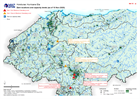
Honduras: Dam locations and capacity levels (as of 10 Nov 2020)
Honduras, Dam locations and capacity levels as of 10th Nov 2020 - including additional settlements and population density. -
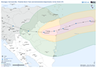
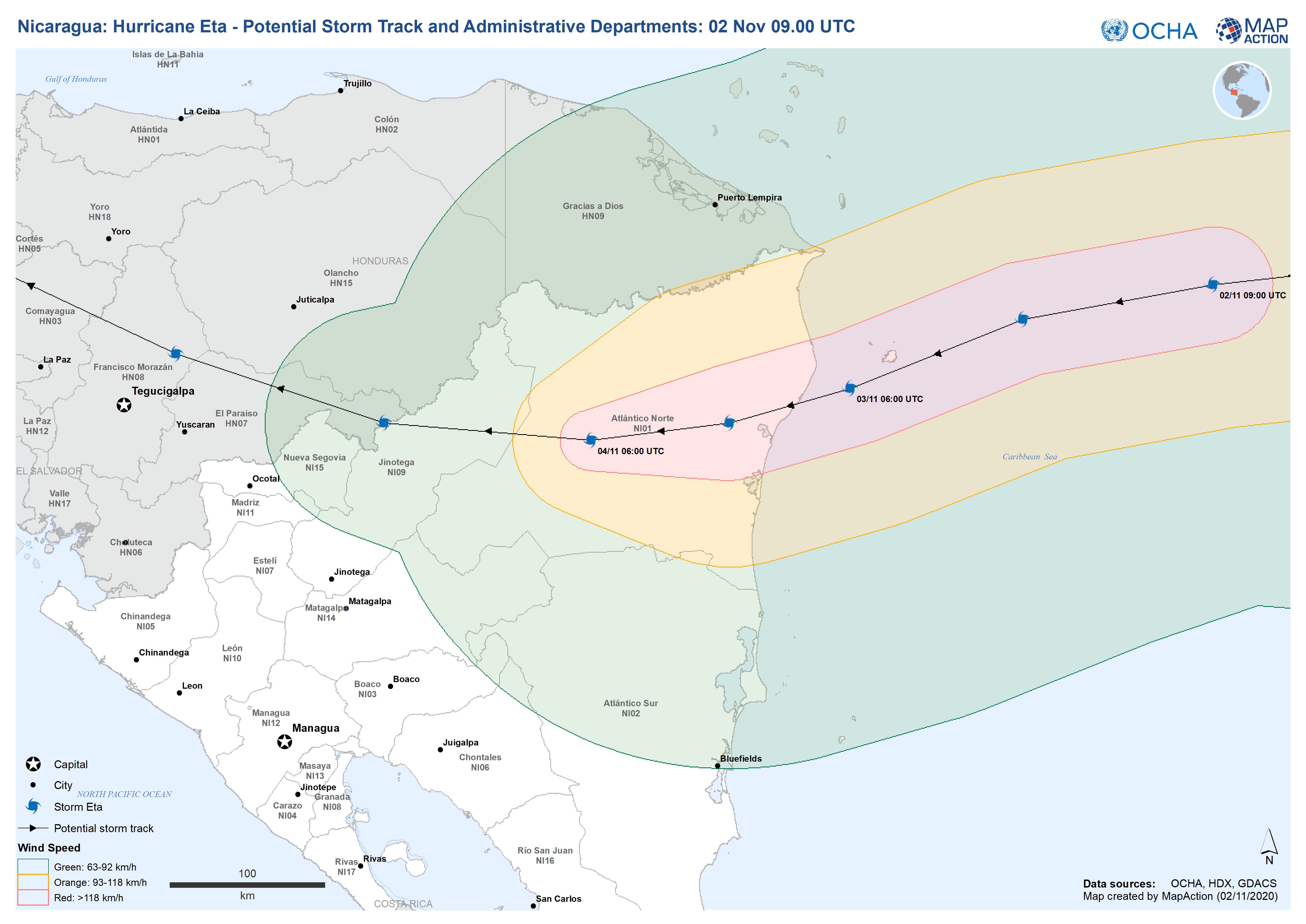
Nicaragua: Hurricane Eta - Potential Storm Track and Administrative Departmen...
This map shows the potential storm track for hurricane Eta with administration level 1 departments for Nicaragua and Honduras. -
Honduras: Destroyed & Damaged Houses in each Municipality (as at 11 Nov 2020)
Honduras, Destroyed & Damaged Houses per Municipality as of 11th Nov 2020 -
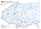
Honduras: Dam locations and capacity levels (as of 10 Nov 2020)
Honduras, Dam locations and capacity levels as of 10th Nov 2020 -

Honduras: Evacuated Persons and number of Evacuation Centres per Municipality...
Map shows evacuated persons and number of evacuation centres per Municipality (as at 11th Nov 2020) -

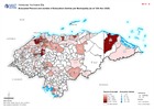
Honduras: Affected Population as at Nov 11th as percentage of baseline popula...
Map shows affected population as at Nov 11th as percentage of baseline population (2020 projected) per Municipality. -

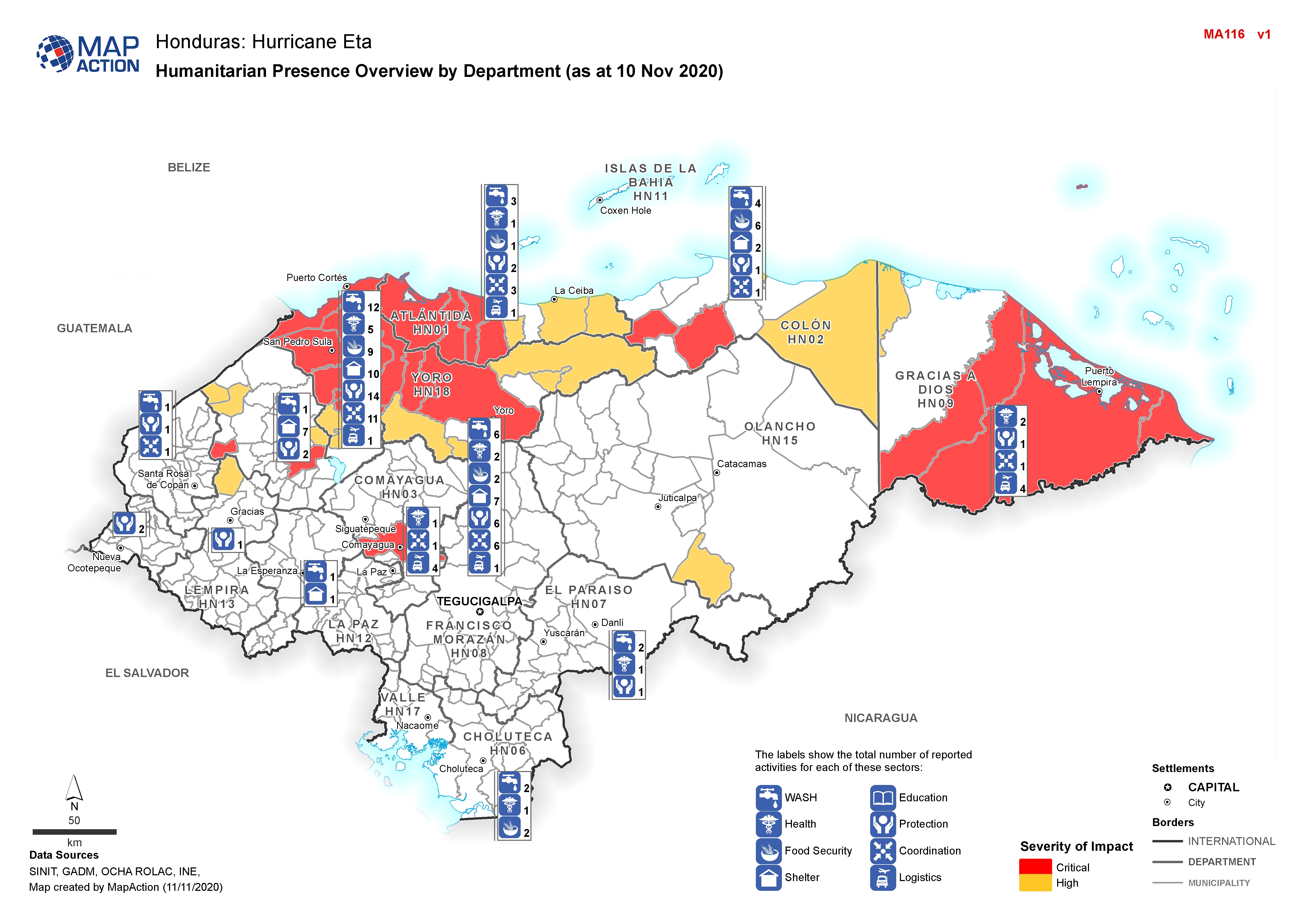
Honduras: Humanitarian Presence Overview by Department (as at 10 Nov 2020)
Map shows the number of reported activities per Sector per Department in Honduras. Critical and High priority response areas are also shown. -
Honduras: Damaged Infrastructure in each Municipality, by Department (as at 1...
Honduras, Mapbook of Damaged Infrastructure as of 10th Nov 2020 (Displayed per Admin 1 / Department) -
Honduras: Destroyed & Damaged Houses in each Municipality, by Department (as ...
Honduras, Mapbook of Destroyed & Damaged Houses per Municipality as of 10th Nov 2020 (Displayed per Admin 1 / Department)