-
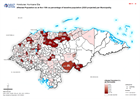
Honduras: Affected Population as at Nov 10th as percentage of baseline popula...
Map shows affected population as at Nov 10th as percentage of baseline population (2020 projected) per Municipality. -

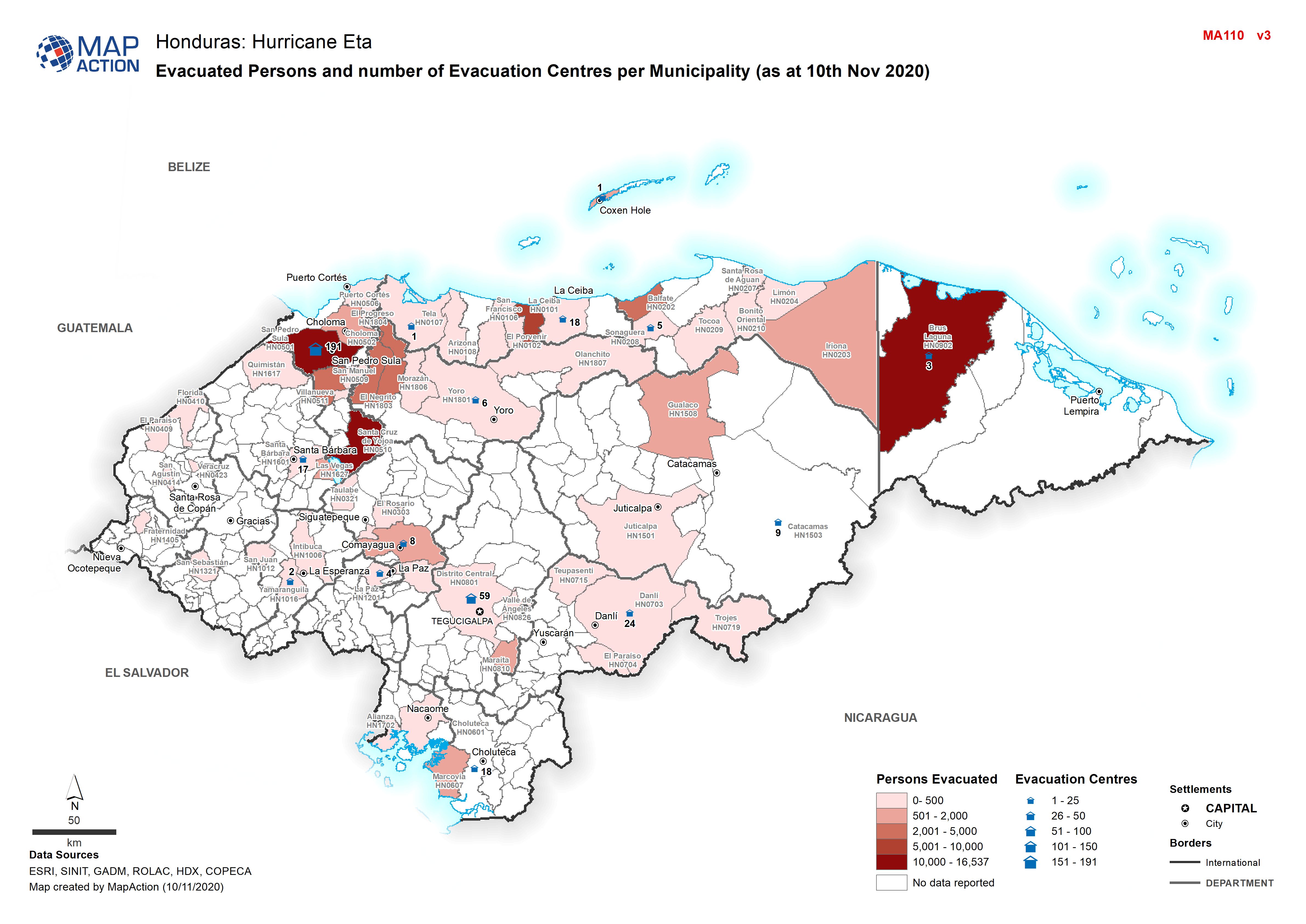
Honduras: Evacuated Persons and number of Evacuation Centres per Municipality...
Map shows evacuated persons and number of evacuation centres per Municipality (as at 10th Nov 2020) -

Honduras: Damaged Infrastructure (as at 09 Nov 2020)
Honduras, Damaged Infrastructure as of 09th Nov 2020 -

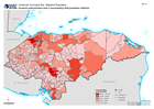
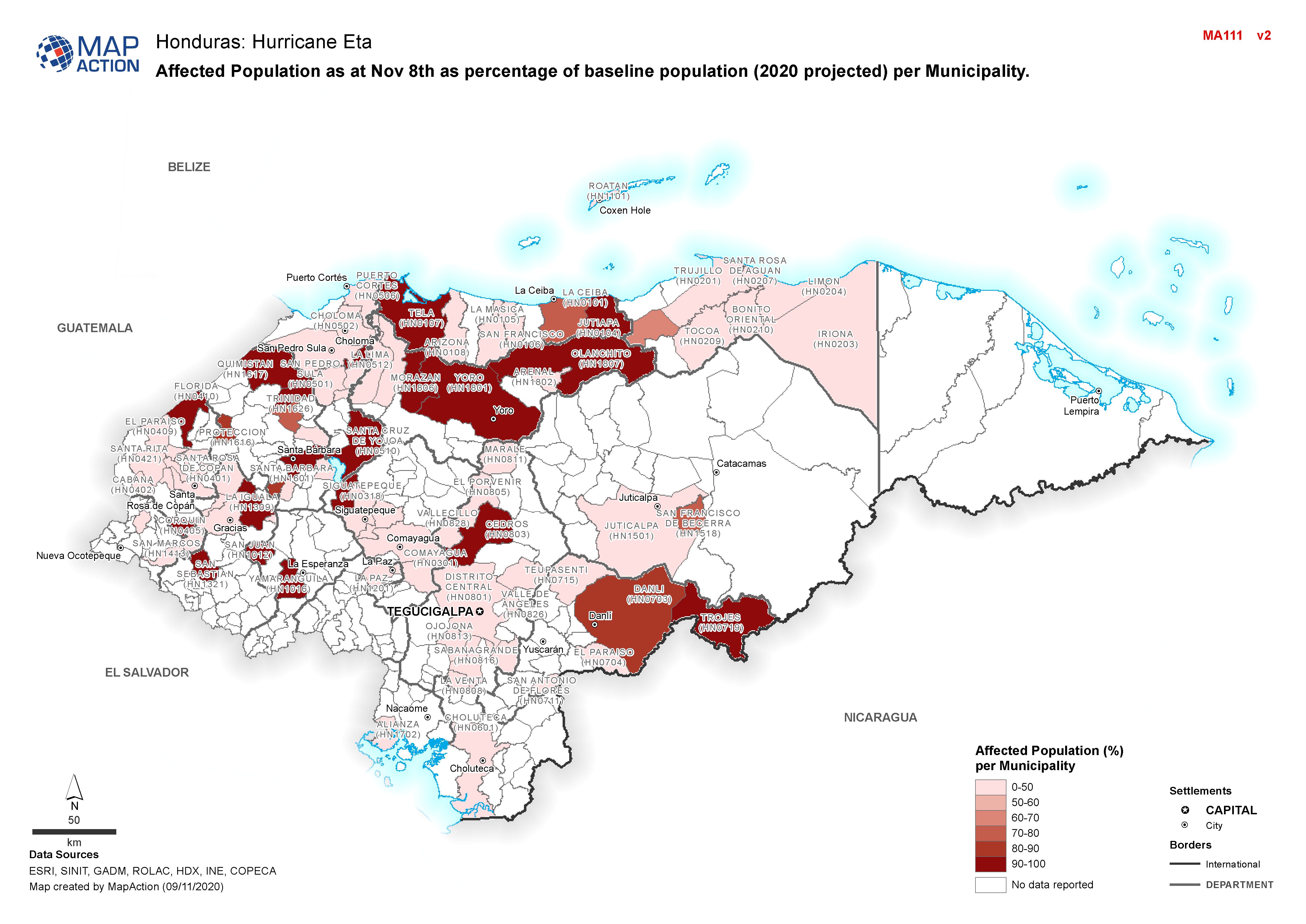
Honduras: Affected Population as at Nov 8th as percentage of baseline populat...
Map shows affected population as at Nov 8th as percentage of baseline population (2020 projected) per Municipality. -

Honduras: Evacuated Persons and number of Evacuation Centres per Municipality...
Map shows evacuated persons and number of evacuation centres per Municipality (as at 8th Nov 2020) -

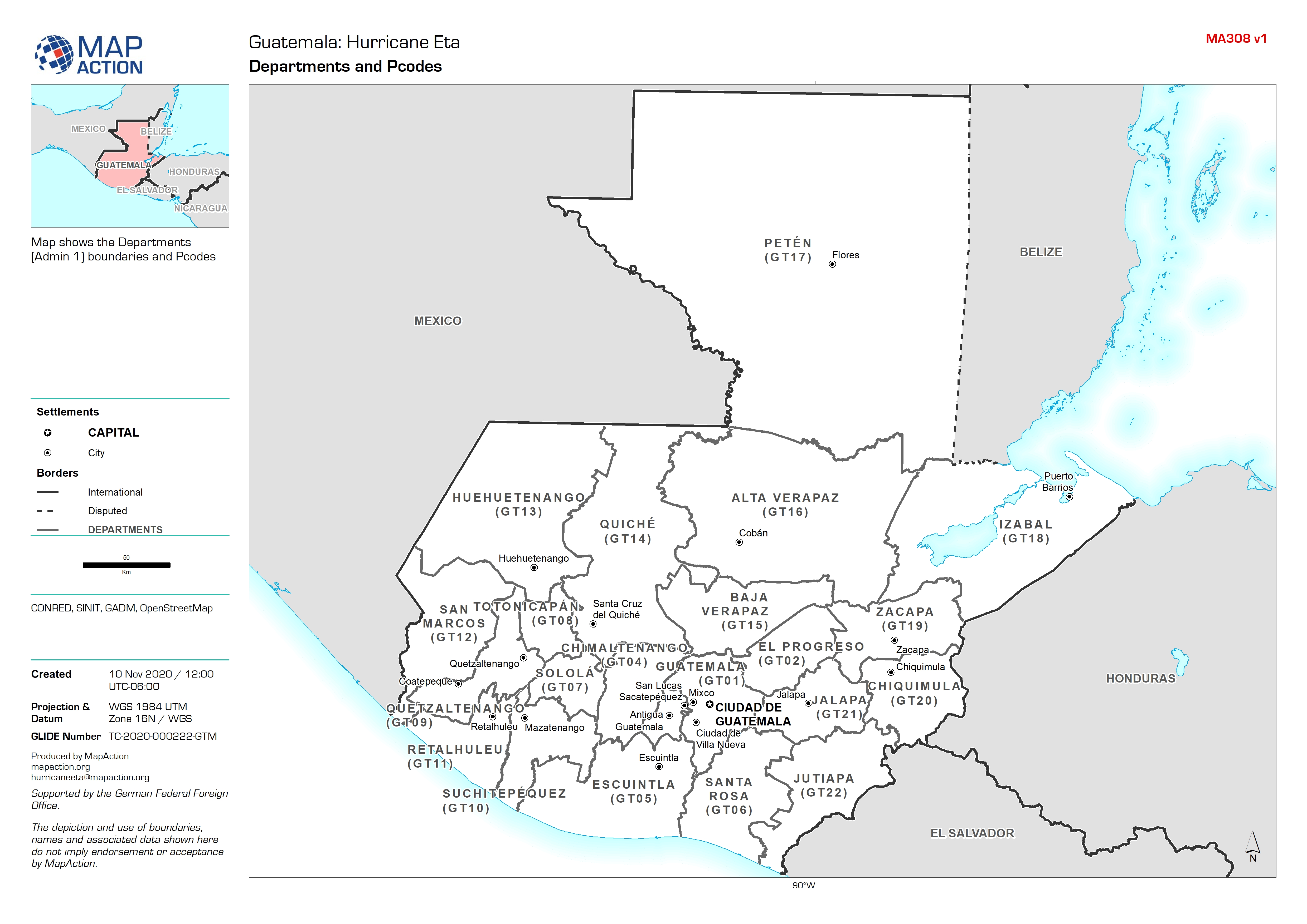
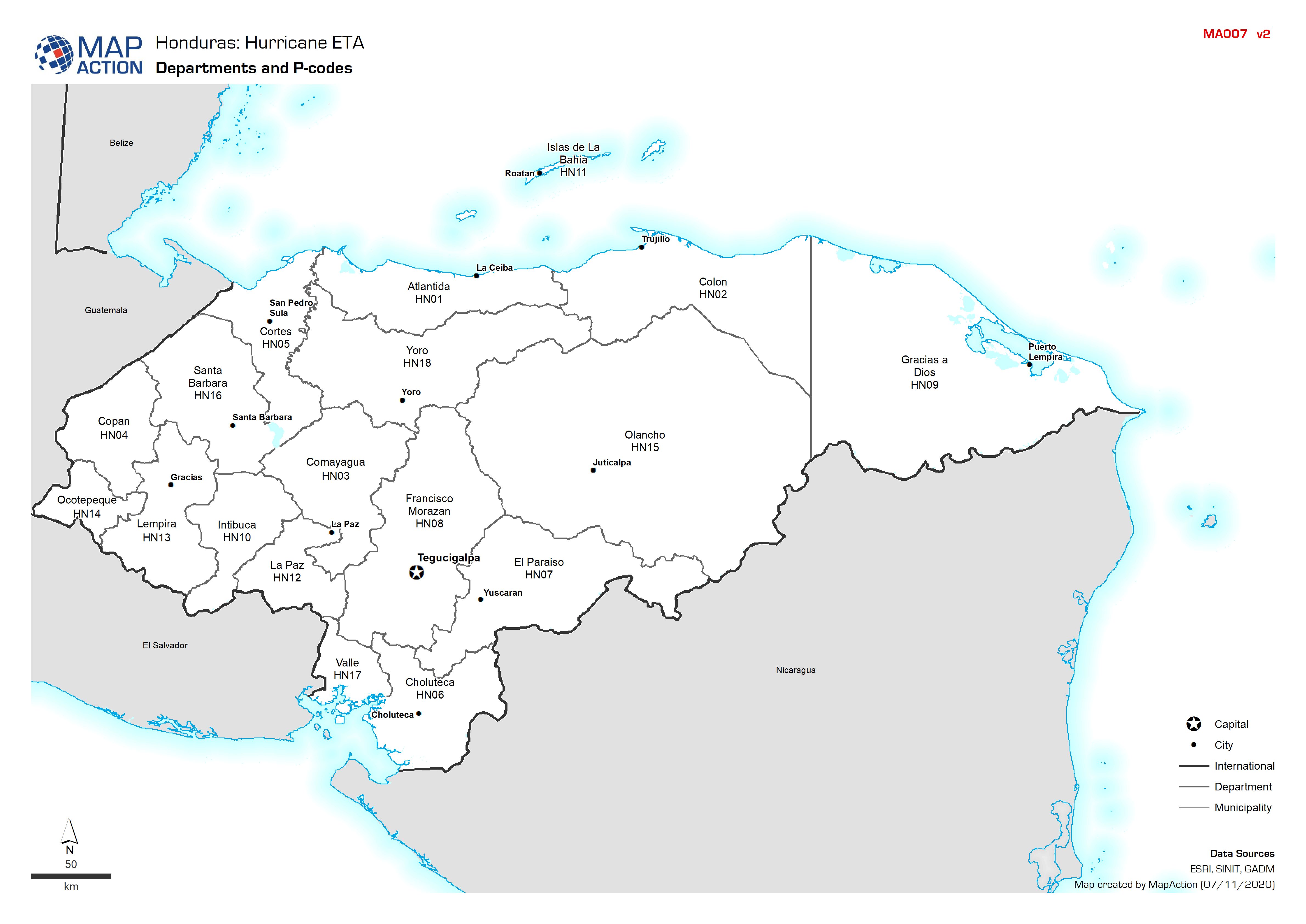
Guatemala: Departments and Pcodes
Map shows the Departments (Admin 1) boundaries and Pcodes -

-
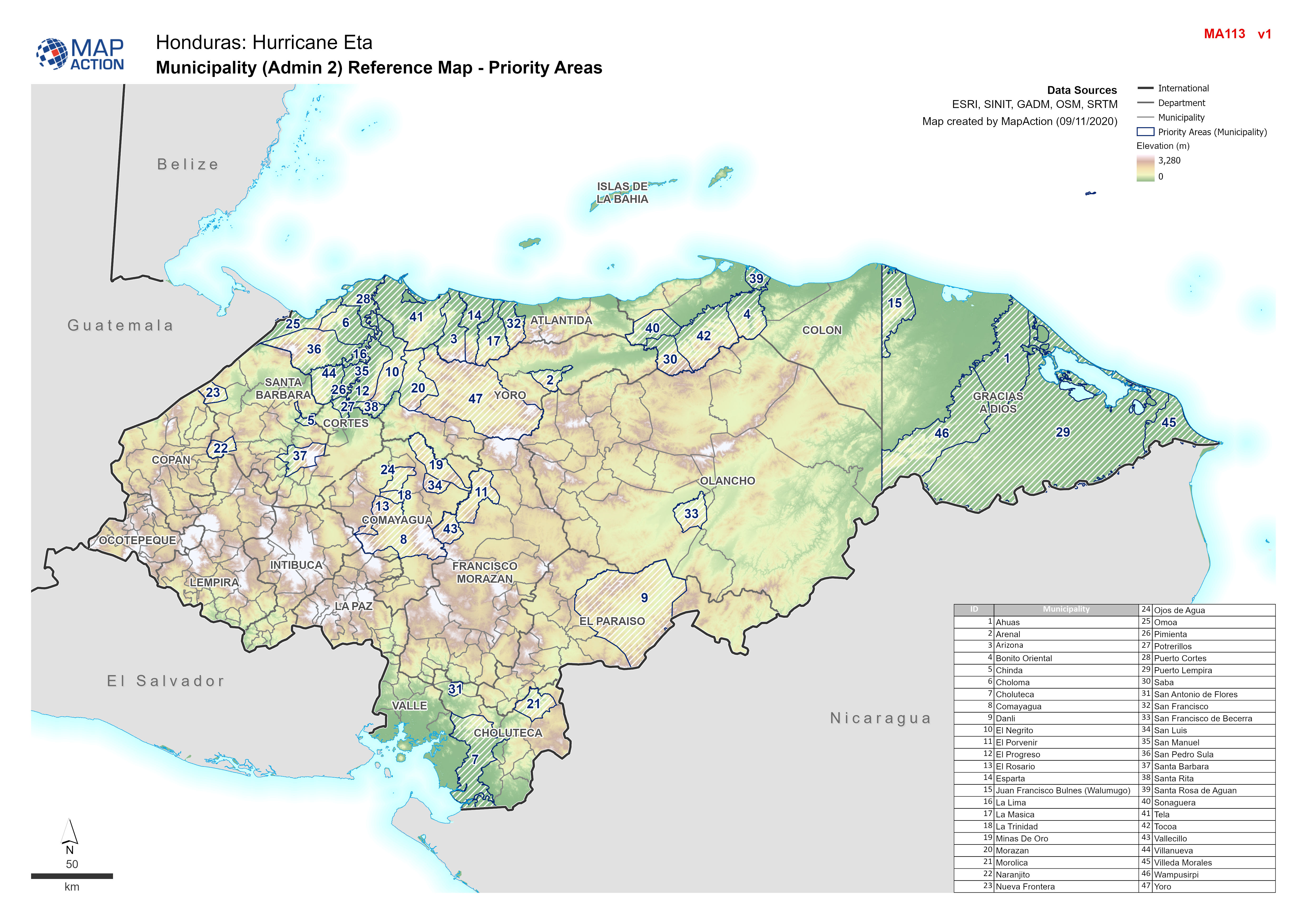
Honduras: Reference maps at Municipality level
Honduras - Reference maps at Municipality level -
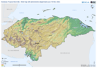
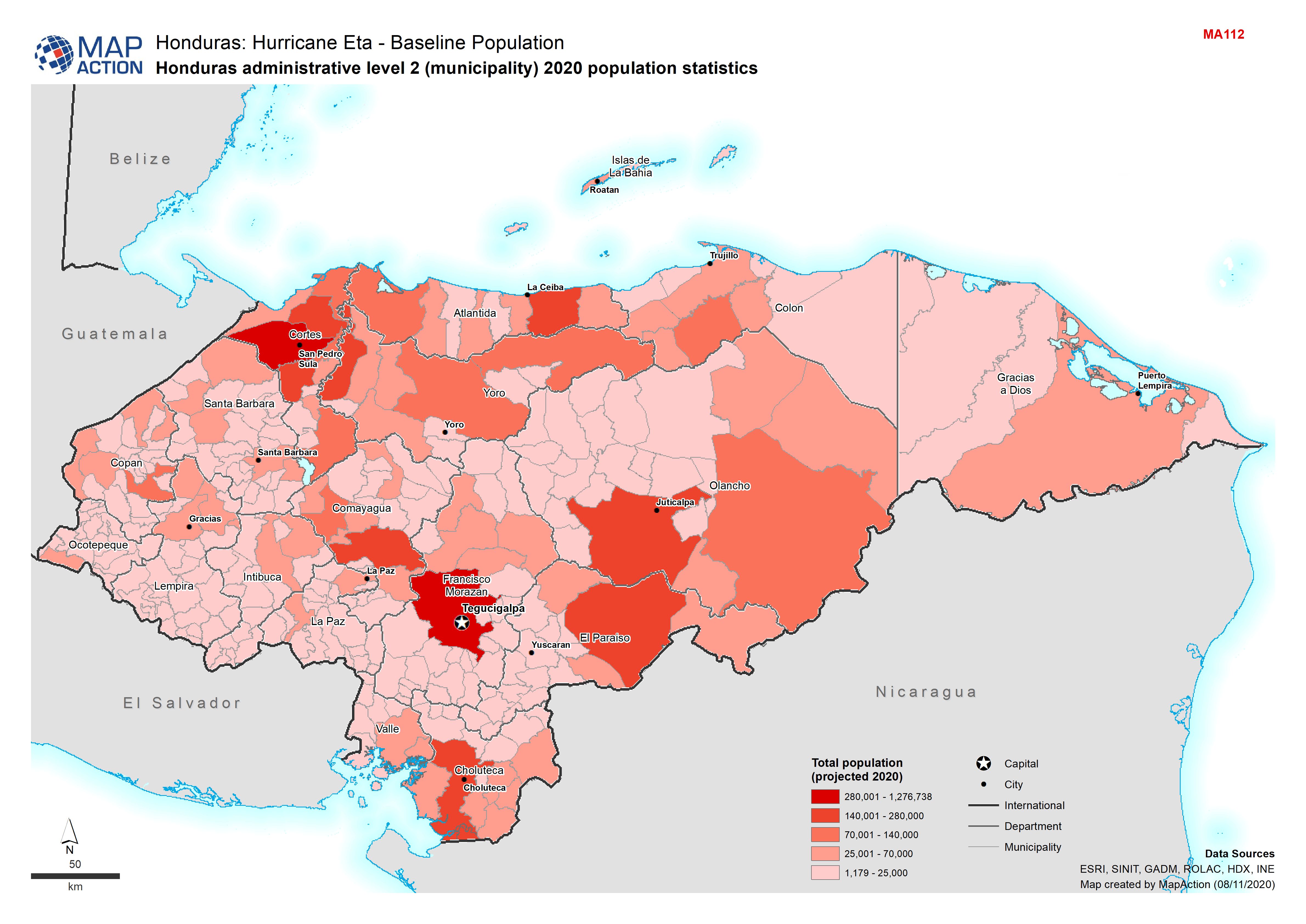
Honduras: administrative level 2 (municipality) 2020 population statistics
Baseline population for Honduras -

-
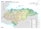
Honduras: Relief map with administrative departments (as of 08 Nov 2020)
This map shows elevation and administration level 1 departments for Honduras. -

Honduras: Affected Departments and Municipalities (as of 07 Nov 2020)
This map shows the storm affected administration level 1 departments and level 2 municipalities for Honduras. -
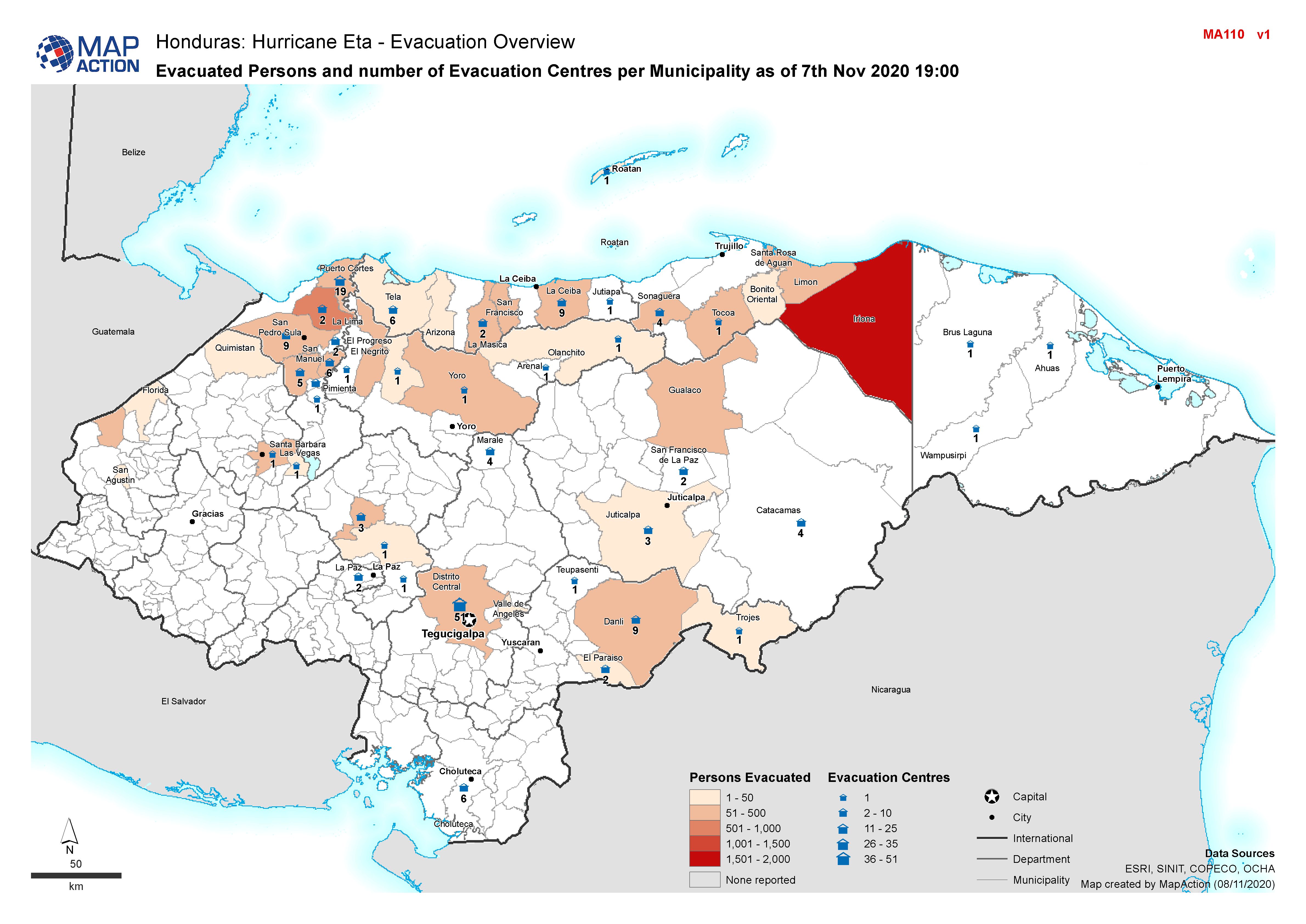
Honduras: Evacuated Persons and number of Evacuation Centres per Municipality...
Honduras, Evacuated Persons and number of Evacuation Centres per Municipality as of 7th Nov 2020 19:00 -