-

Pakistan: IDP camps CHANGE in camp population, 9 to 11 June 2009
This dataset has no description
-

-

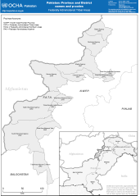
Pakistan: Province and District names and p-codes - Federally Administered Tr...
This dataset has no description
-

-

-
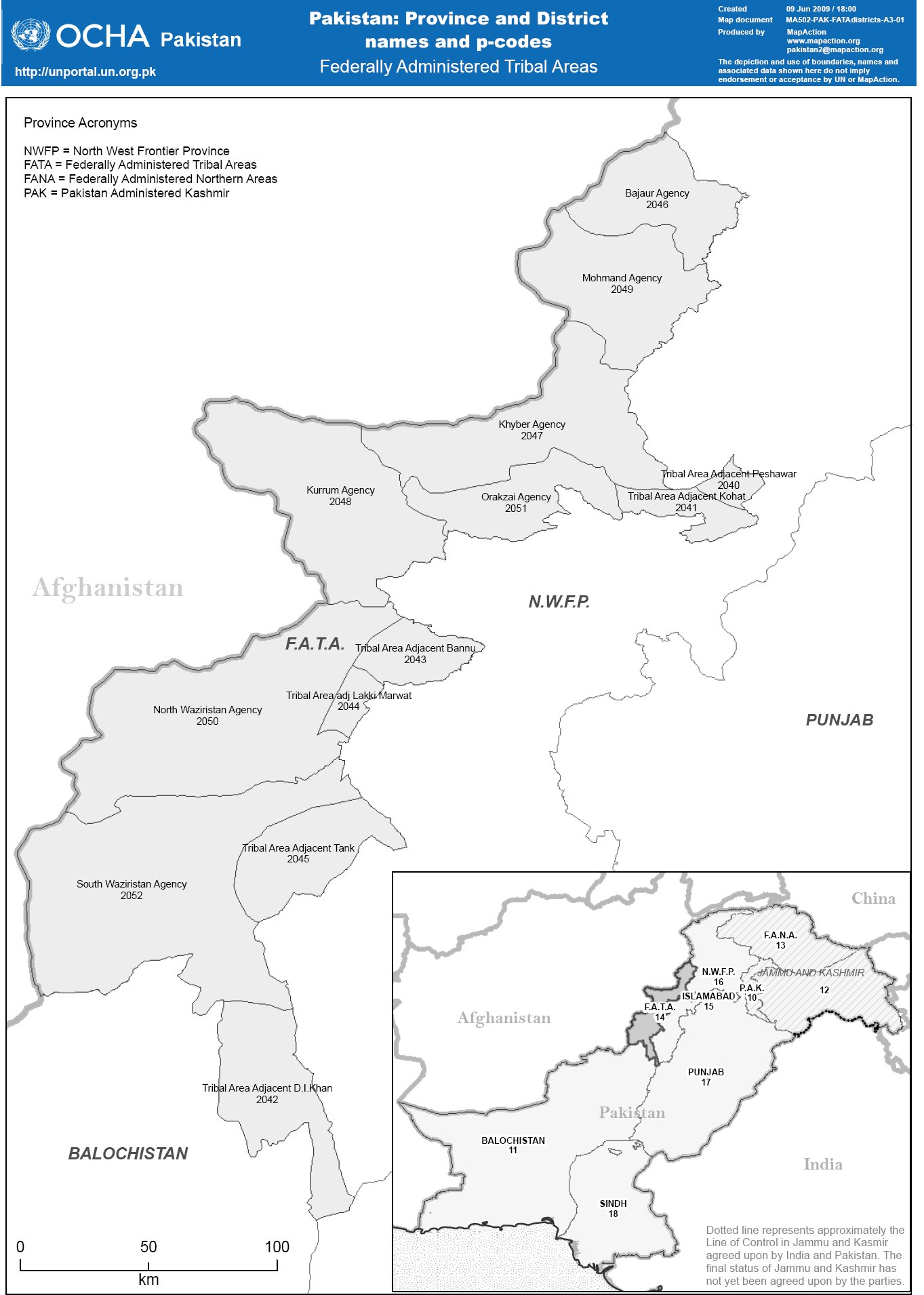
Pakistan: Province and District names and p-codes - Federally Administered Tr...
This dataset has no description
-
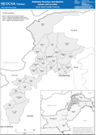
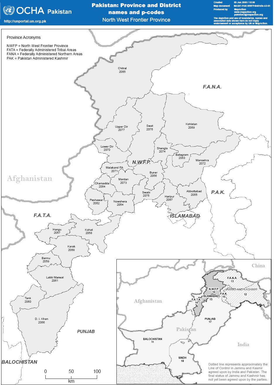
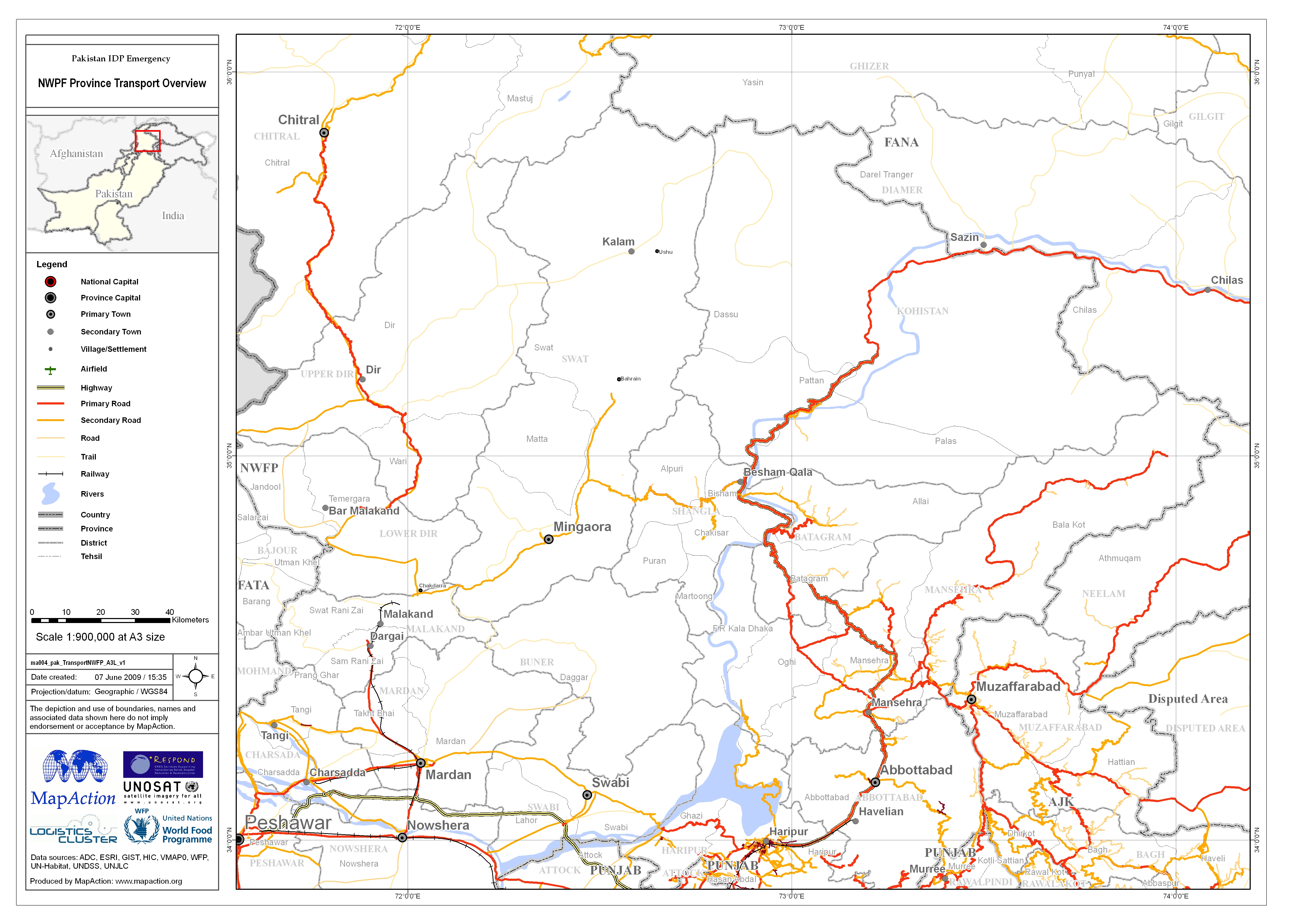
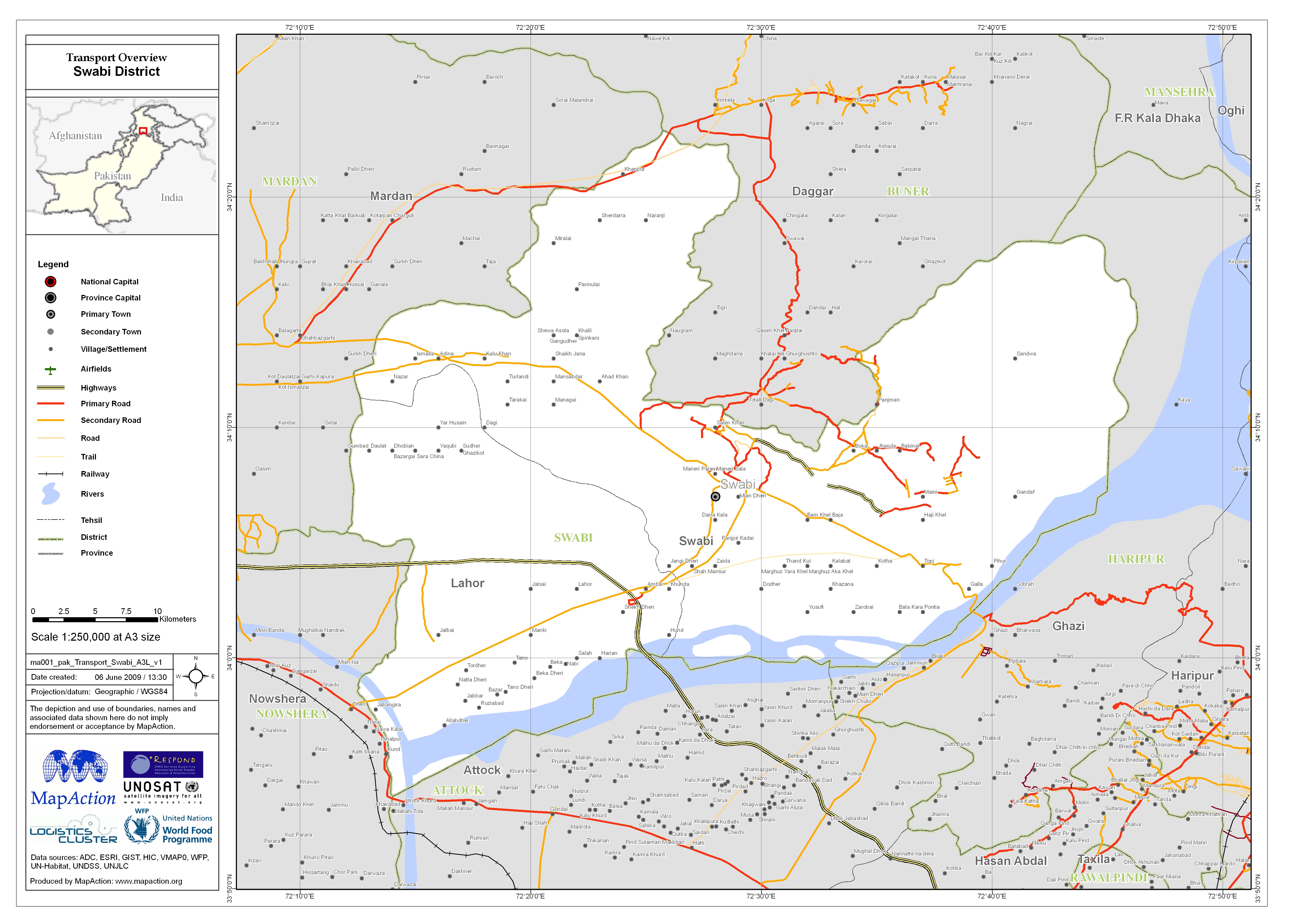
Pakistan: Province and District names and p-codes - North West Frontier Province
This dataset has no description
-
-
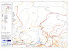
Pakistan IDP Emergency: Quetta to Waziristan Transport Overview
This dataset has no description
-
-

-

Philippines: Typhoon Pepeng - Evacuation Center Overview (as of 08 Oct 2009, ...
This dataset has no description
-

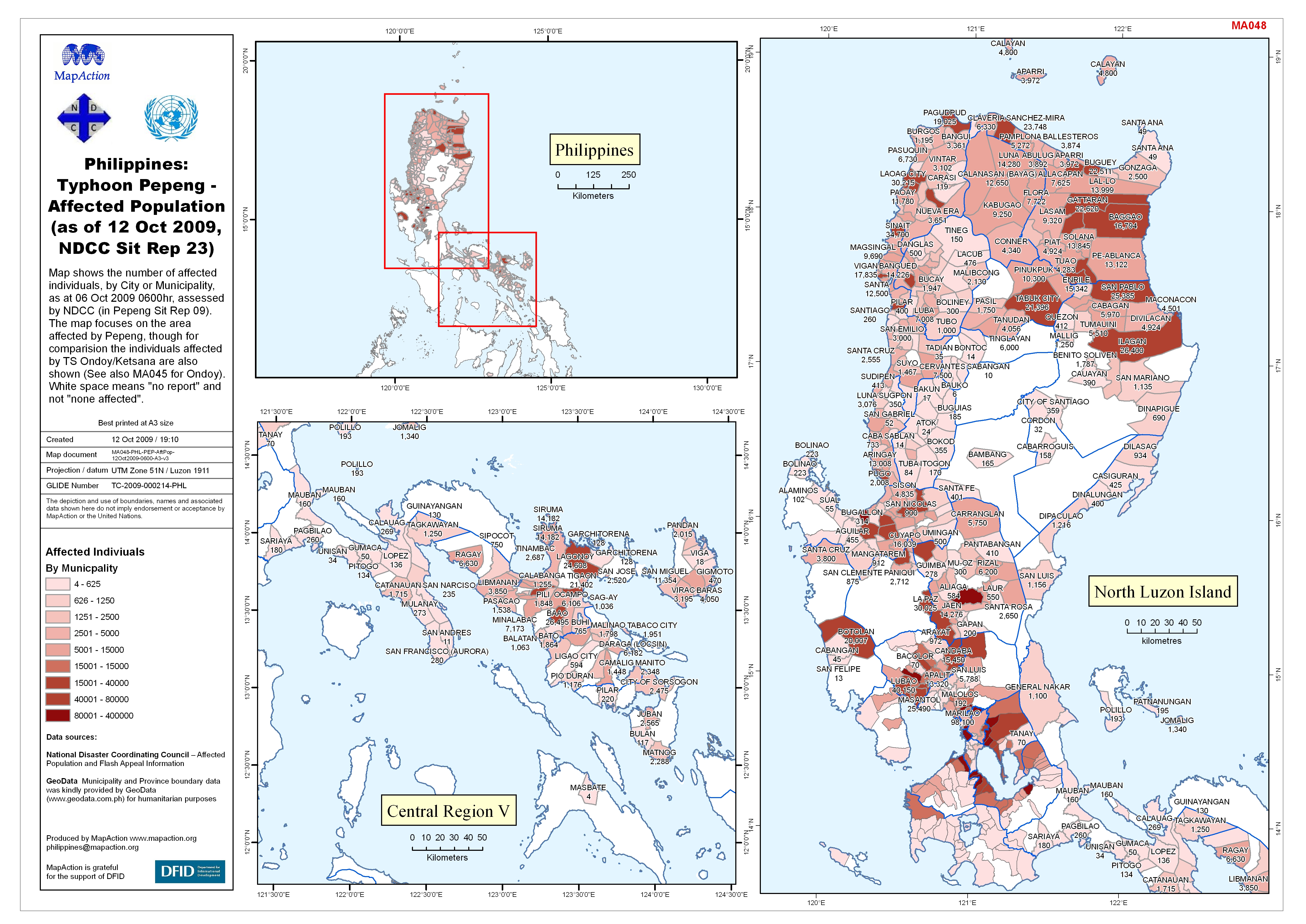
Philippines: Typhoon Pepeng - Affected Population (as of 12 Oct 2009, NDCC Si...
This dataset has no description
-

Philippines: Typhoon Pepeng - Floods as reported in NDCC Sitrep 25 and 26. 13...
Map shows information from the NDCC report No 25 and 26. Also shown are the dam water heights from 99:99 am on 13 Oct 2009. -

Philippines: Typhoon Pepeng - San Roque Dam Situation and Target Areas - 12 O...
The map focuses on the San Roque Dam and Agno River Basin and hows flood information from the National Disaster Coordinating Council Information. Also shown are the target areas... -

Philippines: Typhoon Pepeng - Dam Situation Update and Target Areas - 12 Oct ...
Map shows information from the NDCC report No 21 and 22. Also shown are the target areas as defined by the Philippines Atmospheric, Geophysical and Astronomical Servies... -

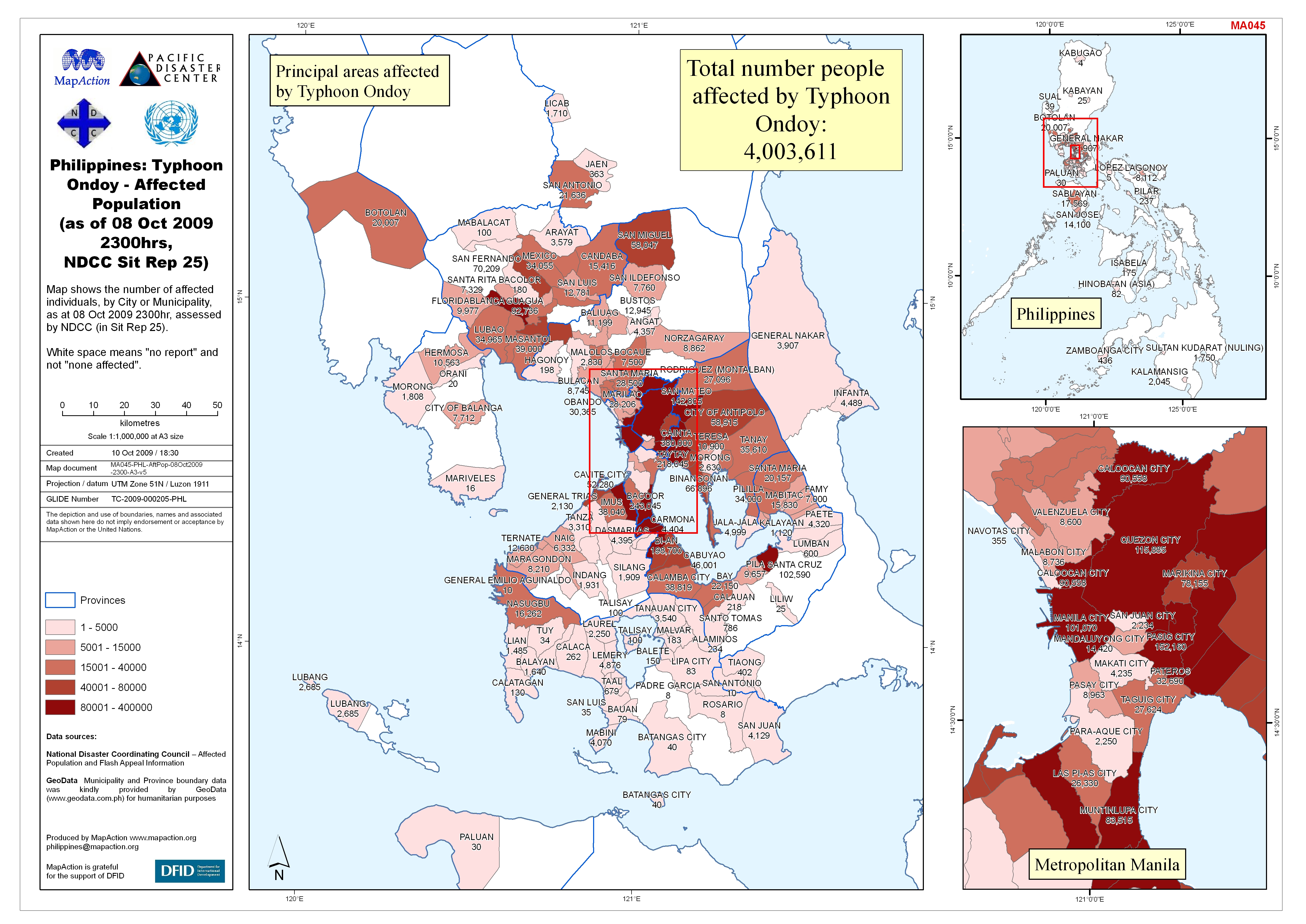
Philippines: Tropical Storm Ondoy - Evacuation Center Overview (as of 08 Oct ...
Map shows the number of individuals staying in Evacuation Centers (ECs), by City or Municipality, as at 08 Oct 2009 2300hr, assessed by NDCC (in Sit Rep 25). Also shown (in text... -

Philippines: Typhoon Ondoy - Affected Population (as of 08 Oct 2009 2300hrs, ...
Map shows the number of affected individuals, by City or Municipality, as at 08 Oct 2009 2300hr, assessed by NDCC (in Sit Rep 25). White space means "no report" and not "none... -

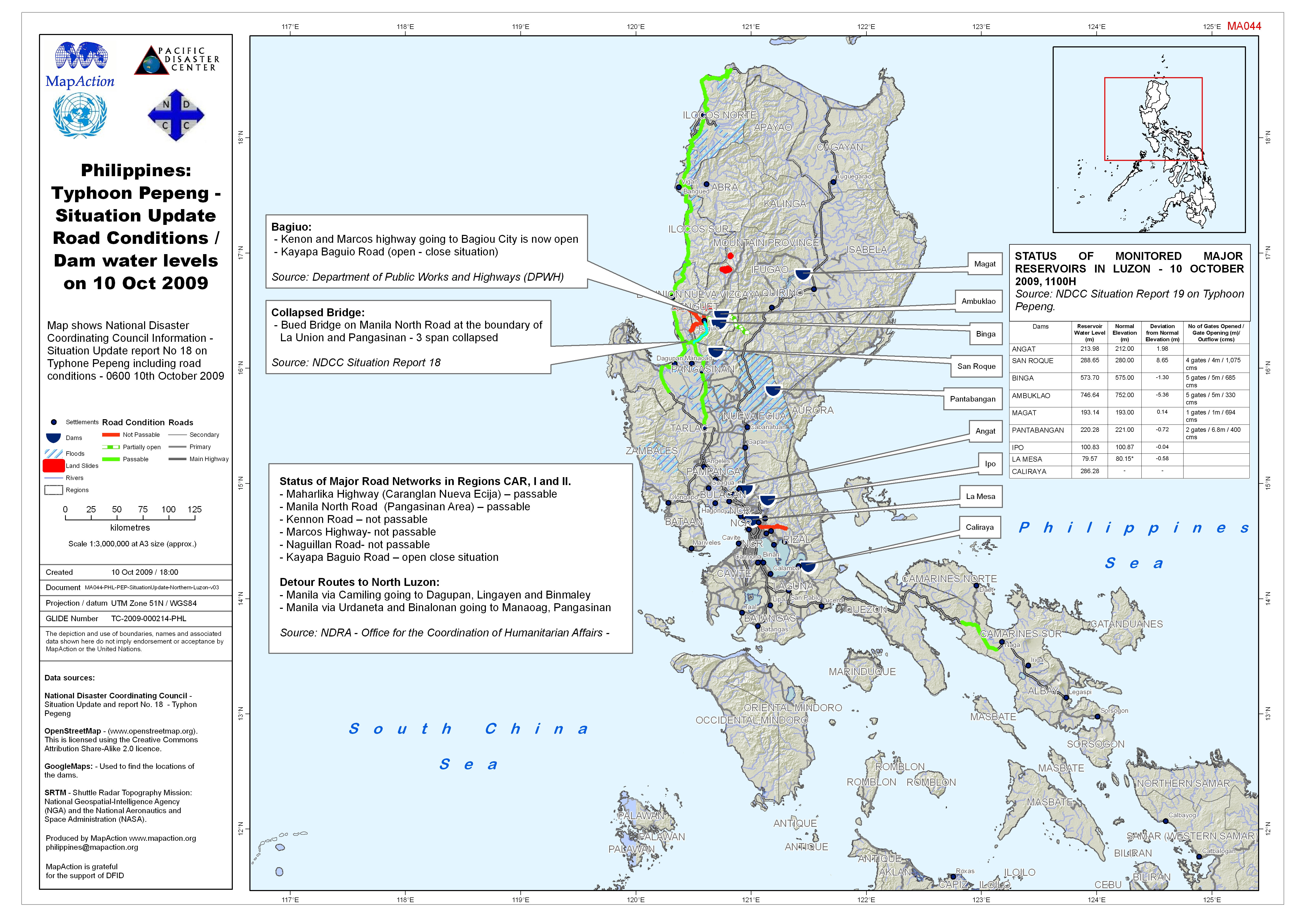
Philippines: Typhoon Pepeng - Situation Update Road Conditions / Dam water le...
Map shows National Disaster Coordinating Council Information - Situation Update report No 18 on Typhone Pepeng including road conditions - 0600 10th October 2009 -
Philippines: Typhoon Pepeng - Situation Update & Assistance Provided 9 Oct 2009
Map shows National Disaster Coordinating Council information from Situation Update Report No 16 on Typhoon Pepeng, 9 Oct 2009 06:00