-
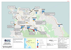
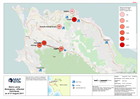
Sierra Leone Landslide/floods - Operations/Logistics (as of 23 Aug 2017)
Map shows key operational locations and the activies being conducted at each site. Points of Interest relevant to the operational setting are also provided. -
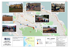
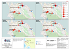
Sierra Leone Landslide & Floods Shelter Sites as of 23 August 2017
Map indicates the location of active and proposed shelters in Freetown identified by national agencies. Confirmation is needed of the status and population of these shelters. -

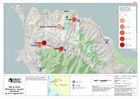
Sierra Leone Emergency - Affected individuals as of 21 August 2017
Map shows the numbers of registered affected individuals reported by Sierra Leone Office of National Security (ONS). -
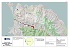
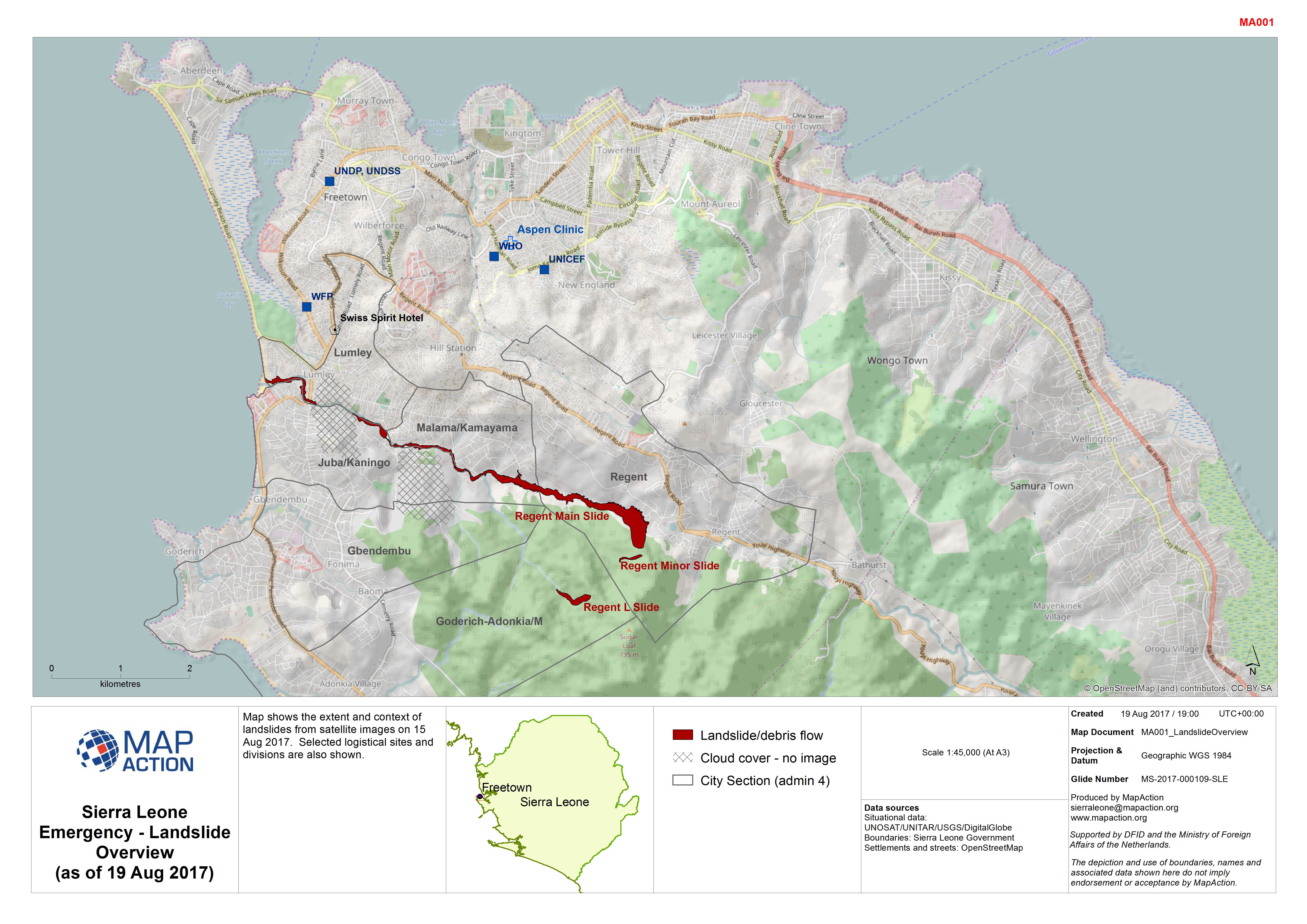
Sierra Leone Emergency - Landslide Overview (as of 19 Aug 2017)
Map shows the extent and context of landslides from satellite images on 15 Aug 2017. Selected logistical sites and divisions are also shown. -

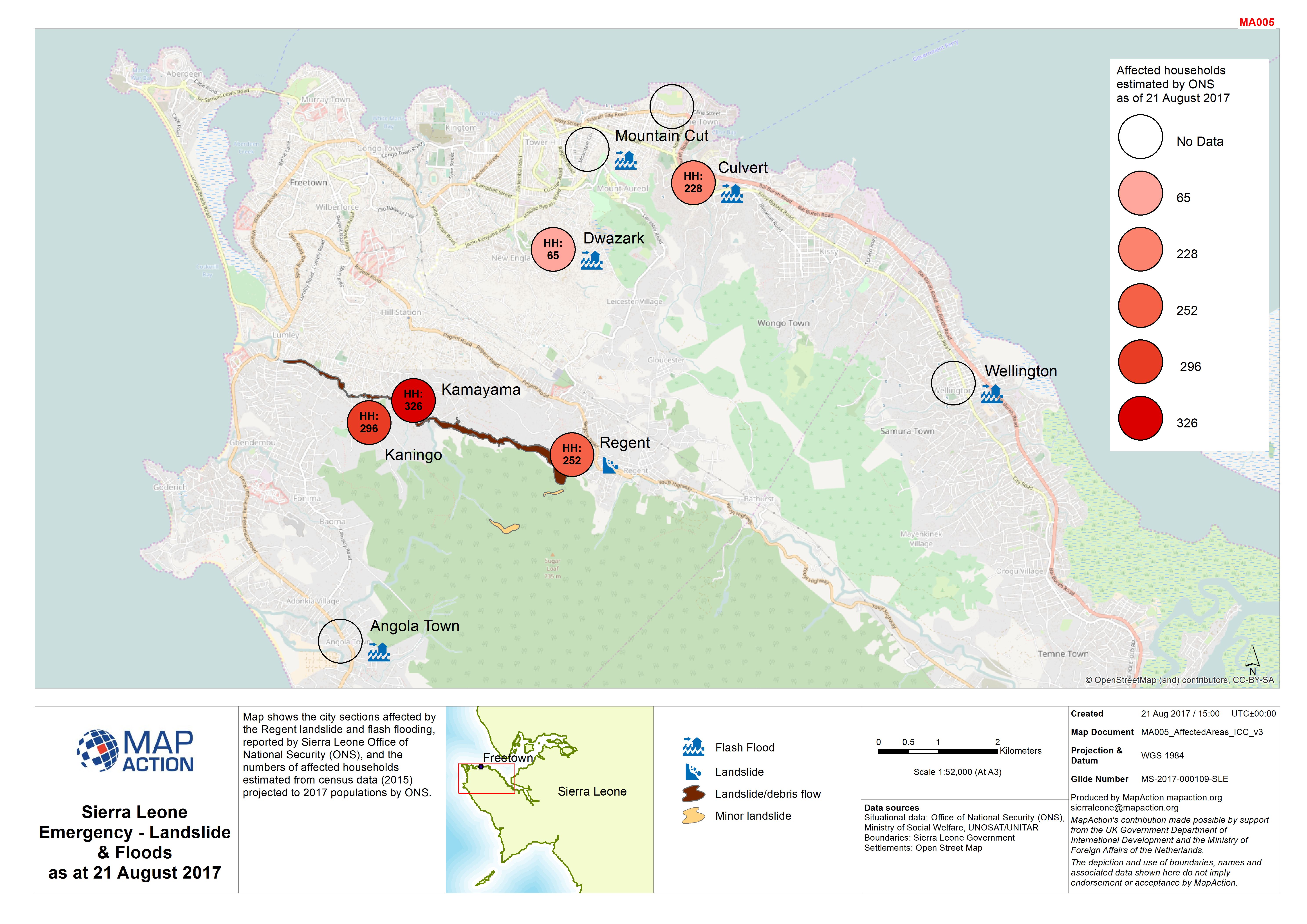
Sierra Leone Emergency - Landslide & Floods as at 21 August 2017
Map shows the city sections affected by the Regent landslide and flash flooding, reported by Sierra Leone Office of National Security (ONS), and the numbers of affected... -
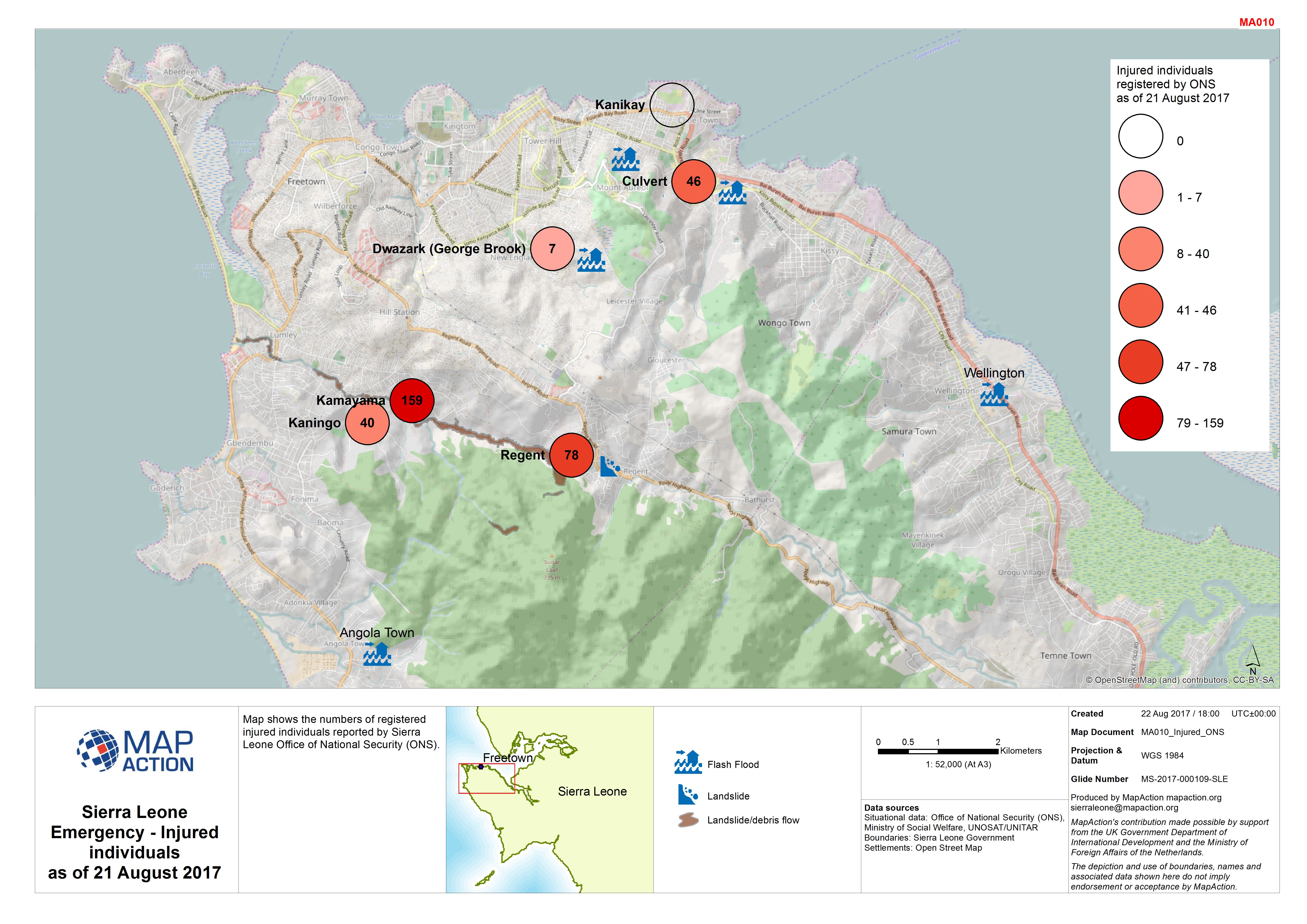
Sierra Leone Emergency - Injured individuals as of 21 August 2017
Map shows the numbers of registered injured individuals reported by Sierra Leone Office of National Security (ONS). -

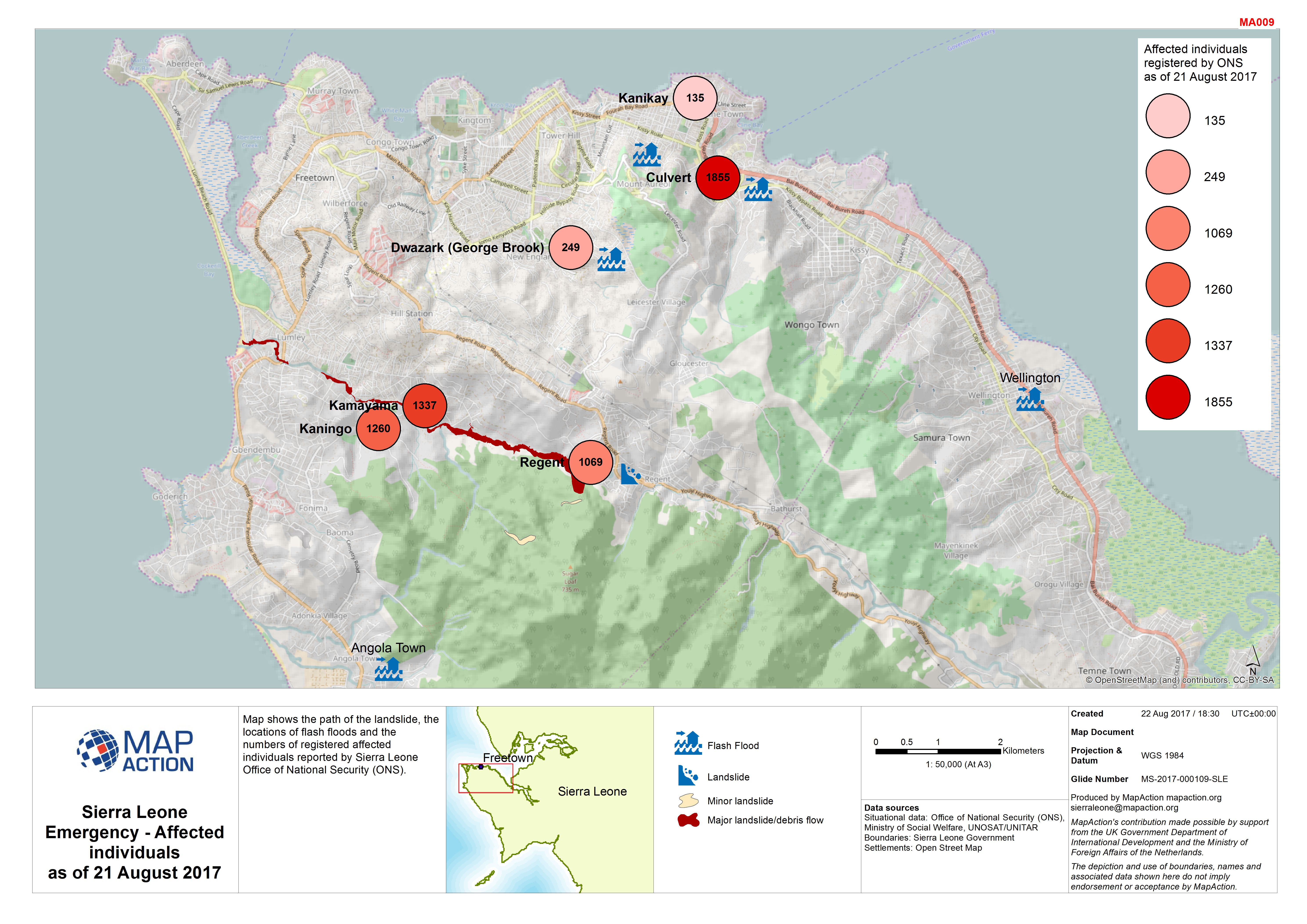
Sierra Leone Emergency - Affected individuals as of 21 August 2017
Map shows the path of the landslide, the locations of flash floods and the numbers of registered affected individuals reported by Sierra Leone Office of National Security (ONS). -
Sierra Leone Emergency - Affected individuals as of 21 August 2017
Map shows the numbers of registered affected individuals reported by Sierra Leone Office of National Security (ONS). -
Sierra Leone Emergency - Affected children as of 21 August 2017
Map shows the numbers of registered affected children by age group, reported by Sierra Leone Office of National Security (ONS). -

Sierra Leone Emergency - Affected children as of 21 August 2017
Map shows the numbers of registered affected children by age group, reported by Sierra Leone Office of National Security (ONS). -

-
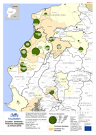
Ecuador: Terremoto Personas Albergades (a 24 Abril 2016)
El mapa muestra el numero de personas albergadas en refugios communidades a 24 abríl. Remarca que la cantidad de personas desplazadas pueda ser elevado. Los cantones afectados y... -

Ecuador: Terremoto - Evaluaciones en Curso (a 19 Abril 2016)
El mapa describe las zonas en donde se estan realizando evaluaciones de danos por el gobierno y por organismos internacionales. -
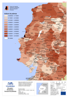
Ecuador: Terremoto - Incices de pobreza
Mapa para planificar de la misión MIRA. Muestra el nivelle de pobresa en los cantones y las limitas de imágenes satelitas que son disponible para la evaluación de edificios... -

Tanzania Earthquake NE of Kagera Region Administrative Map (as of 22 Sep 2016)
Map shows the extent of the damaged districts/wards from the Earthquake with terrain. This is primarily a reference map with villages, road and river displayed to show context...