-
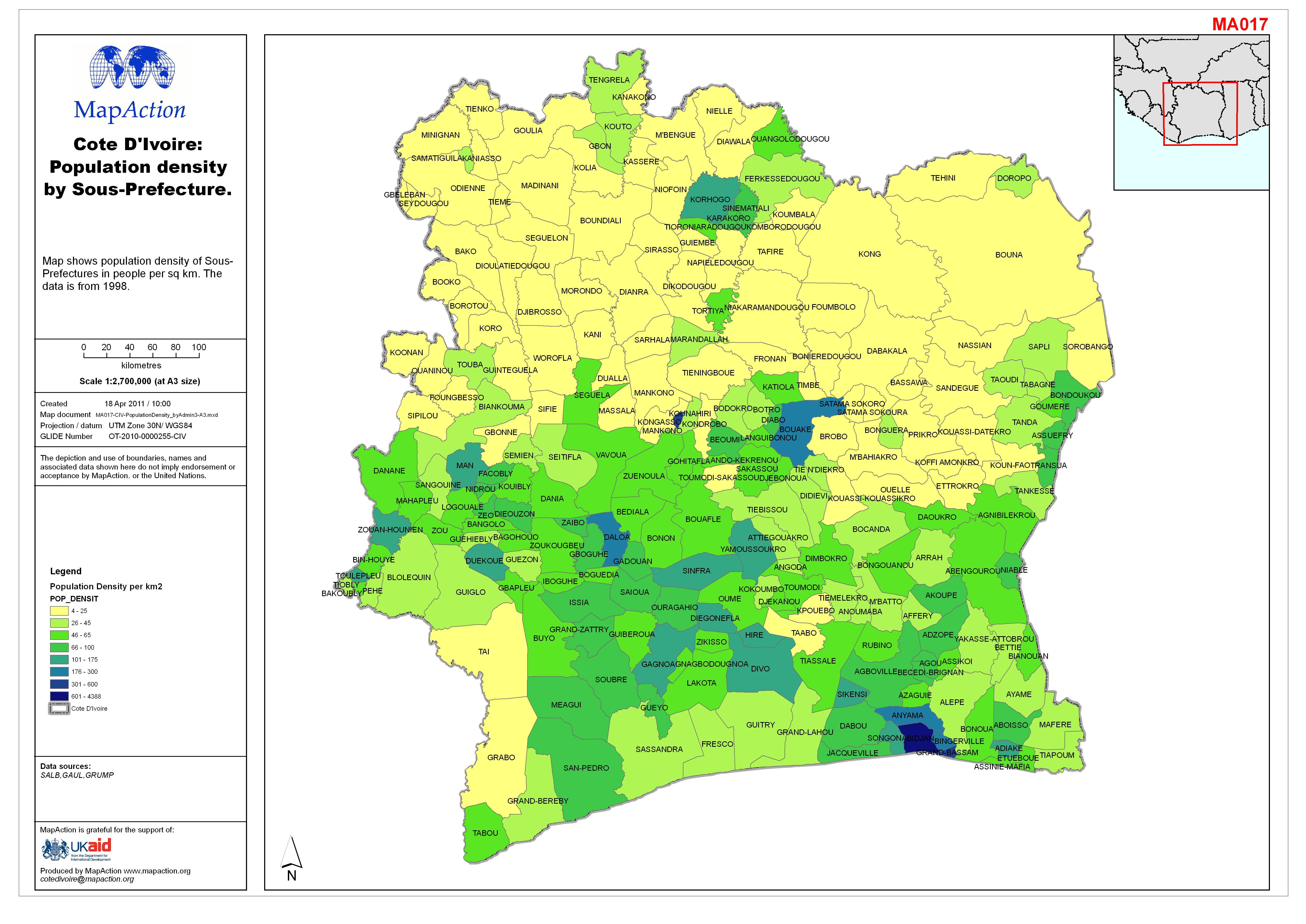
Côte d’Ivoire: Population density by Sous-Prefecture.
Map shows population density of Sous-Prefectures in people per sq km. The data is from 1998. -

Côte d’Ivoire: Indicative population map
Reference map for UNDAC mission to Côte d’Ivoire in April 2011.GRUMP population density data. The settlement population data is from 1988 and should be used as indicative only...