-

-

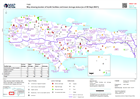
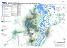
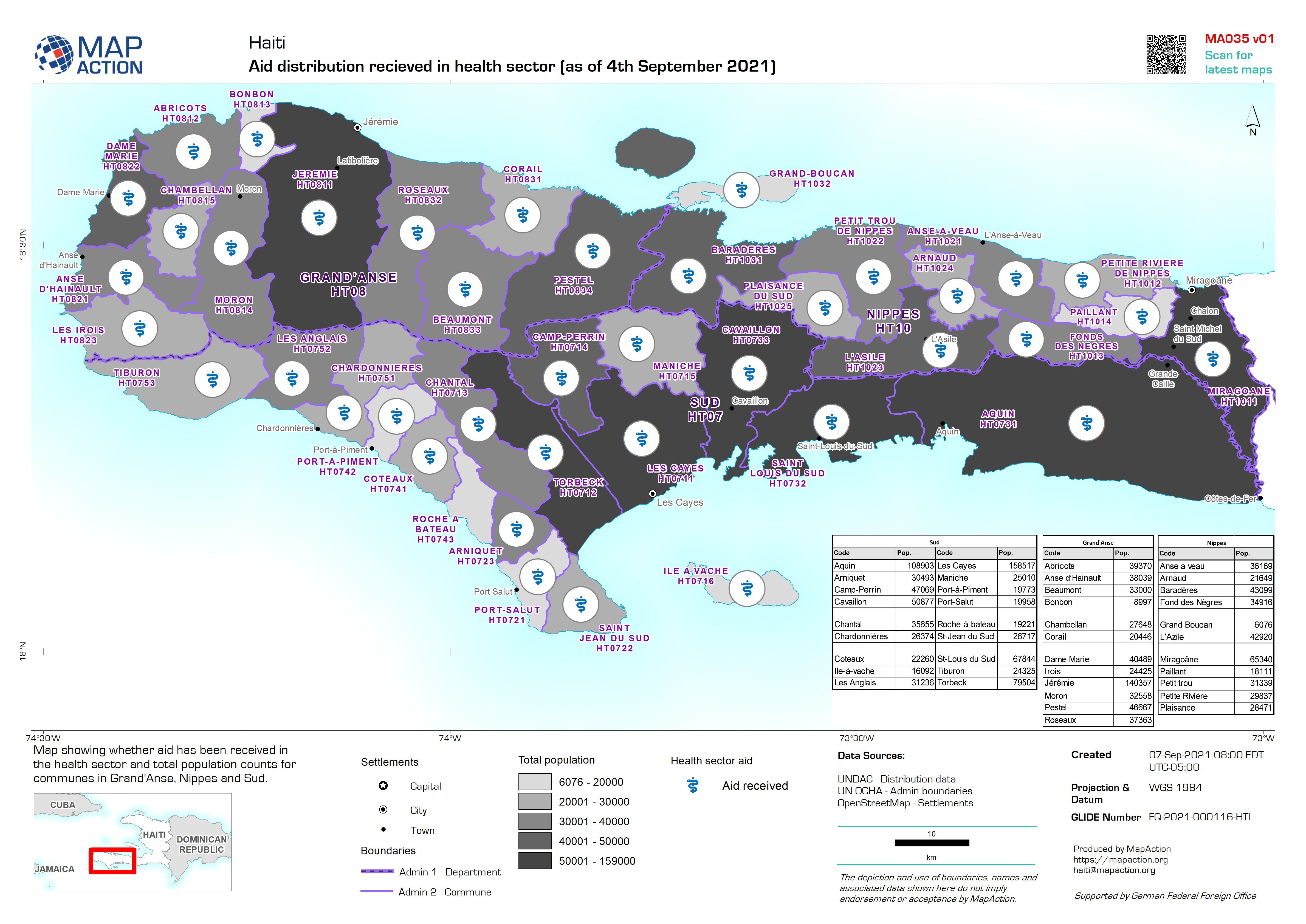
Aid distribution recieved in health sector (as of 4th September 2021)
Map showing whether aid has been received in the health sector and total population counts for communes in Grand'Anse, Nippes and Sud. -
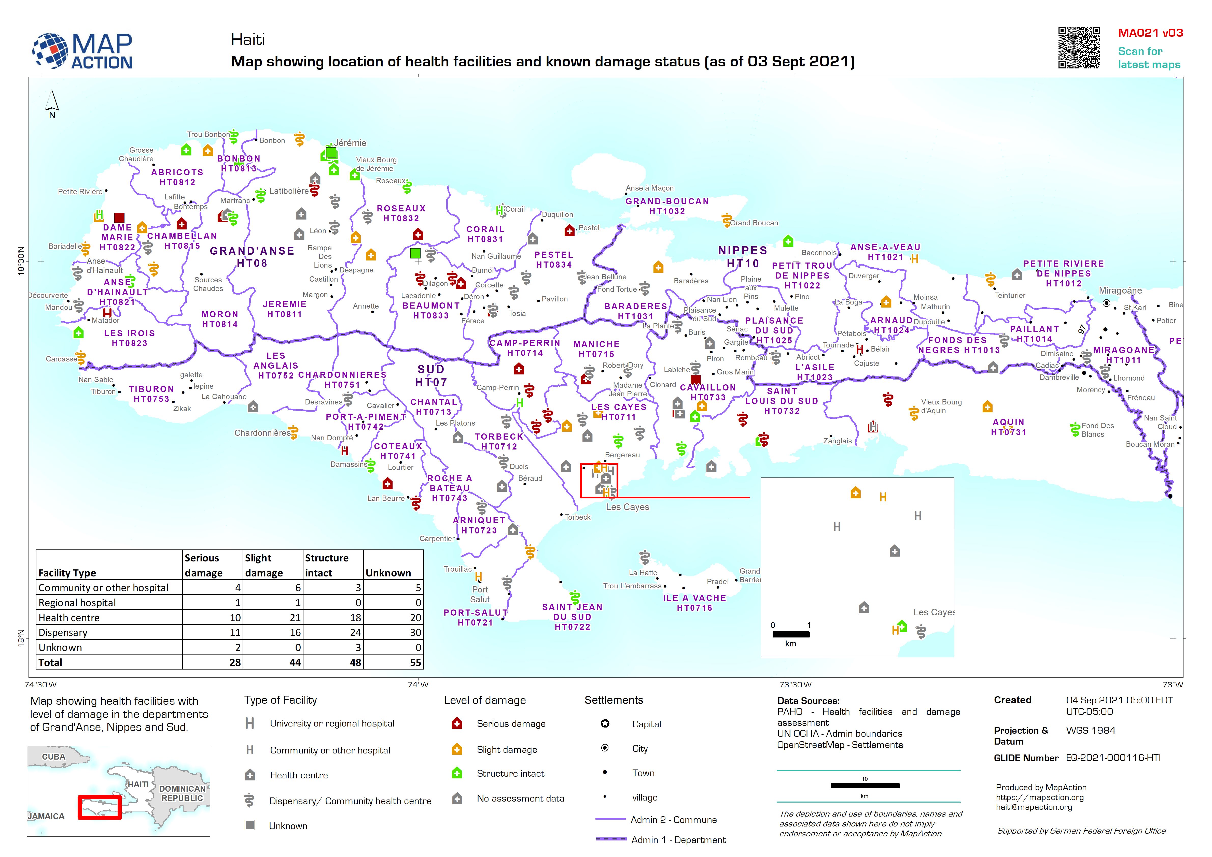
Map showing location of health facilities and known damage status (as of 03 S...
Map showing health facilities with level of damage in the departments of Grand'Anse, Nippes and Sud. Map based upon data published by PAHO accessed on 31/08/2021 -

Map showing location of health facilities and known damage status (as of 03 S...
Map showing health facilities with level of damage in the departments of Grand'Anse, Nippes and Sud. Map based upon data published by PAHO accessed on 31/08/2021 -

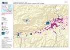
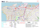
Who, What, Where - Sud Département by Commune for Health Sector (as at 01 Sep...
Map shows who is doing what and where by Commune in Sud Département for Health sector. Governmental and National NGO's are listed in bold text, with International responding... -

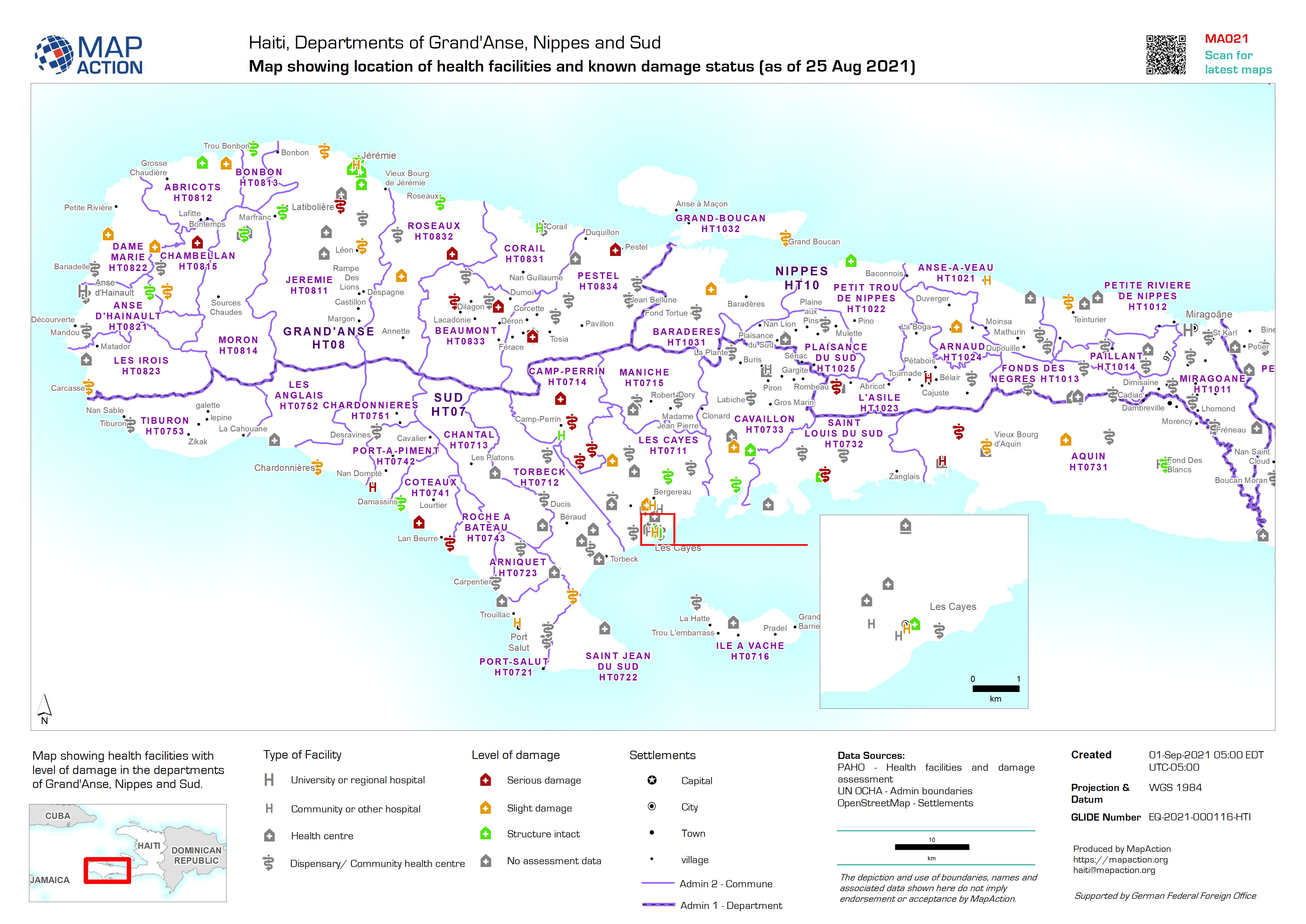
Map showing location of health facilities and known damage status (as of 25 A...
Map showing health facilities with level of damage in the departments of Grand'Anse, Nippes and Sud. Map based upon data published by PAHO accessed on 31/08/2021 -
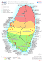
Operational status and capacities of health facilities (as at 20 Apr 2021)
Map shows the status and capacity of health facilities on Saint Vincent -

Location and capacities of health facilities (as at 16 Apr 2021)
Map shows the location and capacity of health facilities on Saint Vincent -

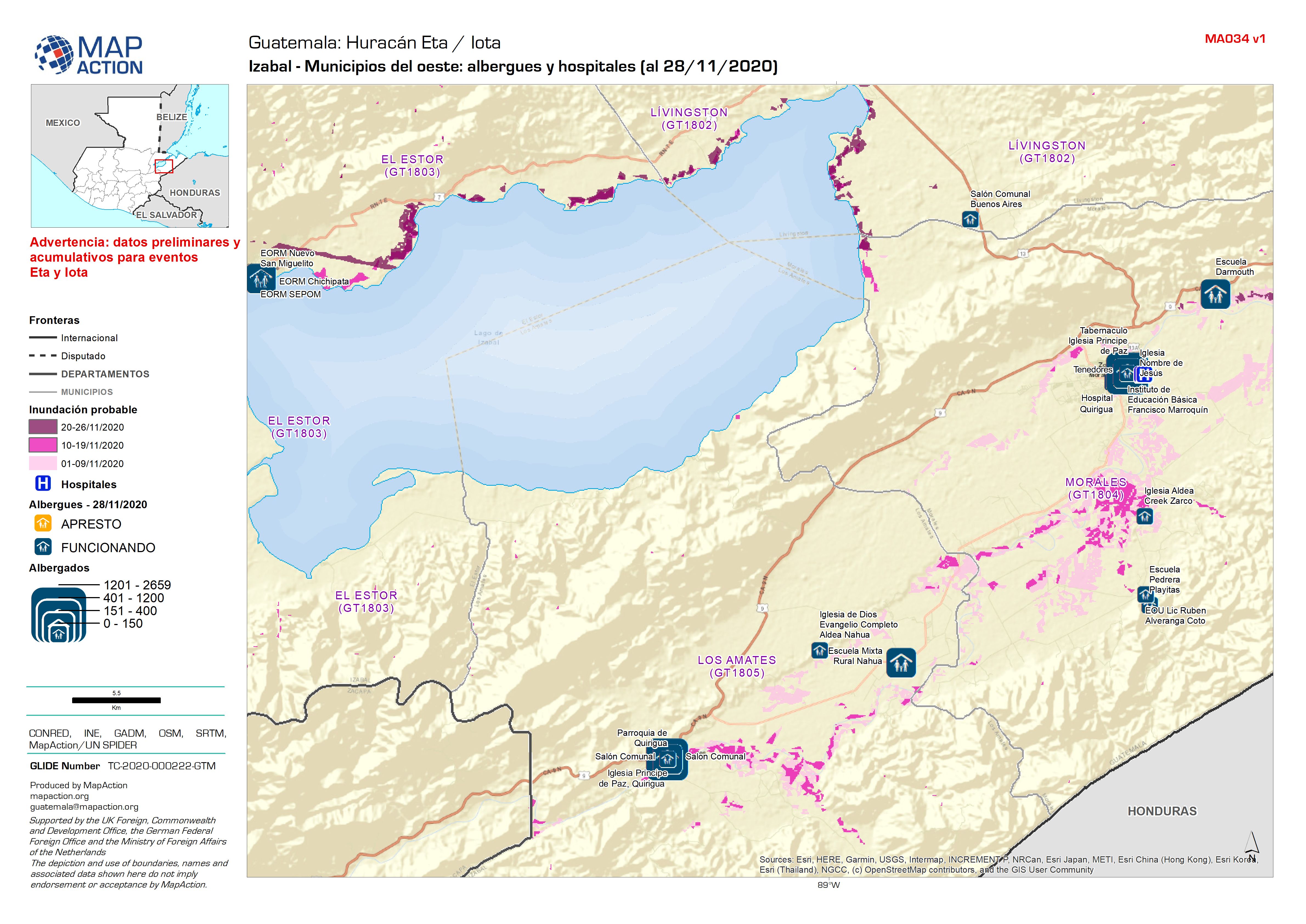
Guatemala: Izabal - Municipios del oeste: albergues y hospitales (al 28/11/2020)
Shelters and Hospitals -
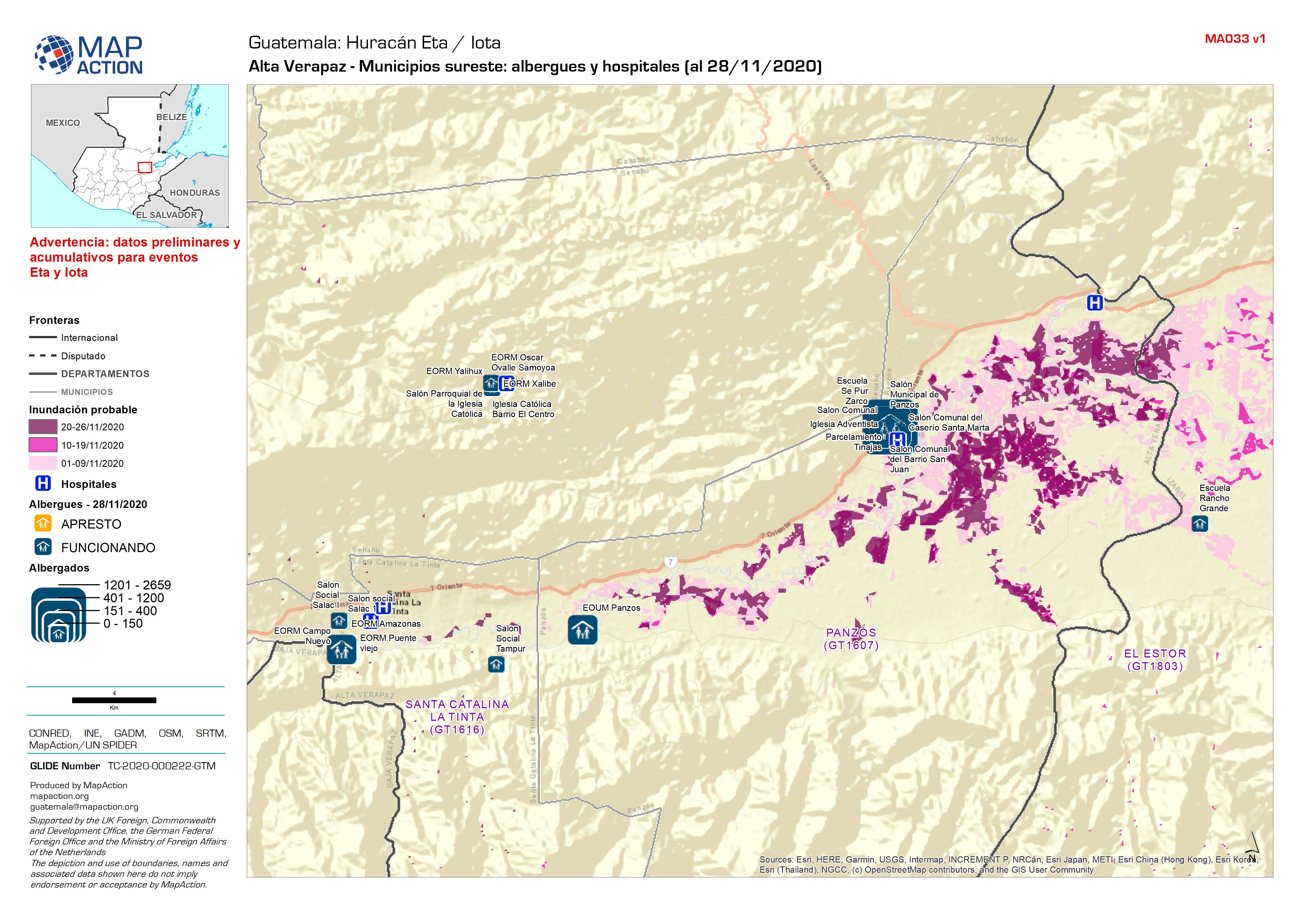
Guatemala: Alta Verapaz - Municipios sureste: albergues y hospitales (al 28/1...
Shelters and Hospitals -
Guatemala: Izabal - Municipios del este: albergues y hospitales (al 28/11/2020)
Shelters and Hospitals -
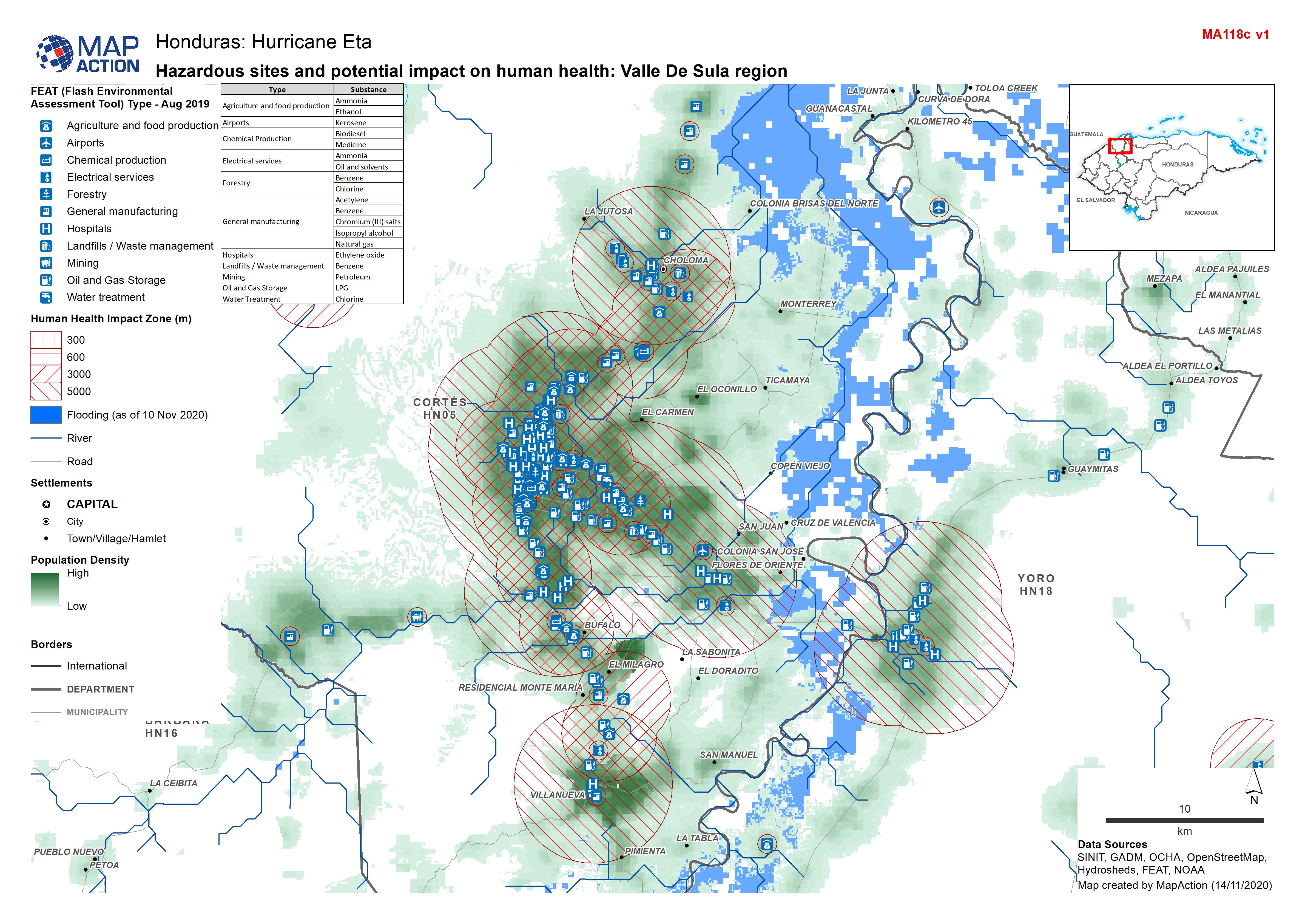
Honduras: Hazardous sites and potential impact on human health: Valle De Sula...
Honduras - Environmental Impact Zones (human health) from FEAT: Valle de Sula region (FEAT - Flash Environmental Assessment Tool) -

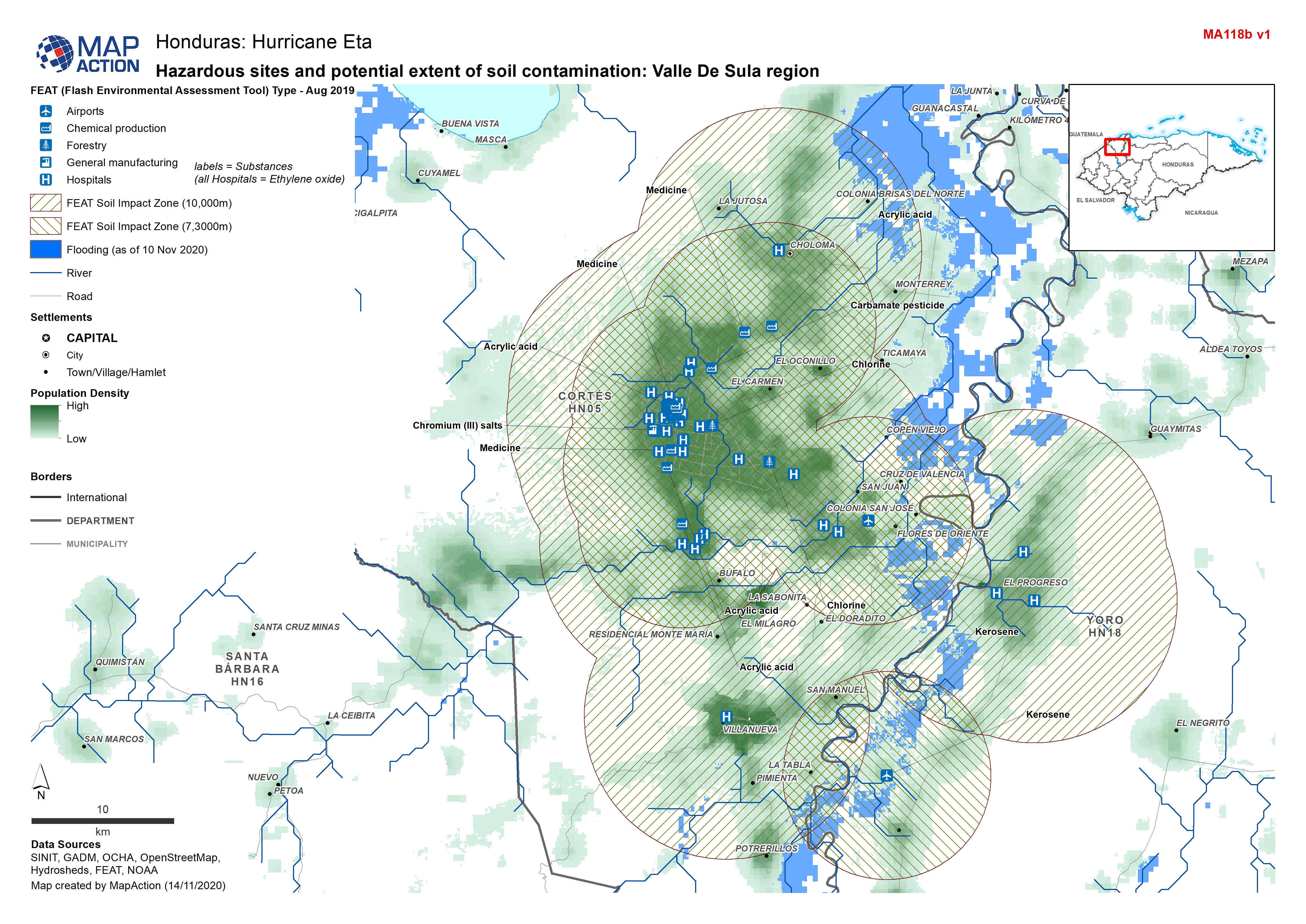
Honduras: Hazardous sites and potential extent of soil contamination: Valle D...
Honduras - Environmental Impact Zones (soil) from FEAT: Valle de Sula region (FEAT - Flash Environmental Assessment Tool) -

Honduras: Hazardous sites and potential extent of water contamination: Valle ...
Honduras - Environmental Impact Zones (water) from FEAT: Valle de Sula region (FEAT - Flash Environmental Assessment Tool) -

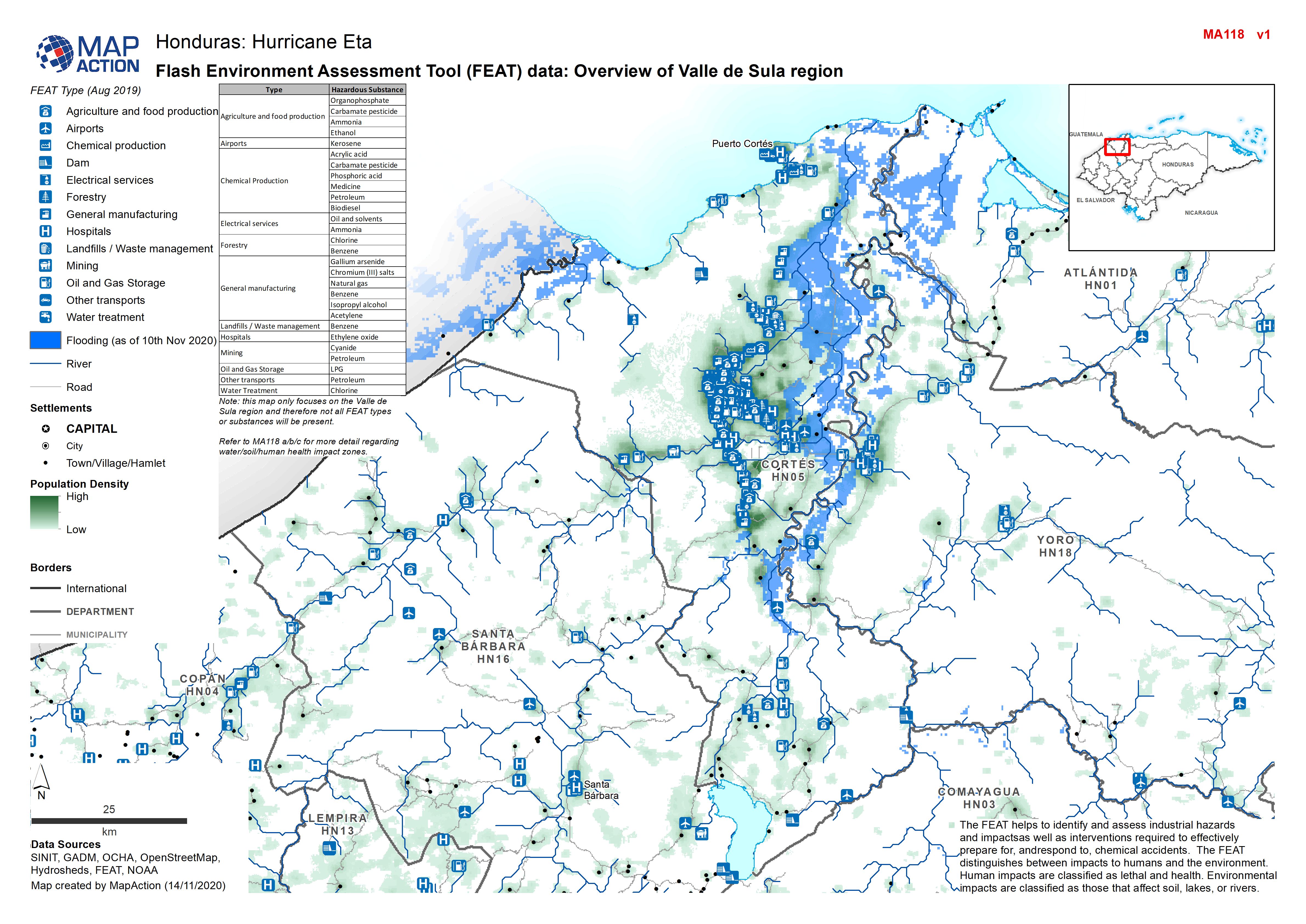
Honduras: Flash Environment Assessment Tool (FEAT) data: Overview of Valle de...
Flash Environment Assessment Tool (FEAT) data: Overview of Valle de Sula region -
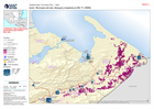
Reference map of Beirut, explosion site and health infrastructure
Reference map of Beirut, explosion site and health infrastructure -
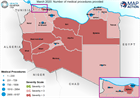
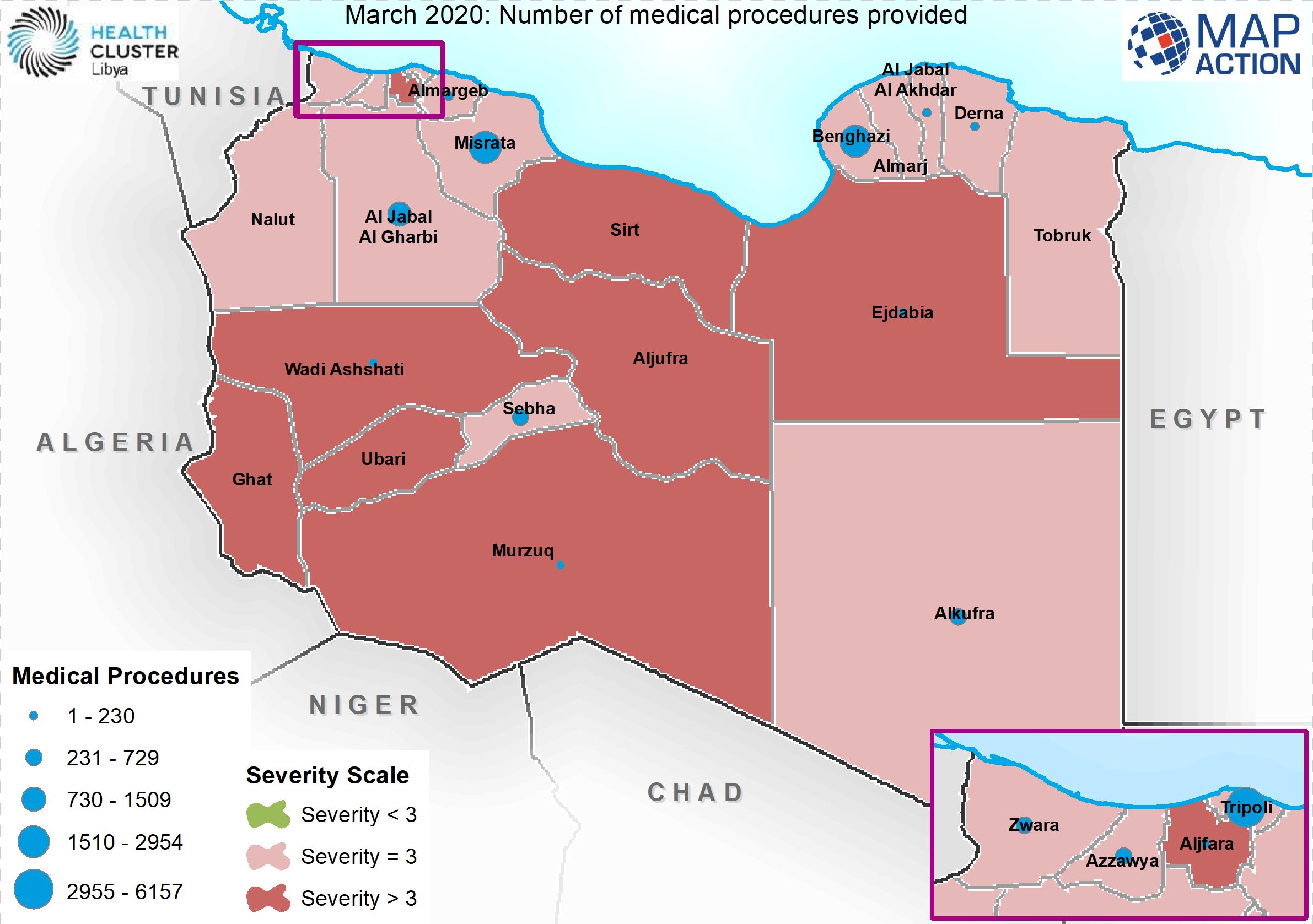
March 2020: Number of medical procedures provided
This map shows the number of medical facilities supported by WHO during the month of March 2020 -

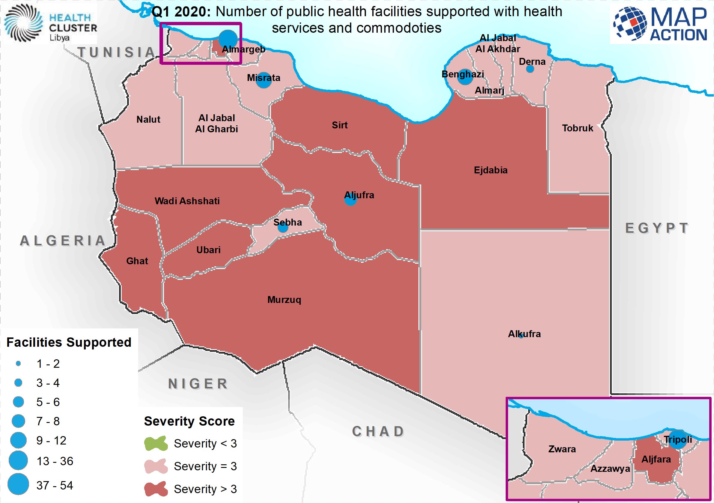
Q1 2020: Number of public health facilities supported with health services an...
Map shows the number o public health facilities supported in the first 3 months of 2020 -

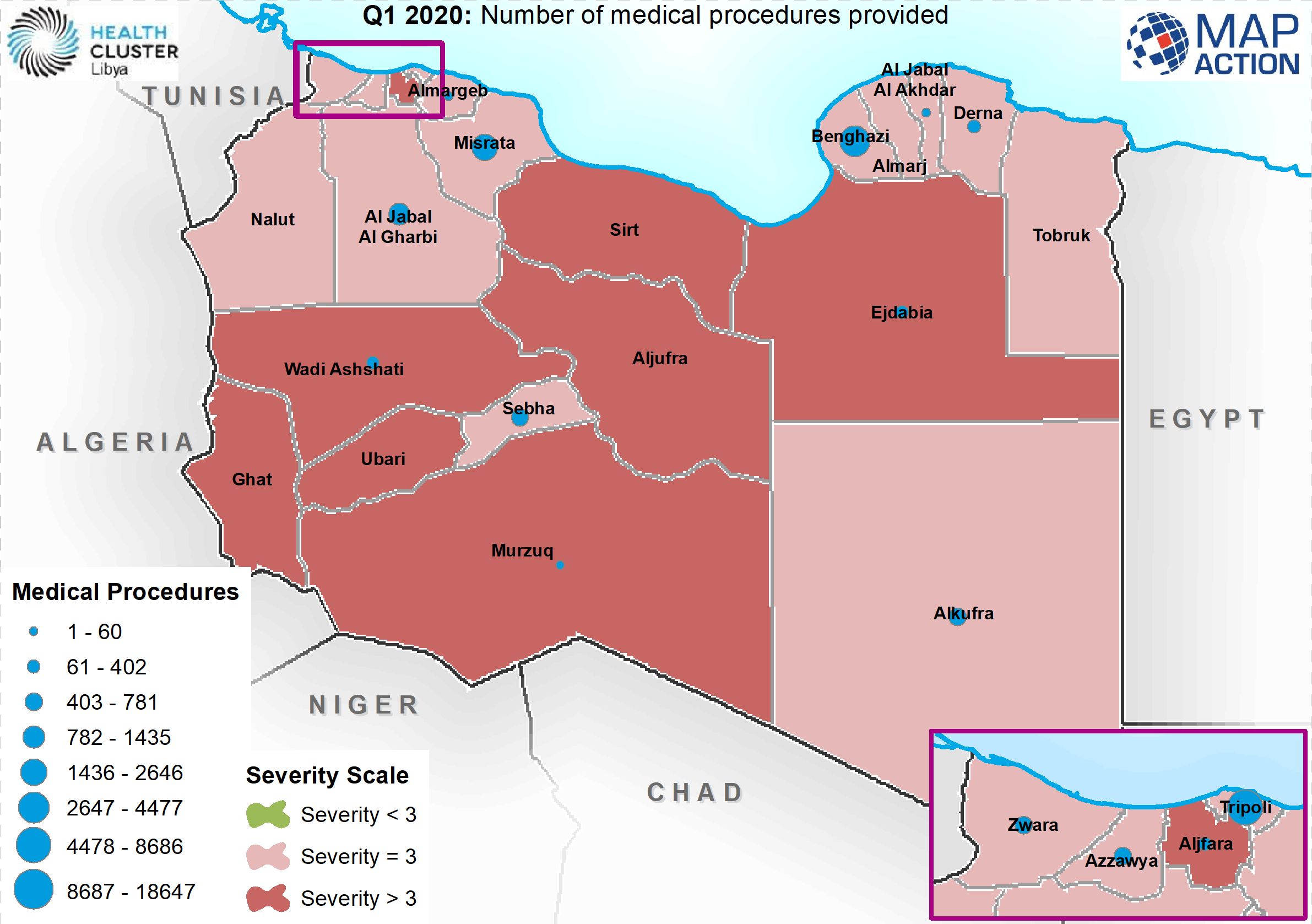
Q1 2020: Number of medical procedures provided
Map shows the composite activities over a three month period (1st quarter) of 2020 -
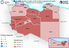
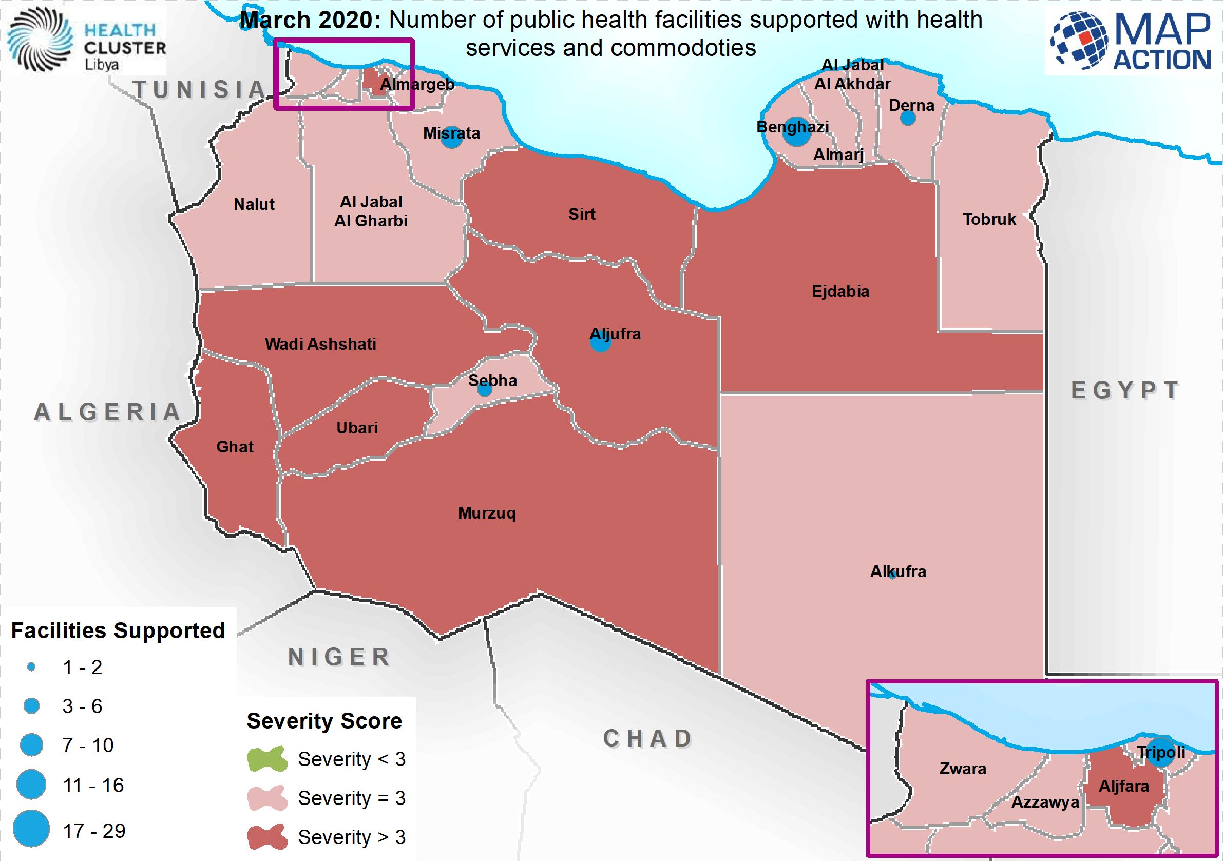
March 2020: Number of public health facilities supported with health services...
Map shows the number of heath facilities supported with health services and commodities for the month of March 2020