-

-

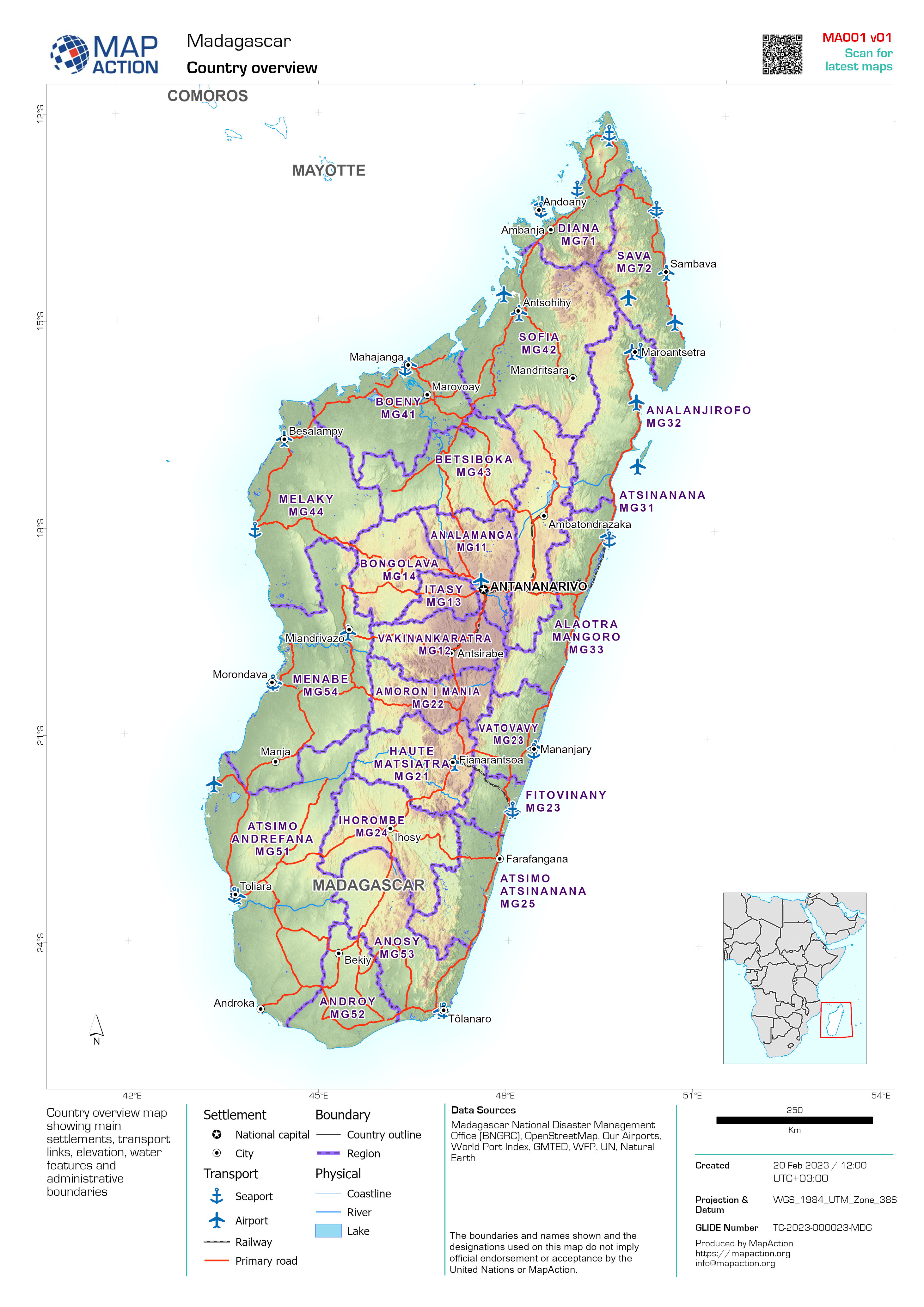
Country overview
Country overview map showing main settlements, transport links, elevation, water features and administrative boundaries -

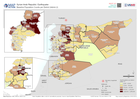
Baseline Population and Shake Intensity showing Affected Area
Overview of baseline population (using 2020 estimates of density per 100m) within affected region of Syria due to earthquakes on 6th Feb 2023 -
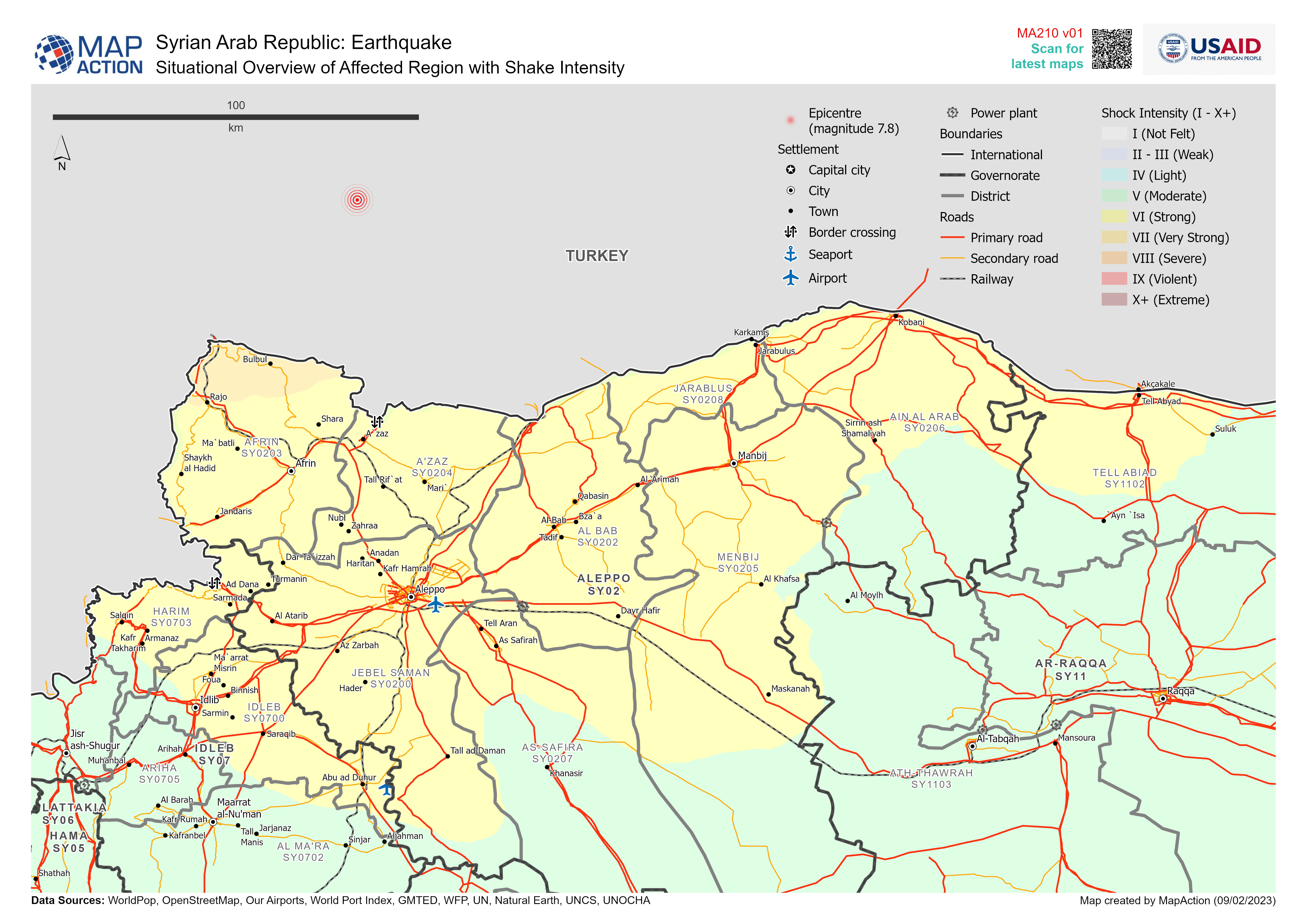
Situational Overview of Affected Region with Shake Intensity
Overview of baseline population (using 2020 estimates of density per 100m) within affected region of Syria due to earthquakes on 6th Feb 2023 -

Baseline Population and Shake Intensity Overview
Overview of baseline population (using 2020 estimates) within affected region of Syria due to earthquakes on 6th Feb 2023 -
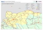
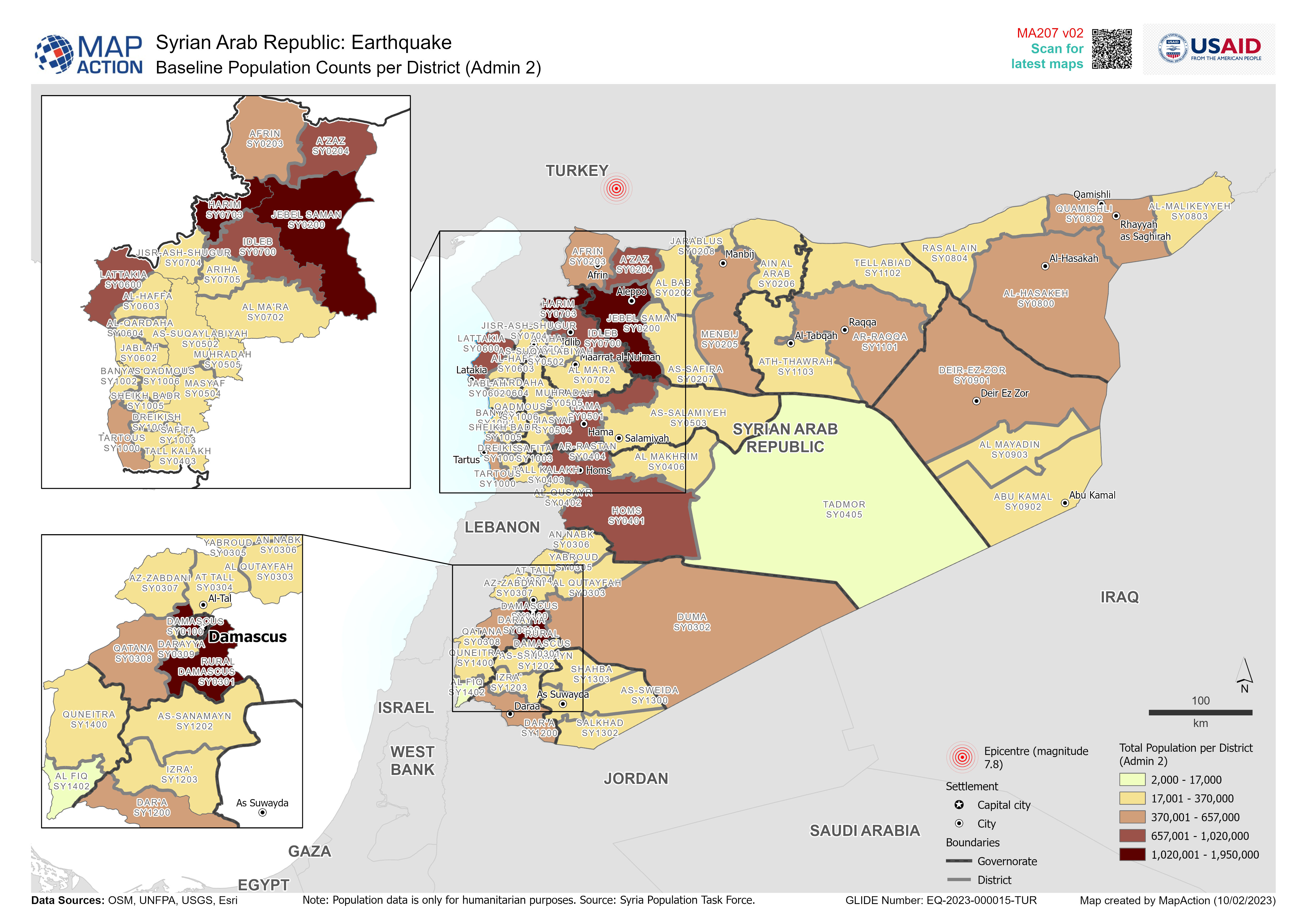
Baseline Population Counts per District (Admin 2)
Overview of baseline population (total number of people per District (Admin 2)) -
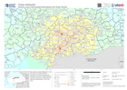
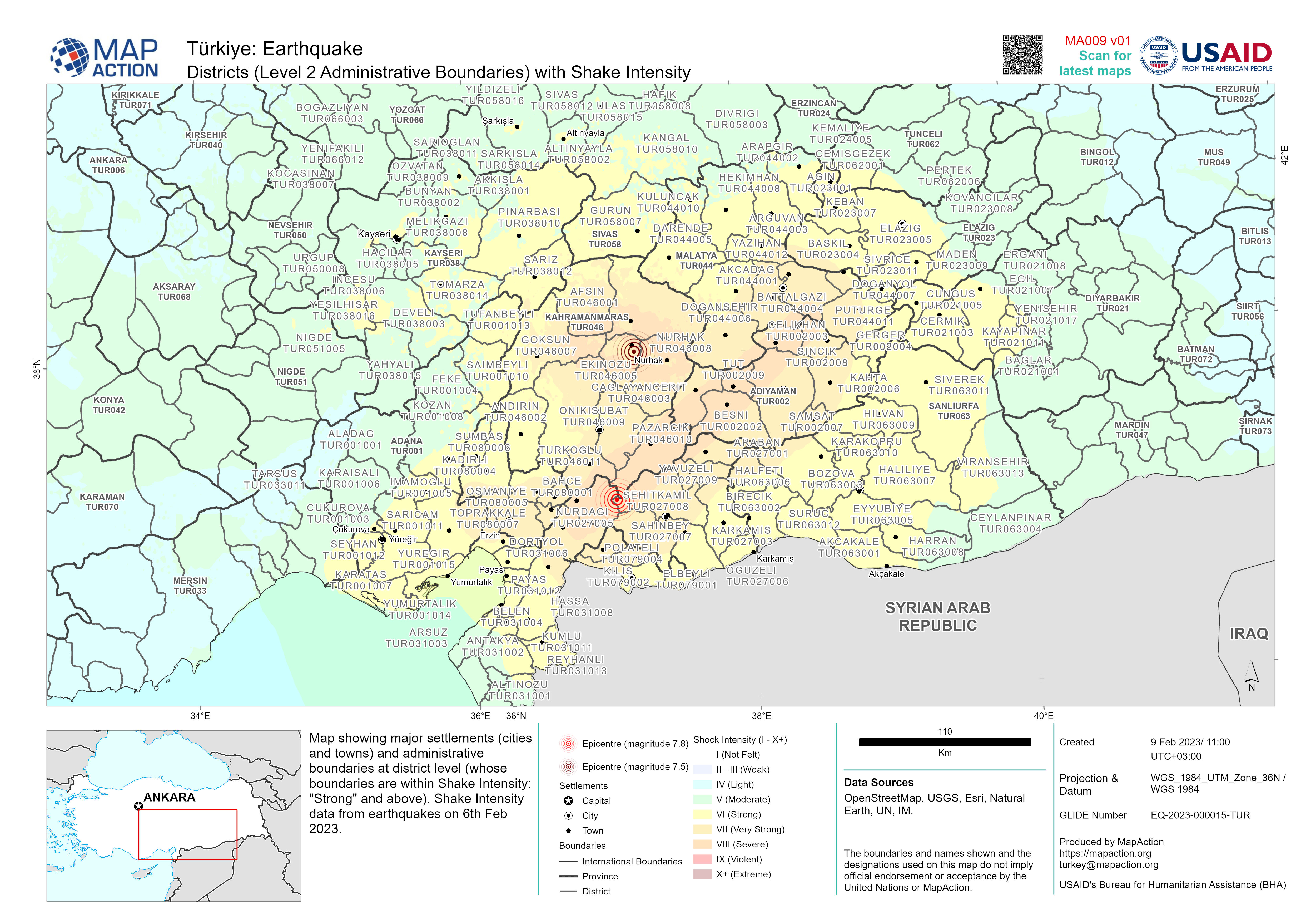
Districts (Level 2 Administrative Boundaries) with Shake Intensity
Map showing major settlements (cities and towns) and administrative boundaries at district level (whose boundaries are within Shake Intensity: "Strong" and above). Shake... -

Country overview
Country overview map showing main settlements, transport links, elevation, water features and administrative boundaries -
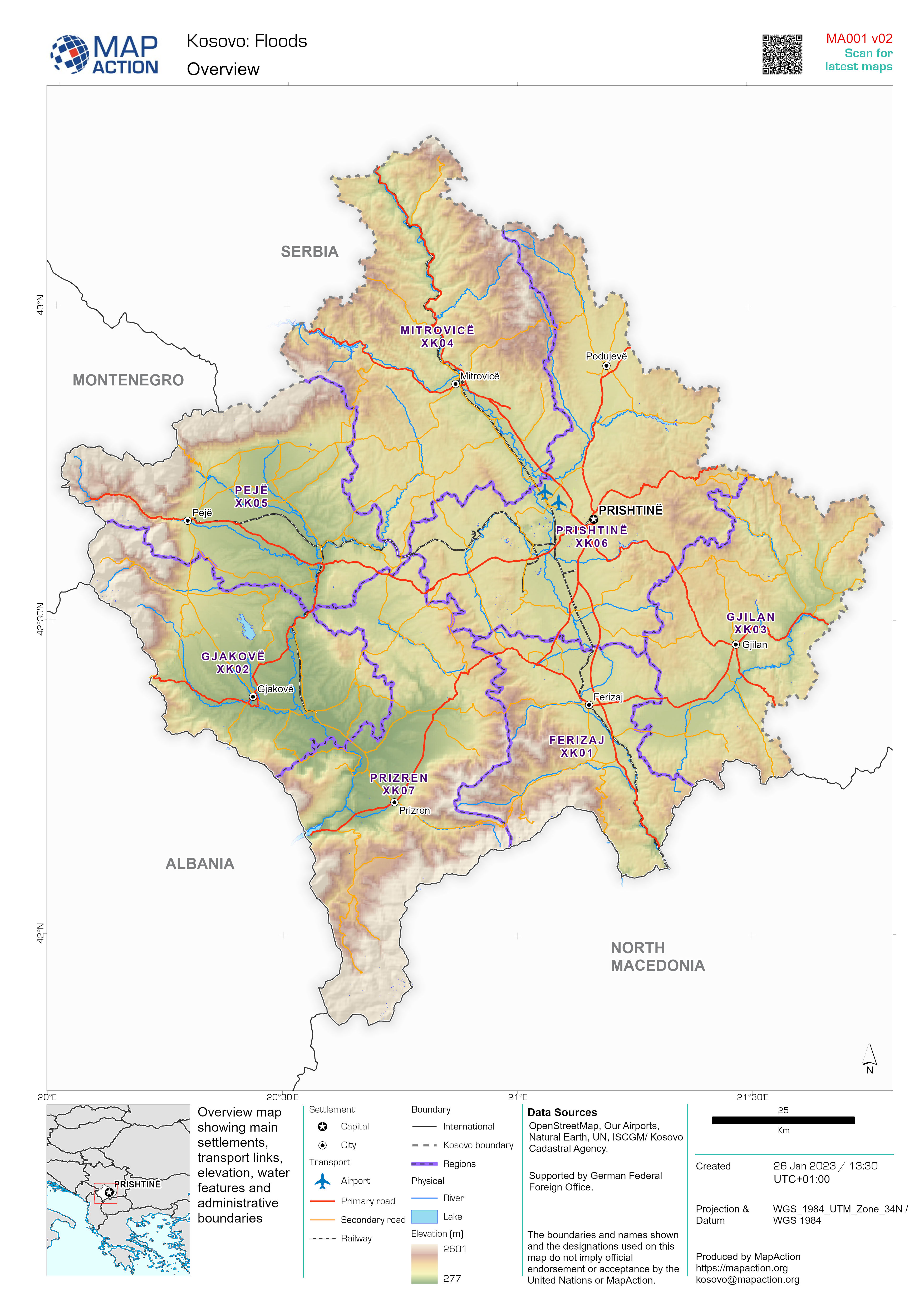
Country overview
Country overview map showing main settlements, transport links, elevation, water features and administrative boundaries -
Provinces (Level 1 Administrative Boundaries)
Map showing major settlements and administrative boundaries at province level -

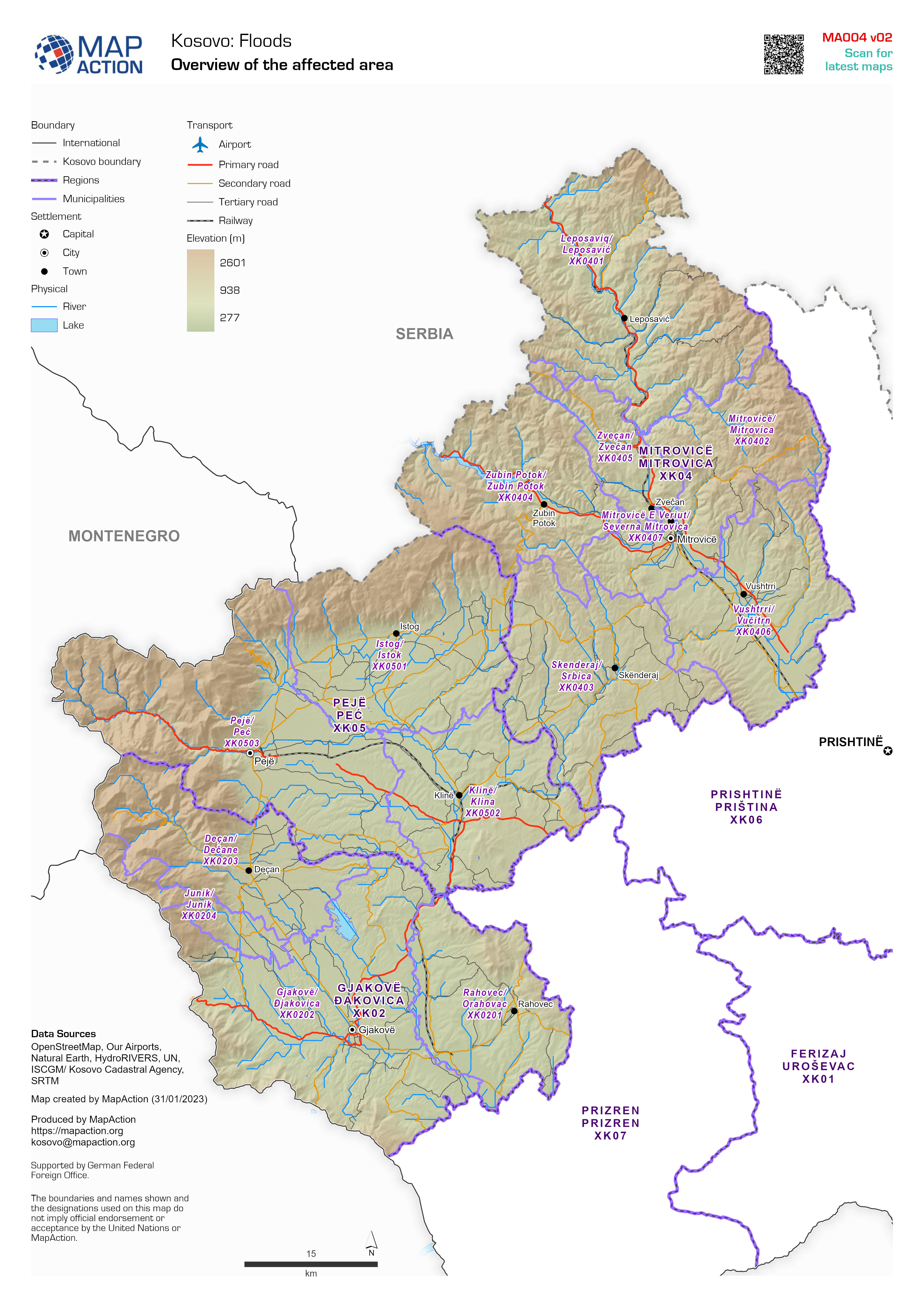
Overview of the affected area
Map showing major settlements, transport links, elevation, water features and administrative boundaries -

Regions (Level 1 Administrative Boundaries)
Map showing major settlements and administrative boundaries at region level -

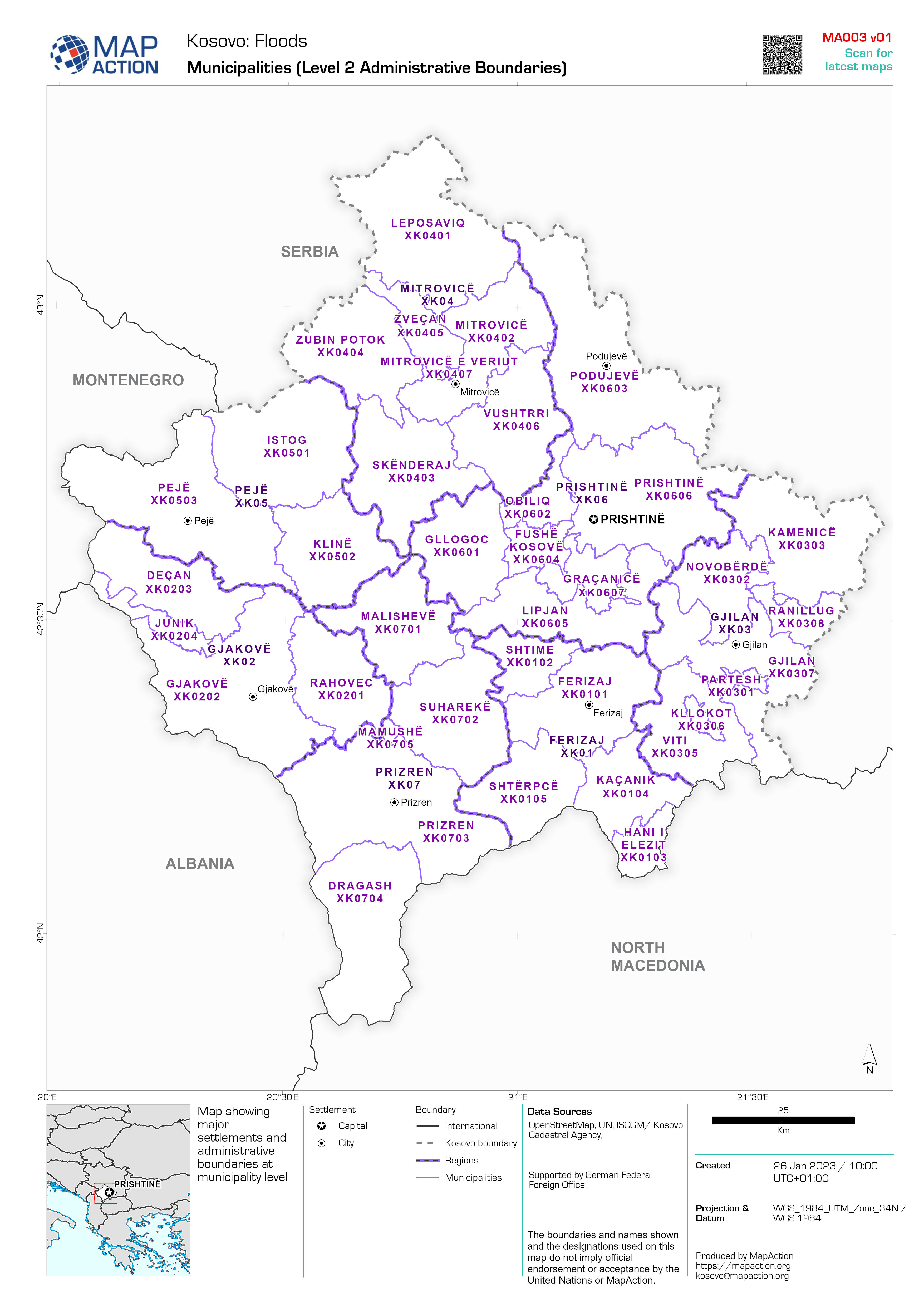
Municipalities (Level 2 Administrative Boundaries)
Map showing major settlements and administrative boundaries at municipality level -

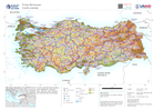
Country Overview
Country overview map showing main settlements, transport links, elevation, water features and administrative boundaries -

Overview of the affected area
Map showing major settlements, transport links, elevation, water features and administrative boundaries -

Regions (Level 1 Administrative Boundaries)
Map showing major settlements and administrative boundaries at region level -

Municipalities (Level 2 Administrative Boundaries)
Map showing major settlements and administrative boundaries at municipality level -

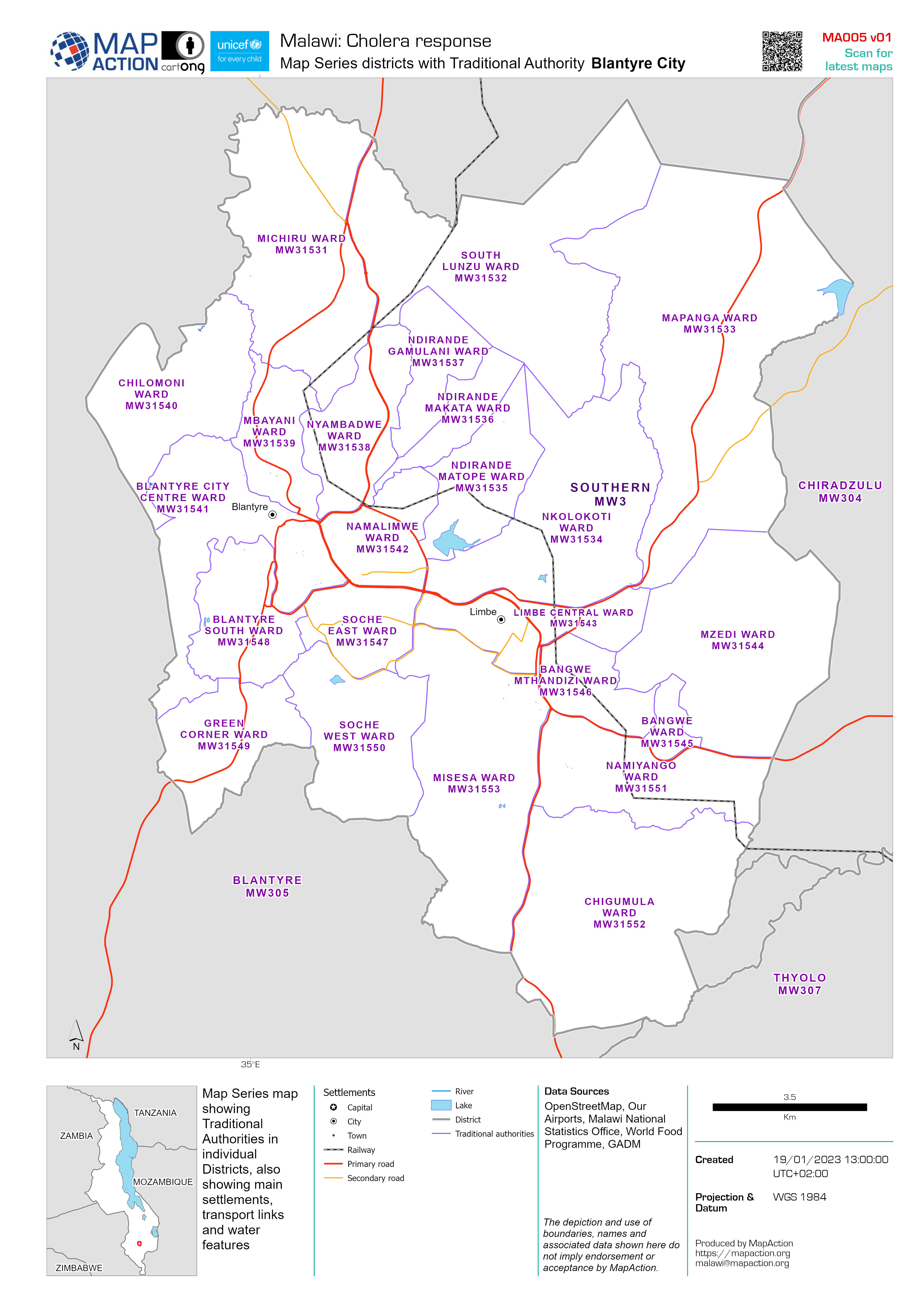
Map Series Districts with Traditional Authority
Map Series map showing Traditional Authorities in individual Districts, also showing main settlements, transport links and water features

