-
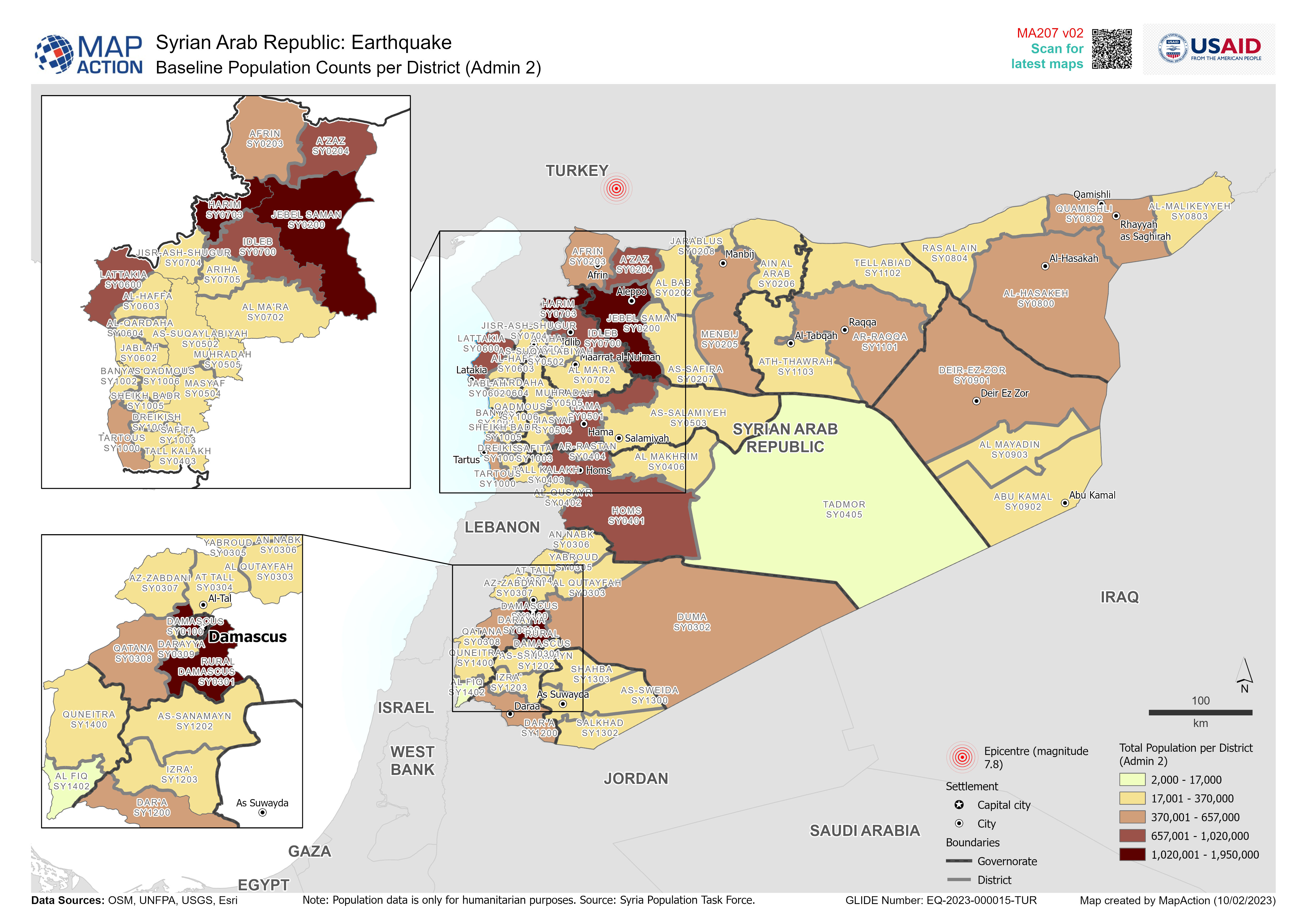
Baseline Population Counts per District (Admin 2)
Overview of baseline population (total number of people per District (Admin 2)) -

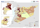
District (Level 2 Admin Boundaries) with Earthquake Intensity:
District (Level 2 Administrative Boundaries) with earthquake intensity from earthquakes on 6th Feb 2023 -
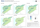
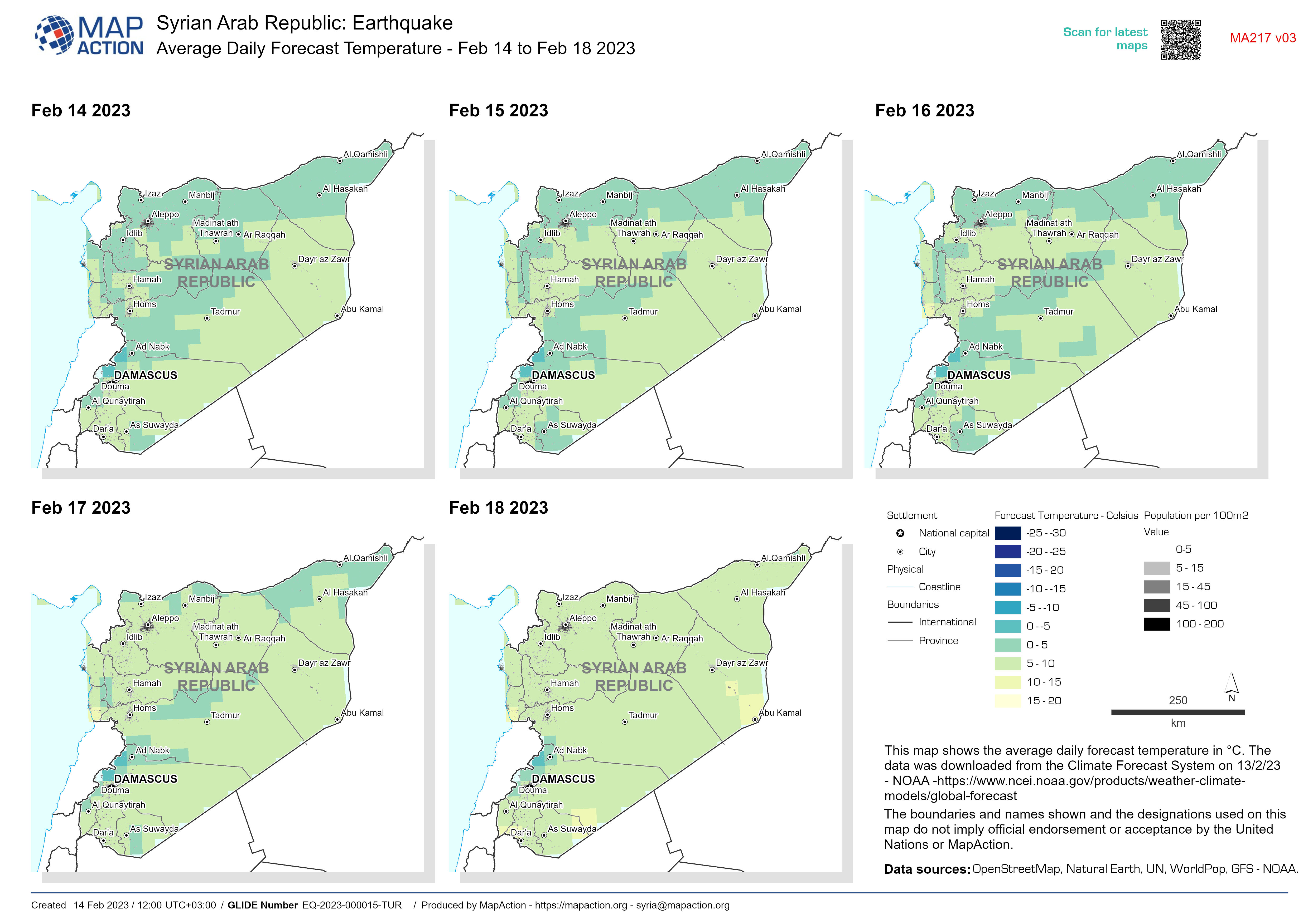
Average Daily Forecast Temperature - Feb 14 to Feb 18 2023
This map shows the average daily forecast temperature in °C. The data was downloaded from the Climate Forecast System on 13/2/23 - NOAA... -

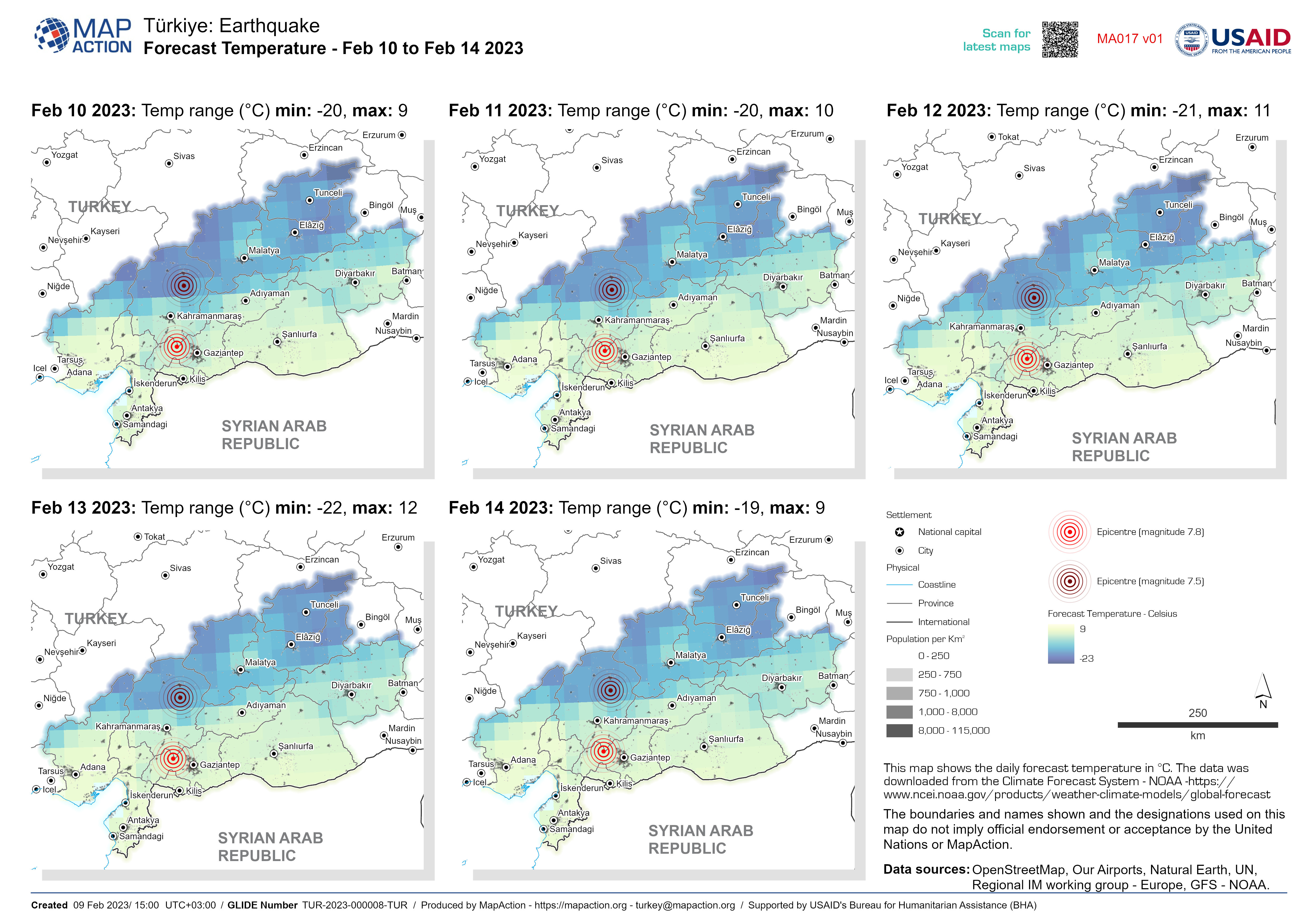
Average Daily Forecast Temperature - Feb 10 to Feb 14 2023
This map shows the daily forecast temperature in °C. The data was downloaded from the Climate Forecast System - NOAA... -

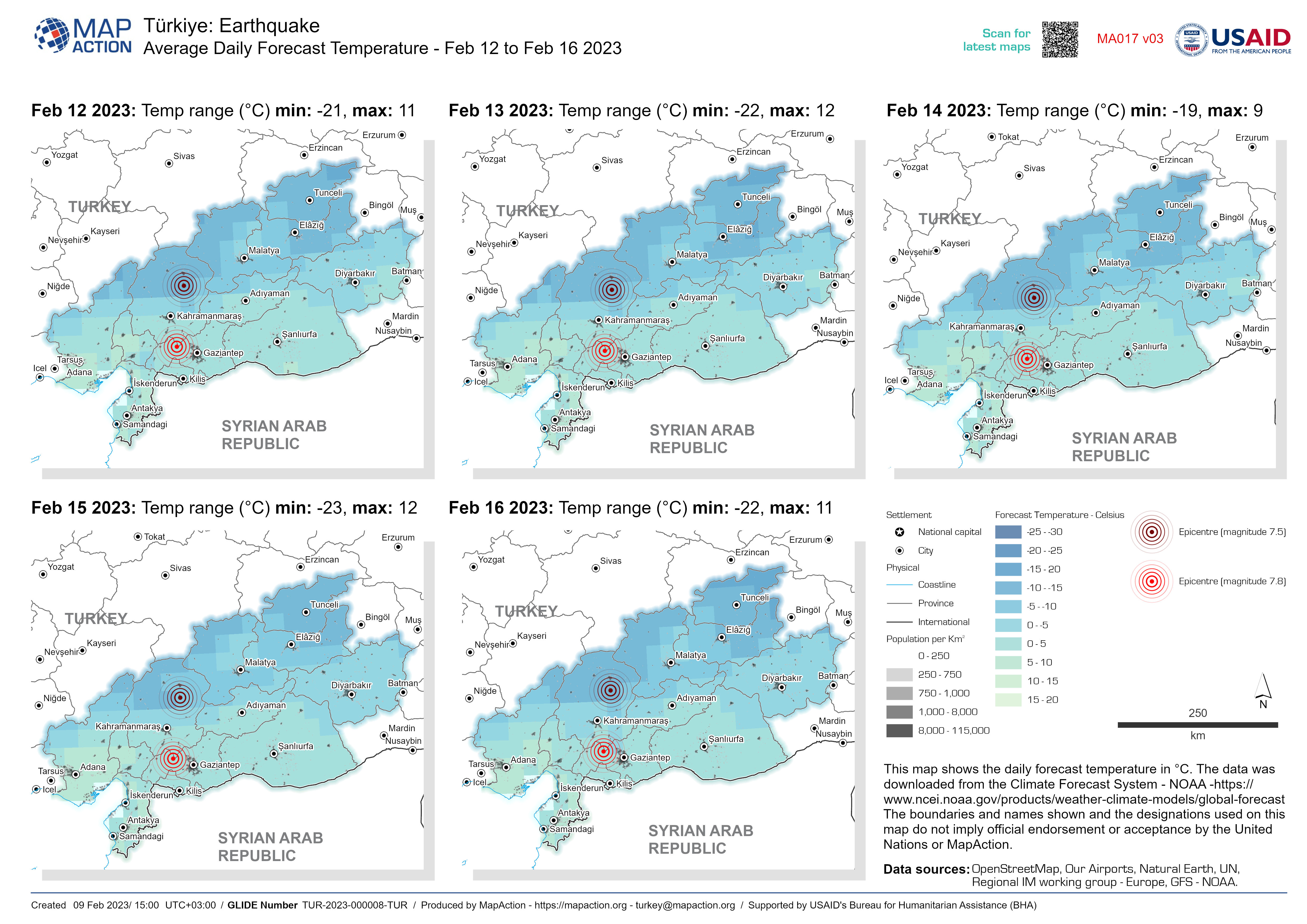
Average Daily Forecast Temperature - Feb 12 to Feb 16 2023
This map shows the daily forecast temperature in °C. The data was downloaded from the Climate Forecast System - NOAA... -

Average Daily Forecast Temperature - Feb 11 to Feb 15 2023
This map shows the daily forecast temperature in °C. The data was downloaded from the Climate Forecast System - NOAA... -
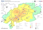
Population Data and Shake Intensity: Displayed by Regions
This map shows the region extent of the earthquake that happened in Turkey on the 6th of February. The map displays the population density in 1 kilometer grids and shake... -

Municipalities affected by flooding (as of 31 Jan 2023)
Municipalities affected by flooding (as of 31 Jan 2023) -

Population density and Flood extents 01 - 29 August for affected provinces
Map shows the maximum extent of known flooding from satellite images on 1-29 Aug 2022 against world population for the most affected provinces. -
Population density and Flood extents 01 - 29 August per district
Flood extents for 01 - 29 August as detected by UNOSAT and estimates of population affected based upon Worldpop data for 2020 One atlas per province impacted by flooding, with... -

Flood extents and affected population estimates for 12 - 21 July and 01 - 29 ...
Flood extents for 12 - 21 July and 01 - 29 August as detected by UNOSAT and estimates of population affected based upon Worldpop data for 2020 -
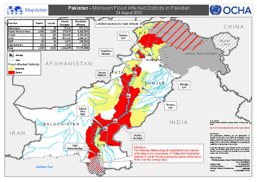
Pakistan - Monsoon Flood Affected Districts in Pakistan - 24 August 2010
This dataset has no description
-

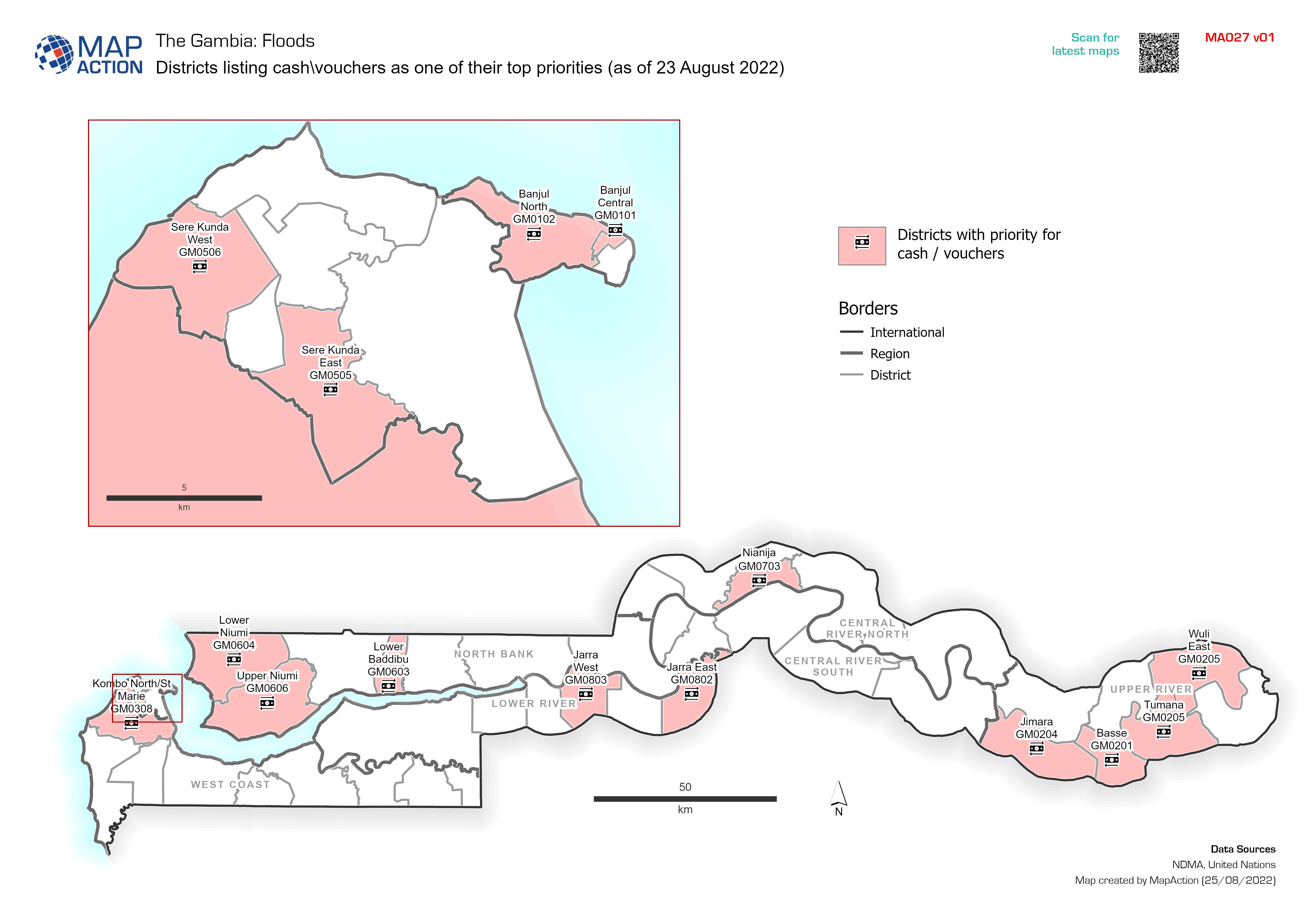
Districts listing cash\vouchers as one of their top priorities (as of 23 Augu...
Districts citing cash\vouchers as one of their top priorities (as of 23 August 2022). Data taken from MIRA -

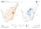
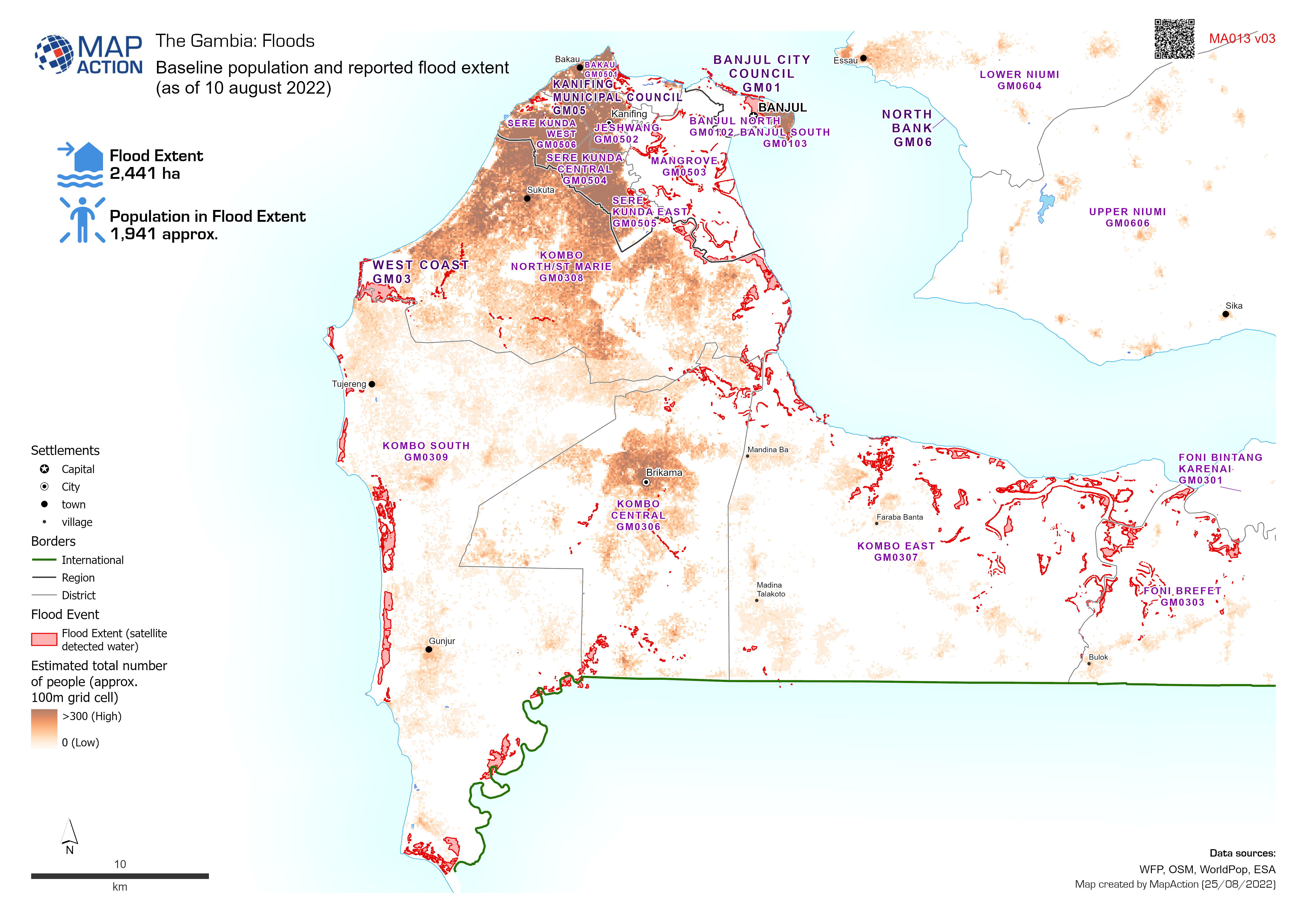
Baseline population and reported flood extent
Baseline population and reported flood extent as of 10 august 2022 -

Affected population by district as a proportion of the total population (as o...
Affected population calculated as a percentage of total population. Affected population based on data for 18 August 2022. Total population is estimated from WorldPop data for 2020 -

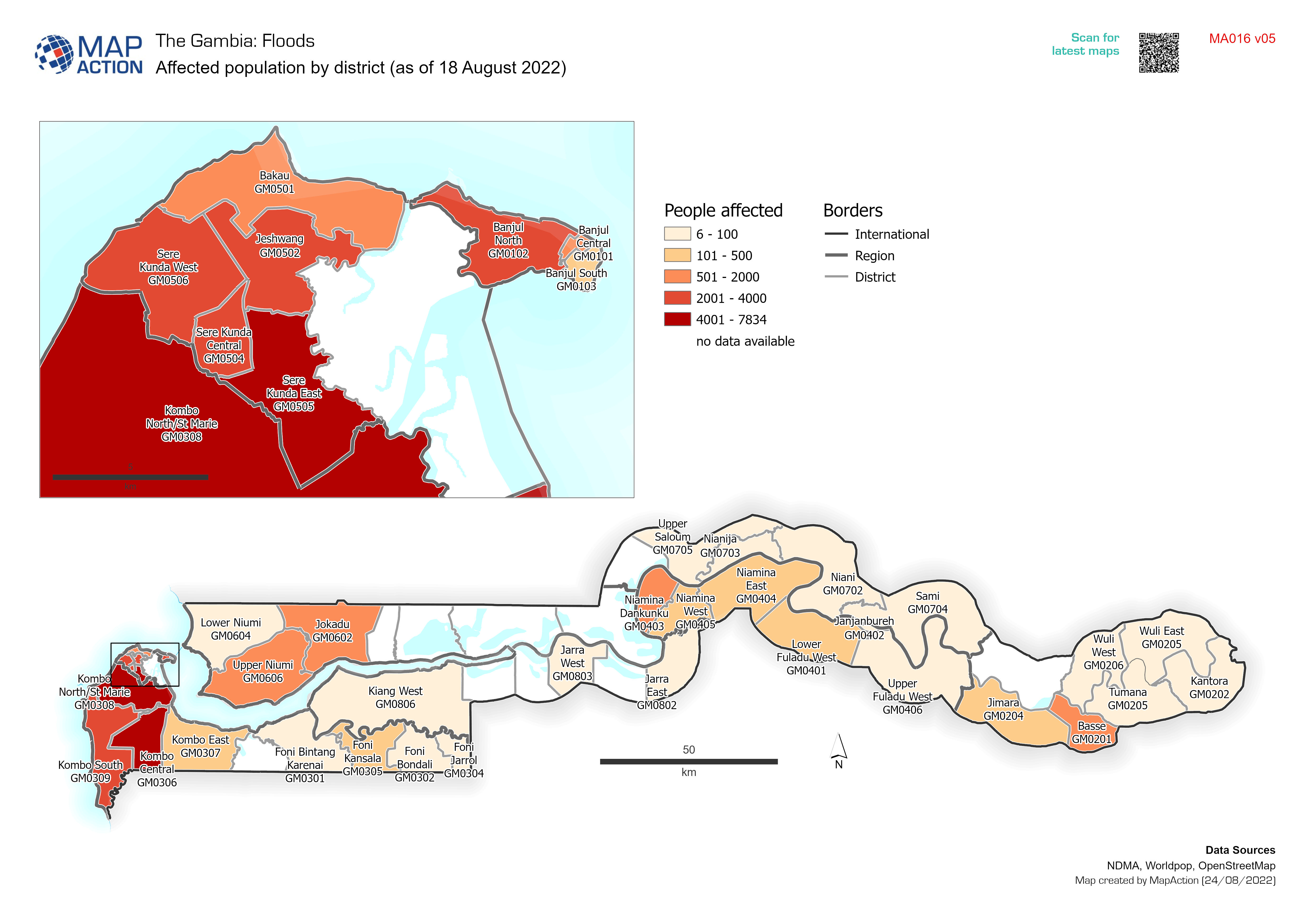
Affected population by district (as of 18 August 2022)
Affected population per district based on data for 18 August 2022. -

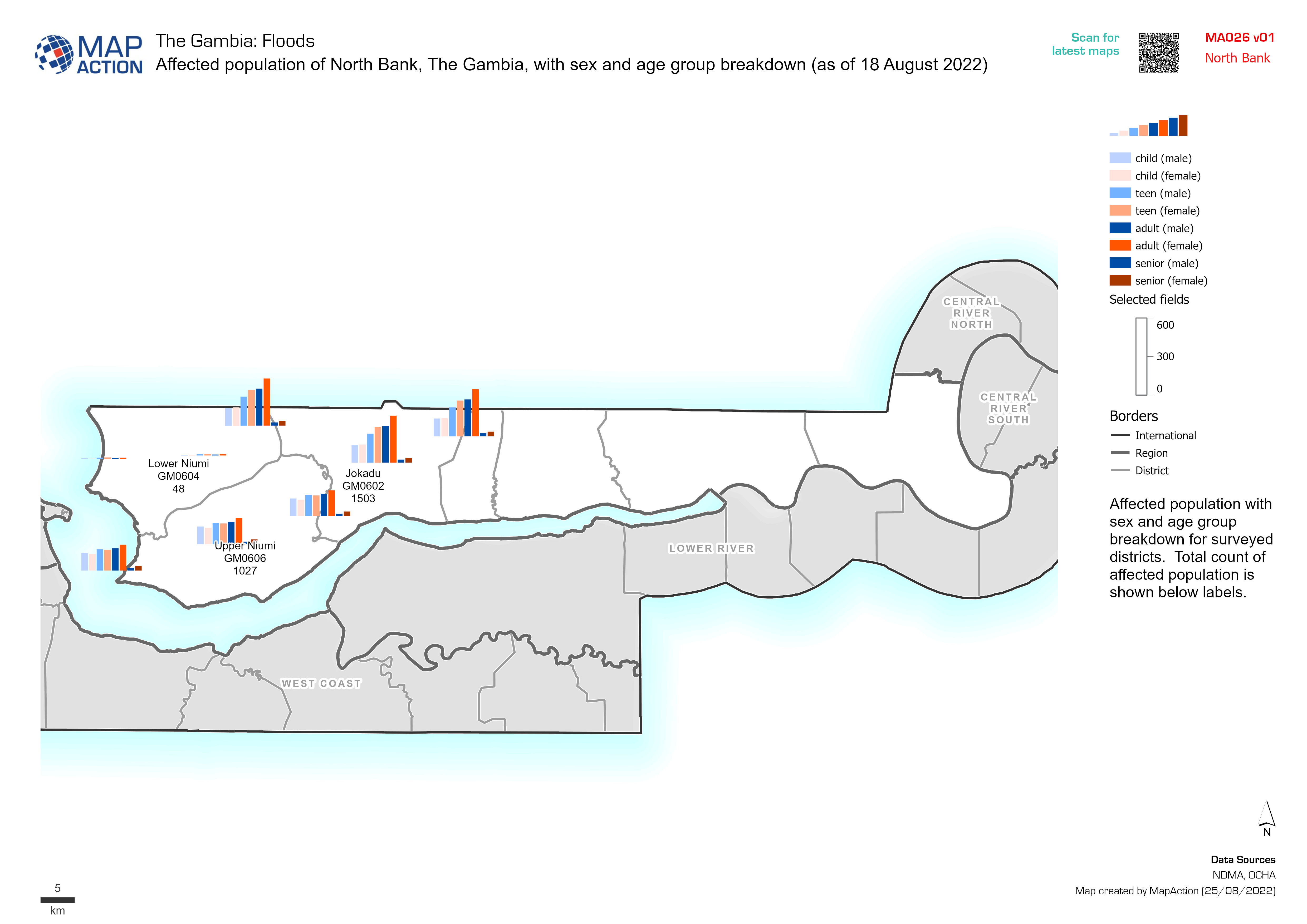
Affected Population by District (as of 18 August 2022)
District population baseline and graph shows the split between females and males -

Baseline population and reported flood extent
Baseline population and reported flood extent as of 10 august 2022

