-

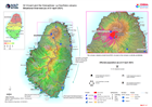
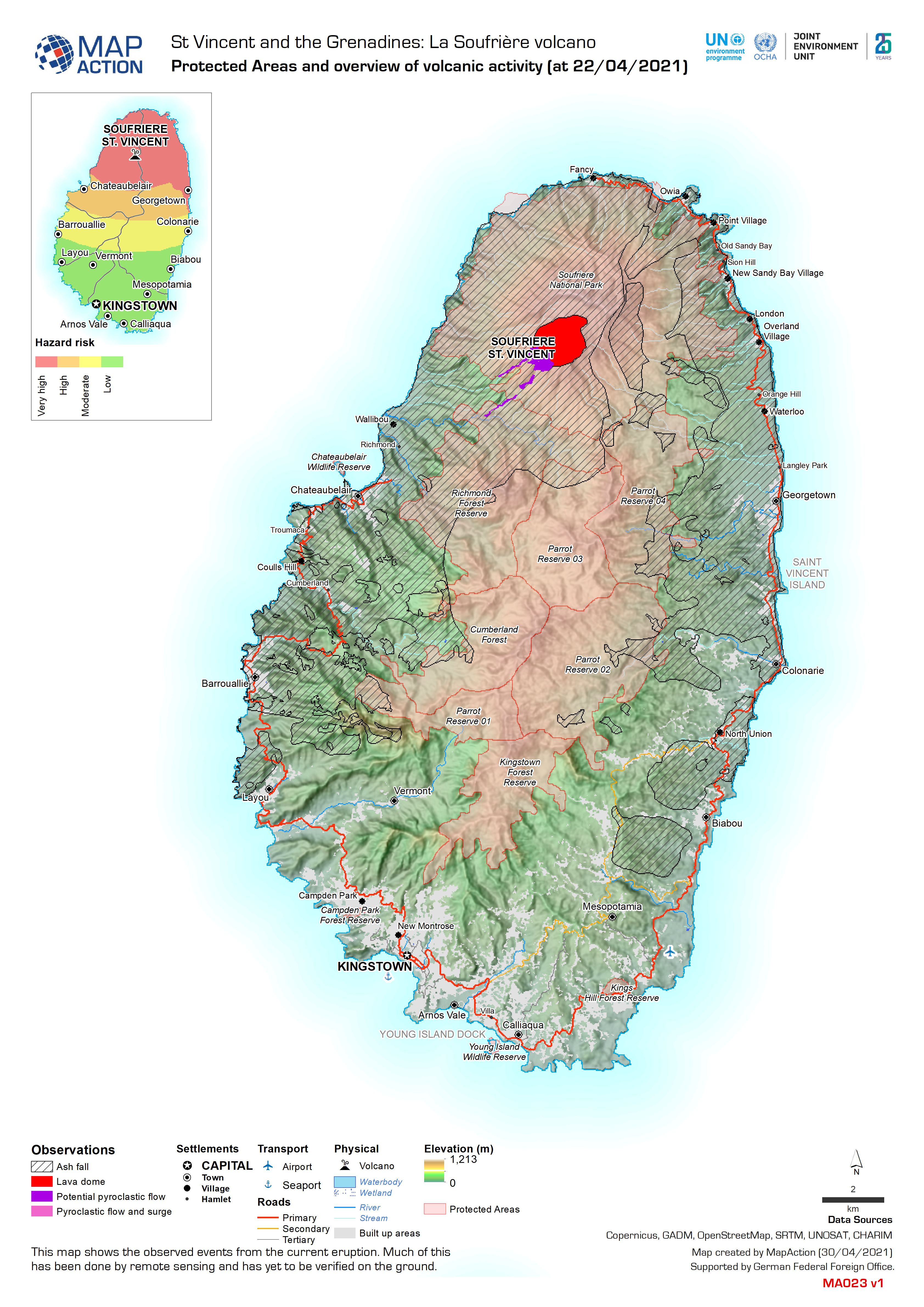
Protected Areas and overview of volcanic activity (at 22/04/2021)
This map shows the observed events from the current eruption. Much of this has been done by remote sensing and has yet to be verified on the ground. -

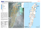
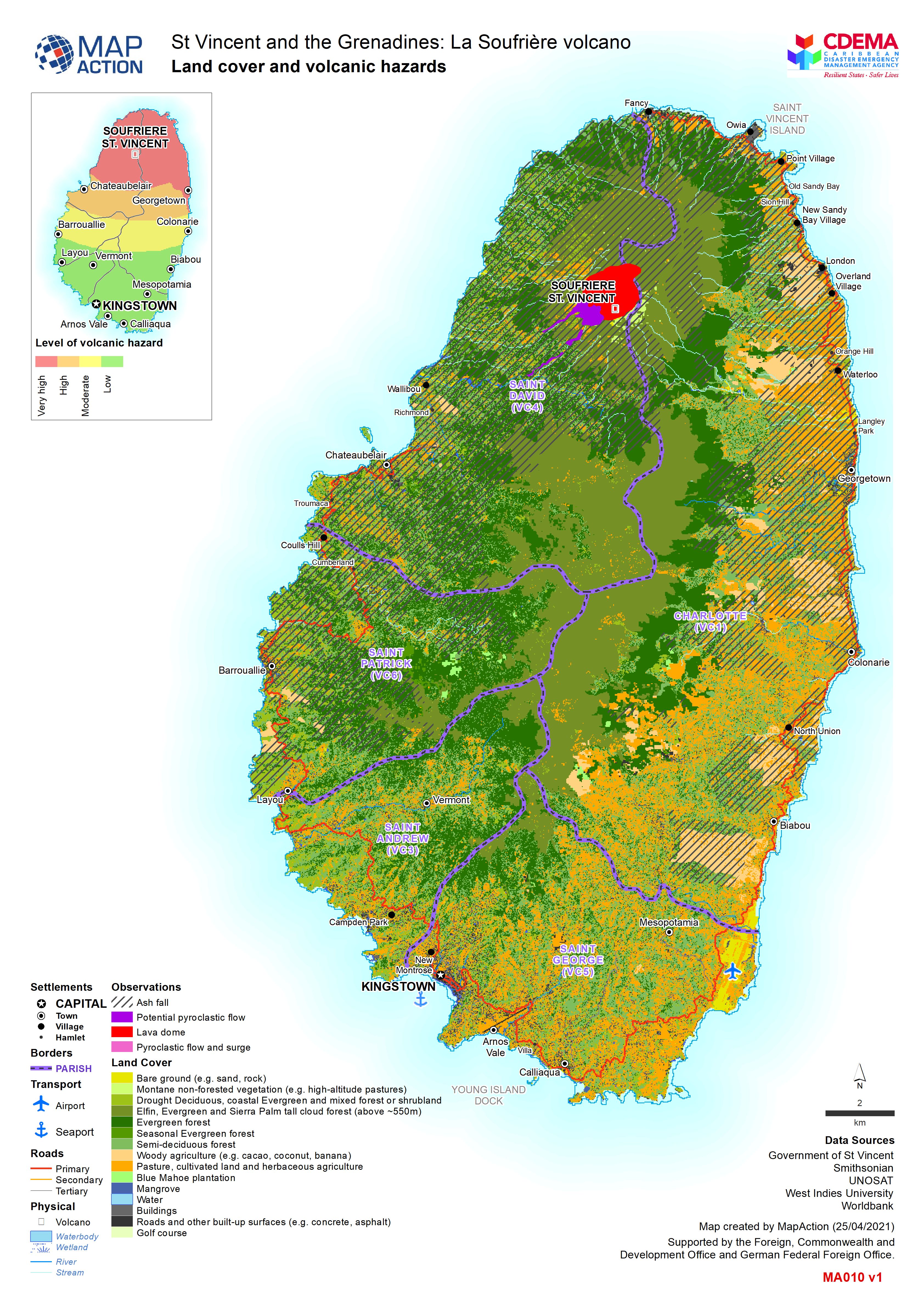
Land cover and volcanic hazards
Map shows landuse in Saint Vincent and the extent of the ash from the La Soufrière eruptions. -
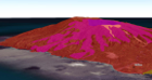
La Soufrière volcano 3D overview
Web map shows the key volcanic events and hazards the La Soufrière volcano -
Situational Overview (as of 21 April 2021)
Map shows the situational overview of the current events and activities as a result of the ongoing eruption of the La Soufrière volcano. -

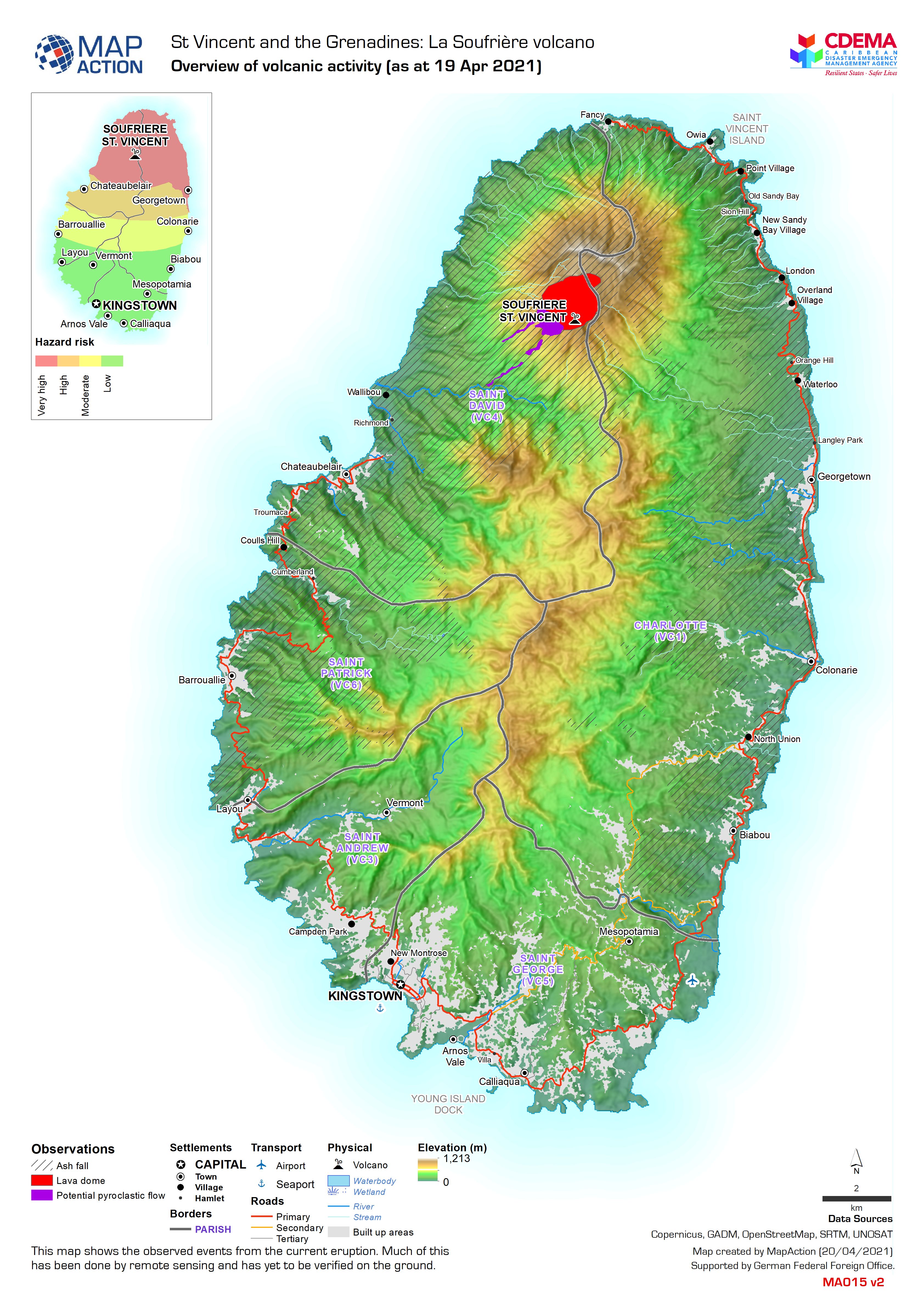
Overview of volcanic activity (as at 19 Apr 2021)
This map shows the observed events from the current eruption. Much of this has been done by remote sensing and has yet to be varified on the ground. -

Overview of volcanic activity (as at 18 Apr 2021)
This map shows the observed events from the current eruption. Much of this has been done by remote sensing and has yet to be varified on the ground. -

Observed and forecasted ash for 17 Apr 2021
Map shows the observed ash from as well as the forecasted ash from the La Soufrière volcano. The forecasted areas are where ash is expected to be but this is likely to change to... -

Columbia: Herramienta de Evaluación Ambiental Rápida (FEAT) y datos de destru...
Herramienta de Evaluación Ambiental Rápida (FEAT) y datos de destrucción en San Andrés, Colombia -
Colombia: Herramienta de Evaluación Ambiental Rápida (FEAT) y datos de destru...
Herramienta de Evaluación Ambiental Rápida (FEAT) y datos de destrucción en San Andrés, Colombia -

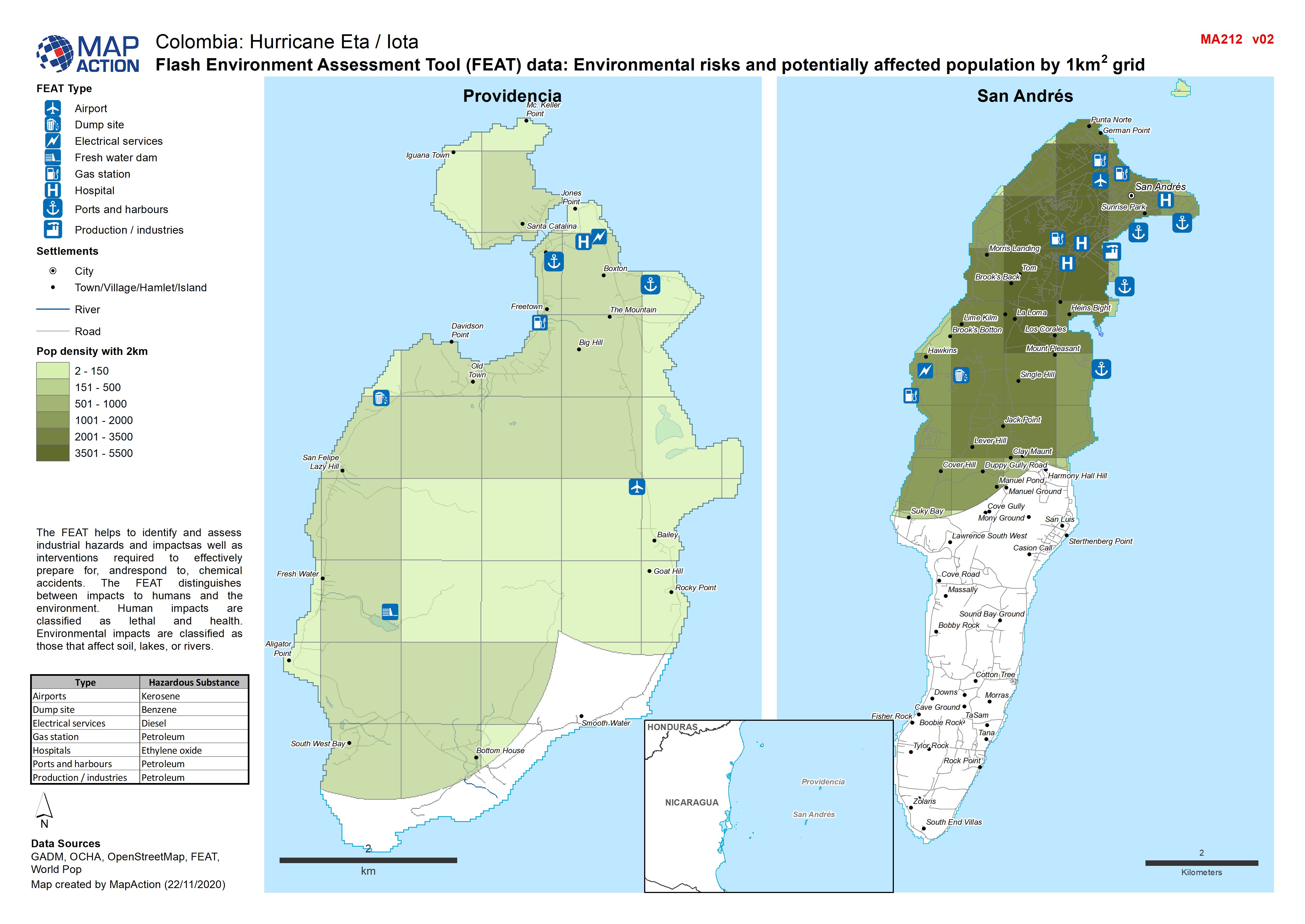
Colombia: Flash Environment Assessment Tool (FEAT) data, Environmental risks ...
Flash Environment Assessment Tool (FEAT) data: Overview of San Andrés and Providencia -

Colombia: Flash Environment Assessment Tool (FEAT) data: Overview of San Andr...
Flash Environment Assessment Tool (FEAT) data: Overview of San Andrés and Providencia -
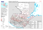
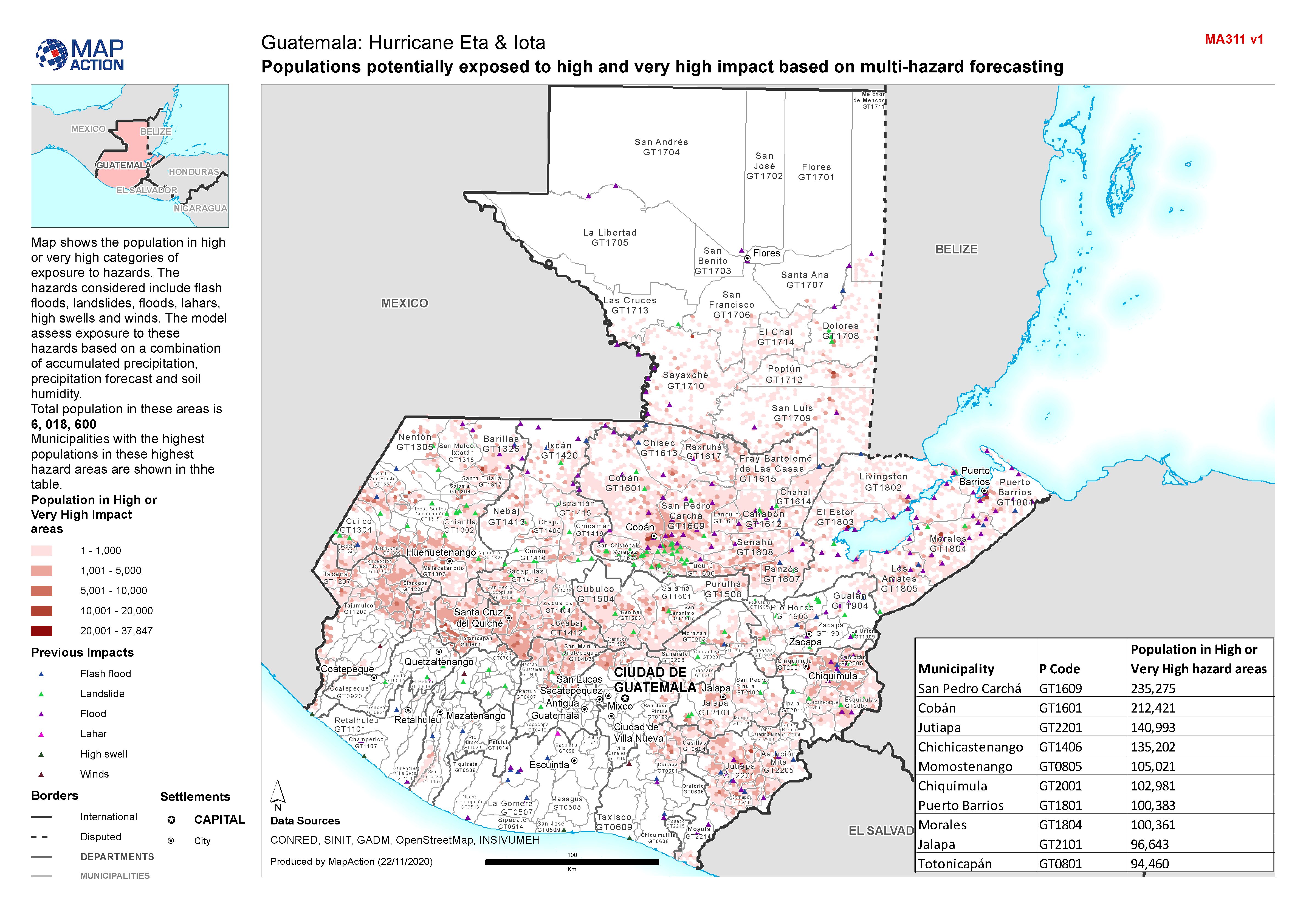
Guatemala: Populations potentially exposed to high and very high impact based...
Map shows the population in high or very high categories of exposure to hazards. The hazards considered include flash floods, landslides, floods, lahars, high swells and winds.... -

-

Ulua Basin: areas evacuated for Hurricane Iota, with El Cajón dam overspillin...
The Municipalities indicated were given mandatory evacuation ordres from low lying land near Ulua and Chameleco rivers pre hurricane Iota. Modelling of possible inundation from... -

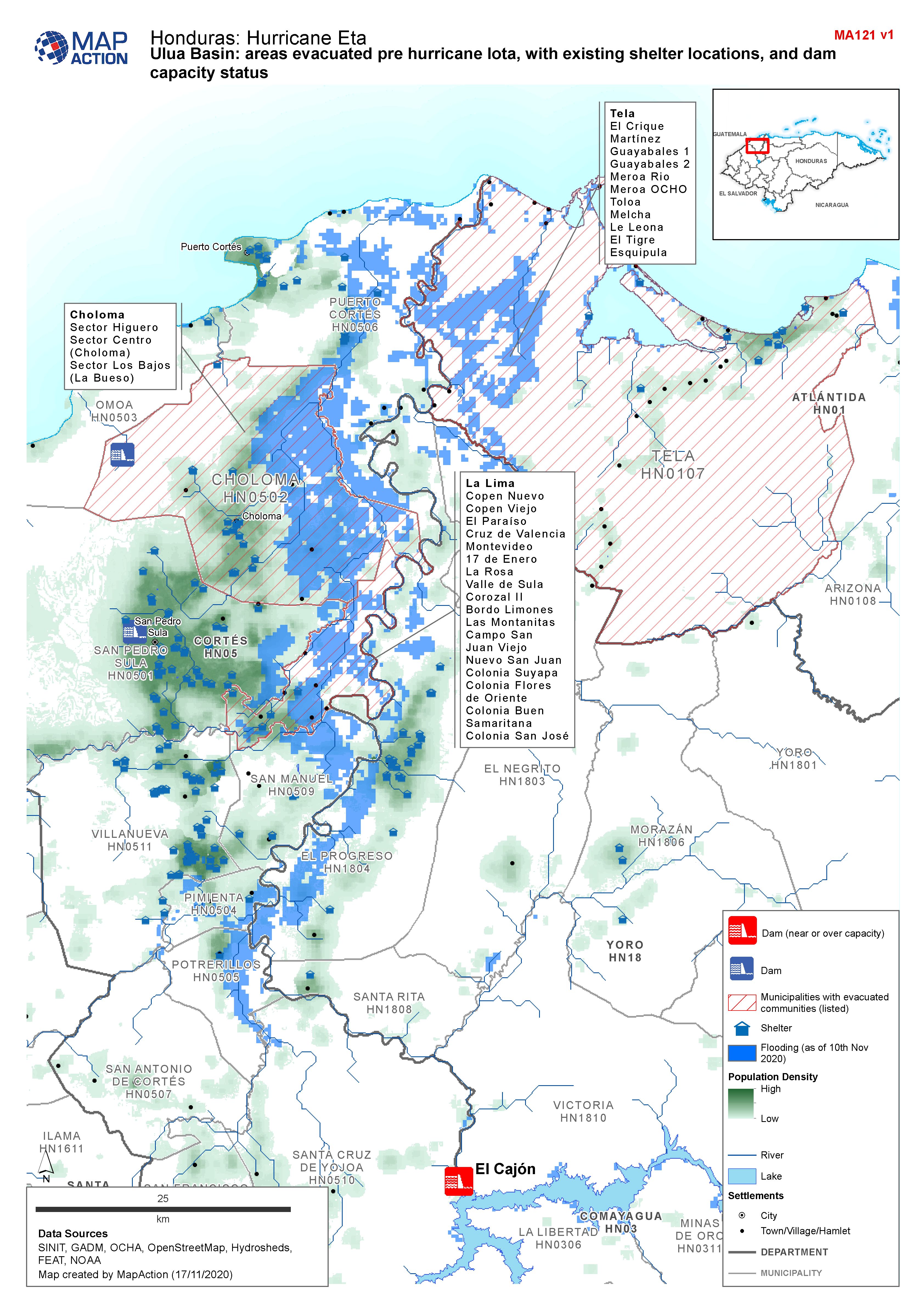
Honduras, Ulua Basin: areas evacuated pre Hurricane Iota, with existing shelt...
Map shows communities evacuated pre hurricane Iota, and existing shelter locations. Population density and capacity status of dams are also shown. -
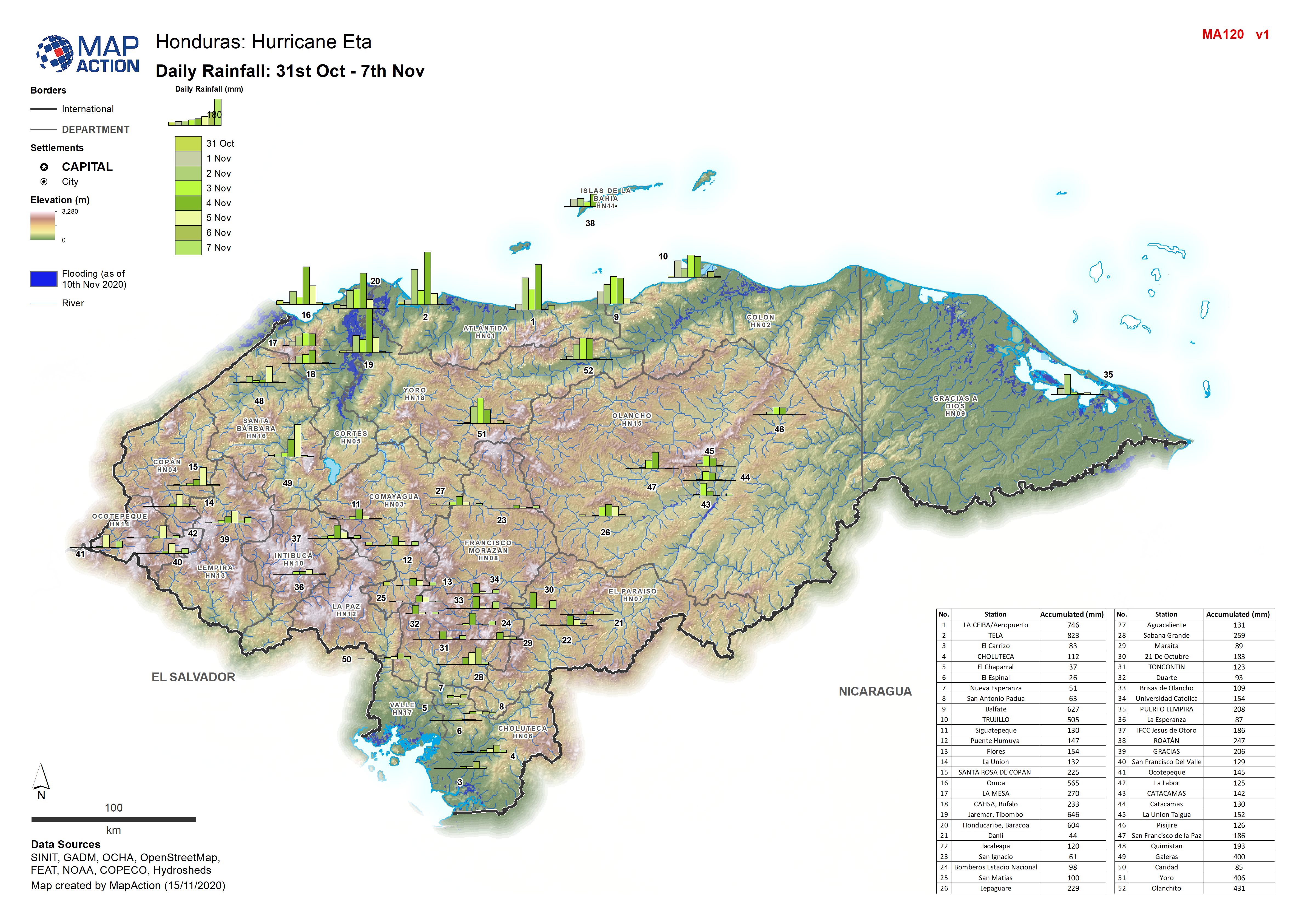
Honduras: Daily Rainfall: 31st Oct - 7th Nov 2020
Honduras: Daily Rainfall: 31st Oct - 7th Nov by weather station -
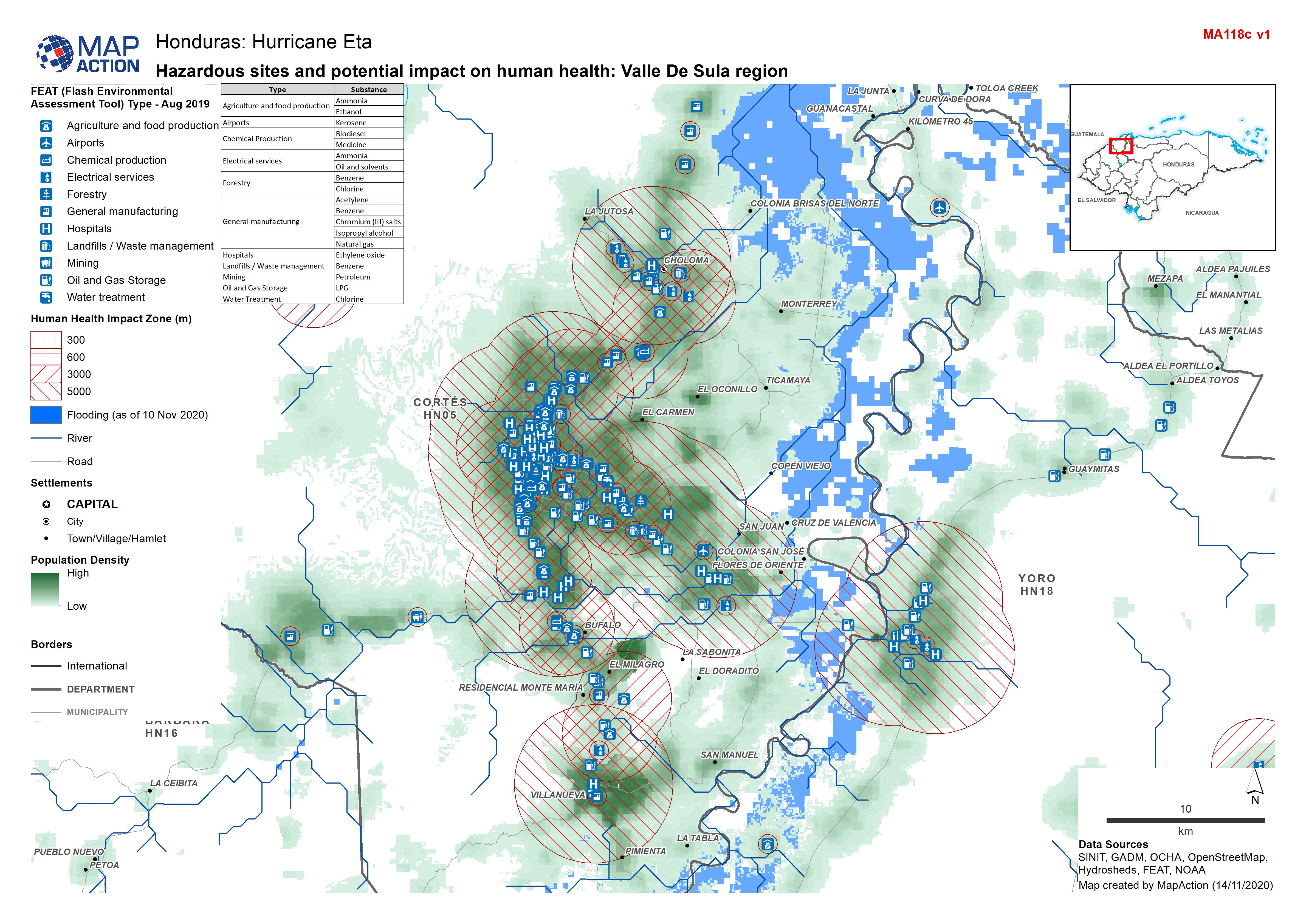
Honduras: Hazardous sites and potential impact on human health: Valle De Sula...
Honduras - Environmental Impact Zones (human health) from FEAT: Valle de Sula region (FEAT - Flash Environmental Assessment Tool) -

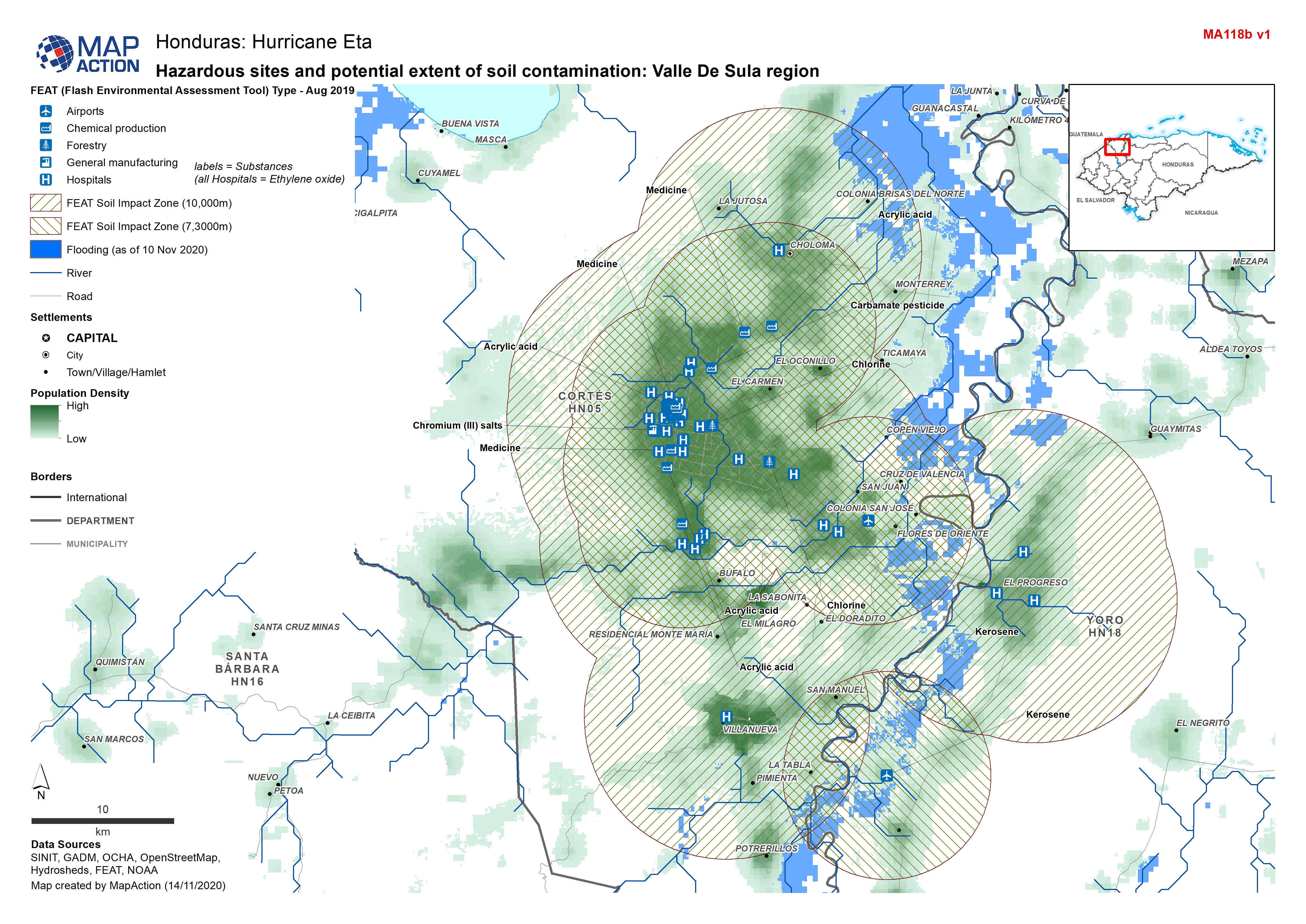
Honduras: Hazardous sites and potential extent of soil contamination: Valle D...
Honduras - Environmental Impact Zones (soil) from FEAT: Valle de Sula region (FEAT - Flash Environmental Assessment Tool) -

Honduras: Hazardous sites and potential extent of water contamination: Valle ...
Honduras - Environmental Impact Zones (water) from FEAT: Valle de Sula region (FEAT - Flash Environmental Assessment Tool) -

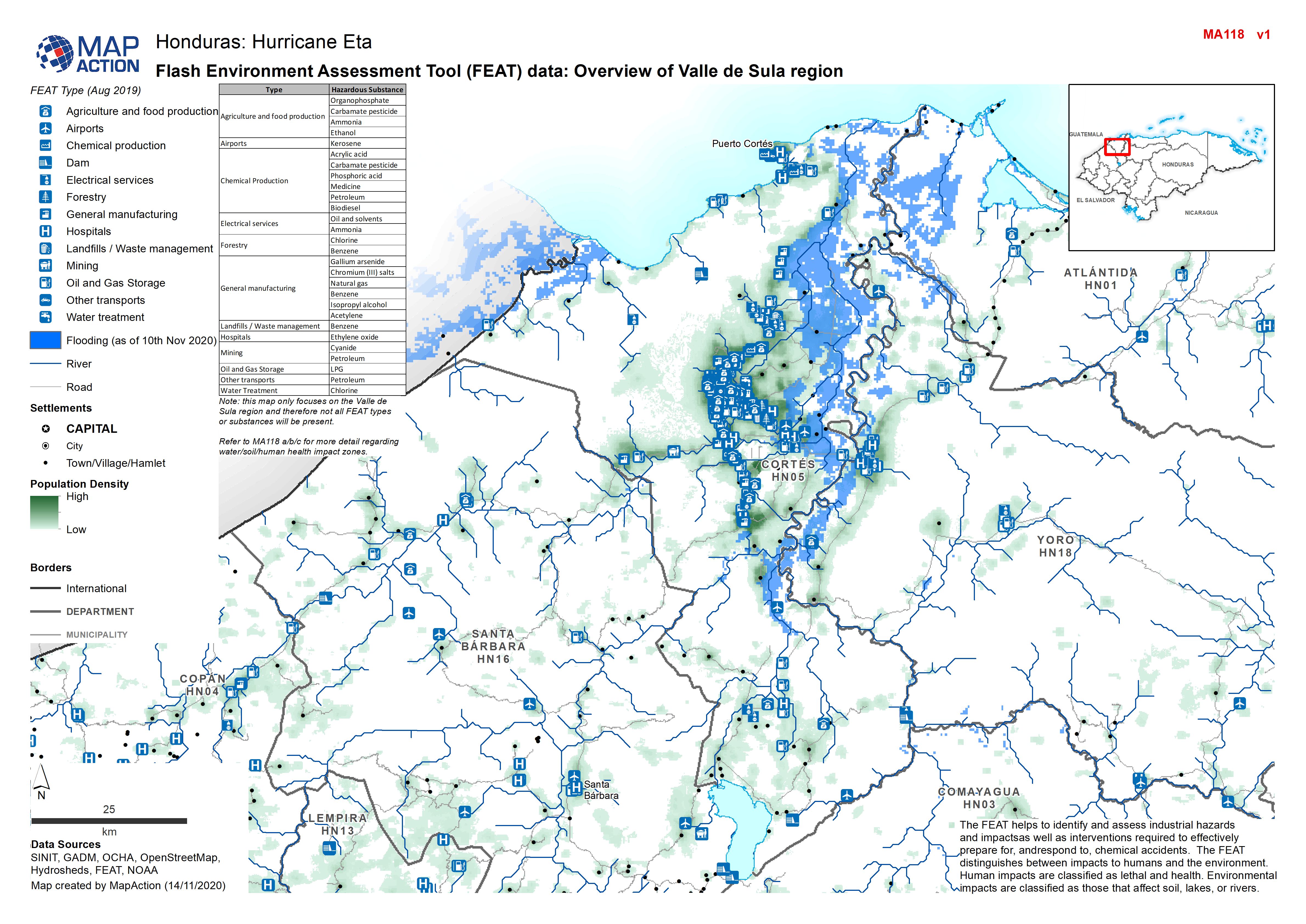
Honduras: Flash Environment Assessment Tool (FEAT) data: Overview of Valle de...
Flash Environment Assessment Tool (FEAT) data: Overview of Valle de Sula region