-

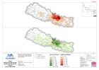
Nepal: Earthquake - Estimate of population directly affected by destroyed hou...
The numbers here should be seen as indicative only. Analysis based on an estimate of the number of buildings destroyed (not including government buildings) and the average... -
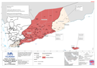
Nepal Kathmandu Earthquake. Deaths and Injuries by District (as of 3 May 2015)
Map shows numbers of deaths and injuries by district. White areas have zero numbers or no data. Map also shows earthquake epicentre. -

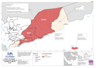
Nepal: Kathmandu Earthquake. Deaths and Injuries by District(as of 01 May 201...
Map shows numbers of deaths and injuries by district. White areas have zero numbers or no data. Map also shows epicentre. -
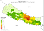
Nepal: Earthquake - Reported injuries in Nepal by district (as of 27 April 2015)
Map shows the early reported number of injuries by District in Nepal. -
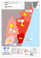
Yemen: TC Chapala - Reports of casualties in affected areas (as of 14 Nov 2015)
The map shows casualties in the three affected Governates and the Mukalla City District. It also reports on some health facilities affected by cyclone Chapala. -

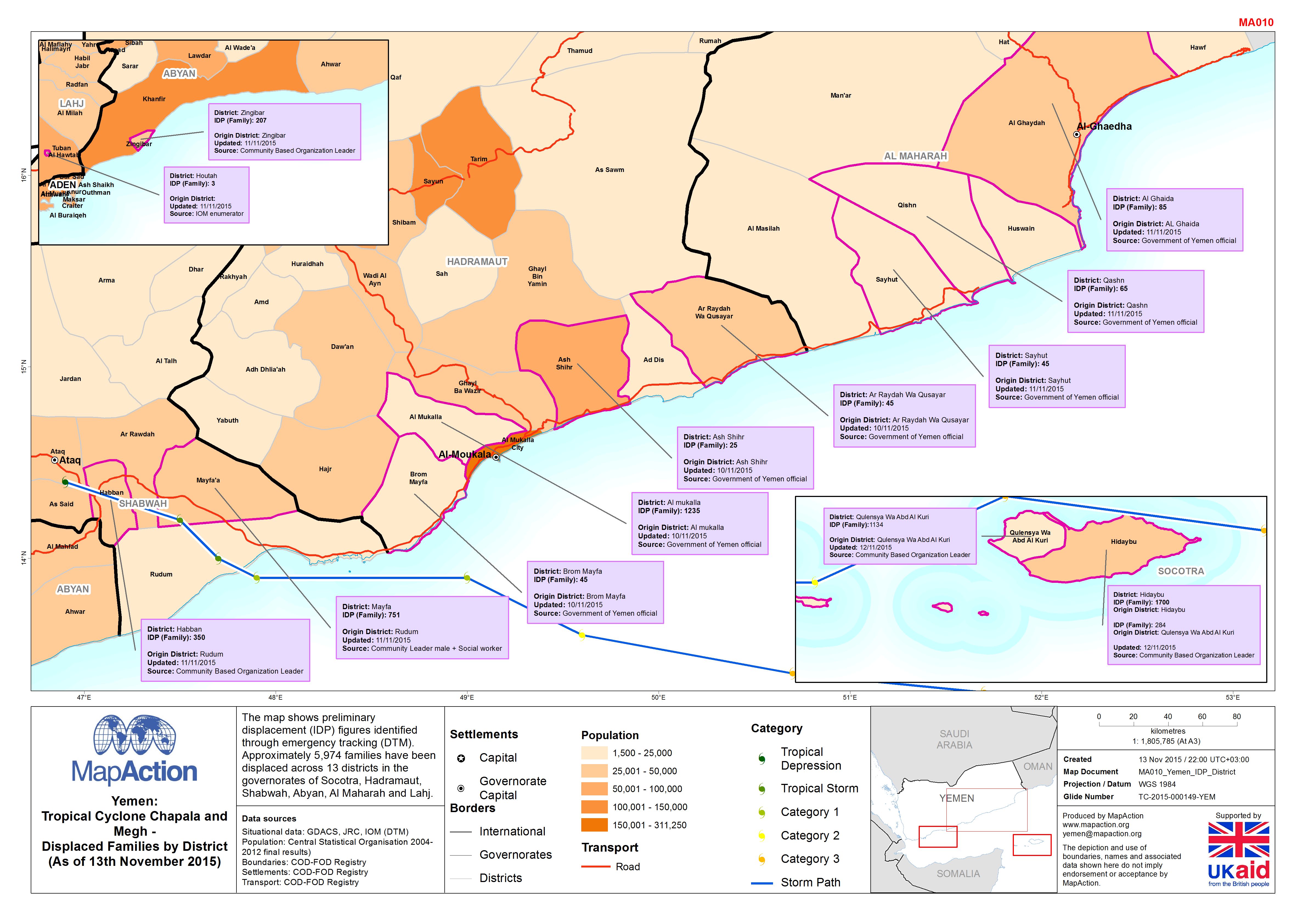
Yemen: Tropical Cyclone Chapala and Megh - Displaced families by district (as...
The map shows preliminary displacement (IDP) figures identified through emergency tracking (DTM). Approximately 5,974 families have been displaced across 13 districts in the... -
Yemen: TC Chapala -The map shows reports on casualties in affected areas.
This dataset has no description
-

Fiji: Cyclone Winston - 2016 Population in Government Hotspot Areas
Projected 2016 population densities by enumeration areas within the Fiji Government Hotspot areas - planning areas for the prioritisation of relief efforts. Showing total... -

Dominica Tropical Storm Erika - Affected Persons (as of 17 Sep 2015)
Map shows the locations and numbers of affected persons. Numbers for Loubiere include Fond Baron, Citroniere, Castle Comfort and Newtown. -

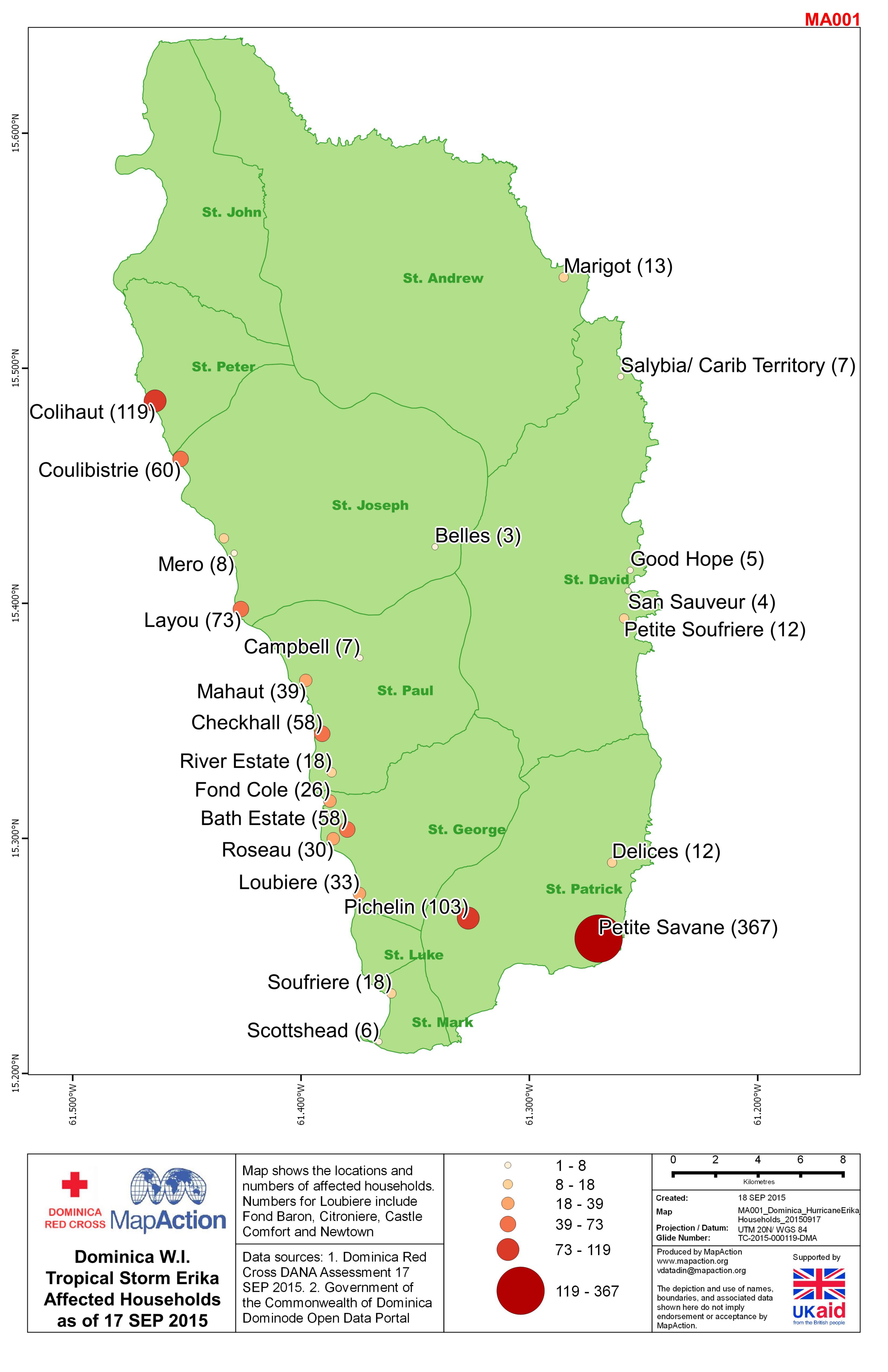
Dominica Tropical Storm Erika - Affected Households (as of 17 Sep 2015)
Map shows the locations and numbers of households. Numbers for Loubiere include Fond Baron, Citroniere, Castle Comfort and Newtown. -
Madagascar: Cyclone Tropical Giovanna - Sécurité Alimentaire Dégâts, Réponses...
This dataset has no description
-

Sahel Crisis: Overview Mali, Mauritania, Niger, Burkina Faso (22nd Feb 2012)
Map shows movement of refugees and IDPs alongside a range of health information. The aim of this map is to help UNICEF prioritise areas most in need of assistance. -

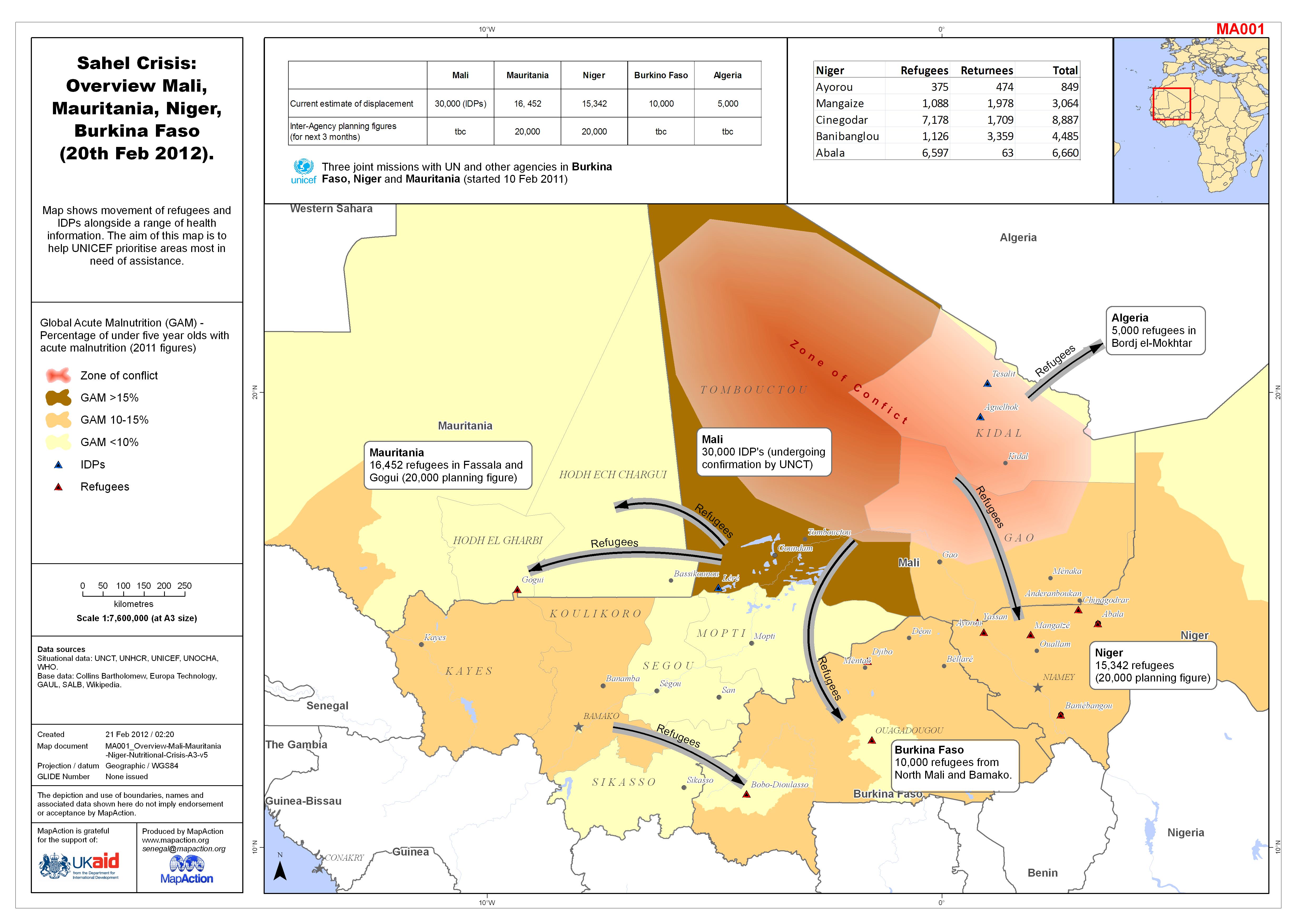
Sahel Crisis: Overview Mali, Mauritania, Niger, Burkina Faso (20th Feb 2012).
Map shows movement of refugees and IDPs alongside a range of health information. The aim of this map is to help UNICEF prioritise areas most in need of assistance. -

Sahel Crisis: Overview Mali, Mauritania, Niger, Burkina Faso (as of 17 Feb 2012)
Map shows movement of refugees and IDPs alongside a range of health information. The aim of this map is to help UNICEF prioritise areas most in need of assistance. -

Sahel Crisis: Overview Mali, Mauritania, Niger (as of 16 Feb 2012)
Map shows movement of refugees and IDPs alongside a range of health information. The aim of this map is to help UNICEF prioritise areas most in need of assistance. -

Sahel Nutrition Crisis: Overview Mali, Mauritania, Niger (as of 14 Feb 2012)
Map shows movement of refugees and IDPs alongside a range of health information. The aim of this map is to help UNICEF prioritise areas most in need of assistance. -

Sahel Crisis: Overview Mali, Mauritania, Niger (as of 16 Feb 2012)
Map shows movement of refugees and IDPs alongside a range of health information. The aim of this map is to help UNICEF prioritise areas most in need of assistance. -
Philippines Tropical Storm Washi (Sendong) Affected Barangays and Evacuation ...
Map shows affected Barangays and Evacuation Centre locations in Cagayan de Oro City -
Philippines Tropical Storm Washi (Sendong) Barangays within Affected Municipa...
Map of Barangays in affected Municipalities. Part of a maps series covering all of the affected area (Affected Municipality information supplied 13/01/2012). -

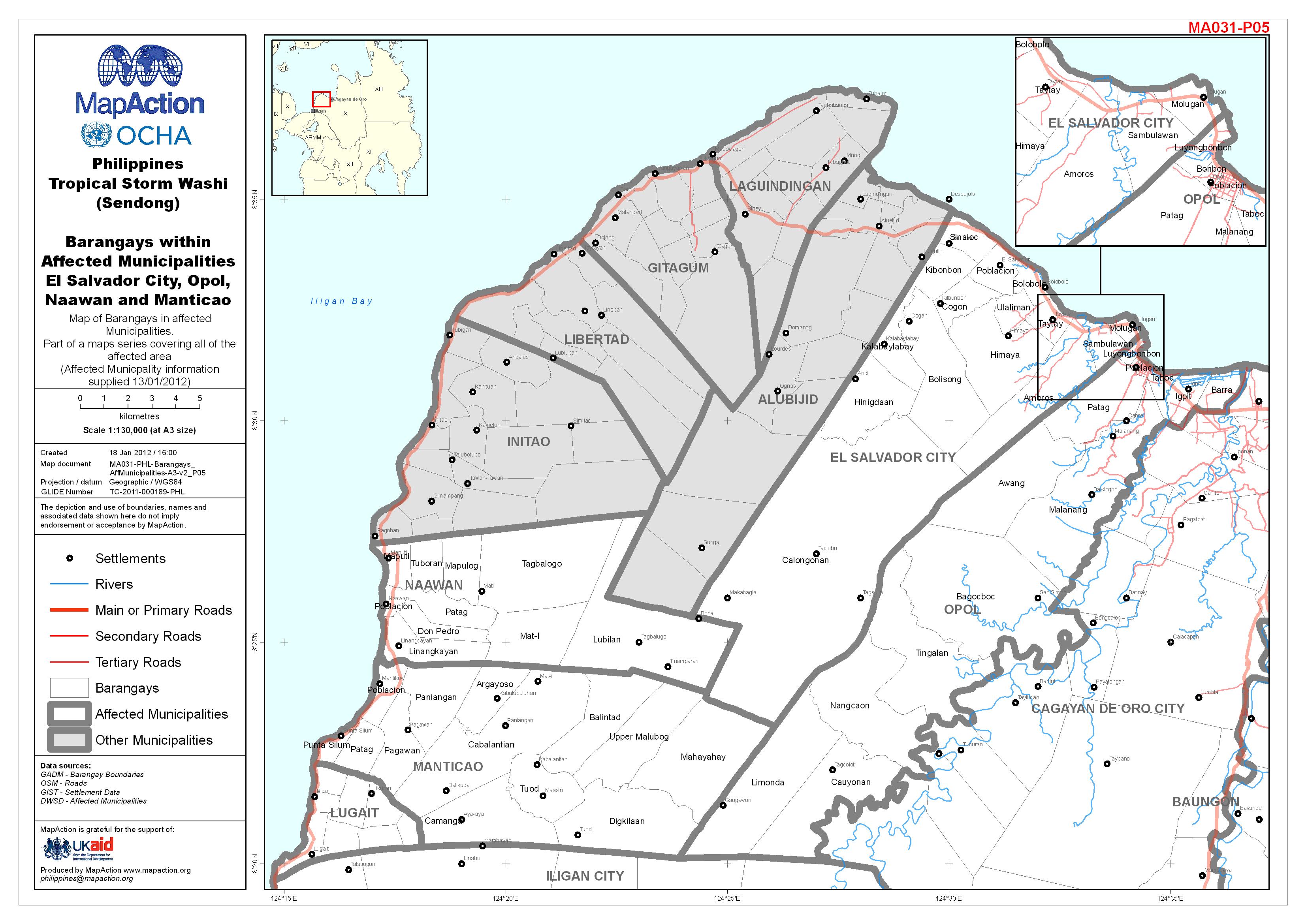
Philippines Tropical Storm Washi (Sendong) Barangays within Affected Municipa...
Map of Barangays in affected Municipalities. Part of a maps series covering all of the affected area (Affected Municipality information supplied 13/01/2012).