-

Indonesia: Sumatra Earthquake - Padang Pariaman Health Cluster Who-What-Where...
Peta menunjukkan data kemanusiaan di Cluster Kesehatan untuk Provinsi Sumatra Barat. Data tersedia bagi Cluster Kesehatan di Padang pada tanggal 13 Oktober 2009. Harap... -

Indonesia: Sumatra Earthquake - Detailed Admin Map - Padang Pariaman South Pe...
Map shows administrative boundaries and within Padang Pariaman (West Sumatra) province. Place codes (p-codes) are shown in labels and should be used when referring to districts... -

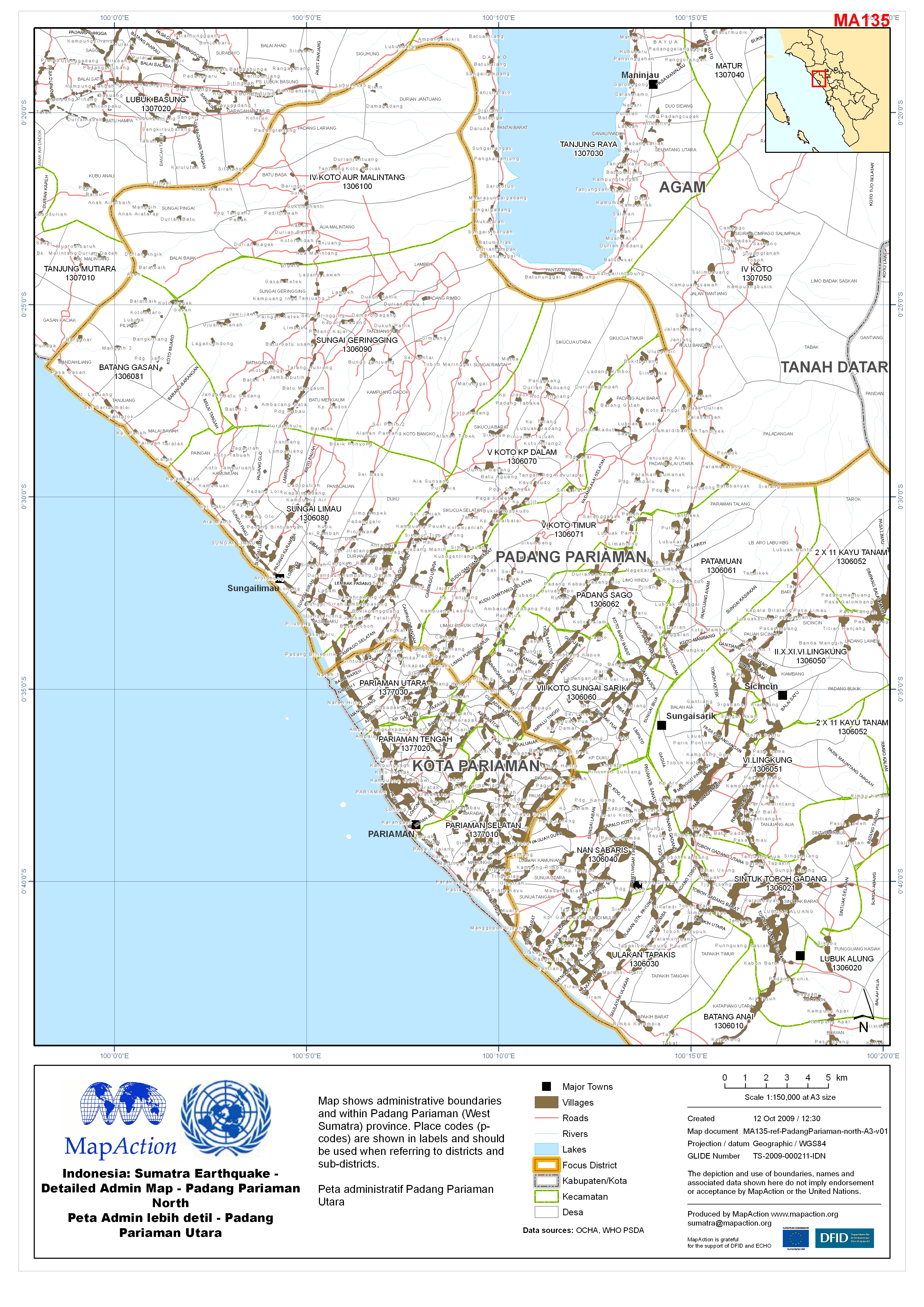
Indonesia: Sumatra Earthquake - Detailed Admin Map - Padang Pariaman North Pe...
Map shows administrative boundaries and within Padang Pariaman (West Sumatra) province. Place codes (p-codes) are shown in labels and should be used when referring to districts... -

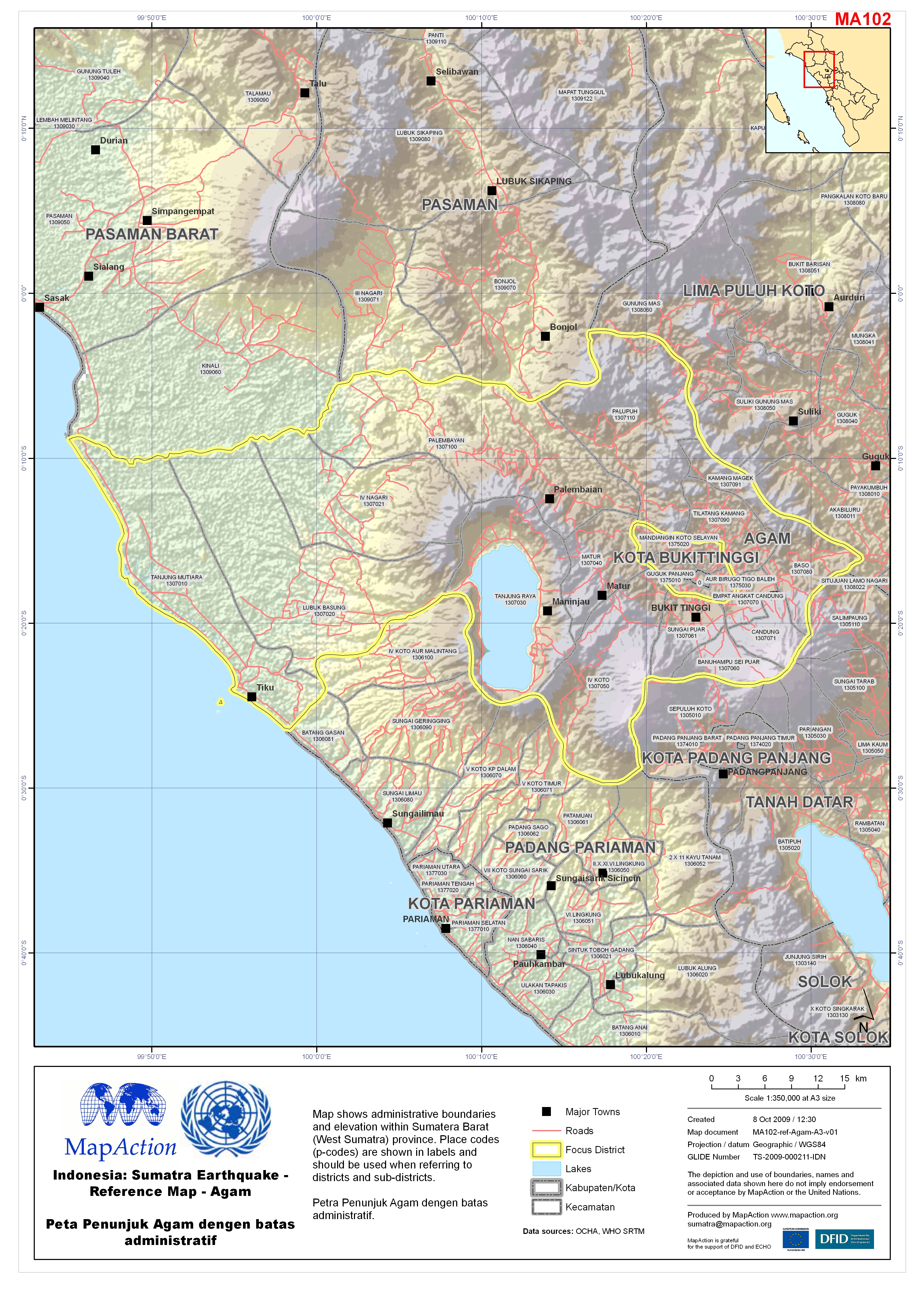
Indonesia: Sumatra Earthquake - Reference Map - Agam Peta Penunjuk Agam denge...
Map shows administrative boundaries and elevation within Sumatera Barat (West Sumatra) province. Place codes (p-codes) are shown in labels and should be used when referring to... -

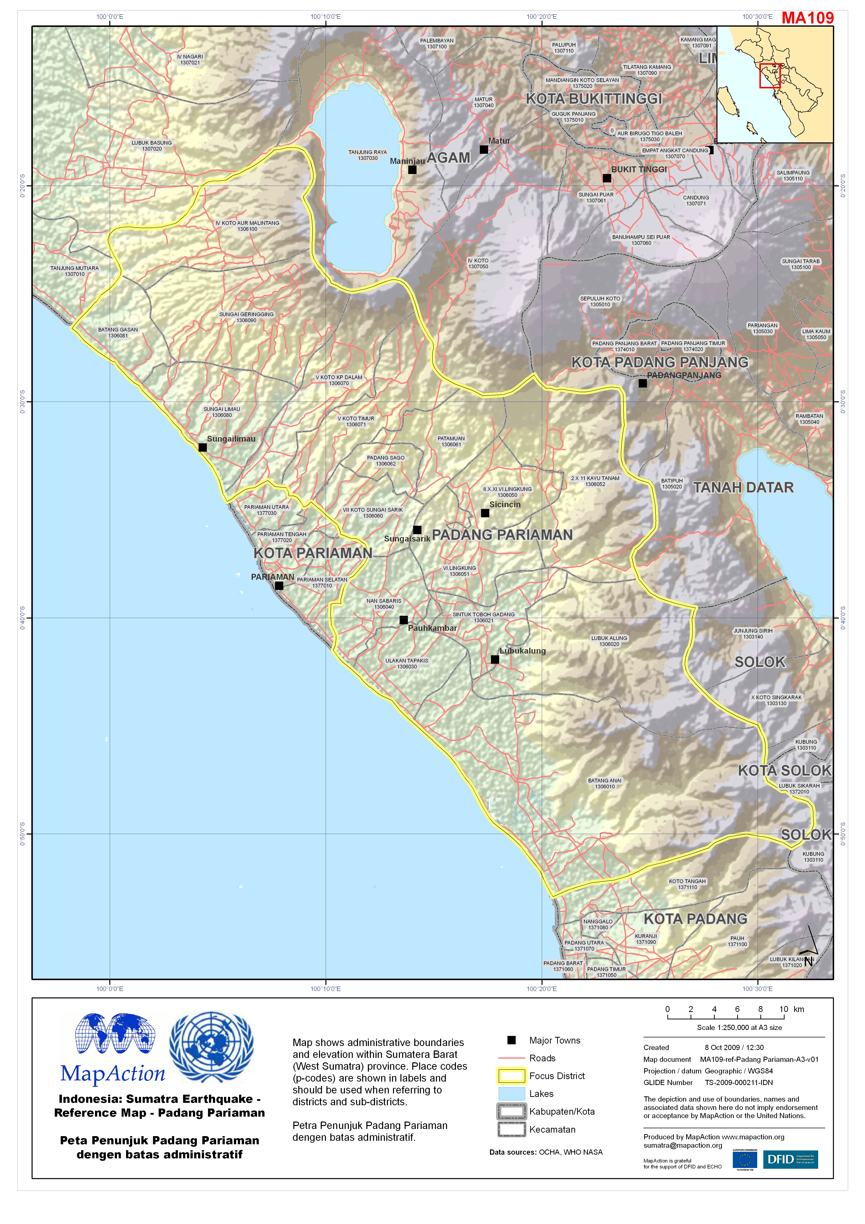
Indonesia: Sumatra Earthquake - Reference Map - Padang Pariaman Peta Penunjuk...
Map shows administrative boundaries and elevation within Sumatera Barat (West Sumatra) province. Place codes (p-codes) are shown in labels and should be used when referring to... -

Indonesia: Sumatra Earthquake - Reference Map - Kota Pariaman Peta Penunjuk K...
Map shows administrative boundaries and elevation within Sumatera Barat (West Sumatra) province. Place codes (p-codes) are shown in labels and should be used when referring to... -

Indonesia: Sumatra Earthquake - Admin Map - Pasaman Peta administratif Pasaman
Map shows administrative boundaries within Sumatera Barat (West Sumatra) province. Place codes (p-codes) are shown in labels and should be used when referring to districts and... -

Indonesia: Sumatra Earthquake - Admin Map - Agam Peta administratif Agam
Map shows administrative boundaries and elevation within Sumatera Barat (West Sumatra) province. Place codes (p-codes) are shown in labels and should be used when referring to... -

Indonesia: Sumatra Earthquake - Admin Map - Pasaman Barat Peta administratif ...
Map shows administrative boundaries and elevation within Sumatera Barat (West Sumatra) province. Place codes (p-codes) are shown in labels and should be used when referring to... -

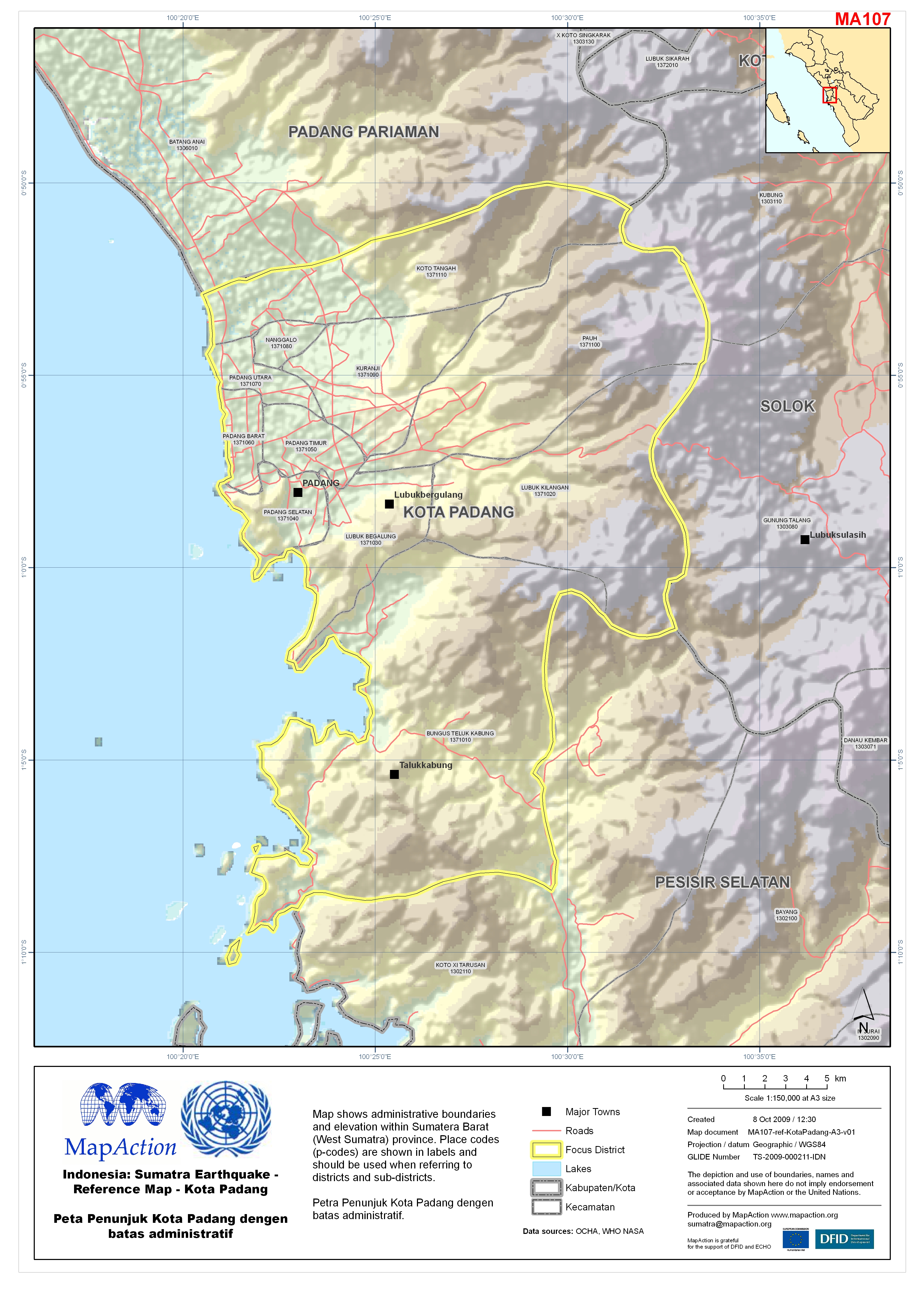
Indonesia: Sumatra Earthquake - Admin Map - Kota Padang Peta administratif Ko...
Map shows administrative boundaries and elevation within Sumatera Barat (West Sumatra) province. Place codes (p-codes) are shown in labels and should be used when referring to... -

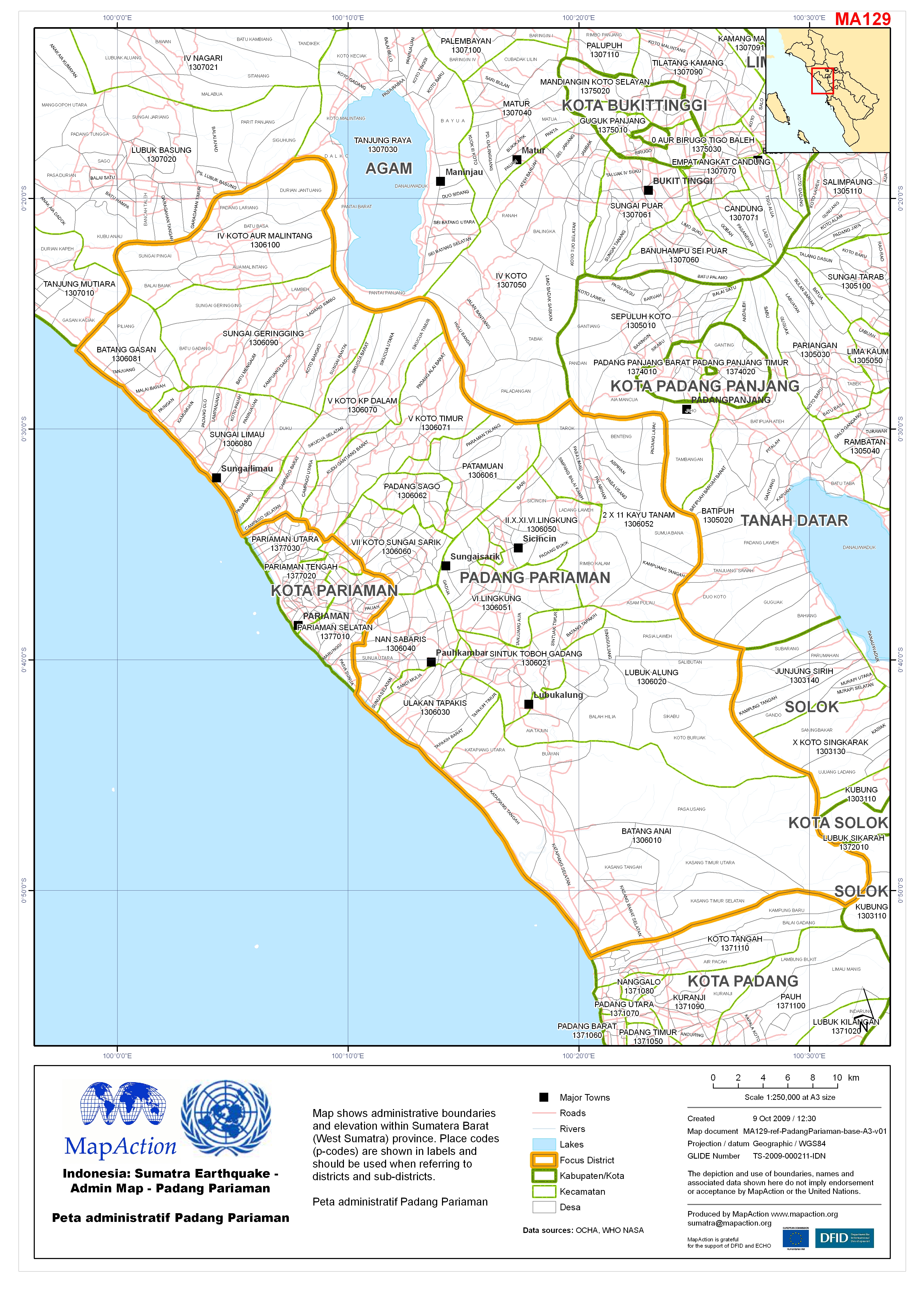
Indonesia: Sumatra Earthquake - Admin Map - Padang Pariaman Peta administrati...
Map shows administrative boundaries and elevation within Sumatera Barat (West Sumatra) province. Place codes (p-codes) are shown in labels and should be used when referring to... -

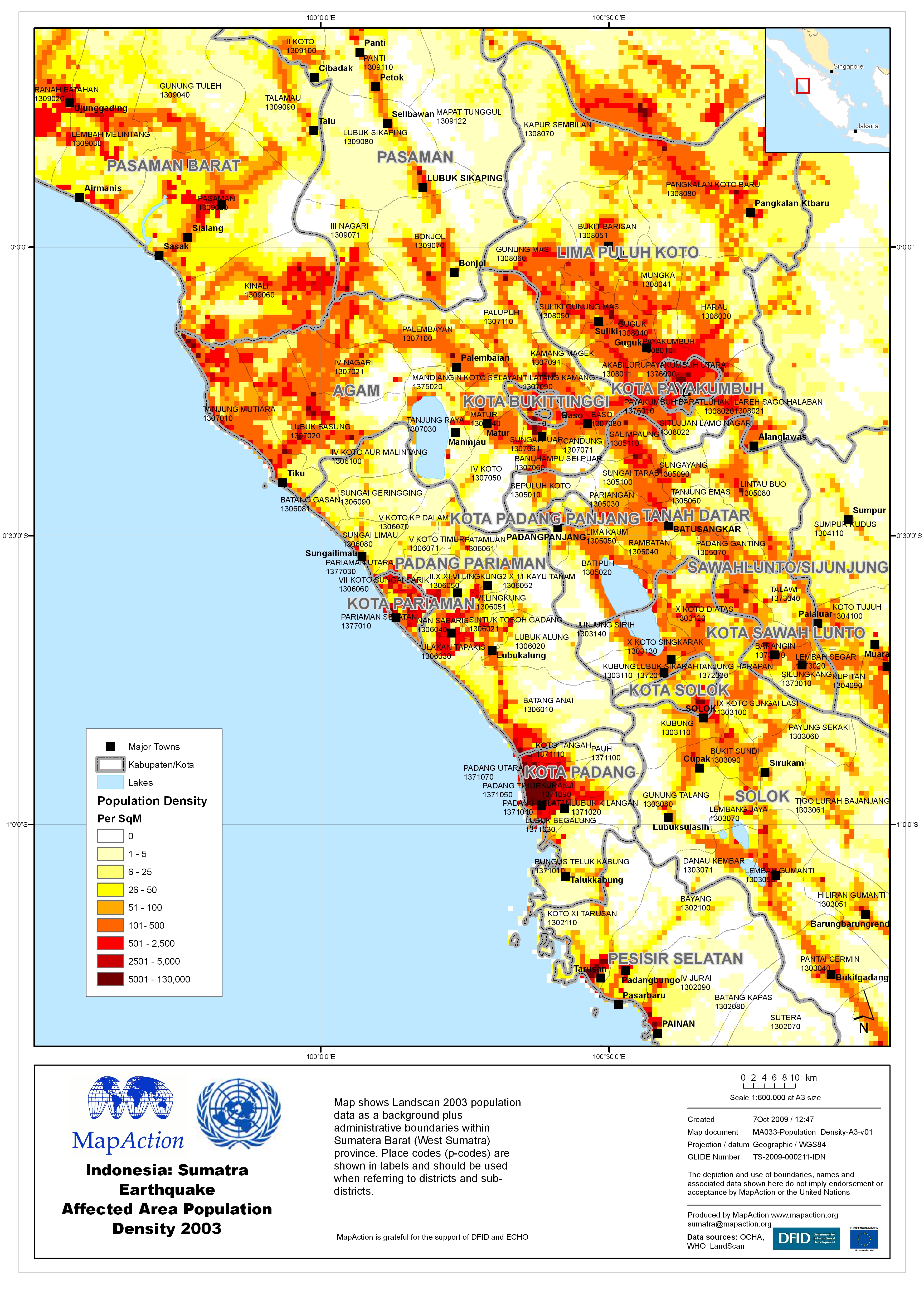
Indonesia: Sumatra Earthquake Affected Area Population Density 2003
Map shows Landscan 2003 population data as a background plus administrative boundaries within Sumatera Barat (West Sumatra) province. Place codes (p-codes) are shown in labels... -

Indonesia: Sumatra Earthquake - Padang Pariaman Health Cluster Who-What-Where...
Map shows humanitarian Health Cluster data for West Sumatra province. Data provided to Health Cluster in Padang on 9 October 2009. Note that some infrastructure may not yet be... -

Indonesia: Sumatra Earthquake - Reference Map - Pasaman Peta Penunjuk Pasaman...
Map shows administrative boundaries and elevation within Sumatera Barat (West Sumatra) province. Place codes (p-codes) are shown in labels and should be used when referring to... -

Indonesia: Sumatra Earthquake - Reference Map - Kota Padang Peta Penunjuk Kot...
Map shows administrative boundaries and elevation within Sumatera Barat (West Sumatra) province. Place codes (p-codes) are shown in labels and should be used when referring to... -

Indonesia: Sumatra Earthquake - Reference Map - Pasaman Peta Penunjuk Pasaman...
Map shows administrative boundaries and elevation within Sumatera Barat (West Sumatra) province. Place codes (p-codes) are shown in labels and should be used when referring to... -
Indonesia: Sumatra Earthquake - Reference Map - Pasaman Peta Penunjuk Pasaman...
Map shows administrative boundaries and elevation within Sumatera Barat (West Sumatra) province. Place codes (p-codes) are shown in labels and should be used when referring to... -

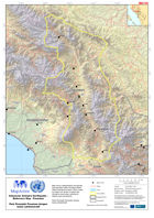
Indonesia: Sumatra Earthquake - IFRC Aerial and Ground Assessment NW of Padan...
Map shows Aerial and ground assessment carried out by IFRC over the dates 4th-7th October. Damage starts in NW and continues south east towards Padang Pariaman. South Eastern... -

Indonesia: Sumatra Earthquake - WASH Who-What-Where (3W) as at 8-Oct-09
Map shows humanitarian water, sanitation and hygiene actions in West Sumatra province. Data provided to WASH Cluster in Padang on 6 September 2009. Note that some infrastructure... -
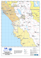
Indonesia: Sumatra Earthquake - Padang to Pesisir Selatan 05-Oct-2009
Map shows administrative boundaries within Sumatera Barat (West Sumatra)province. Place codes (p-codes) are shown in labels and should be used when referring to districts and...