-

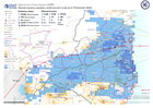
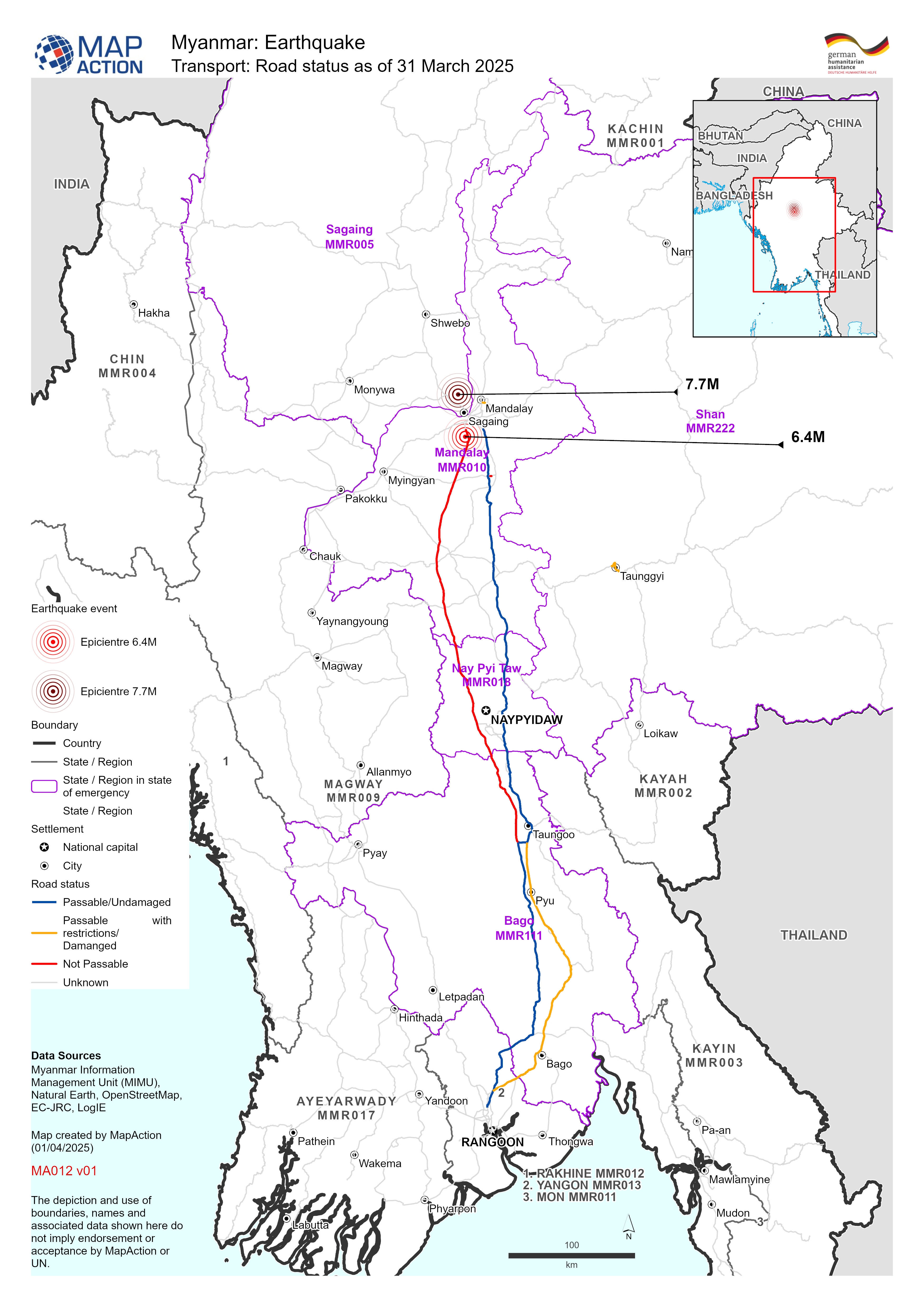
Transport: Road status as of 31 March 2025
Map shows the road status (as of 31 March April 2025) with earthquake epicentres and affected State - Regions of Myanmar. -

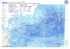
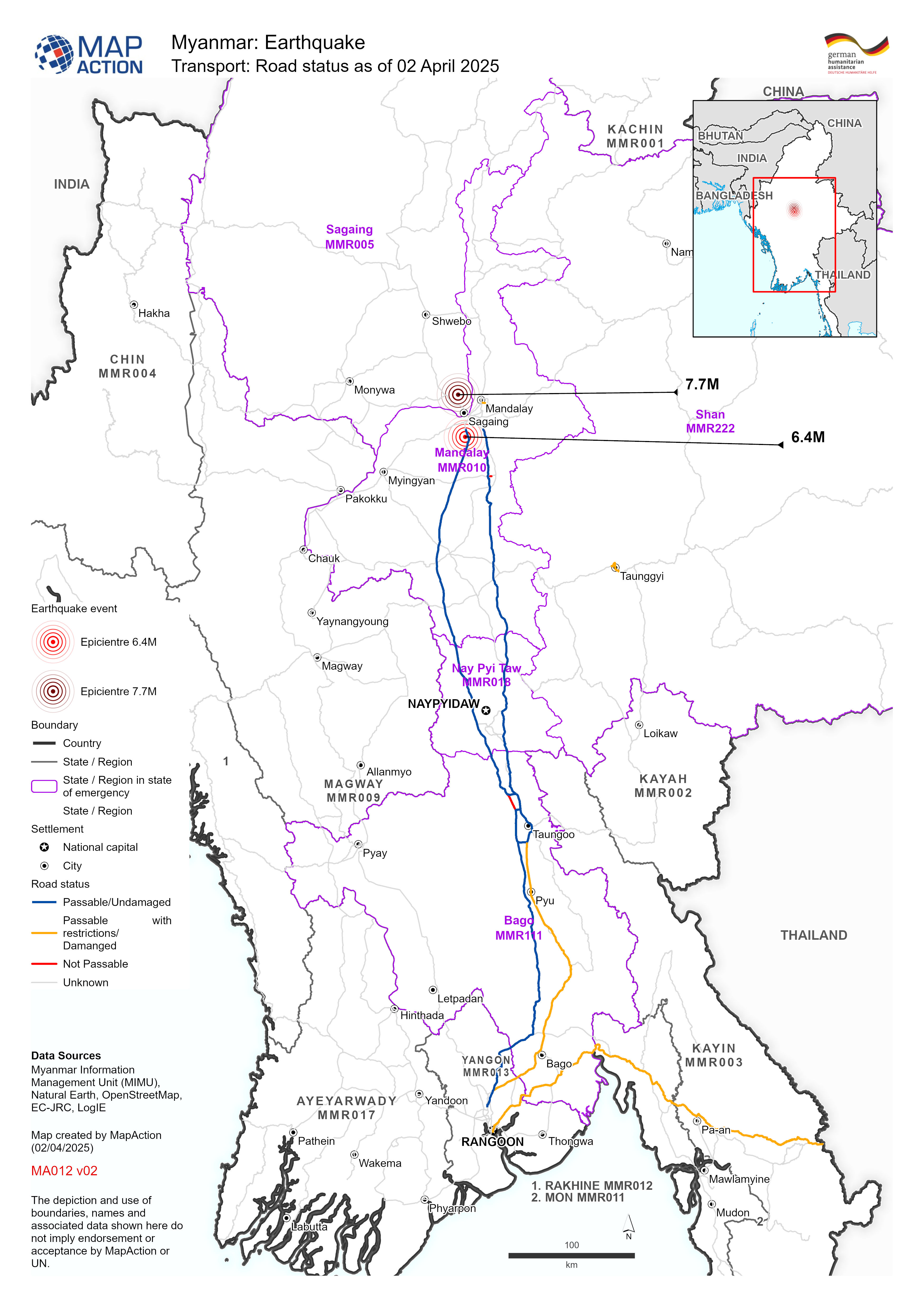
Transport: Road status as of 02 April 2025
Map shows the road status (as of 02 April 2025) with earthquake epicentres and affected State - Regions of Myanmar. -

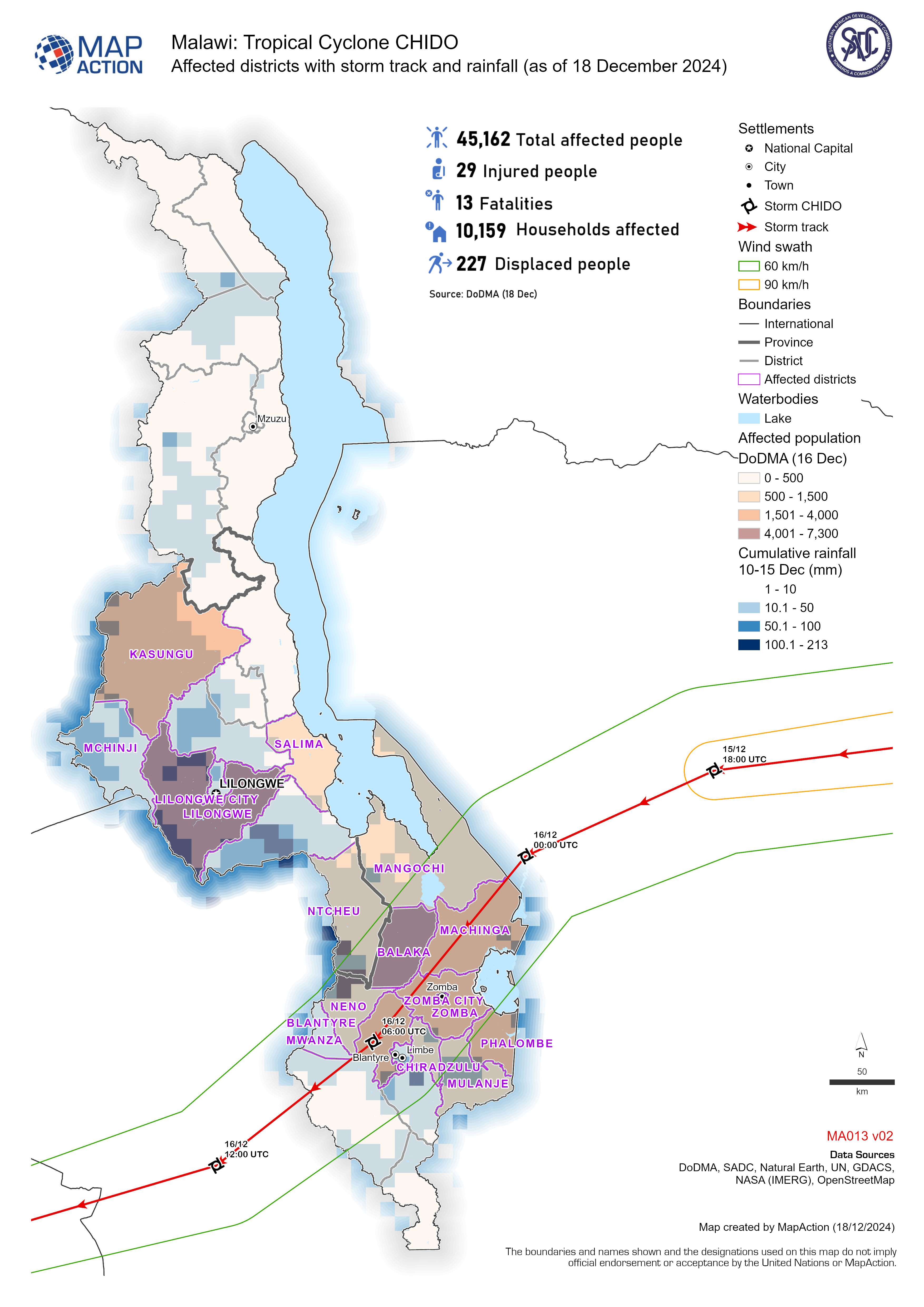
Affected districts with storm track and rainfall (as of 18 December 2024)
Affected population and households with storm track and rainfall for tropical cyclone Chido -
Affected provinces, population, rainfall and storm track (as of 18 December 2...
Affected population by tropical cyclone Chido, showing population density, cumulative rainfall and storm track. -
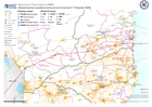
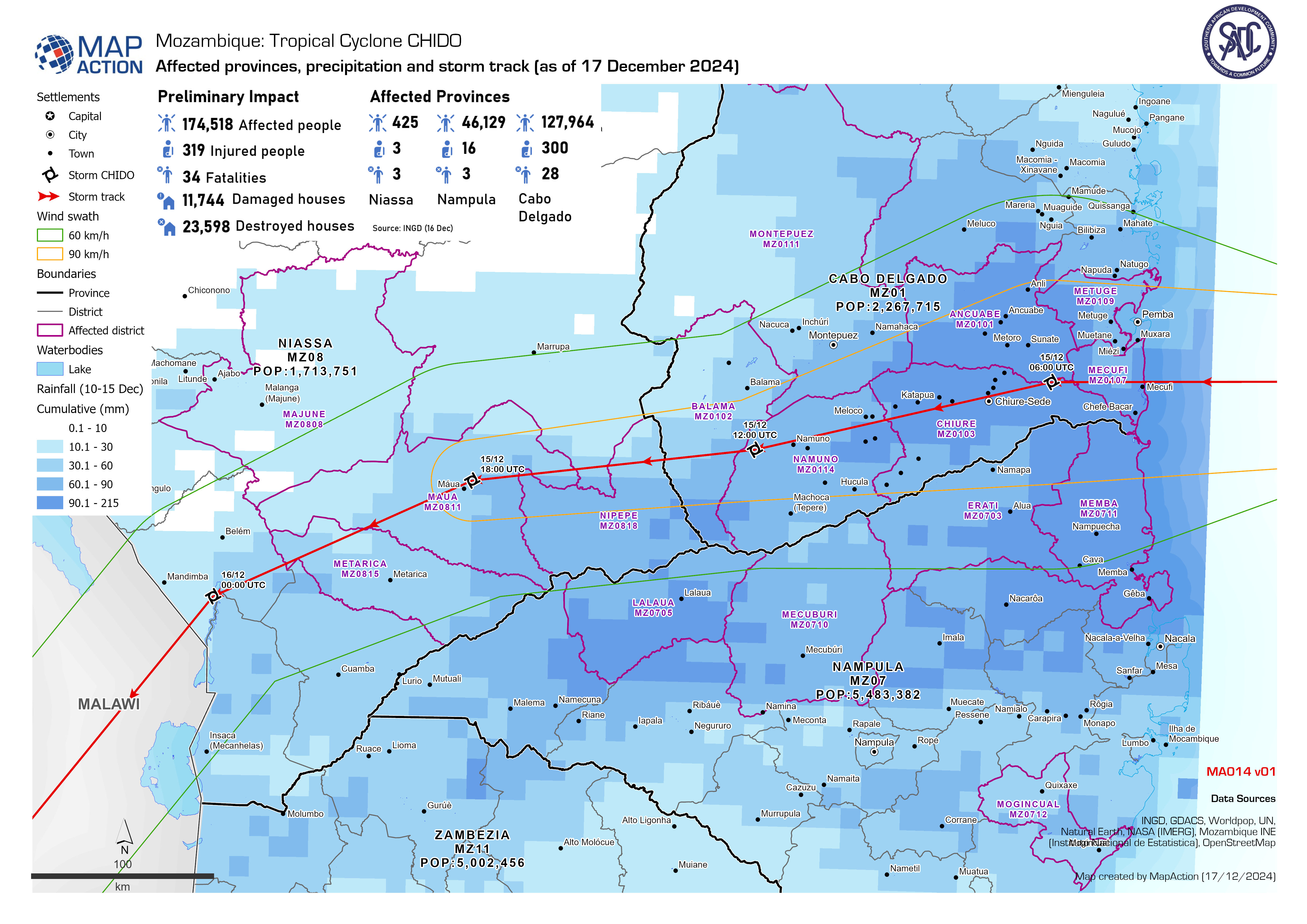
Affected provinces, precipitation and storm track (as of 17 December 2024)
Affected population by the tropical cyclone Chido, showing cumulative rainfall and storm track. -
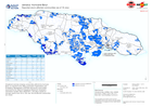
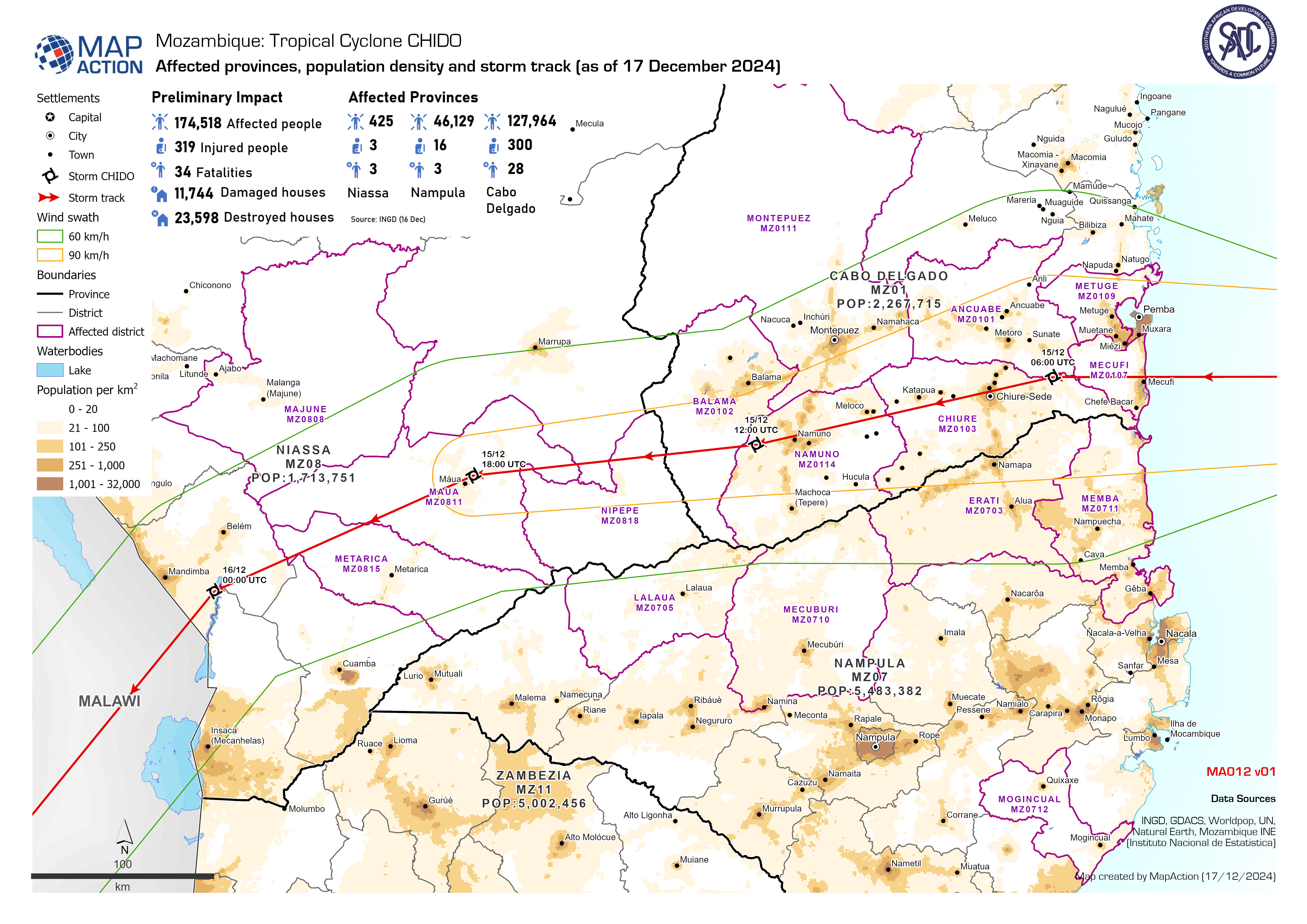
Affected provinces, population density and storm track (as of 17 December 2024)
Affected population by tropical cyclone Chido, showing population density, cumulative rainfall and storm track. -

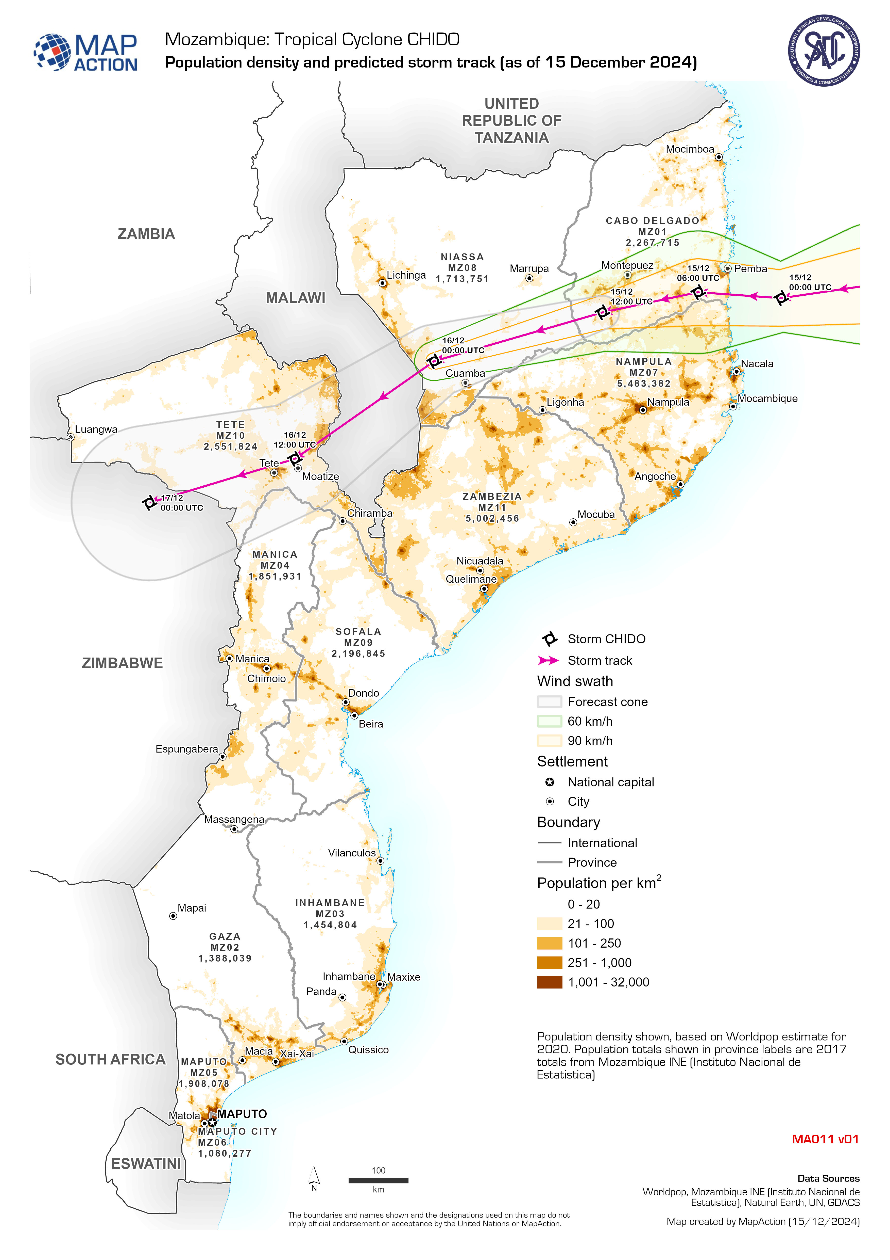
Population density and predicted storm track (as of 15 December 2024)
Population density shown, based on Worldpop estimate for 2020. Population totals shown in province labels are 2017 totals from Mozambique INE (Instituto Nacional de Estatistica) -
Reported storm affected communities (as of 18 July)
Situational overview showing communities affected by hurricane Beryl, as reported to the Office of Disaster Preparedness and Emergency Management (ODPEM) and priority... -

Assessment locations - 10 and 15 July 2024
Map shows the location of the assessments carried out on 10 July 2024. Teams included members from ODPEM, UNDAC, OIM, FAO, UNDSS, UNDP, UNICEF, ATLAS, JEU and TSF. Roads,... -
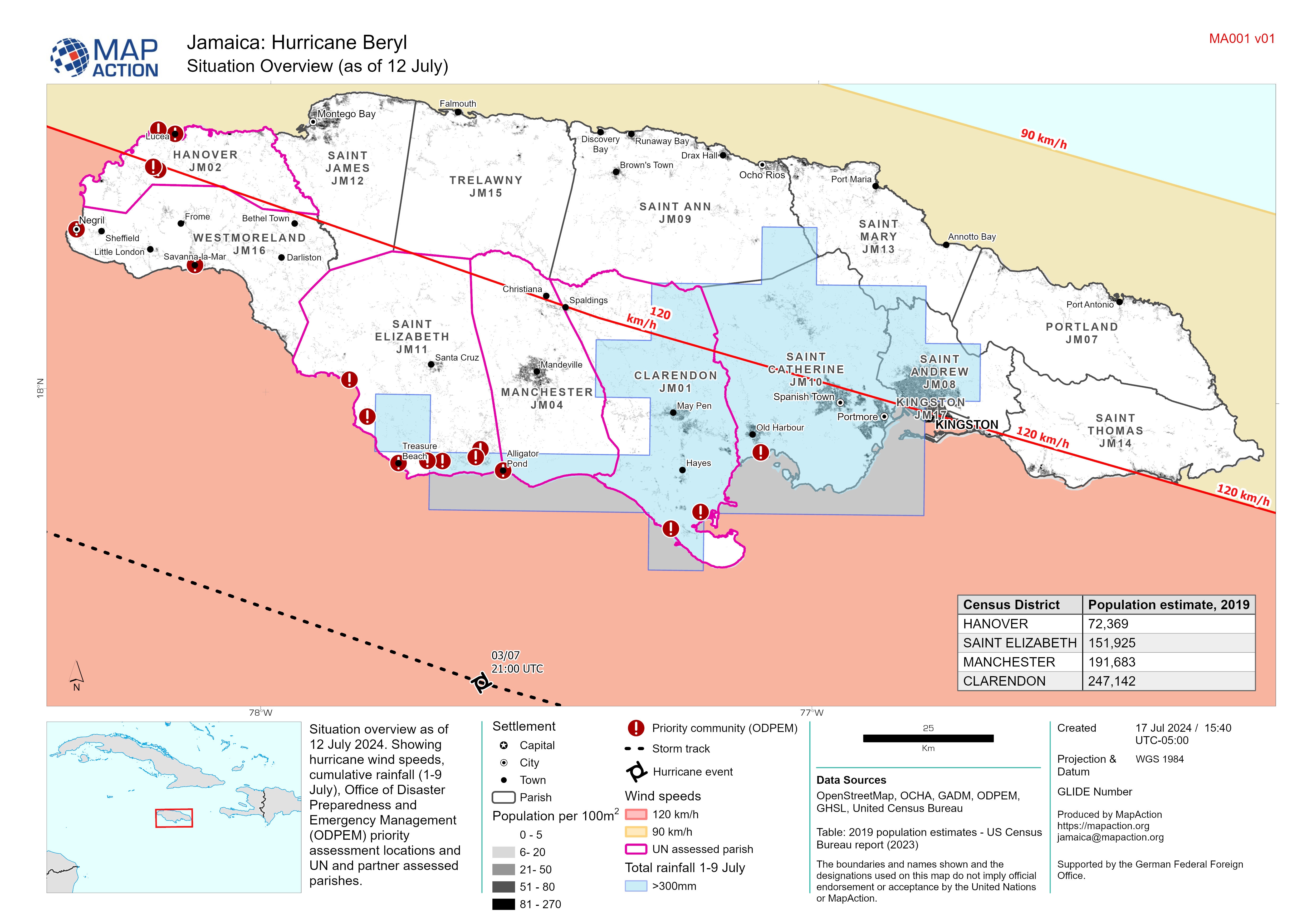
Situation Overview (as of 12 July)
Situation overview as of 12 July 2024. Showing hurricane wind speeds, cumulative rainfall (1-9 July), Office of Disaster Preparedness and Emergency Management (ODPEM) priority... -

Population Density for Affected Provinces
Morocco population density for affected provinces at 1 km2 spatial distribution from 2020 WorldPop data. Tabular population data at province level supplied by Haut Commissaire... -

Flood Extents (As of 02 Dec 2023) and Baseline Population
Table shows estimated baseline population in 2022 for affected regions in South Somalia. Population distribution shown on map is based on Worldpop estimate for 2020. Flood... -

Affected Population from Flooding by District
Percentage affected population. Based on Worldpop baseline estimates for 2020 and Unosat flood extents from 23rd OCtober 2023.. -

ASAL Humanitarian Network Drought Response - Activity by Ward (as of 23 Augus...
The map shows the 3w (who, what, where) response activity by wards for the planned and ongoing multi-purpose cash program implemented by the ASAL Humanitarian Network (AHN), in... -

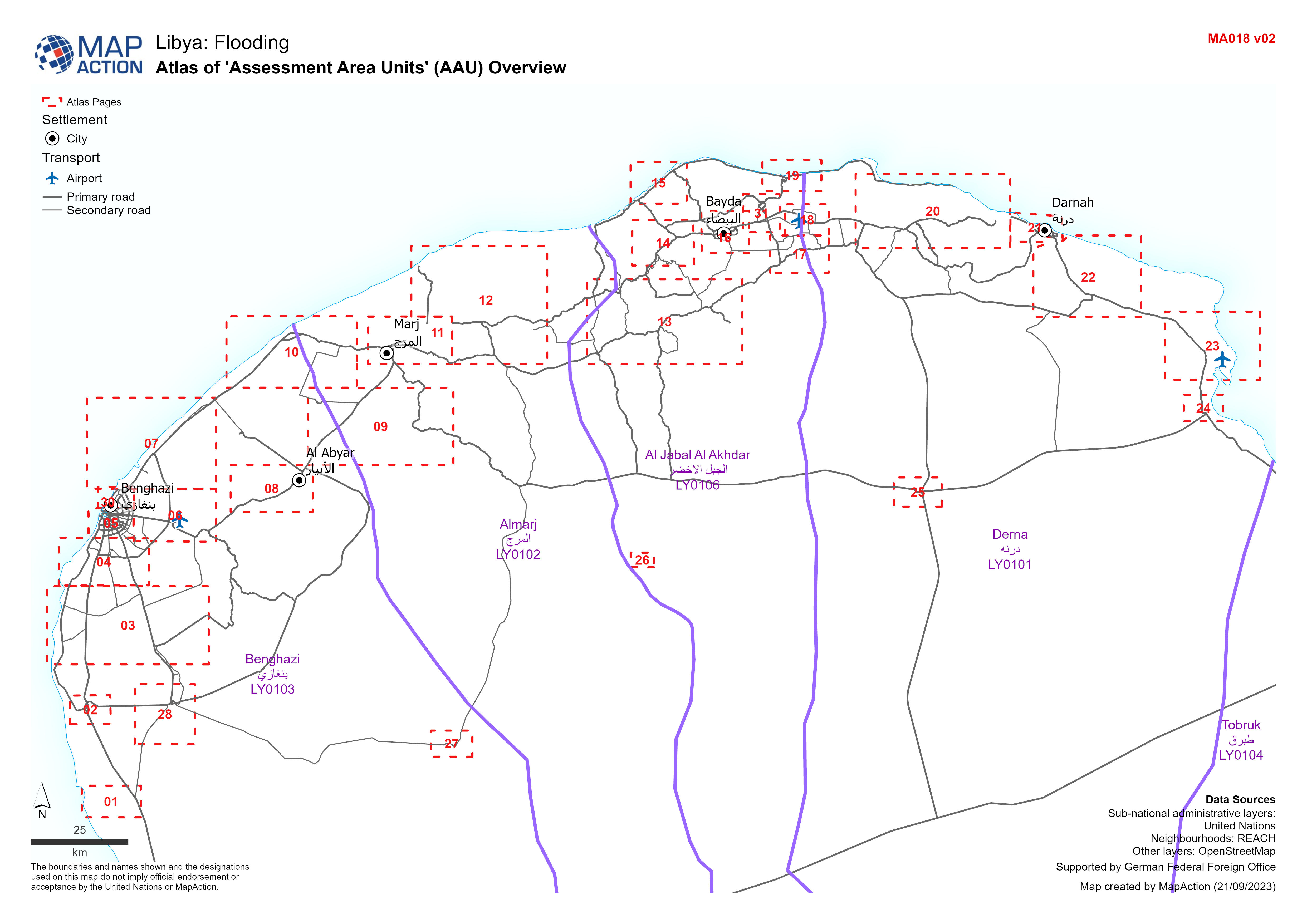
'Assessment Area Units' (AAU) Overview
Showing Assesment Area Units (AAUs) atlas pages for urban area between Benghazi and Derna -

A4 Atlas of 'Assessment Area Units' (AAU):
Atlas showing Assessment Area Units (AAUs) for urban area between Benghazi and Derna -

A3 Atlas of 'Assessment Area Units' (AAU):
Atlas showing Assessment Area Units (AAUs) for urban area between Benghazi and Derna -

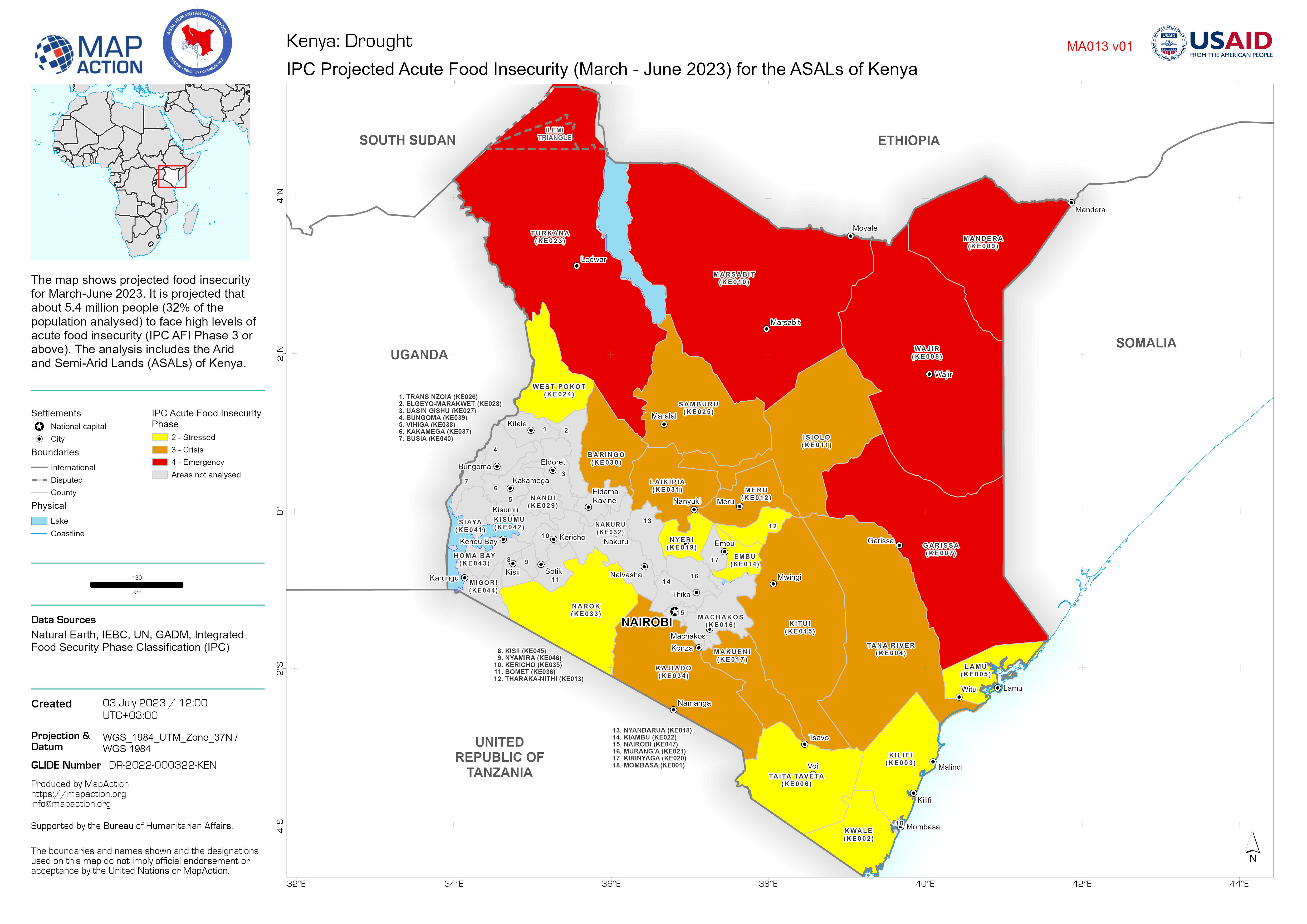
IPC Projected Acute Food Insecurity (March - June 2023) for the ASALs of Kenya
The map shows projected food insecurity for March-June 2023. It is projected that about 5.4 million people (32% of the population analysed) to face high levels of acute food... -

Storm path tropical cyclone Mocha (as of 15 May 2023) with baseline populatio...
Storm path as reported by Joint Typhoon Warning Centre. Population totals in table are 2022 estimates by UNFPA and US Census Bureau (USCB). Baseline population distribution...
