-

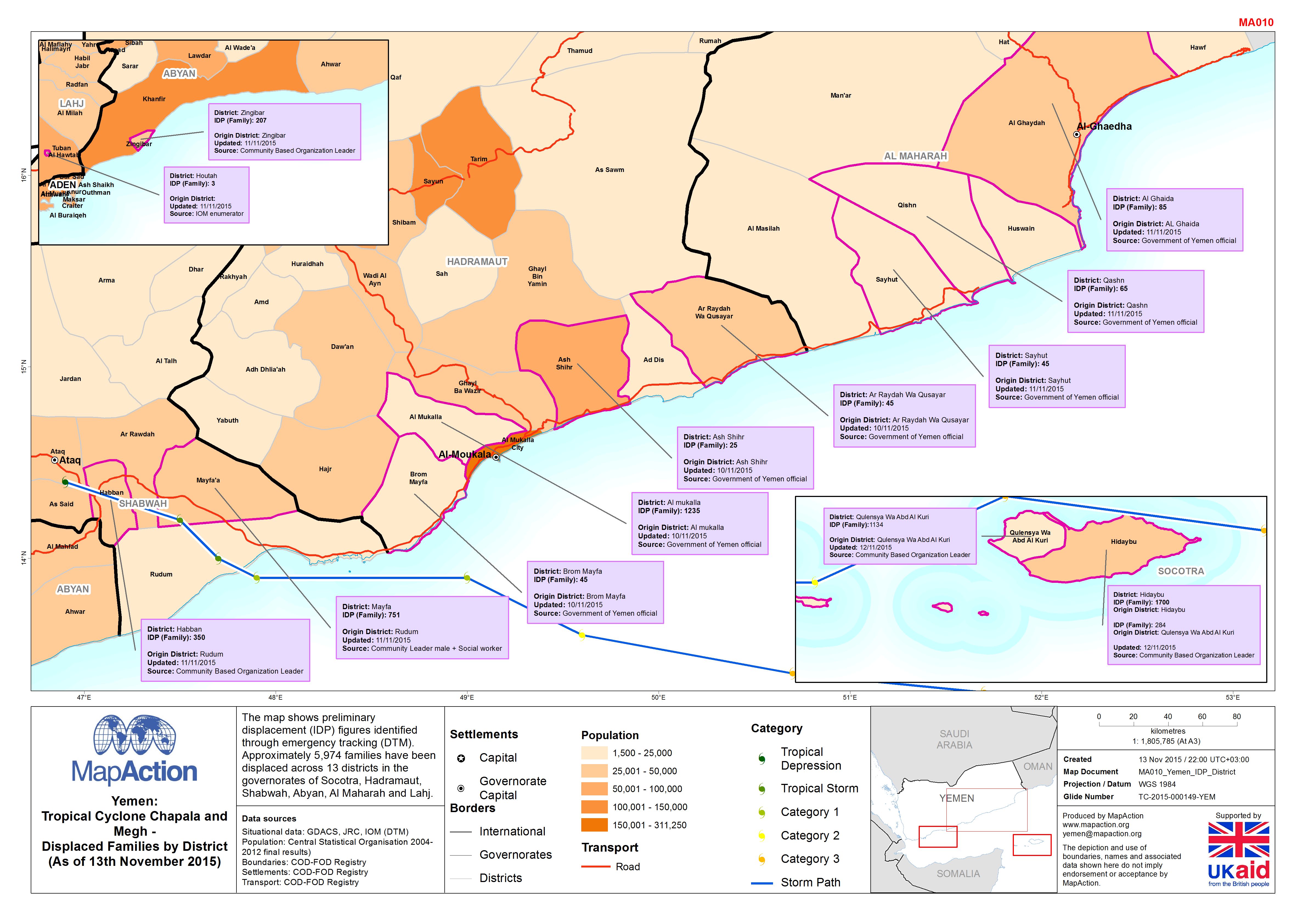
Yemen: Tropical Cyclone Chapala and Megh - Displaced families by district (as...
The map shows preliminary displacement (IDP) figures identified through emergency tracking (DTM). Approximately 5,974 families have been displaced across 13 districts in the... -
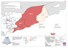
Yemen: TC Chapala -The map shows reports on casualties in affected areas.
This dataset has no description
-

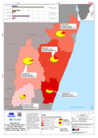
Fiji: Cyclone Winston - 2016 Population in Government Hotspot Areas
Projected 2016 population densities by enumeration areas within the Fiji Government Hotspot areas - planning areas for the prioritisation of relief efforts. Showing total... -

Dominica Tropical Storm Erika - Affected Persons (as of 17 Sep 2015)
Map shows the locations and numbers of affected persons. Numbers for Loubiere include Fond Baron, Citroniere, Castle Comfort and Newtown. -

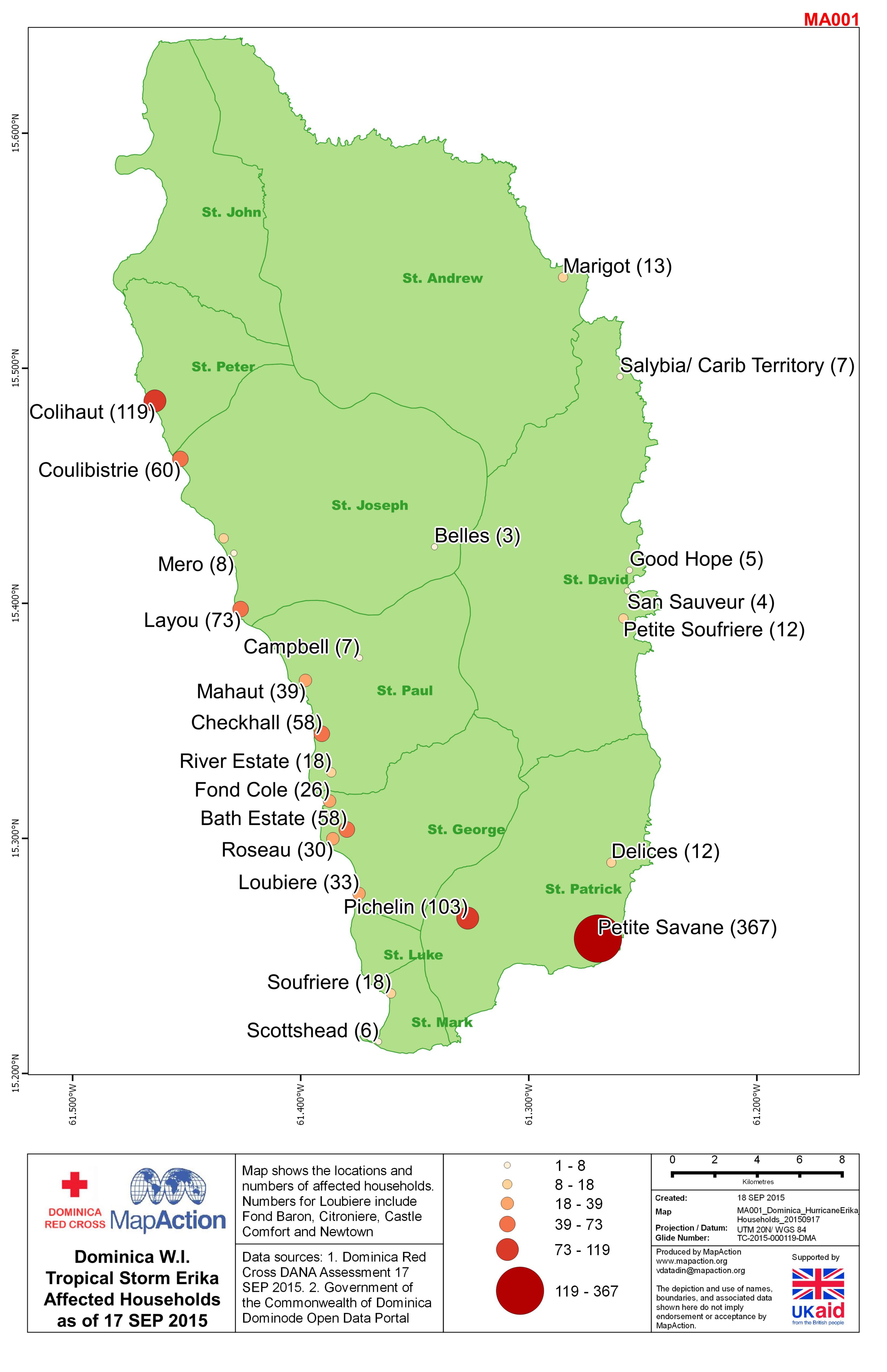
Dominica Tropical Storm Erika - Affected Households (as of 17 Sep 2015)
Map shows the locations and numbers of households. Numbers for Loubiere include Fond Baron, Citroniere, Castle Comfort and Newtown. -
Madagascar: Cyclone Tropical Giovanna - Sécurité Alimentaire Dégâts, Réponses...
This dataset has no description
-

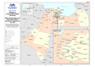
Sahel Crisis: Overview Mali, Mauritania, Niger, Burkina Faso (22nd Feb 2012)
Map shows movement of refugees and IDPs alongside a range of health information. The aim of this map is to help UNICEF prioritise areas most in need of assistance. -

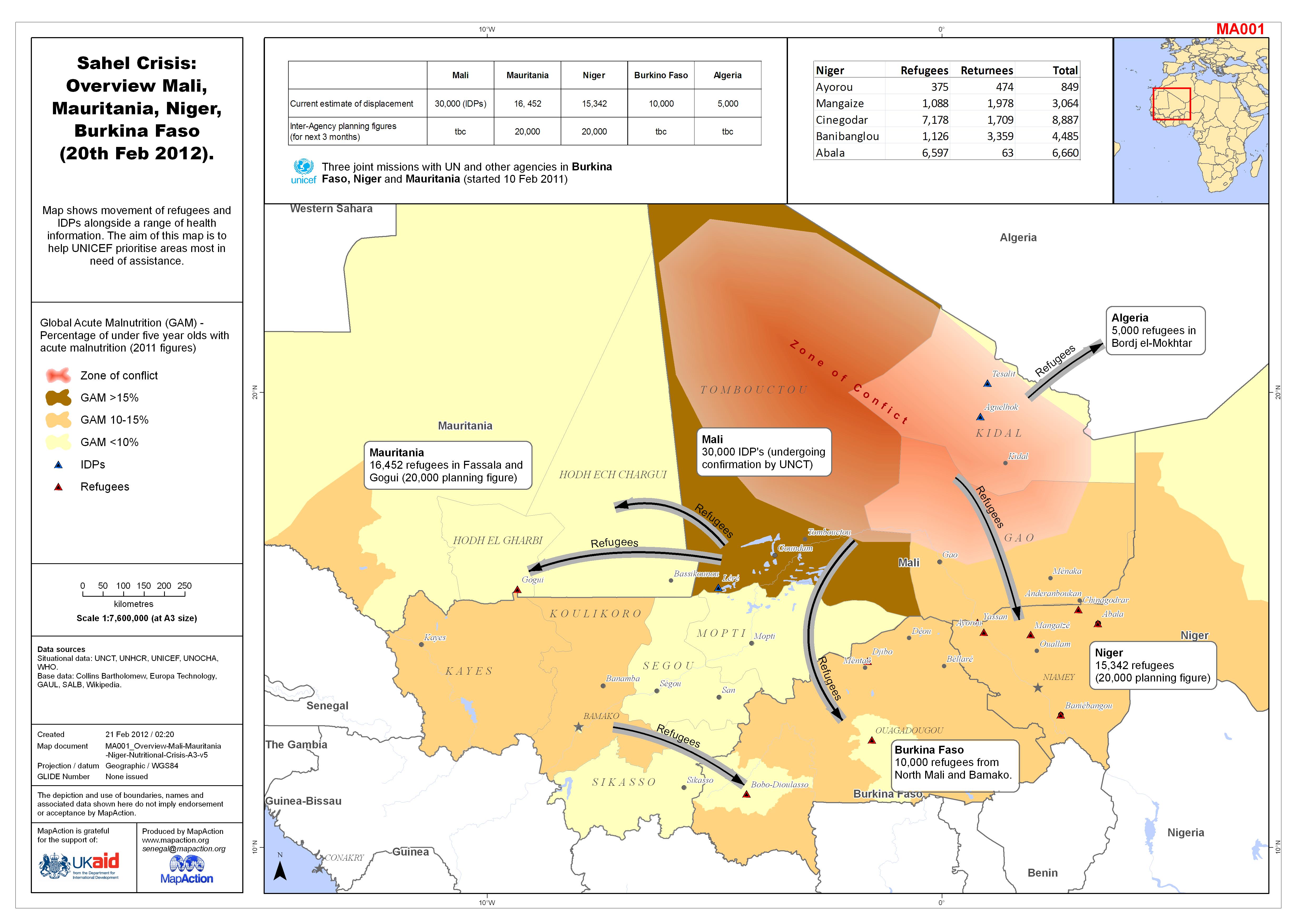
Sahel Crisis: Overview Mali, Mauritania, Niger, Burkina Faso (20th Feb 2012).
Map shows movement of refugees and IDPs alongside a range of health information. The aim of this map is to help UNICEF prioritise areas most in need of assistance. -

Sahel Crisis: Overview Mali, Mauritania, Niger, Burkina Faso (as of 17 Feb 2012)
Map shows movement of refugees and IDPs alongside a range of health information. The aim of this map is to help UNICEF prioritise areas most in need of assistance. -

Sahel Crisis: Overview Mali, Mauritania, Niger (as of 16 Feb 2012)
Map shows movement of refugees and IDPs alongside a range of health information. The aim of this map is to help UNICEF prioritise areas most in need of assistance. -

Sahel Nutrition Crisis: Overview Mali, Mauritania, Niger (as of 14 Feb 2012)
Map shows movement of refugees and IDPs alongside a range of health information. The aim of this map is to help UNICEF prioritise areas most in need of assistance. -

Sahel Crisis: Overview Mali, Mauritania, Niger (as of 16 Feb 2012)
Map shows movement of refugees and IDPs alongside a range of health information. The aim of this map is to help UNICEF prioritise areas most in need of assistance. -
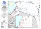
Philippines Tropical Storm Washi (Sendong) Affected Barangays and Evacuation ...
Map shows affected Barangays and Evacuation Centre locations in Cagayan de Oro City -
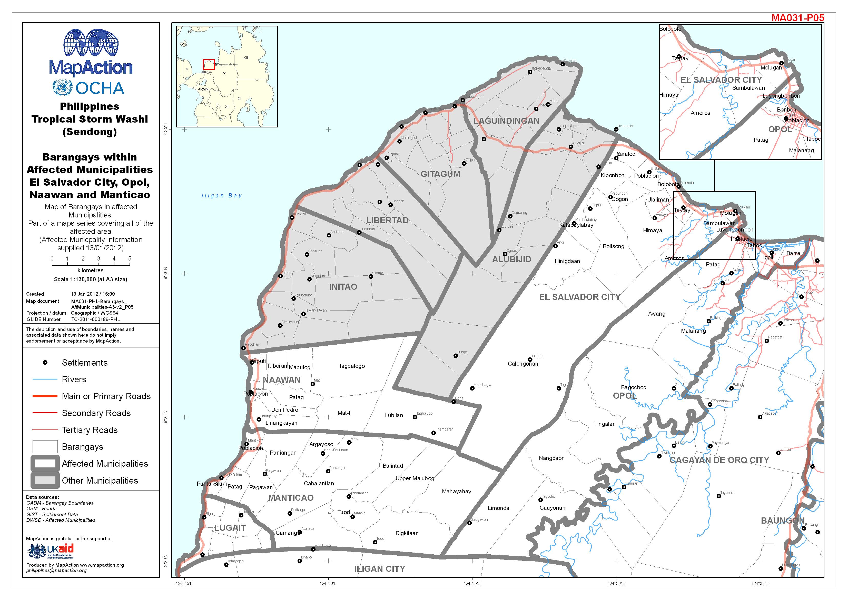
Philippines Tropical Storm Washi (Sendong) Barangays within Affected Municipa...
Map of Barangays in affected Municipalities. Part of a maps series covering all of the affected area (Affected Municipality information supplied 13/01/2012). -

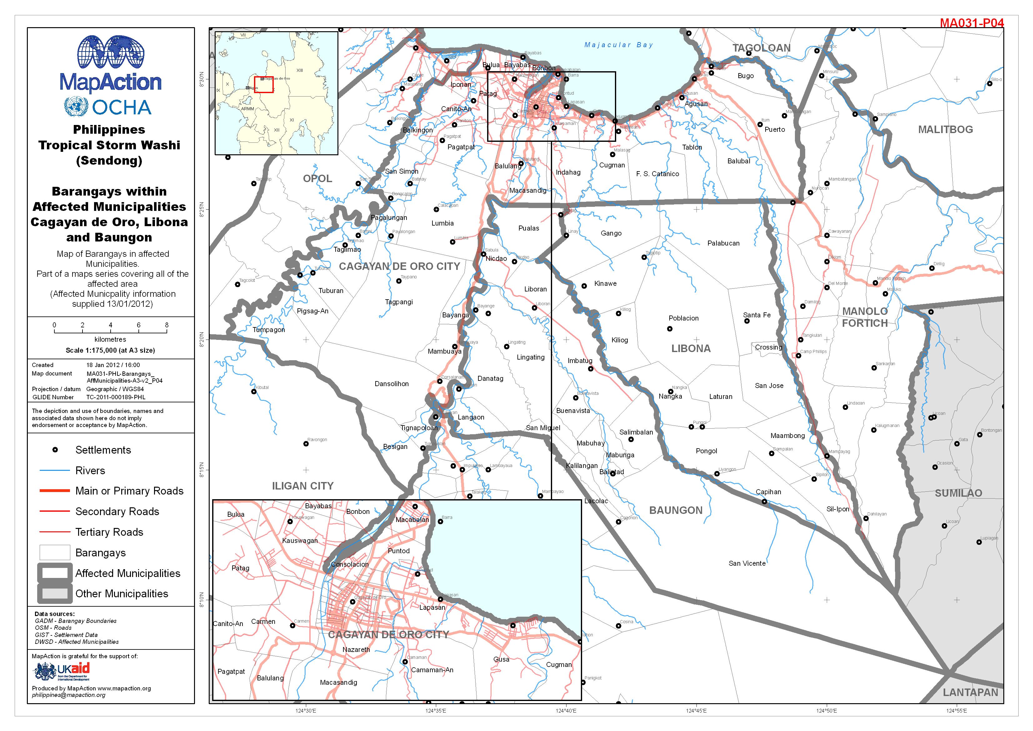
Philippines Tropical Storm Washi (Sendong) Barangays within Affected Municipa...
Map of Barangays in affected Municipalities. Part of a maps series covering all of the affected area (Affected Municipality information supplied 13/01/2012). -

Philippines Tropical Storm Washi (Sendong) Barangays within Affected Municipa...
Map of Barangays in affected Municipalities. Part of a maps series covering all of the affected area (Affected Municipality information supplied 13/01/2012). -

Philippines Tropical Storm Washi (Sendong) Barangays within Affected Municipa...
Map of Barangays in affected Municipalities. Part of a maps series covering all of the affected area (Affected Municipality information supplied 13/01/2012). -

Philippines Tropical Storm Washi (Sendong) Barangays within Affected Municipa...
Map of Barangays in affected Municipalities. Part of a maps series covering all of the affected area (Affected Municipality information supplied 13/01/2012). -

Philippines Tropical Storm Washi (Sendong) Barangays within Affected Municipa...
Map of Barangays in affected Municipalities. Part of a maps series covering all of the affected area (Affected Municipality information supplied 13/01/2012). -
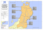
Japan Earthquake and Tsunami Affected Population of Tohoku 12:00 23rd March 2011
Map showing affected population figures broken down by prefecture together with 2010 National Census figures.