-

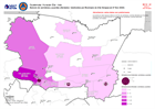
Personas evacuadas y número de centros de evacuación a nivel municipal (a 4 d...
Personas evacuadas y número de centros de evacuación a nivel municipal (a 03 Diciembre 2020 -

Presencia humanitaria: quién hace qué, dónde en cada municipio, departmento (...
Esta serie de mapas muestra quién está realizando actividades por sector y municipio en Honduras. La densidad de población, el número de albergues y su ocupación por municipio... -
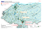
Guatemala: Presencia humanitaria - quién hace qué, dónde en cada departamento...
El mapa muestra el número de actividades reportadas por sector y quién las realiza para el departamento de Alta Verapaz en Guatemala. La extensión de las áreas inundadas también... -
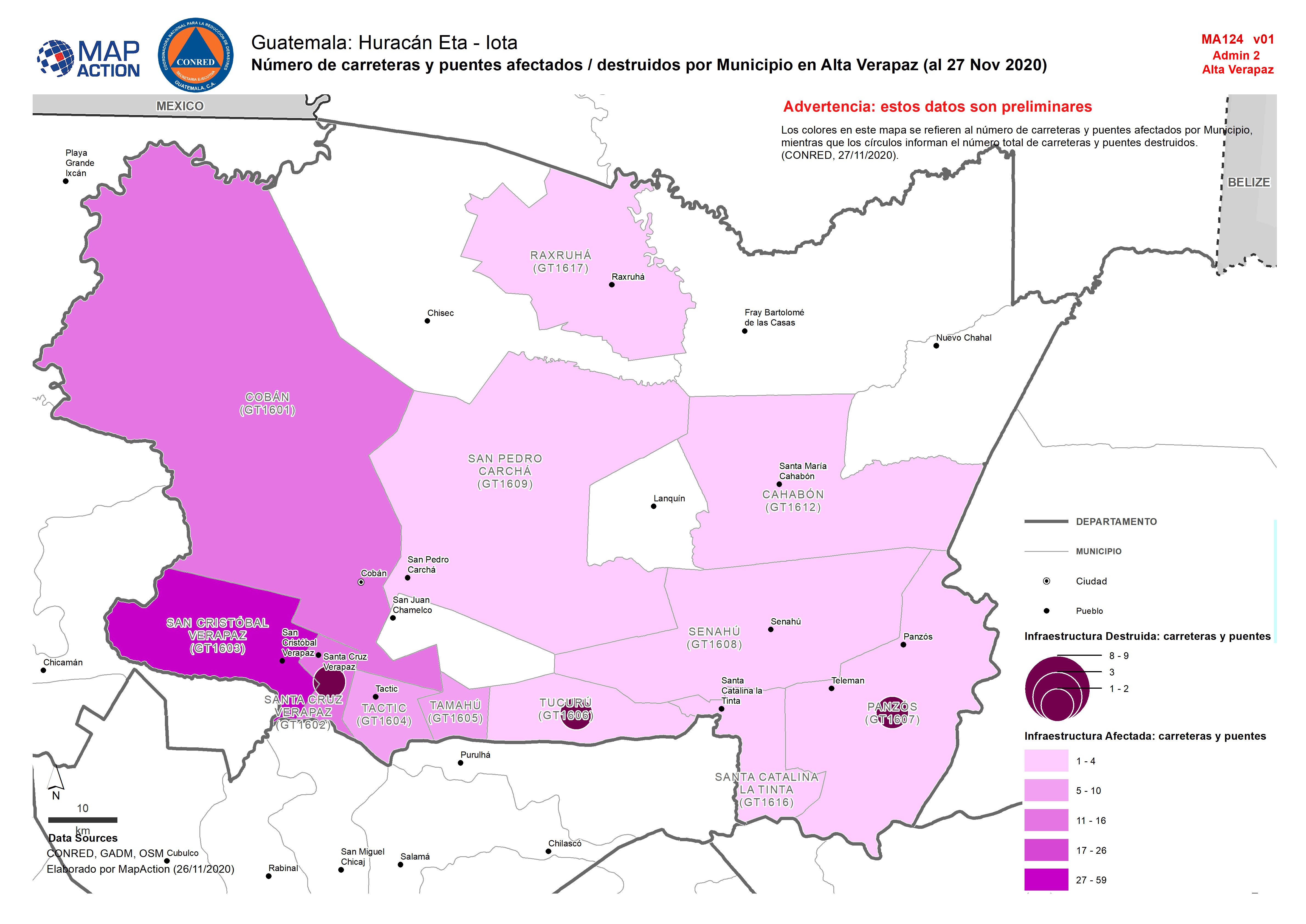
Guatemala: Número de carreteras y puentes afectados / destruidos por Municipi...
Map shows the number of destroyed and affected roads and bridges by department. -
Guatemala: Albergues y hospitales (al 28/11/2020)
Map shows shelters and hospitals in the affected areas. Also shown is the number of affected people and predicted flood extents. -
-

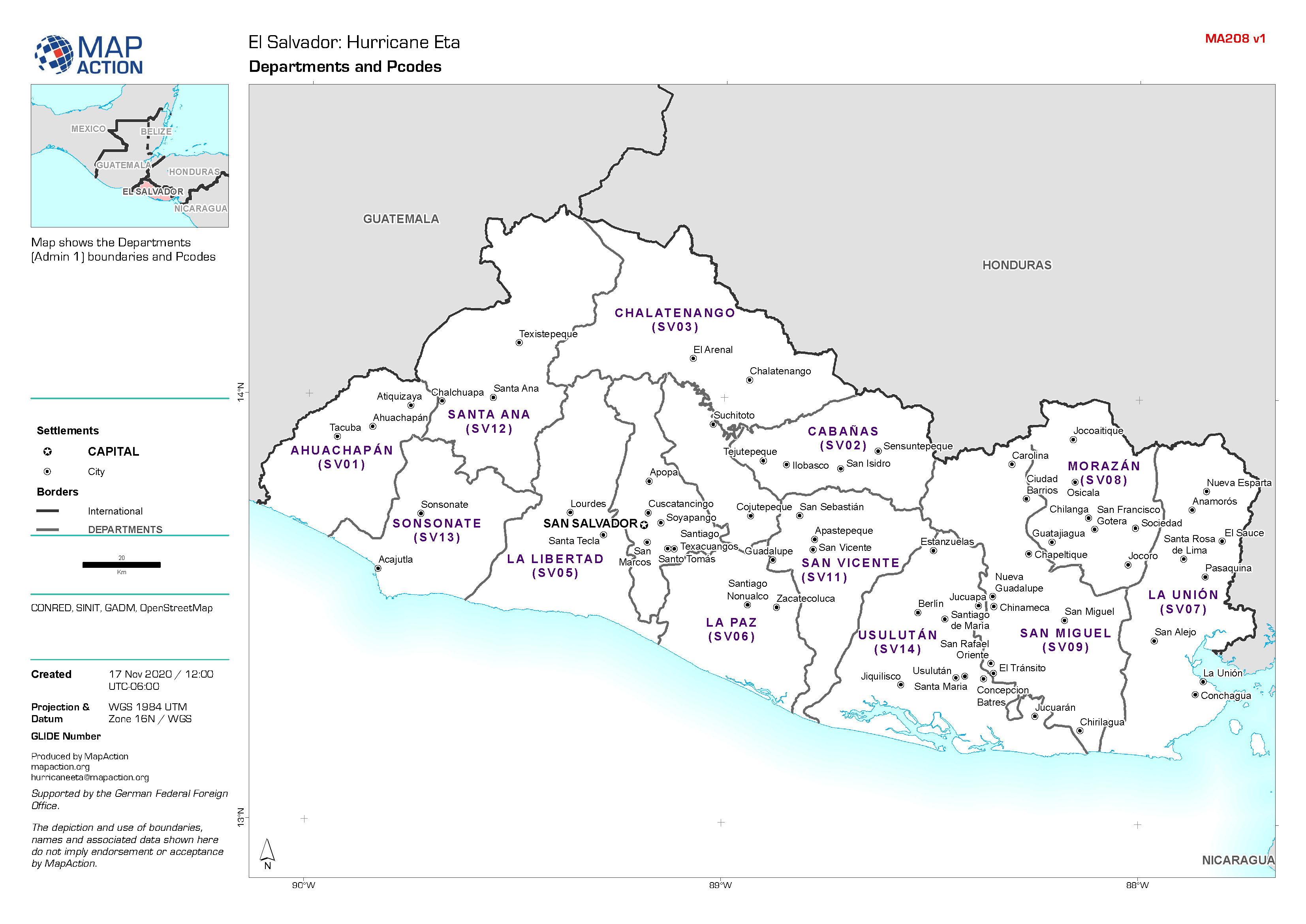
El Salvador: Departments and Pcodes
Map shows the Departments (Admin 1) boundaries and Pcodes. -
El Salvador: Departments, Municipalities and Pcodes Atlas
Map shows Departments (Admin 1), Municipalities (Admin 2) boundaries with Pcodes. -

-
The Philippines: Typhoons Goni (Rolly) and Vamco (Ulysses) - Affected populat...
Map shows the number of reported affected people per Municipality. -

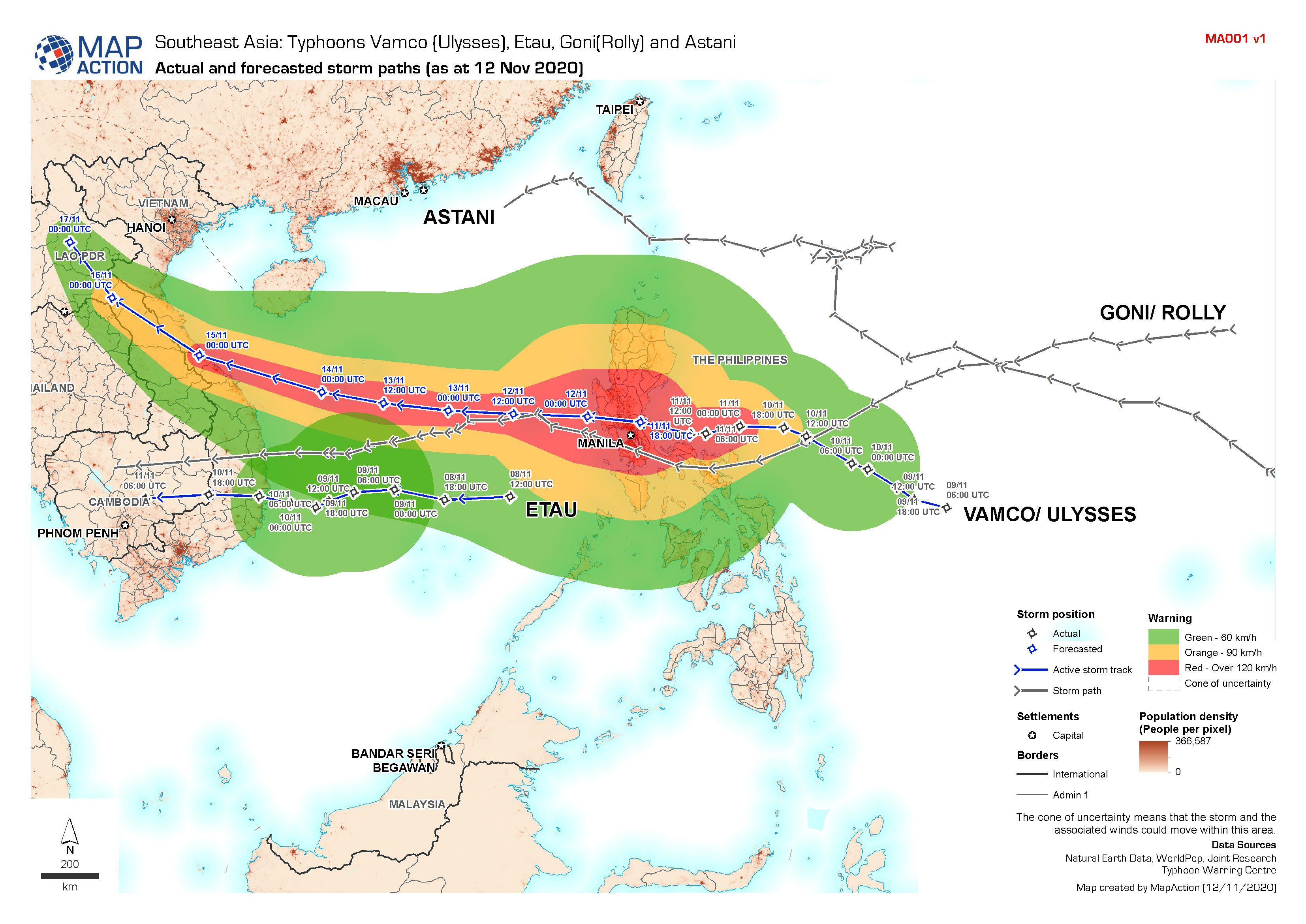
Southeast Asia Typhoons: Actual and forecasted storm paths (as at 12 Nov 2020)
Map shows the tracks of Typhoons Vamco (Ulysses), Etau, Goni (Rolly) and Astani. -
Honduras: Dam locations and capacity levels (as of 10 Nov 2020)
Honduras, Dam locations and capacity levels as of 10th Nov 2020 - including additional settlements and population density. -
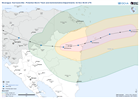
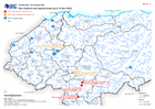
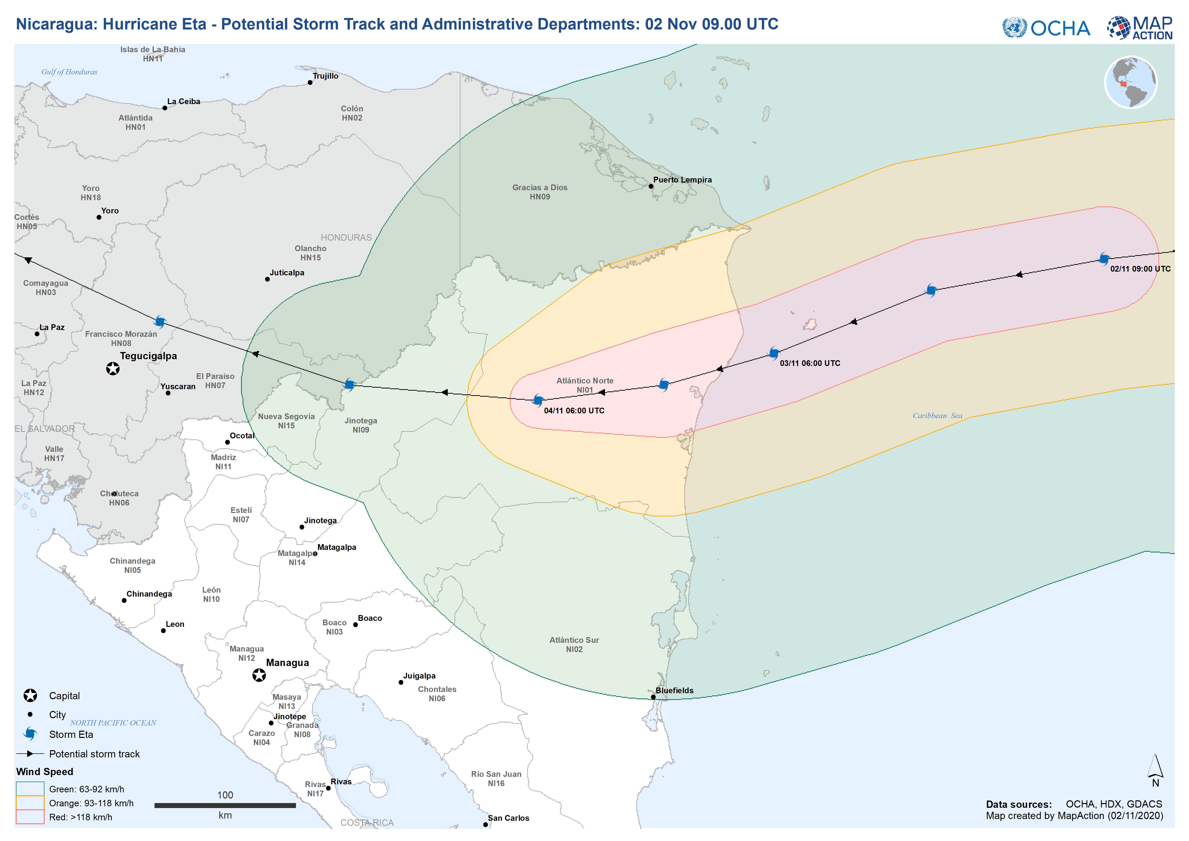
Nicaragua: Hurricane Eta - Potential Storm Track and Administrative Departmen...
This map shows the potential storm track for hurricane Eta with administration level 1 departments for Nicaragua and Honduras. -
Honduras: Dam locations and capacity levels (as of 10 Nov 2020)
Honduras, Dam locations and capacity levels as of 10th Nov 2020 -
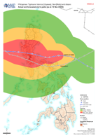
The Philippines: Typhoons Vamco (Ulysses), Goni(Rolly) and Astani - Actual an...
Map shows the tracks of Typhoons Vamco (Ulysses), Goni (Rolly) and Astani moving through The Philippines. -

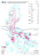
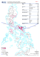
The Philippines: Typhoon Goni (Rolly) - Affected population by Municipality (...
Map shows the number of reported affected people per Municipality. -
The Philippines: Typhoon Goni (Rolly) - Affected population by Municipality (...
Map shows the number of reported affected people per Municipality. -
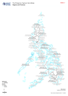
The Philippines: Typhoon Goni (Rolly) - Regions and Provinces
Map shows the Regions and Provinces of The Philippines with thir pcodes. -
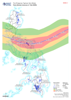
The Philippines: Typhoon Goni (Rolly) - Flood affected areas (as at 1 Nov 2020)
Map shows flood extents derived from satallite imagery that has been processed by the Department of Science and Technology, The Philippines. -

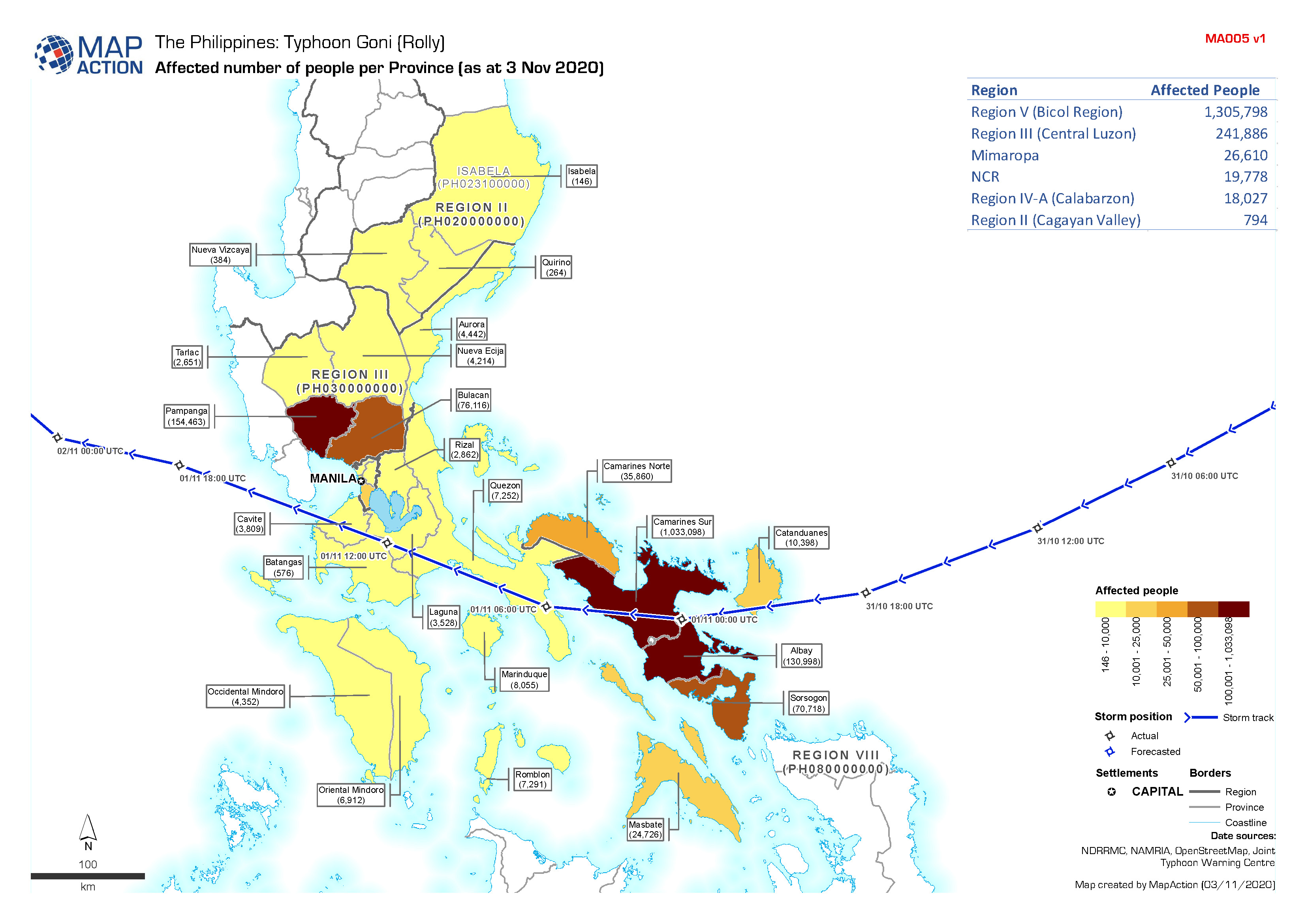
The Philippines: Typhoon Goni (Rolly) - Affected number of people (as at 3 No...
Map shows the number of affected people per Province.