-

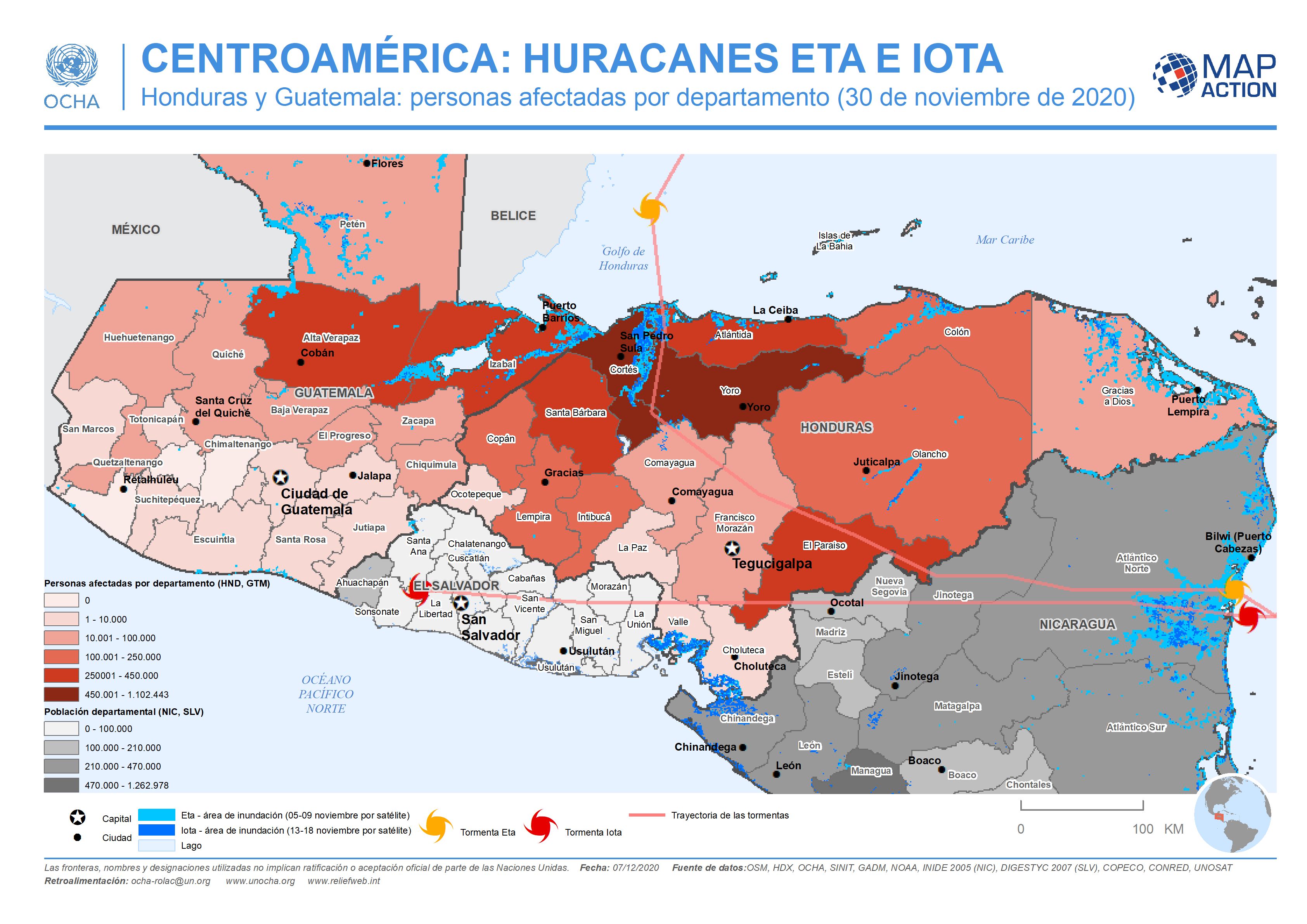
This map shows the storm tracks and flood extents for hurricane Eta and Iota. Across Honduras and in the two most highly affected departments in Guatemala the map shows affected...
-

This map shows the storm tracks and flood extents for hurricane Eta and Iota. It also shows estimated affected population at administrative 1 departmental level for Honduras and...
-

This map shows the storm tracks and flood extents for hurricane Eta and Iota. It also shows estimated affected population figures at administrative 1 departmental level for...
-

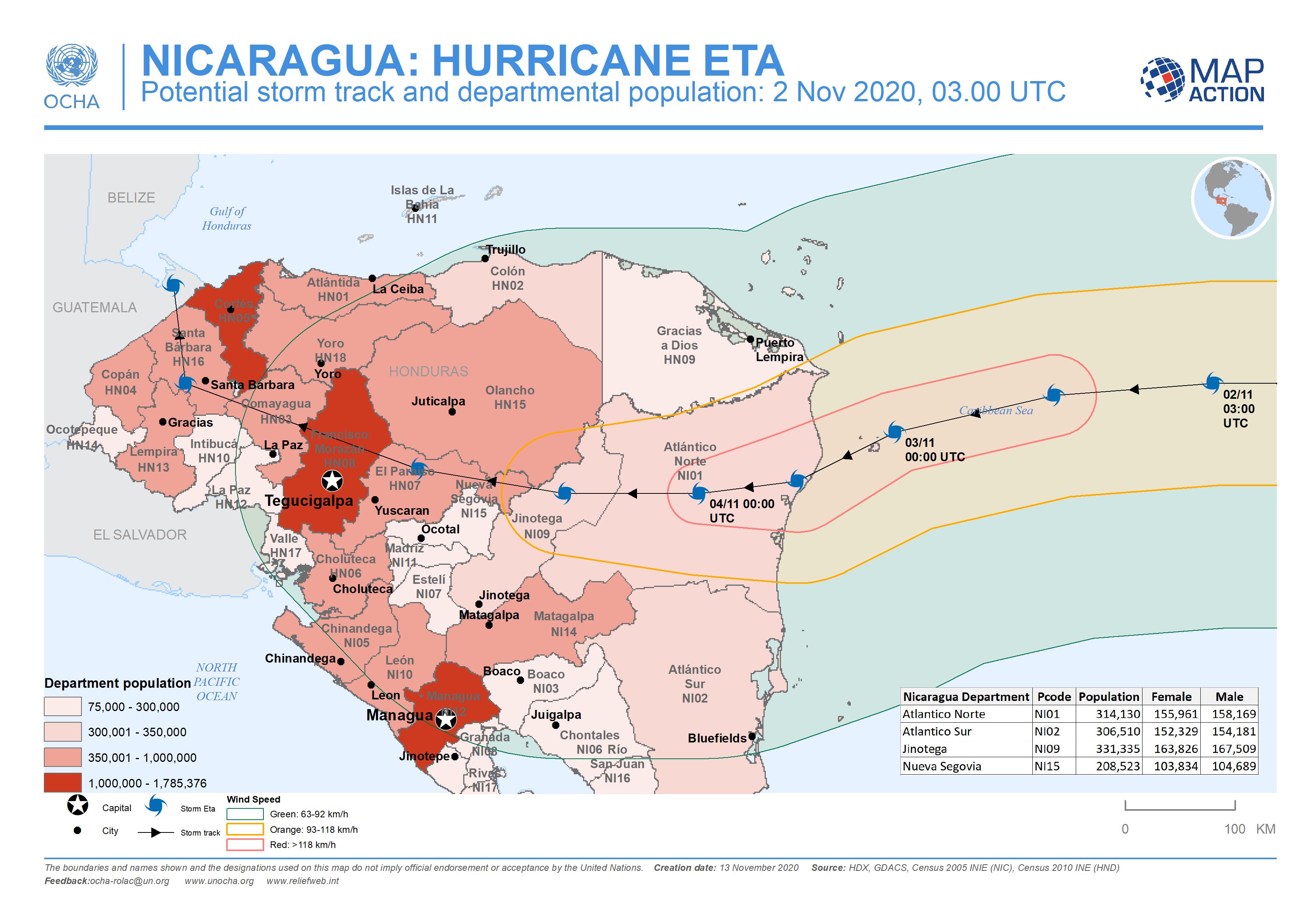
This map shows the storm track for hurricane Iota, with potentially affected administrative departments for Nicaragua and Honduras. It also includes previous flooded areas from...
-

This map shows the potentially affected administration level 1 departments for Nicaragua and Honduras, with departmental population and predicted wind speed cones.
-

This map shows the affected administration level 2 municipalities for Nicaragua, with population estimates and predicted wind speed cones.