-

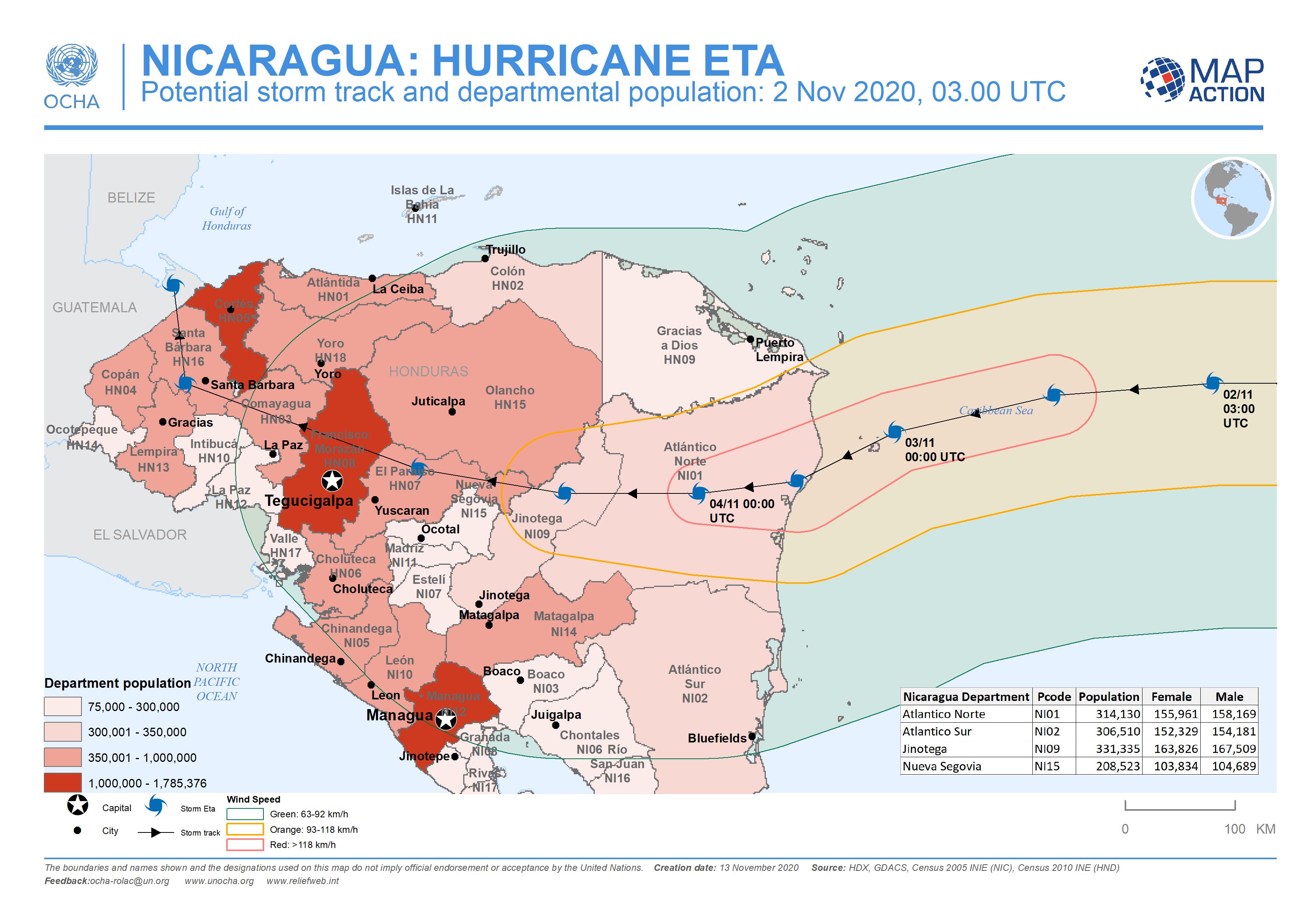
Nicaragua: Potential storm track and departmental population: 2 Nov 2020, 03....
This map shows the potentially affected administration level 1 departments for Nicaragua and Honduras, with departmental population and predicted wind speed cones. -

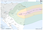
Nicaragua: Potential storm track, elevation and municipalities: 4 Nov 2020, 0...
This map shows the Hurricane Eta affected administration level 2 municipalities for Nicaragua with predicted wind speed cones, aganst elevation data and settlement locations. -

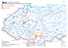
Nicaragua: Potential storm track, elevation and municipalities: 3 Nov 2020, ...
This map shows the affected administration level 2 municipalities for Nicaragua, with population estimates and predicted wind speed cones. -
Honduras: Dam locations and capacity levels (as of 10 Nov 2020)
Honduras, Dam locations and capacity levels as of 10th Nov 2020 - including additional settlements and population density. -
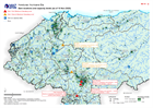
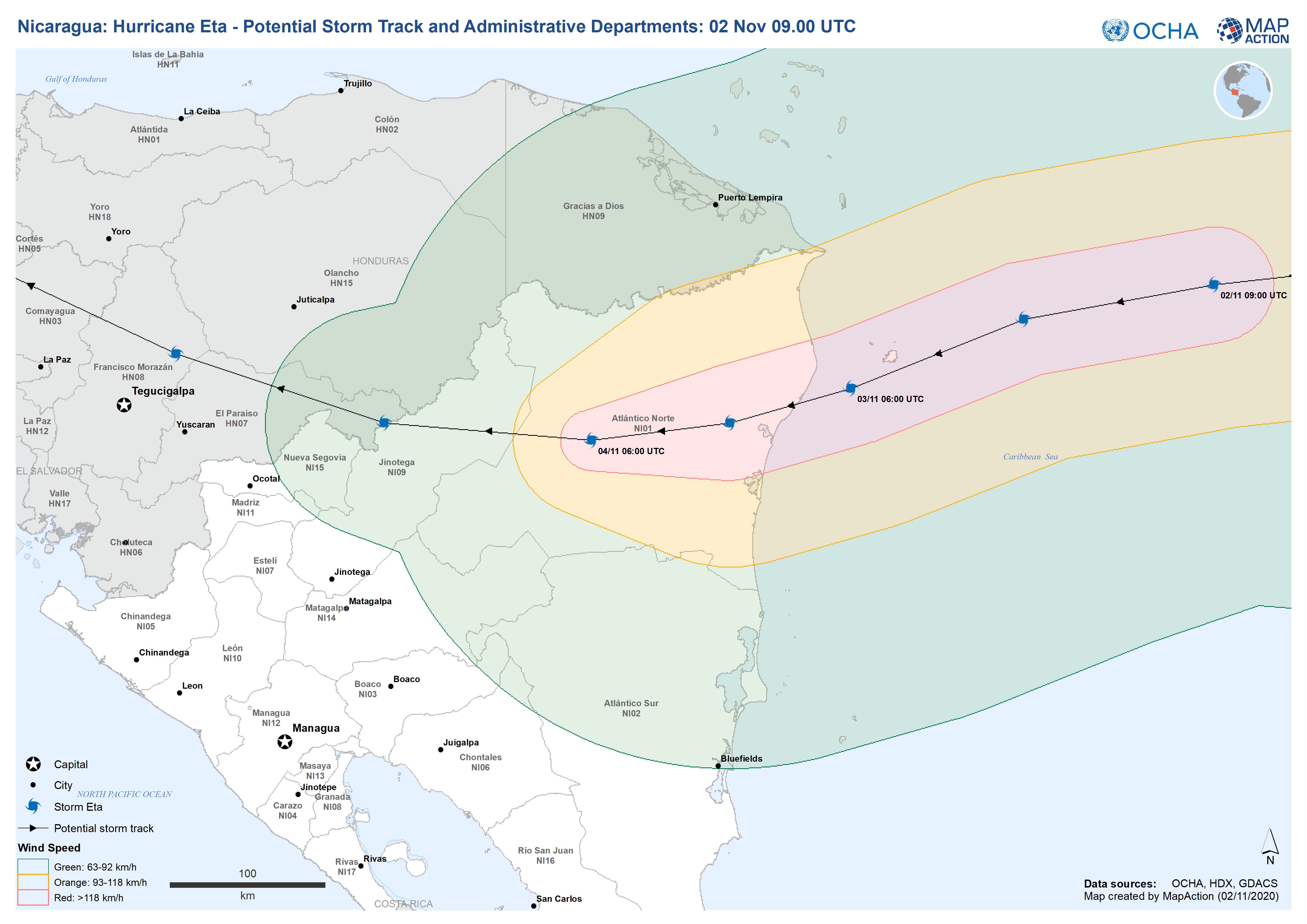
Nicaragua: Hurricane Eta - Potential Storm Track and Administrative Departmen...
This map shows the potential storm track for hurricane Eta with administration level 1 departments for Nicaragua and Honduras. -
Honduras: Dam locations and capacity levels (as of 10 Nov 2020)
Honduras, Dam locations and capacity levels as of 10th Nov 2020 -

Honduras: Damaged Infrastructure (as at 09 Nov 2020)
Honduras, Damaged Infrastructure as of 09th Nov 2020 -

-

Honduras: Affected Departments and Municipalities (as of 07 Nov 2020)
This map shows the storm affected administration level 1 departments and level 2 municipalities for Honduras.