-

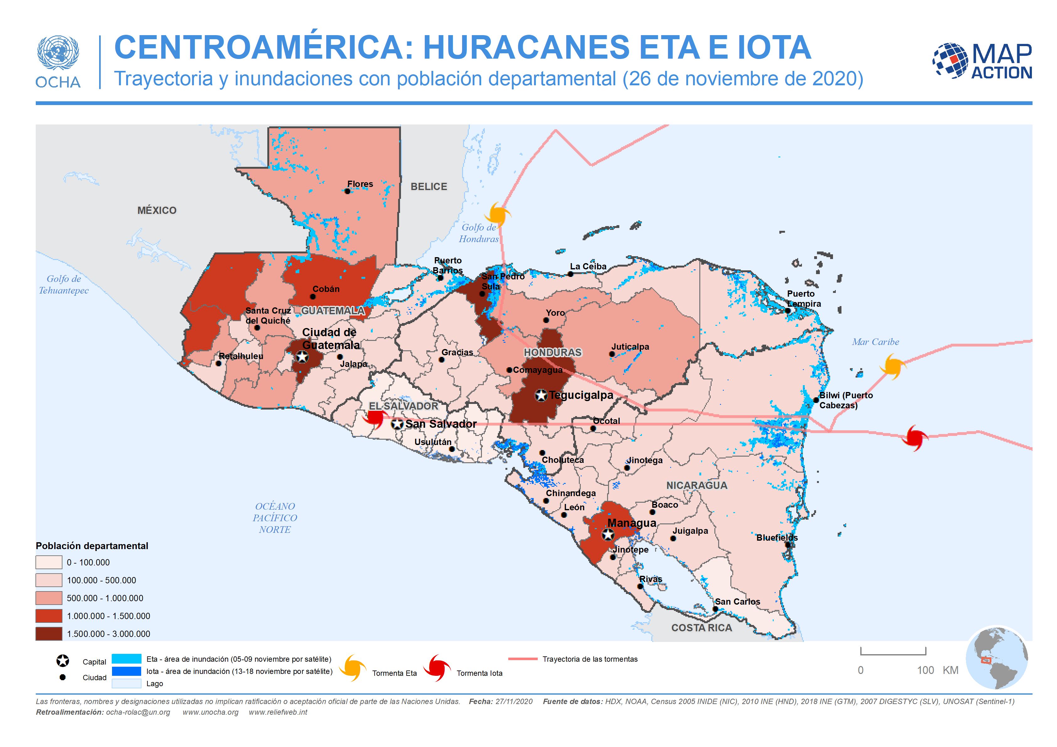
This map shows the storm tracks and flood extents for hurricane Eta and Iota. Across Honduras and in the two most highly affected departments in Guatemala the map shows affected...
-
This map shows the storm tracks and flood extents for hurricane Eta and Iota, with baseline administrative 1 level departmental population figures across the affected region...
-

This map shows the potentially affected administration level 1 departments, with departmental population for Nicaragua and Honduras, and the predicted hurricane path cone.