MA010-v01-zwe-Baseline_Population-300dpi.jpg
From the dataset abstract
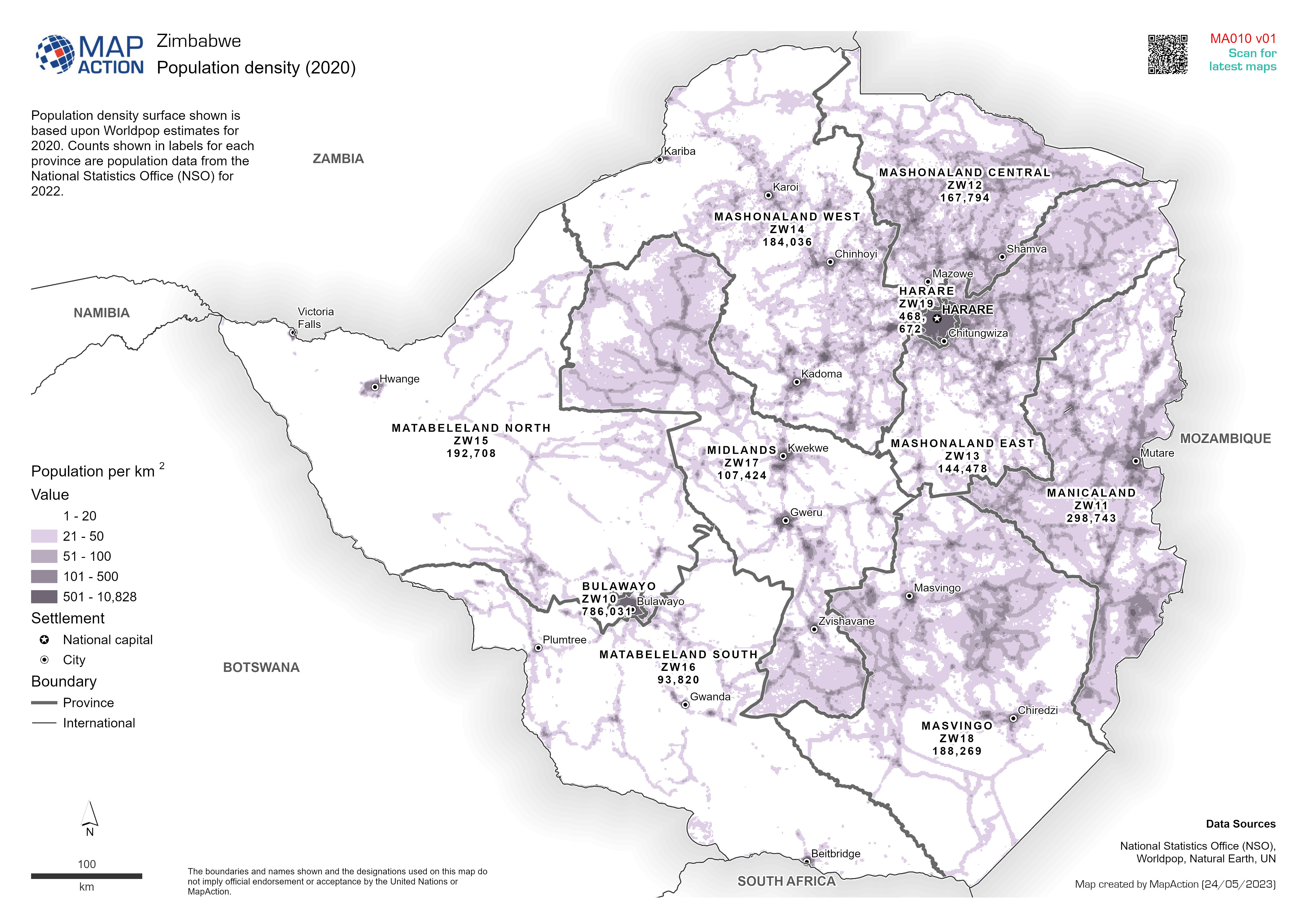
Population density surface shown is based upon Worldpop estimates for 2020. Counts shown in labels for each province are population data from the National Statistics Office (NSO) for 2022.
Source: Population density (2020)
Additional Information
| Field | Value |
|---|---|
| Data last updated | May 25, 2023 |
| Metadata last updated | May 25, 2023 |
| Created | May 25, 2023 |
| Format | JPEG |
| License | License not specified |
| Has views | True |
| Id | 5f8cf702-e39a-4662-a6ae-fe3ce6af89e5 |
| Mimetype | image/jpeg |
| On same domain | True |
| Package id | 810f4e36-568e-4454-aac8-4a07a052aa84 |
| Position | 1 |
| Revision id | 0a72a7a1-137d-454c-ac54-e54d23a197c9 |
| Size | 1.6 MiB |
| State | active |
| Url type | upload |