thumbnail.png
From the dataset abstract
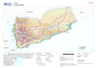
Country overview showing administrative boundaries, main settlements, transport infrastructure and natural features
Source: Country overview
Additional Information
| Field | Value |
|---|---|
| Data last updated | August 14, 2024 |
| Metadata last updated | August 14, 2024 |
| Created | August 14, 2024 |
| Format | PNG |
| License | License not specified |
| Has views | True |
| Id | 0b3cb103-c6ca-48f7-9e23-cfb1db326eb3 |
| Mimetype | image/png |
| On same domain | True |
| Package id | 4f8e2b2a-f0ee-47b2-84aa-9701b475d5f3 |
| Position | 2 |
| Revision id | 7e49d29a-f441-40b7-b5df-95c728746c4f |
| Size | 17 KiB |
| State | active |
| Url type | upload |