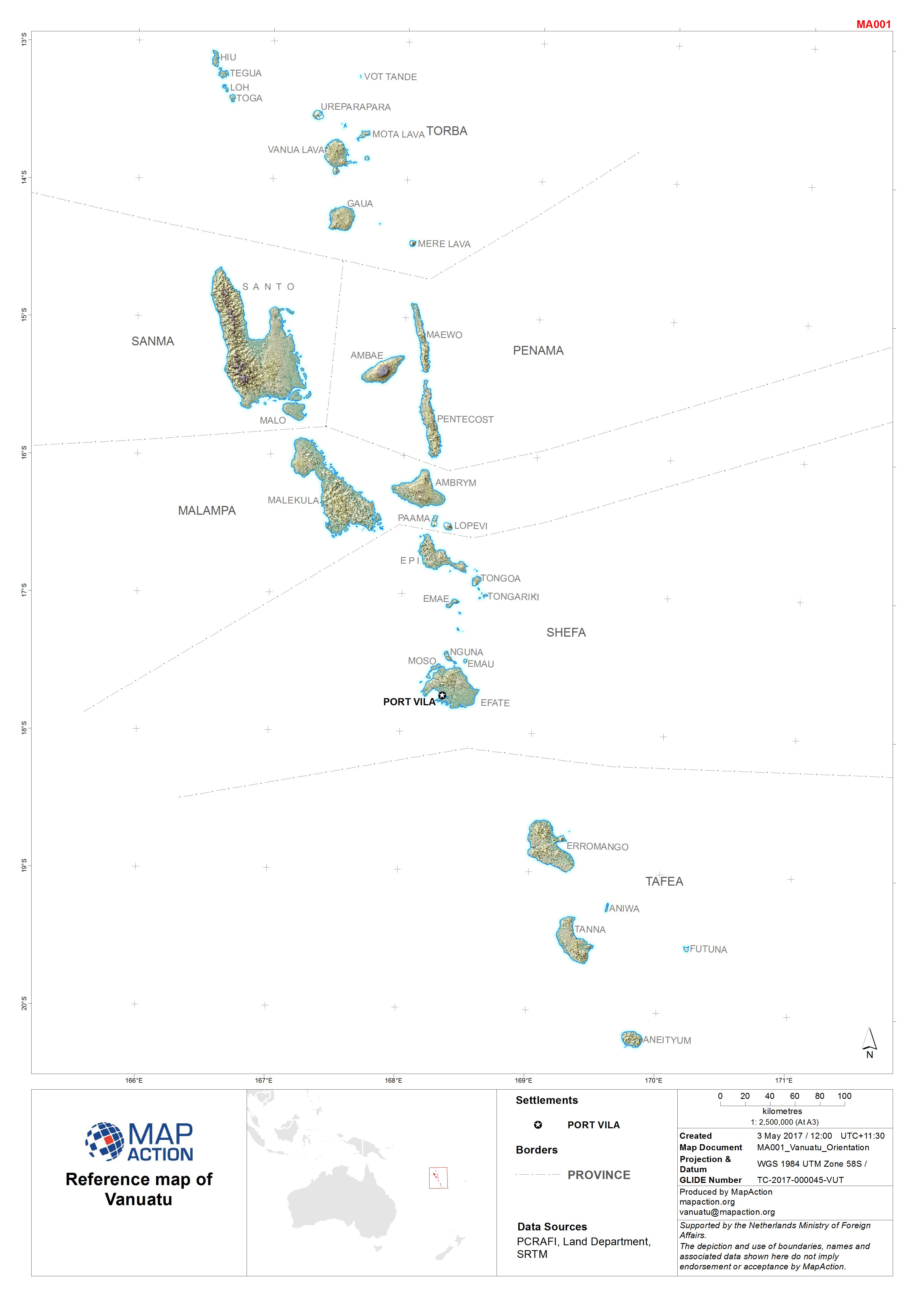
MA001_Vanuatu_Orientation-300dpi.jpeg
From the dataset abstract
Map shows the Provinces and islands of Vanuatu
Additional Information
| Field | Value |
|---|---|
| Data last updated | May 5, 2017 |
| Metadata last updated | May 5, 2017 |
| Created | May 5, 2017 |
| Format | JPEG |
| License | License not specified |
| Has views | True |
| Id | 82ee7b42-e941-4d9e-ac3a-918c945a6deb |
| On same domain | True |
| Package id | 54dbb297-af7e-4be2-ab05-1d20d9fc8eb8 |
| Revision id | d6c44663-fe7e-48a0-8ed6-debf986ec899 |
| State | active |
| Url type | upload |
