MA019_VulnerableGroups-300dpi.jpeg
From the dataset abstract
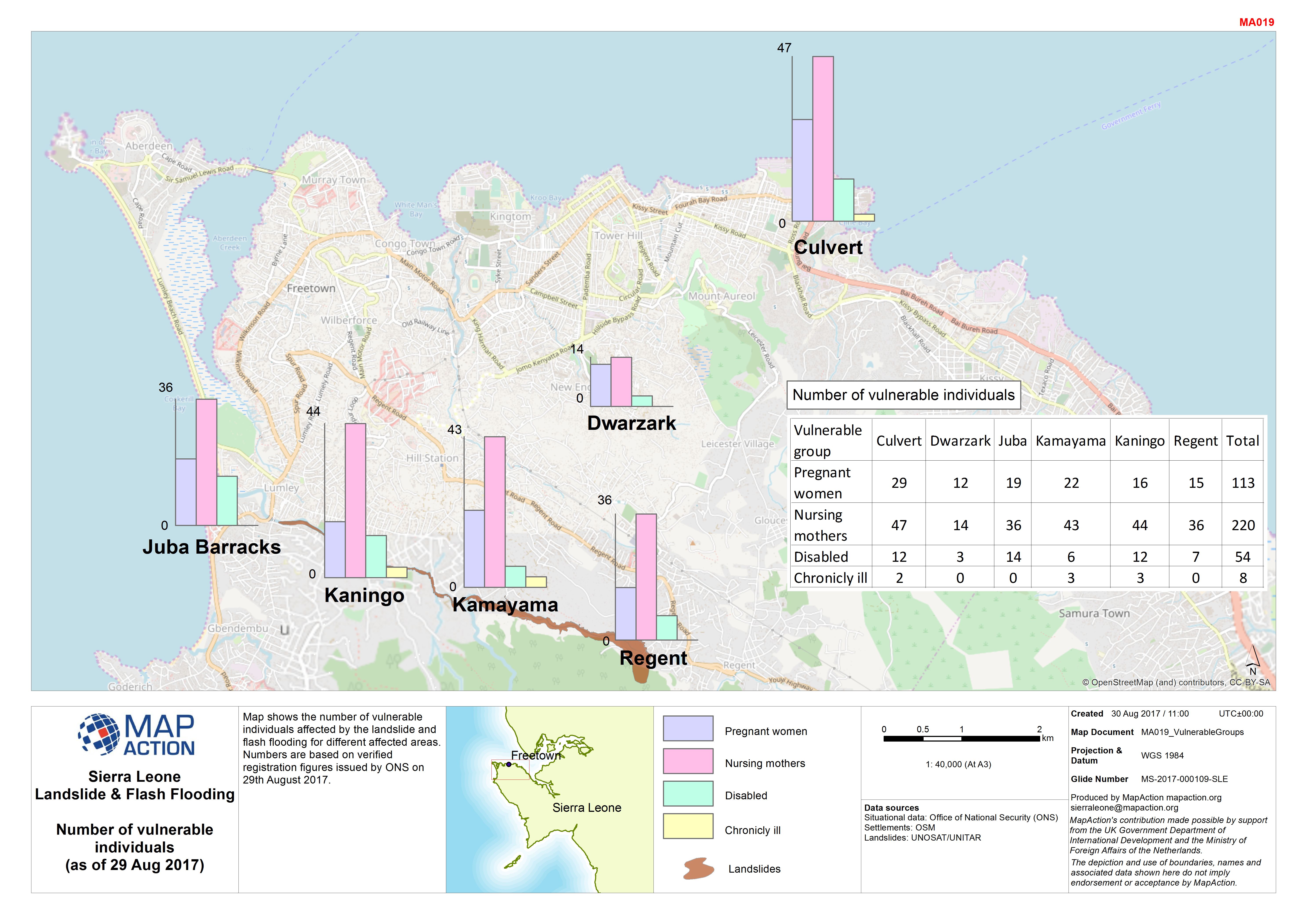
Map shows the number of vulnerable individuals affected by the landslide and flash flooding for different affected areas. Numbers are based on verified registration figures issued by ONS...
Source: Sierra Leone Landslide & Flash Flooding Number of vulnerable individuals (as of 29 Aug 2017)
Additional Information
| Field | Value |
|---|---|
| Data last updated | August 30, 2017 |
| Metadata last updated | August 30, 2017 |
| Created | August 30, 2017 |
| Format | JPEG |
| License | License not specified |
| Has views | True |
| Id | 423bde8b-2c38-4150-b340-7249cf32dc8d |
| On same domain | True |
| Package id | e22b8a64-0b3c-4352-805f-38512936580f |
| Revision id | 5fdfbee6-bc51-4392-8cd6-0e17fcddfbf4 |
| State | active |
| Url type | upload |