MA005_AffectedAreas_ICC_v3-300dpi.jpeg
From the dataset abstract
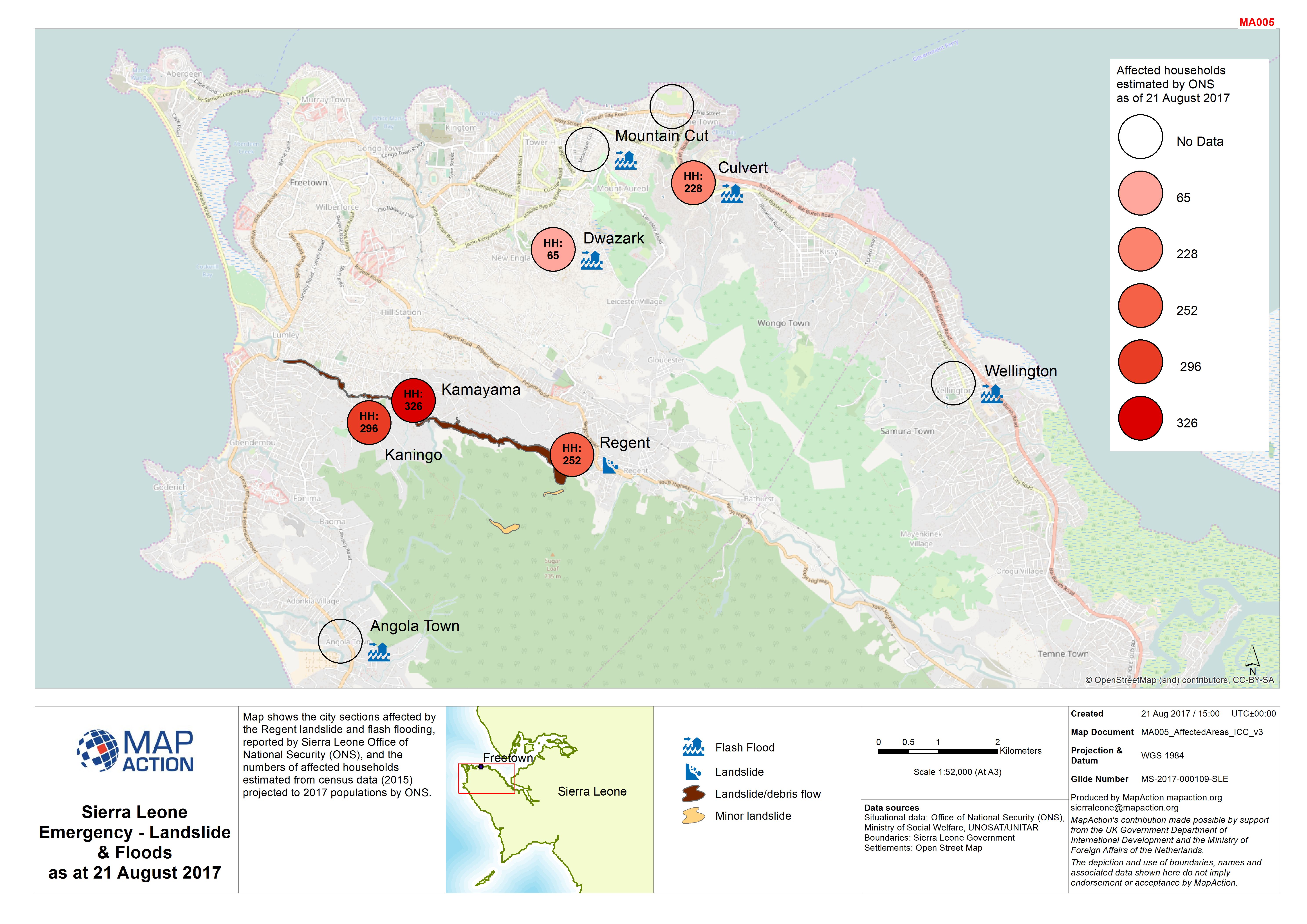
Map shows the city sections affected by the Regent landslide and flash flooding, reported by Sierra Leone Office of National Security (ONS), and the numbers of affected households...
Source: Sierra Leone Emergency - Landslide & Floods as at 21 August 2017
Additional Information
| Field | Value |
|---|---|
| Data last updated | August 25, 2017 |
| Metadata last updated | August 25, 2017 |
| Created | August 25, 2017 |
| Format | JPEG |
| License | Creative Commons Attribution |
| Has views | True |
| Id | 3492876a-31b2-4796-854d-85c6844f40f0 |
| On same domain | True |
| Package id | e828034f-5c4b-4242-aab1-26ce1e170859 |
| Revision id | 95b1276f-83ca-459c-93be-d7b7ad275000 |
| State | active |
| Url type | upload |