MA009_Afectacion_por_departamento_20170407-300d ...
From the dataset abstract
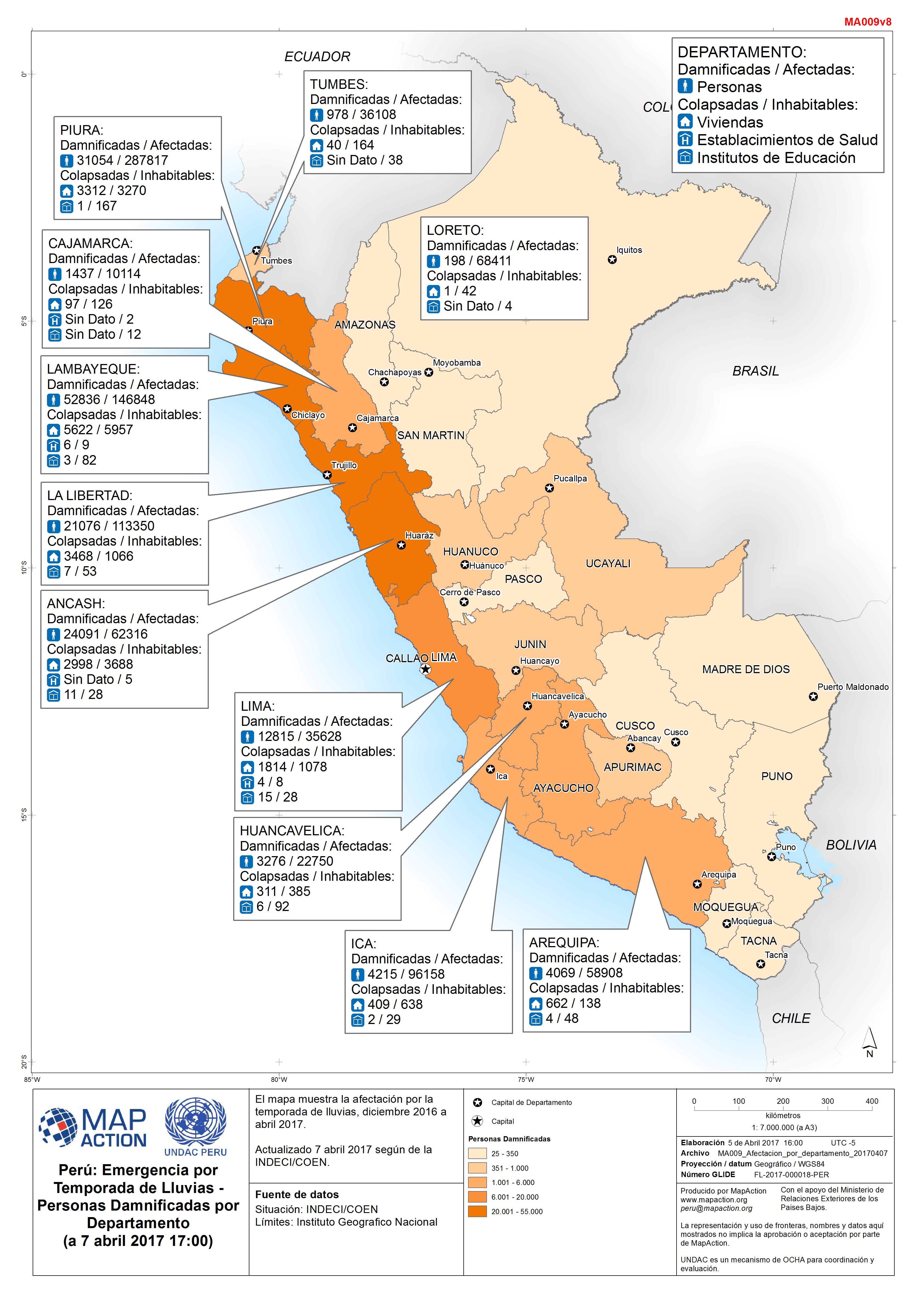
El mapa muestra la afectación por la temporada de lluvias, diciembre 2016 a abril 2017. Actualizado 7 abril 2017 según de la INDECI/COEN.
Additional Information
| Field | Value |
|---|---|
| Data last updated | April 8, 2017 |
| Metadata last updated | April 8, 2017 |
| Created | April 8, 2017 |
| Format | JPEG |
| License | License not specified |
| Has views | True |
| Id | 25135b84-7129-42ca-9f74-723a651303d1 |
| On same domain | True |
| Package id | db293044-1f67-4873-b412-cce6762f5f8f |
| Revision id | 17703d00-0d15-4927-a34f-c64e72b01753 |
| State | active |
| Url type | upload |