MA019_Moz_HealthFacilities_v1-300dpi.jpeg
From the dataset abstract
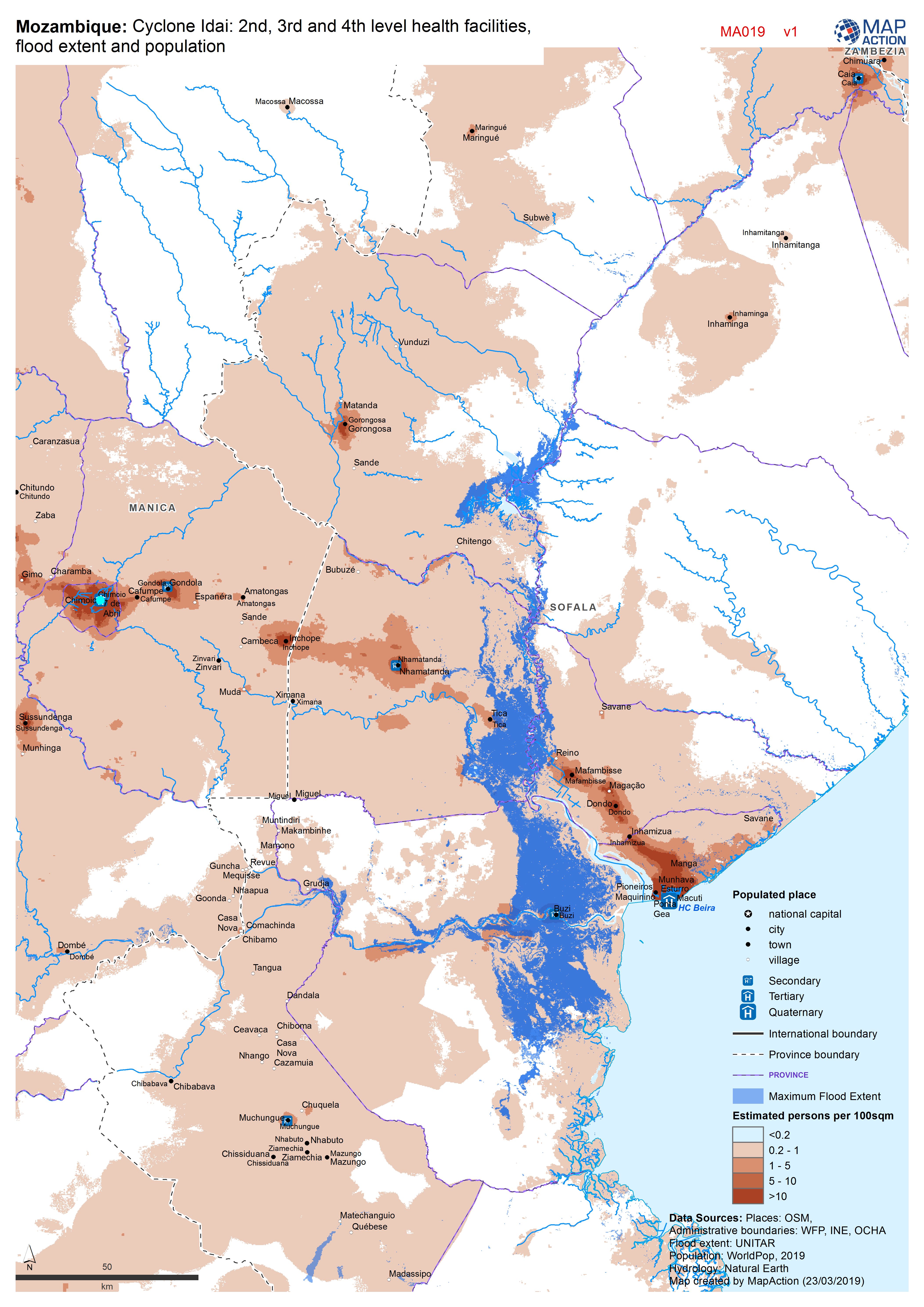
Map shows the population (based on WorldPop at 100m resolution generating through AI) and the Flood Extents known as of 19/20 March 2019 plus Health facilities
Source: Mozambique: Cyclone Idai - 2nd, 3rd and 4th level health facilities, flood extent and population
Additional Information
| Field | Value |
|---|---|
| Data last updated | March 23, 2019 |
| Metadata last updated | March 23, 2019 |
| Created | March 23, 2019 |
| Format | JPEG |
| License | License not specified |
| Has views | True |
| Id | be7f8fe8-1ed6-44d6-ba13-fd624d97f0c8 |
| Mimetype | image/jpeg |
| On same domain | True |
| Package id | d57d42f1-0129-42b7-bab0-86bd22a0204a |
| Revision id | 691294f9-bbc3-4c4e-986d-3c153e5b4e6b |
| Size | 2.1 MiB |
| State | active |
| Url type | upload |