MA014v3_ImpactMap6Ind_BNGRCData_District-300dpi ...
From the dataset abstract
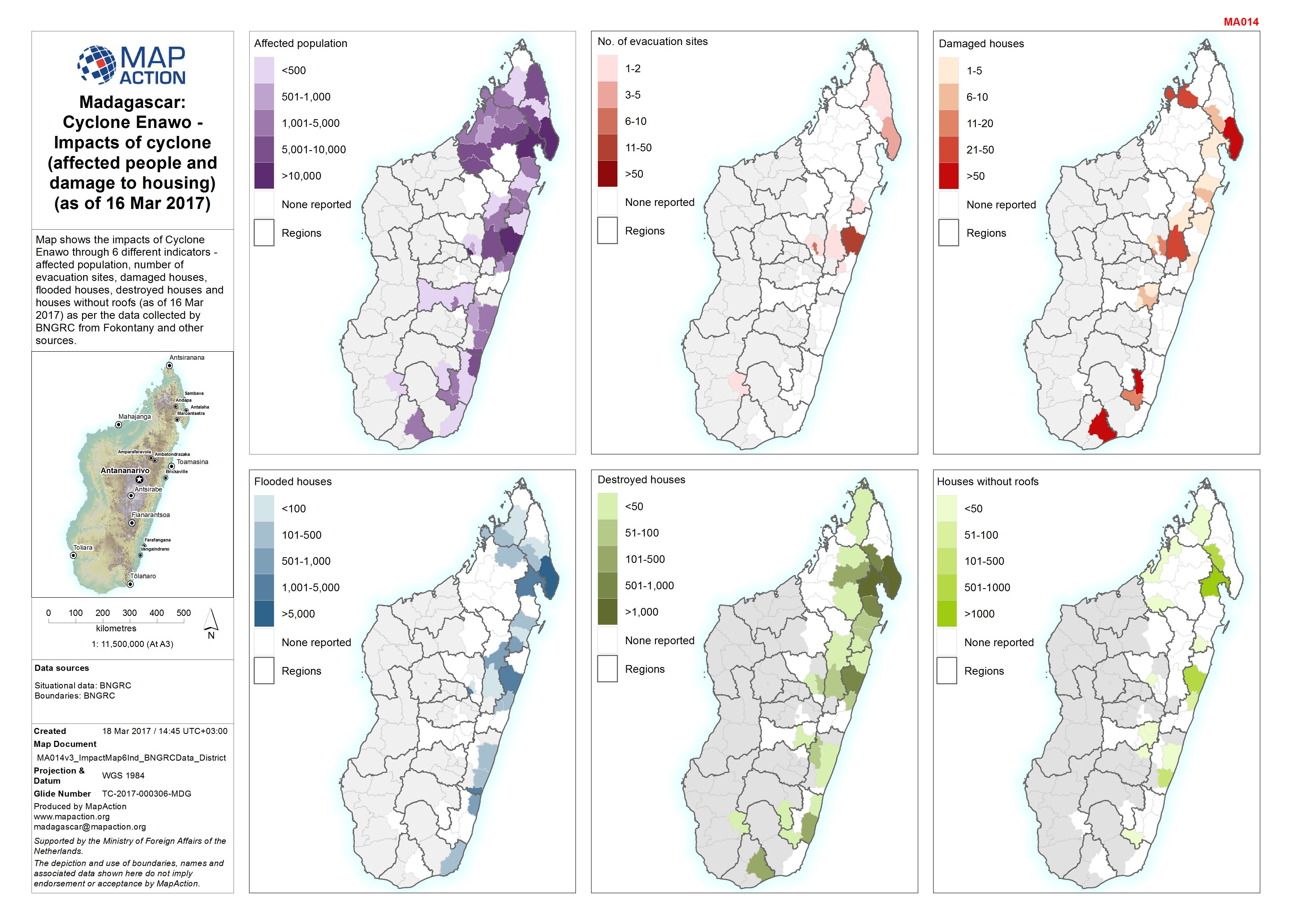
Map shows the impacts of Cyclone Enawo through 6 different indicators - affected population, number of evacuation sites, damaged houses, flooded houses, destroyed houses and houses...
Additional Information
| Field | Value |
|---|---|
| Data last updated | March 19, 2017 |
| Metadata last updated | March 19, 2017 |
| Created | March 19, 2017 |
| Format | JPEG |
| License | License not specified |
| Has views | True |
| Id | 6c8902ef-4b82-4c9b-abea-8d81a6417895 |
| On same domain | True |
| Package id | 916a752d-7a5a-441c-8546-97312c5dfcbf |
| Revision id | 8c4f4d8b-cf75-4339-96ba-05b2ee92bc4b |
| State | active |
| Url type | upload |