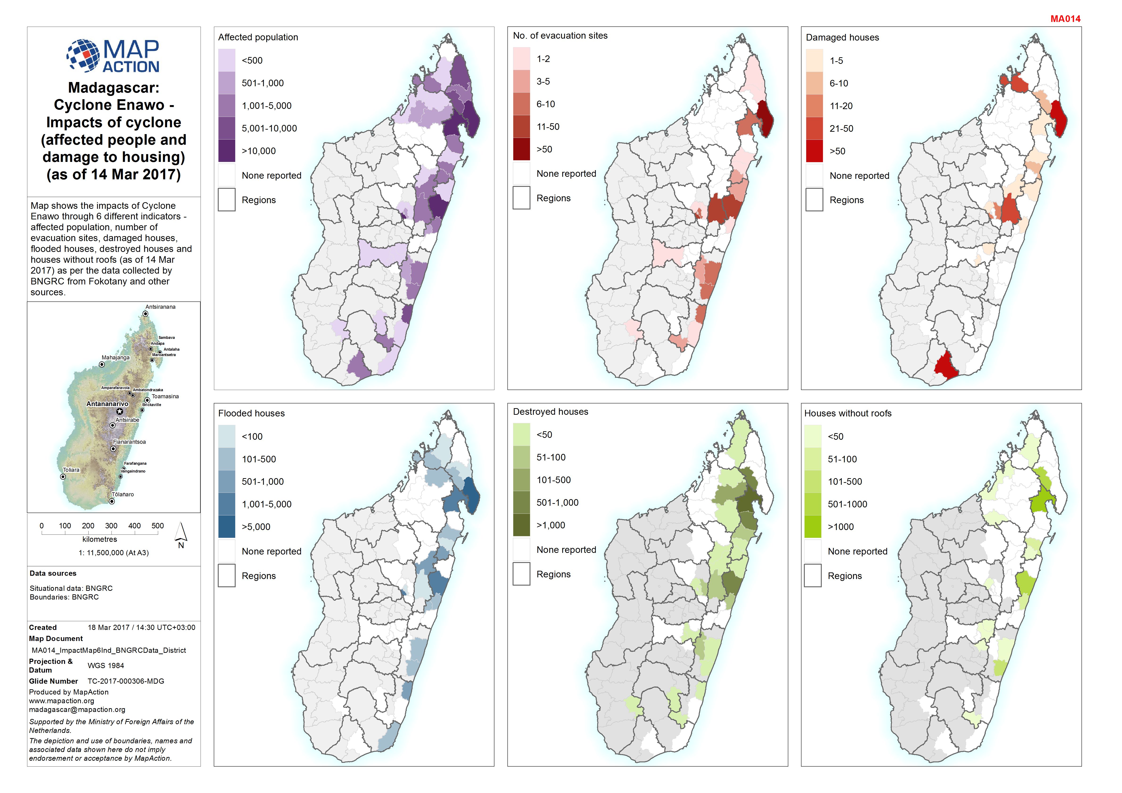
MA014_ImpactMap6Ind_BNGRCData_District-300dpi.jpeg
From the dataset abstract
Map shows the impacts of Cyclone Enawo through 6 different indicators - affected population, number of evacuation sites, damaged houses, flooded houses, destroyed houses and houses...
Additional Information
| Field | Value |
|---|---|
| Data last updated | March 19, 2017 |
| Metadata last updated | March 19, 2017 |
| Created | March 19, 2017 |
| Format | JPEG |
| License | License not specified |
| Has views | True |
| Id | 2b447be3-2c88-48b7-9462-fbcc5cc66d44 |
| On same domain | True |
| Package id | 1c638991-1afc-4f28-a814-c82eabebc7ca |
| Revision id | bcb9ccf2-a50f-41a3-a559-e21fa86c4637 |
| State | active |
| Url type | upload |
