MA003_Antananarivo_Floods_10032017-300dpi.jpeg
From the dataset abstract
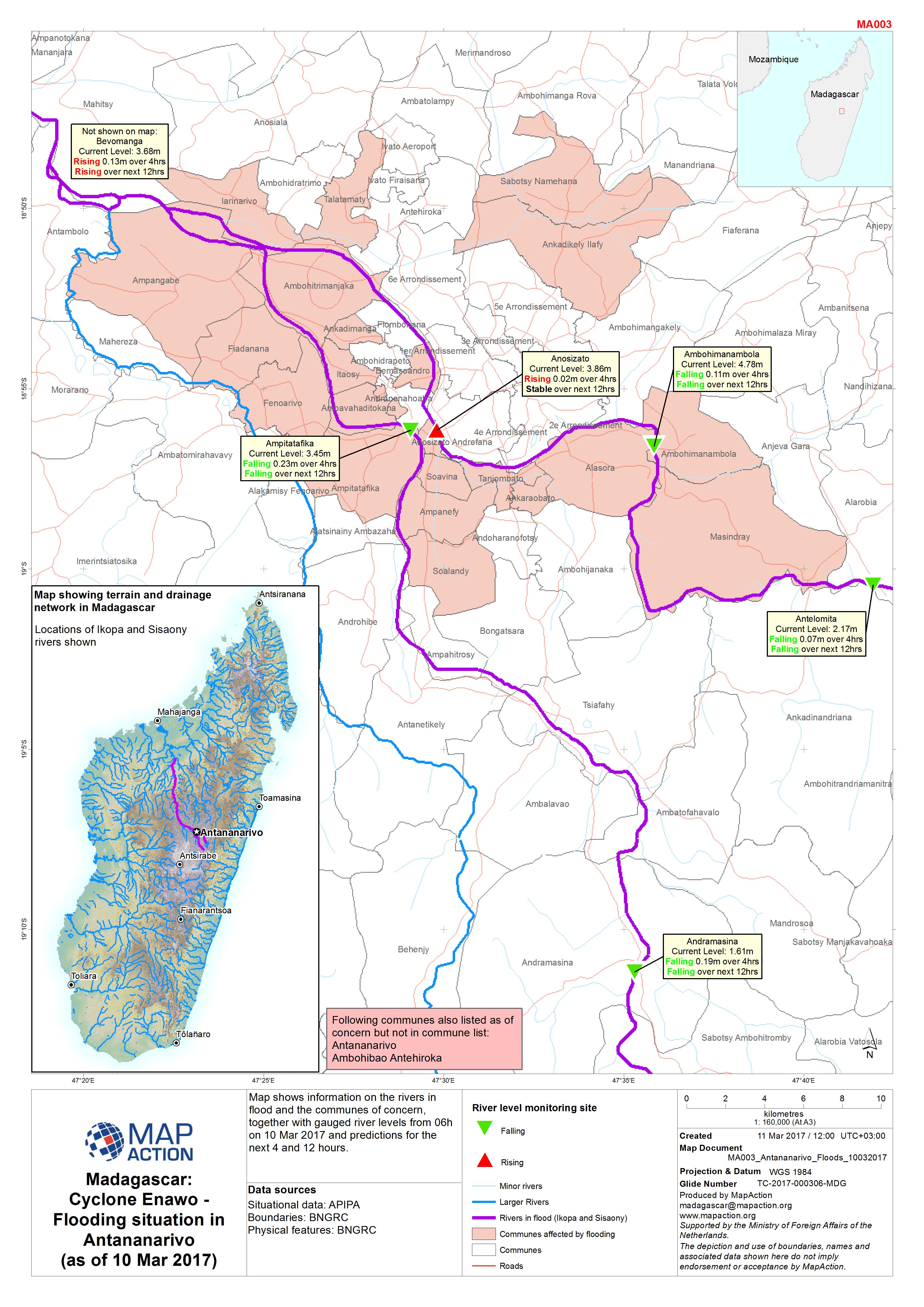
Map shows information on the rivers in flood and the communes of concern, together with gauged river levels from 06h on 10 Mar 2017 and predictions for the next 4 and 12 hours.
Source: Madagascar: Cyclone Enawo - Flooding situation in Antananarivo (as of 10 Mar 2017)
Additional Information
| Field | Value |
|---|---|
| Data last updated | March 13, 2017 |
| Metadata last updated | March 13, 2017 |
| Created | March 13, 2017 |
| Format | JPEG |
| License | License not specified |
| Has views | True |
| Id | 4ea67cc4-844d-4074-86d1-ee6152cbab20 |
| On same domain | True |
| Package id | 5338c40f-3446-4aaf-abb9-07eb7ec3edbb |
| Revision id | a8e4df02-a2e7-4fb3-b8bd-78871baea268 |
| State | active |
| Url type | upload |