MA012-v01-jam-infrastructure-300dpi.jpg
From the dataset abstract
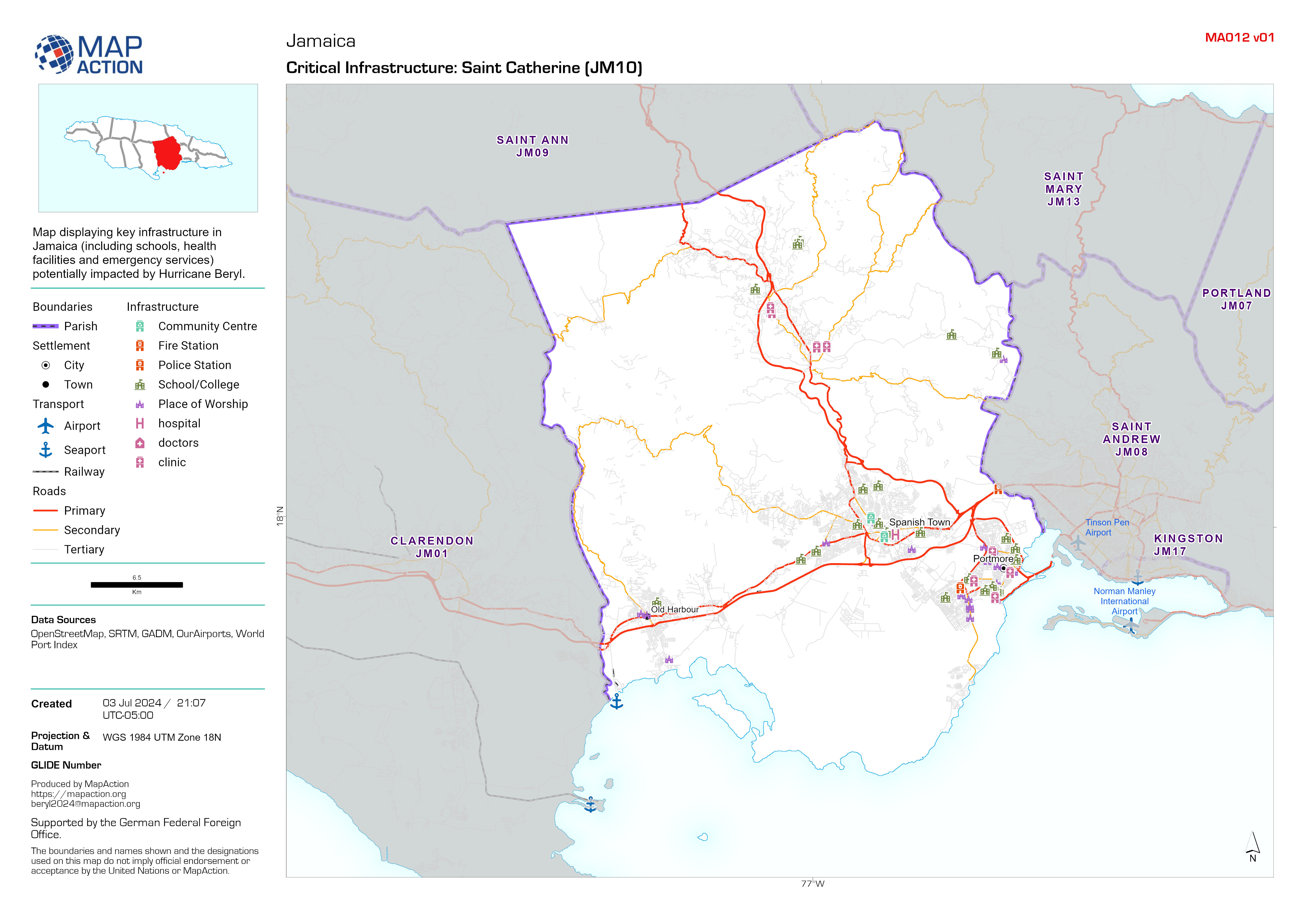
Map displaying key infrastructure in Jamaica (including schools, health facilities and emergency services) potentially impacted by Hurricane Beryl.
Additional Information
| Field | Value |
|---|---|
| Data last updated | July 4, 2024 |
| Metadata last updated | July 4, 2024 |
| Created | July 4, 2024 |
| Format | JPEG |
| License | License not specified |
| Has views | True |
| Id | d6b24e59-fc94-47a2-b0f2-0e14325b2d6d |
| Mimetype | image/jpeg |
| On same domain | True |
| Package id | efd15bb8-0bf8-47af-882a-d6fe2725916e |
| Position | 1 |
| Revision id | 4a8d7f8c-76c2-4f04-9c30-da70b66d14dc |
| Size | 1.3 MiB |
| State | active |
| Url type | upload |