MA007_Dominica_Building_Flood_Risk-300dpi.jpeg
From the dataset abstract
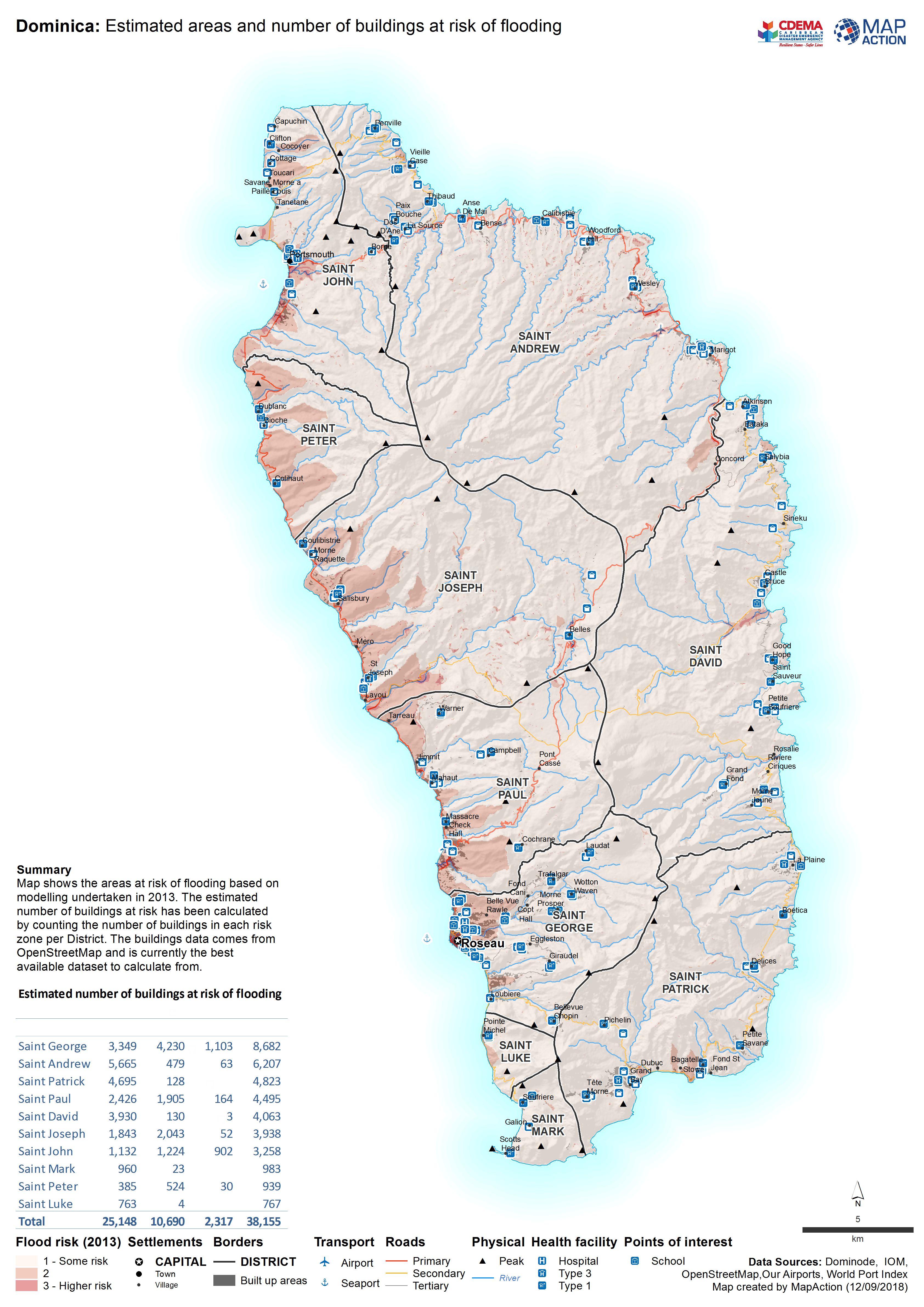
Map shows the areas at risk of flooding based on modelling undertaken in 2013. The estimated number of buildings at risk has been calculated by counting the number of buildings in each...
Source: Dominica: Estimated areas and number of buildings at risk of flooding
Additional Information
| Field | Value |
|---|---|
| Data last updated | September 13, 2018 |
| Metadata last updated | September 13, 2018 |
| Created | September 13, 2018 |
| Format | JPEG |
| License | License not specified |
| Has views | True |
| Id | b4039a68-f37f-43ce-bb19-5e5b2fcca4cc |
| On same domain | True |
| Package id | 94d2305b-6de3-4418-bd0c-5c77a8790482 |
| Revision id | 5d7022b7-94d8-4de9-921f-7baaafc396e7 |
| State | active |
| Url type | upload |