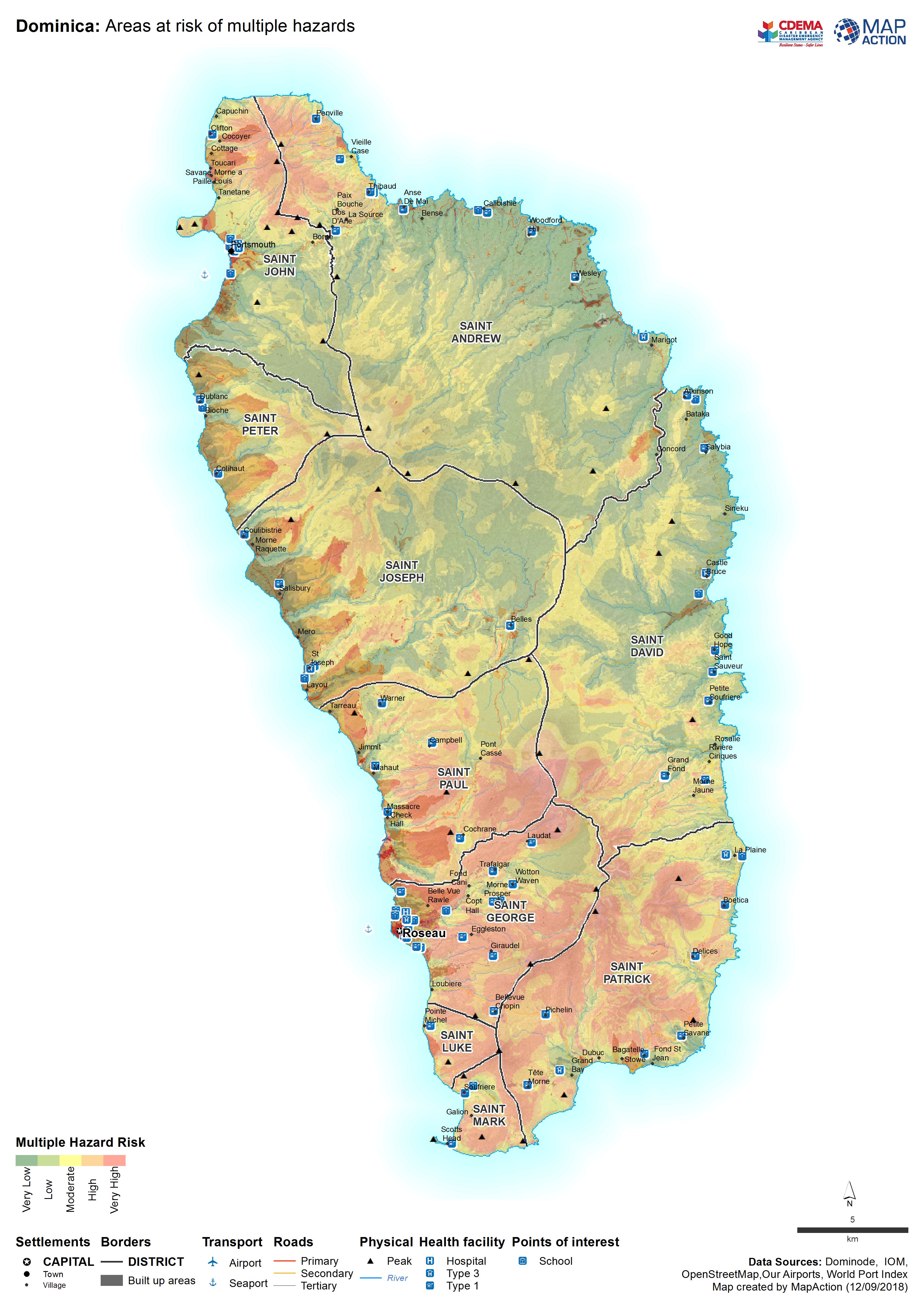
MA006_Dominica_Hazards-300dpi.jpeg
From the dataset abstract
Map shows areas that are at risk of multiple hazards including landslides, storm surge and flooding.
Additional Information
| Field | Value |
|---|---|
| Data last updated | September 13, 2018 |
| Metadata last updated | September 13, 2018 |
| Created | September 13, 2018 |
| Format | JPEG |
| License | License not specified |
| Has views | True |
| Id | f0ae5d69-e1fa-4ed9-a28a-502b70c4ee5e |
| On same domain | True |
| Package id | 649bad67-052c-43c8-9f9b-67c19e1975d5 |
| Revision id | cb19d479-639f-4abd-99c1-3240111d1a3a |
| State | active |
| Url type | upload |
