MA502_StormTrack_Bahamas_v1-300dpi.jpeg
From the dataset abstract
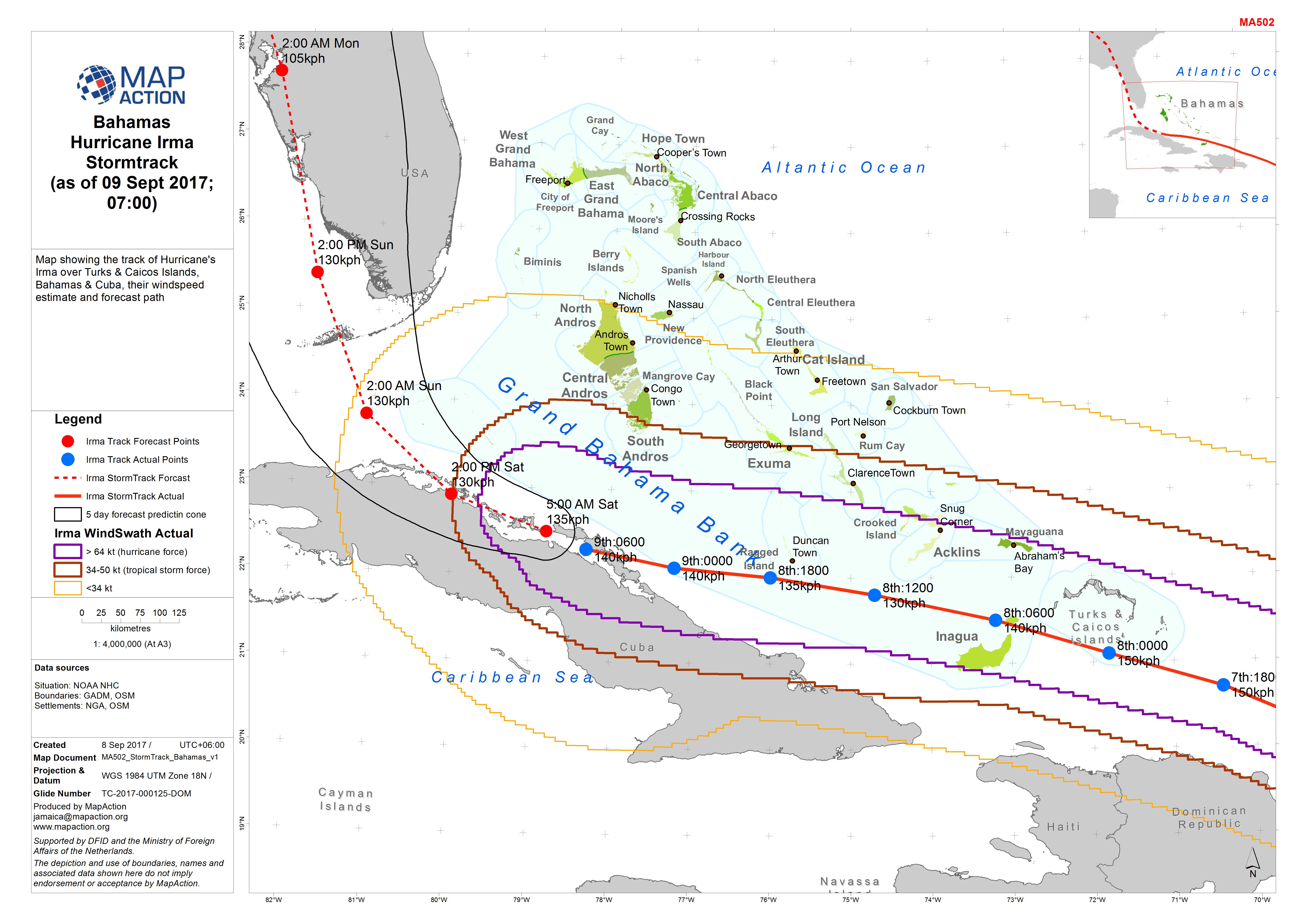
Map showing the track of Hurricane's Irma over Turks & Caicos Islands, Bahamas & Cuba, their windspeed estimate and forecast path
Source: Bahamas Hurricane Irma Stormtrack (as of 09 Sept 2017; 07:00)
Additional Information
| Field | Value |
|---|---|
| Data last updated | September 9, 2017 |
| Metadata last updated | September 9, 2017 |
| Created | September 9, 2017 |
| Format | JPEG |
| License | Creative Commons Attribution |
| Has views | True |
| Id | eab2d081-b5b9-4e3e-bac4-d43ac3b227d5 |
| On same domain | True |
| Package id | 42f7a963-c639-43e5-94b6-30b59970ea87 |
| Revision id | 1d9a342a-6145-40a2-b0bc-ea21b92f7db3 |
| State | active |
| Url type | upload |