MA458_IDA_ProvoLocAreas_v1-300dpi.jpeg
From the dataset abstract
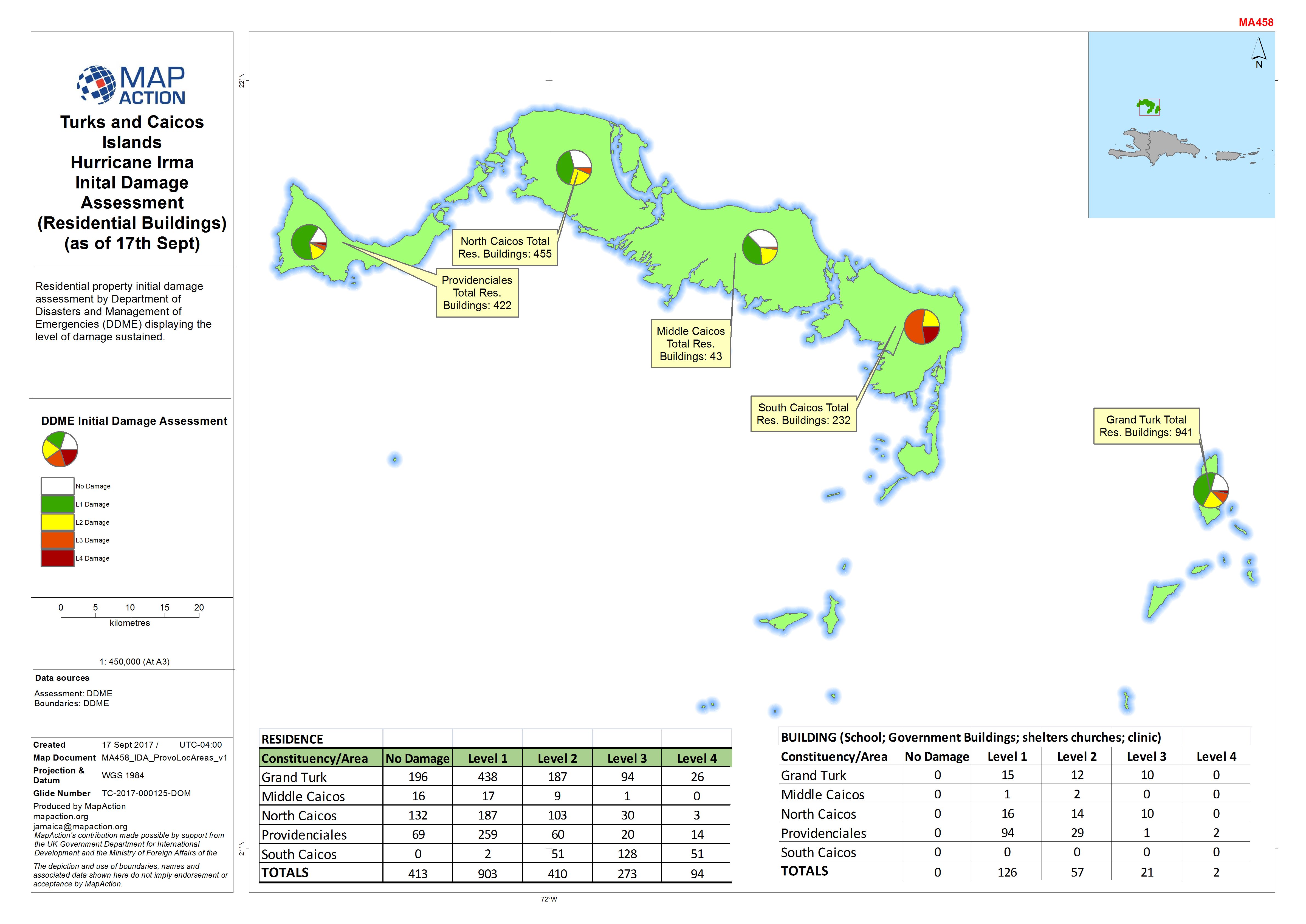
Residential property initial damage assessment by Department of Disasters and Management of Emergencies (DDME) displaying the level of damage sustained.
Additional Information
| Field | Value |
|---|---|
| Data last updated | September 23, 2017 |
| Metadata last updated | September 23, 2017 |
| Created | September 23, 2017 |
| Format | JPEG |
| License | License not specified |
| Has views | True |
| Id | 1e79bcd5-6f2e-4deb-970d-1db7d92633fe |
| On same domain | True |
| Package id | 79a5d88e-466a-4cd6-acd8-99c9748e753b |
| Revision id | a9b0fac5-0125-450a-a875-0cf81b37049a |
| State | active |
| Url type | upload |