MA020_VulnerablePopulation_Admn2-300dpi.jpeg
From the dataset abstract
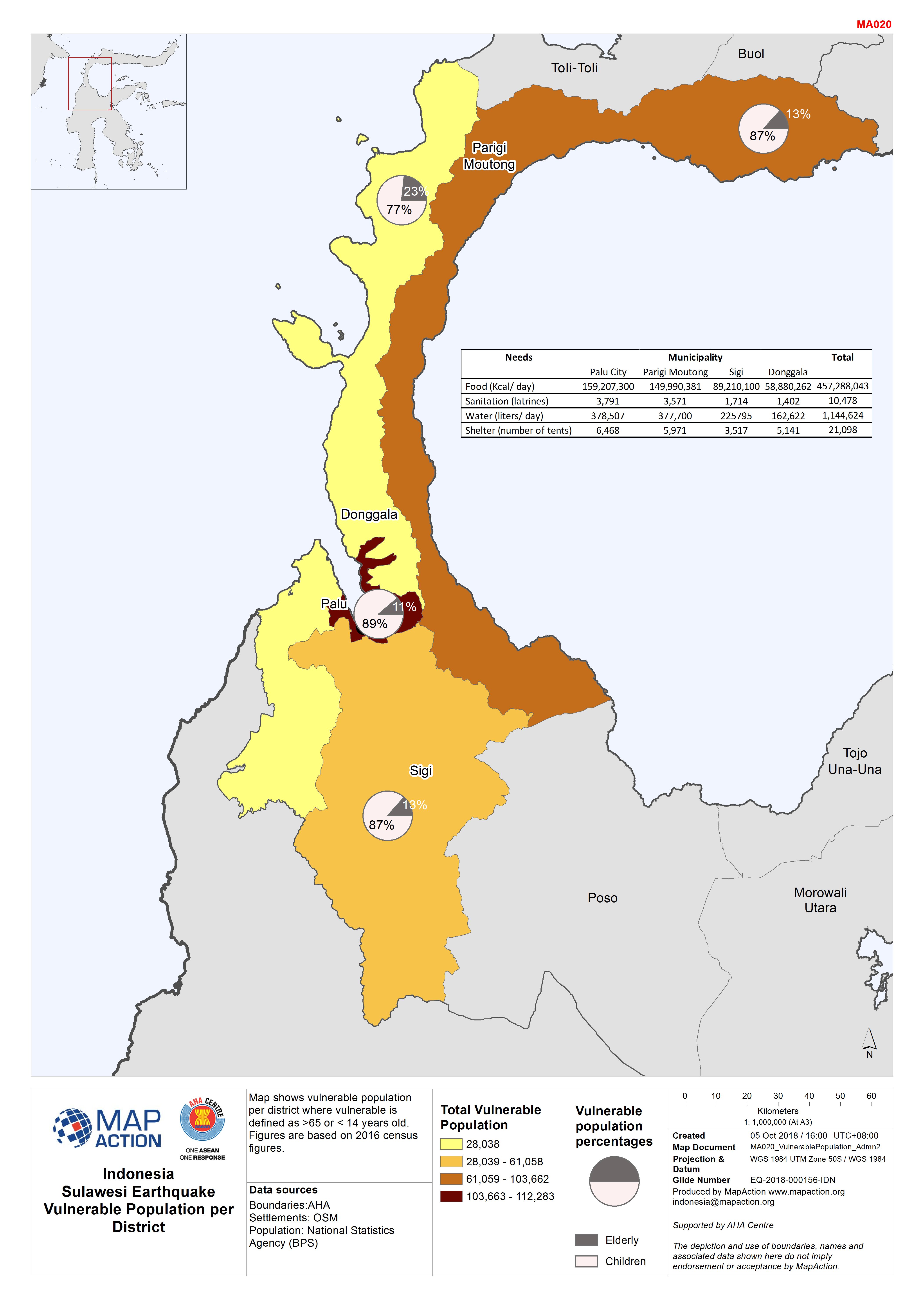
Map shows vulnerable population per district where vulnerable is defined as >65 or < 14 years old. Figures are based on 2016 census figures.
Source: Indonesia Sulawesi Earthquake Vulnerable Population per District
Additional Information
| Field | Value |
|---|---|
| Data last updated | October 5, 2018 |
| Metadata last updated | October 5, 2018 |
| Created | October 5, 2018 |
| Format | JPEG |
| License | License not specified |
| Has views | True |
| Id | 95426263-c6e7-4882-b54a-b9413f8be113 |
| On same domain | True |
| Package id | 27a961c3-b283-44c3-b821-7897aa94b5b2 |
| Revision id | 5c9f5d4f-1219-420a-a32b-0432bf2eeb4a |
| State | active |
| Url type | upload |