thumbnail.png
From the dataset abstract
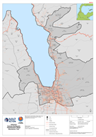
Map shows the administrative village (admin level 4) boundaries for the Palu Region of Central Sulawesi and road network.
Source: Indonesia Sulawesi Earthquake Administrative Village Boundaries: Palu
Additional Information
| Field | Value |
|---|---|
| Data last updated | October 3, 2018 |
| Metadata last updated | October 3, 2018 |
| Created | October 3, 2018 |
| Format | PNG |
| License | License not specified |
| Has views | True |
| Id | 31f66b96-7020-4abb-bb81-9d8f6b0c8fc0 |
| On same domain | True |
| Package id | 81947d8b-5310-48e3-8bda-e8ff8393fa5f |
| Position | 2 |
| Revision id | 888aca06-df72-4a9f-9064-2ed0e8719b46 |
| State | active |
| Url type | upload |