thumbnail.png
From the dataset abstract
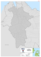
Map shows the administrative village (admin level 4) boundaries for the Sigi Region of Central Sulawesi
Source: Indonesia Sulawesi Earthquake Administrative Village Boundaries: Sigi
Additional Information
| Field | Value |
|---|---|
| Data last updated | October 2, 2018 |
| Metadata last updated | October 2, 2018 |
| Created | October 2, 2018 |
| Format | PNG |
| License | License not specified |
| Has views | True |
| Id | ad789cf5-0a1f-4640-83bd-f93d71add9d8 |
| On same domain | True |
| Package id | 99a7867a-9e1e-441e-b4da-ed70af93b4ee |
| Position | 2 |
| Revision id | 63908e5a-b4ae-46a0-b6f7-6aefabad5571 |
| State | active |
| Url type | upload |