thumbnail.png
From the dataset abstract
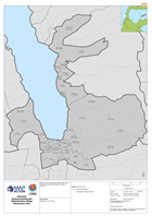
Map shows the administrative village (admin level 4) boundaries for the Palu Region of Central Sulawesi
Source: Indonesia Sulawesi Earthquake Administrative Village Boundaries: Palu
Additional Information
| Field | Value |
|---|---|
| Data last updated | October 2, 2018 |
| Metadata last updated | October 2, 2018 |
| Created | October 2, 2018 |
| Format | PNG |
| License | License not specified |
| Has views | True |
| Id | 836ffc8a-d757-40d2-8e49-cd9a3fb87ecc |
| On same domain | True |
| Package id | d1aa776b-63f7-47cd-9867-4e56ee161d76 |
| Position | 2 |
| Revision id | 512b913b-f03f-4e81-99a5-8e97ebc86fdf |
| State | active |
| Url type | upload |