MA003_Sulawesi_population-300dpi.jpg
From the dataset abstract
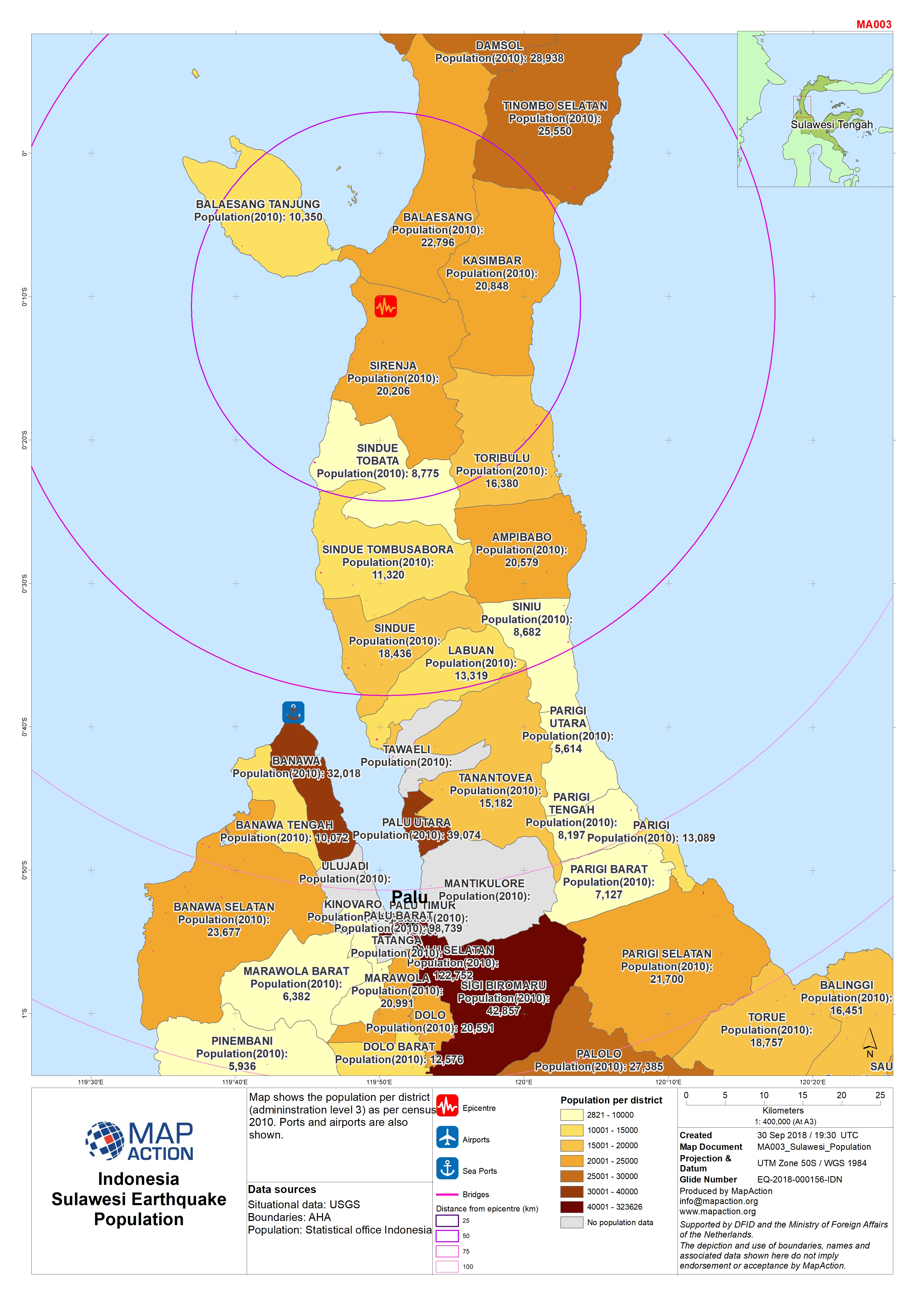
Map shows population per district (admininstration level 3). Ports are also shown.
Source: Sulawesi Earthquake - Population
Additional Information
| Field | Value |
|---|---|
| Data last updated | October 1, 2018 |
| Metadata last updated | October 1, 2018 |
| Created | October 1, 2018 |
| Format | JPEG |
| License | Creative Commons Attribution |
| Has views | True |
| Id | 834f9085-8e6d-46db-be34-5a675881f8b8 |
| On same domain | True |
| Package id | 445c25d3-6133-47c0-974d-2d6d75845b4e |
| Revision id | ba8a1f81-f6cb-426e-bd2c-8a958b332a44 |
| State | active |
| Url type | upload |