MA038_Haiti_Security_V1_A3-300dpi.jpeg
From the dataset abstract
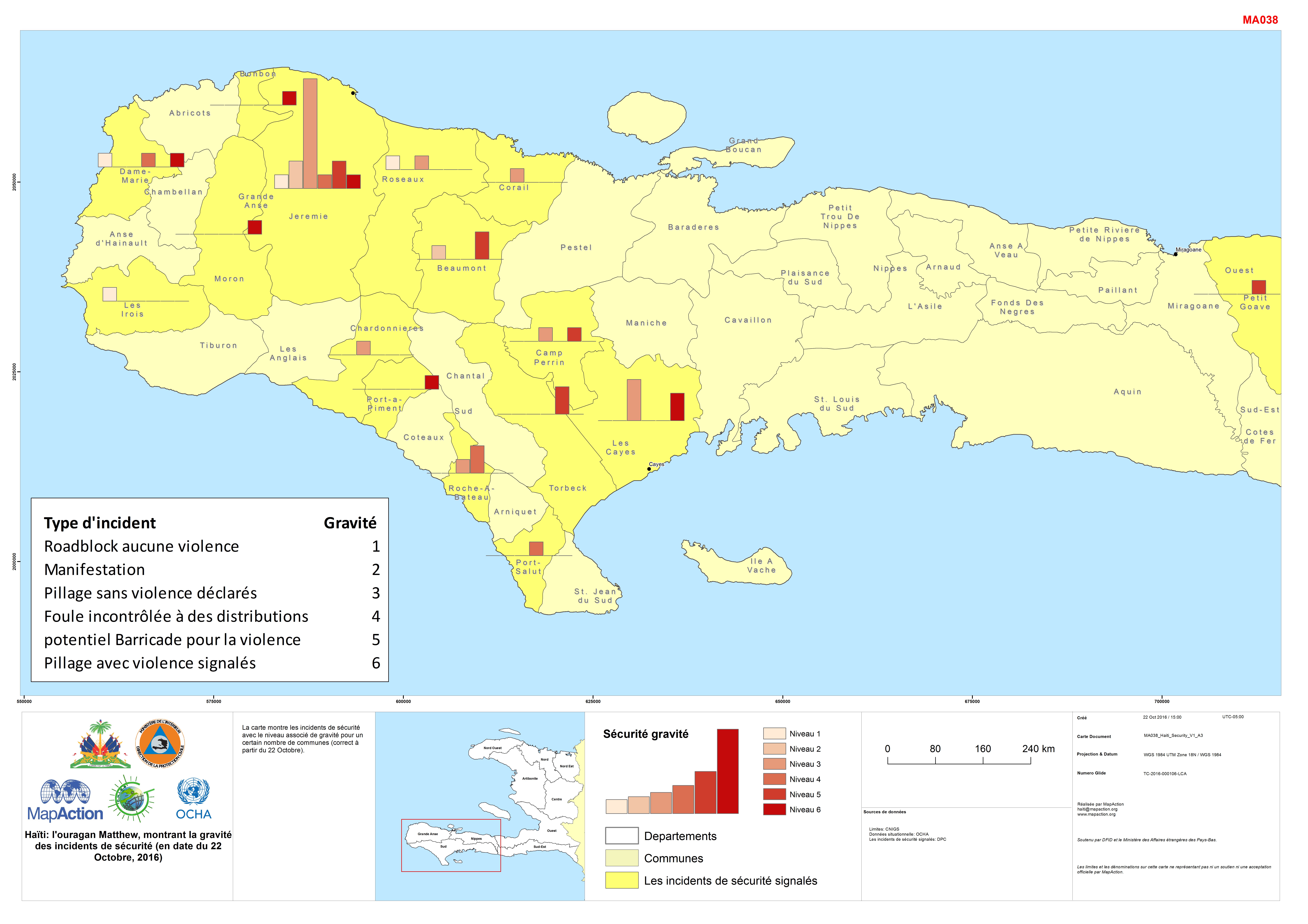
La carte montre les incidents de sécurité avec le niveau associé de gravité pour un certain nombre de communes (correct à partir du 22 Octobre).
Additional Information
| Field | Value |
|---|---|
| Data last updated | October 24, 2016 |
| Metadata last updated | October 24, 2016 |
| Created | October 24, 2016 |
| Format | JPEG |
| License | License not specified |
| Has views | True |
| Id | 6afd1d8b-c39f-450b-8e20-345d98adaf10 |
| On same domain | True |
| Package id | fb7603ce-c97a-49cb-bd26-7a7b9f436042 |
| Position | 1 |
| Revision id | 8e1f62e6-e648-4f8b-a5c4-20d382bb1c22 |
| State | active |
| Url type | upload |
