MA028_Haiti_Damaged_Areas_v1_A3-300dpi.jpeg
From the dataset abstract
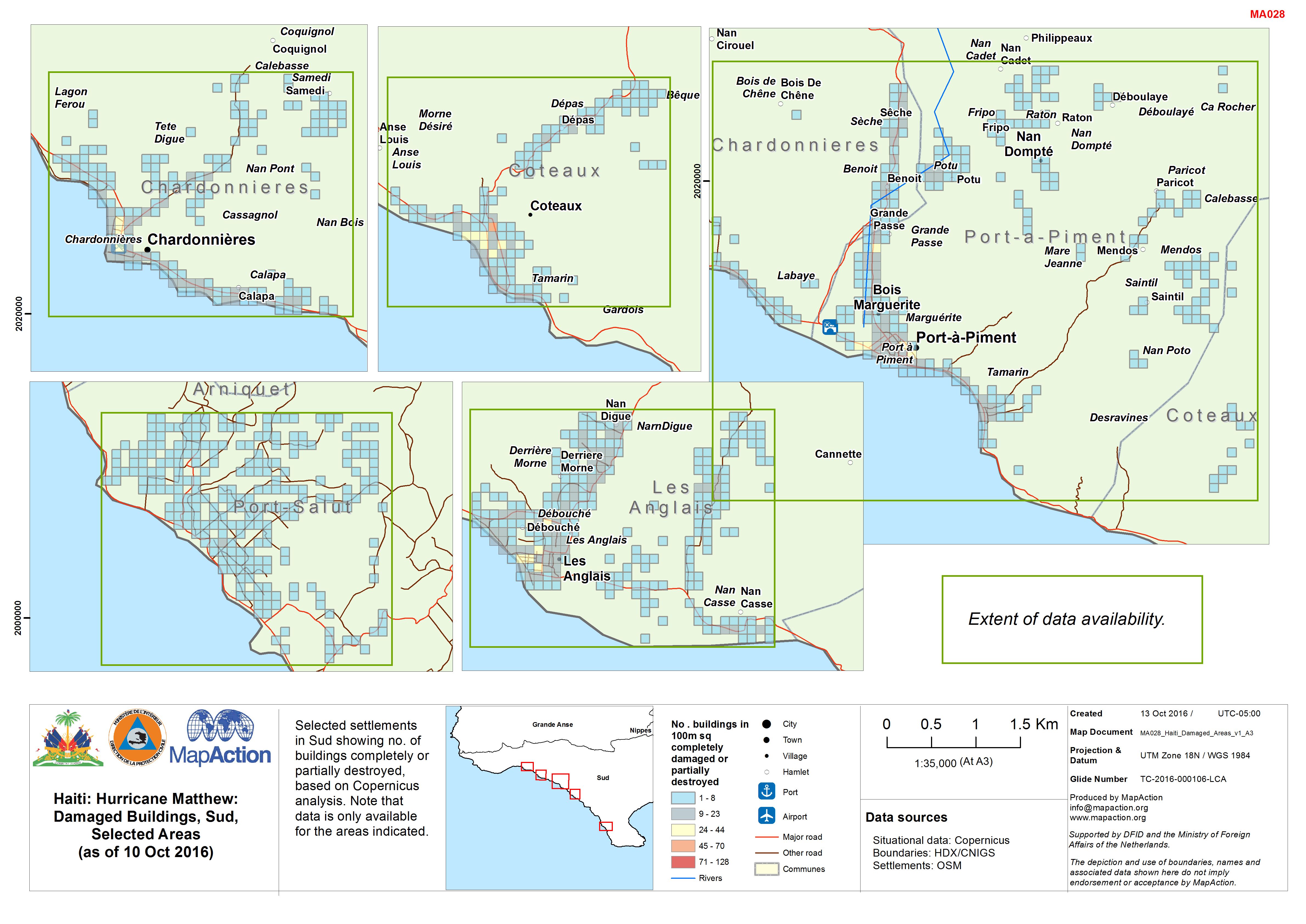
Selected settlements in Sud showing no. of buildings completely or partially destroyed, based on Copernicus analysis. Note that data is only available for the areas indicated.
Source: Haiti: Hurricane Matthew: Damaged Buildings, Sud, Selected Areas (as of 10 Oct 2016)
Additional Information
| Field | Value |
|---|---|
| Data last updated | October 13, 2016 |
| Metadata last updated | October 13, 2016 |
| Created | October 13, 2016 |
| Format | JPEG |
| License | Other (Public Domain) |
| Has views | True |
| Id | 8c016409-ce3d-483a-9af3-8ddc2fe5c0ee |
| On same domain | True |
| Package id | ea72a391-0c97-49c0-a5f4-fe153cdb7b29 |
| Revision id | 71a1377b-488d-4223-99bf-84907ff8bdc6 |
| State | active |
| Url type | upload |