ma4010-iraq-shelter-type.jpg
From the dataset abstract
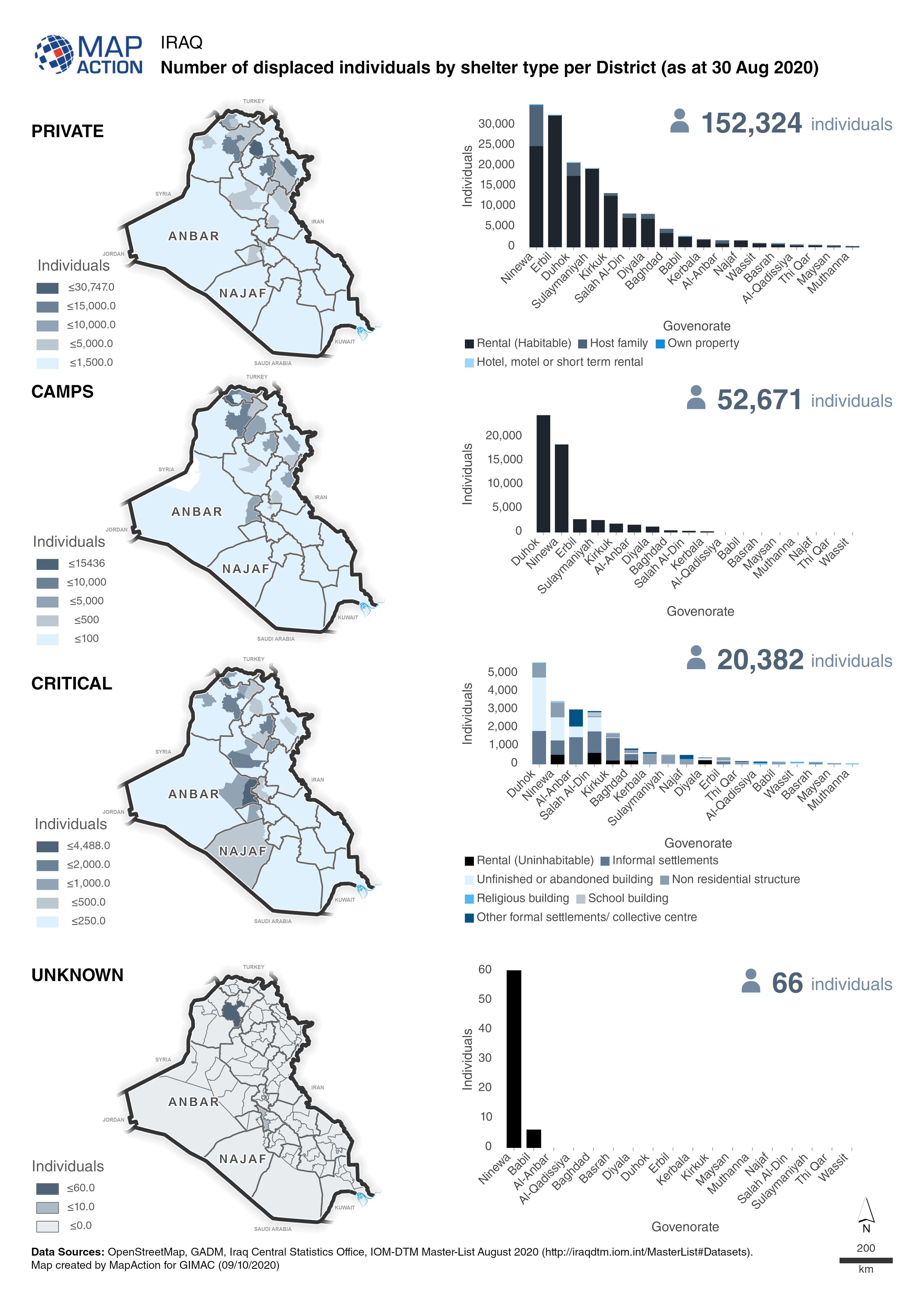
Maps and charts show a breakdown of the number displaced individuals in private accomodation, camps, critical shelters or unknown.
Source: Iraq: Number of displaced individuals by shelter type per district (as at 30 August 2020)
Additional Information
| Field | Value |
|---|---|
| Data last updated | August 25, 2021 |
| Metadata last updated | August 25, 2021 |
| Created | August 25, 2021 |
| Format | JPEG |
| License | License not specified |
| Has views | True |
| Id | a75405cf-350c-4929-a797-e2b47ad4c08d |
| Mimetype | image/jpeg |
| On same domain | True |
| Package id | 3802953f-1419-4bd1-a2ed-a24e6c2aa628 |
| Revision id | 4fa0552c-863b-4779-991d-854144248625 |
| Size | 3.2 MiB |
| State | active |
| Url type | upload |