thumbnail.png
From the dataset abstract
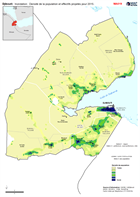
Population Density for 2018 with population totals projected forward from 2009 census to 2015 for Admin Level 1 (District/Region) and Admin Level 2 (Prefecture, Sous Prefecture and...
Source: Djibouti: Inondation: Densité de la population et effectifs projetés pour 2015.
Additional Information
| Field | Value |
|---|---|
| Data last updated | December 17, 2019 |
| Metadata last updated | December 17, 2019 |
| Created | December 17, 2019 |
| Format | PNG |
| License | License not specified |
| Has views | True |
| Id | cbc532e3-143e-462a-b29c-ff5a5e1342b4 |
| Mimetype | image/png |
| On same domain | True |
| Package id | e2f87a4b-374b-467e-90f3-832a05a21d37 |
| Position | 2 |
| Revision id | f16469f5-44b6-4536-ac35-c40ae0e1d83d |
| Size | 28.1 KiB |
| State | active |
| Url type | upload |