MA010-v01-bdi-pop-regions-300dpi.jpg
From the dataset abstract
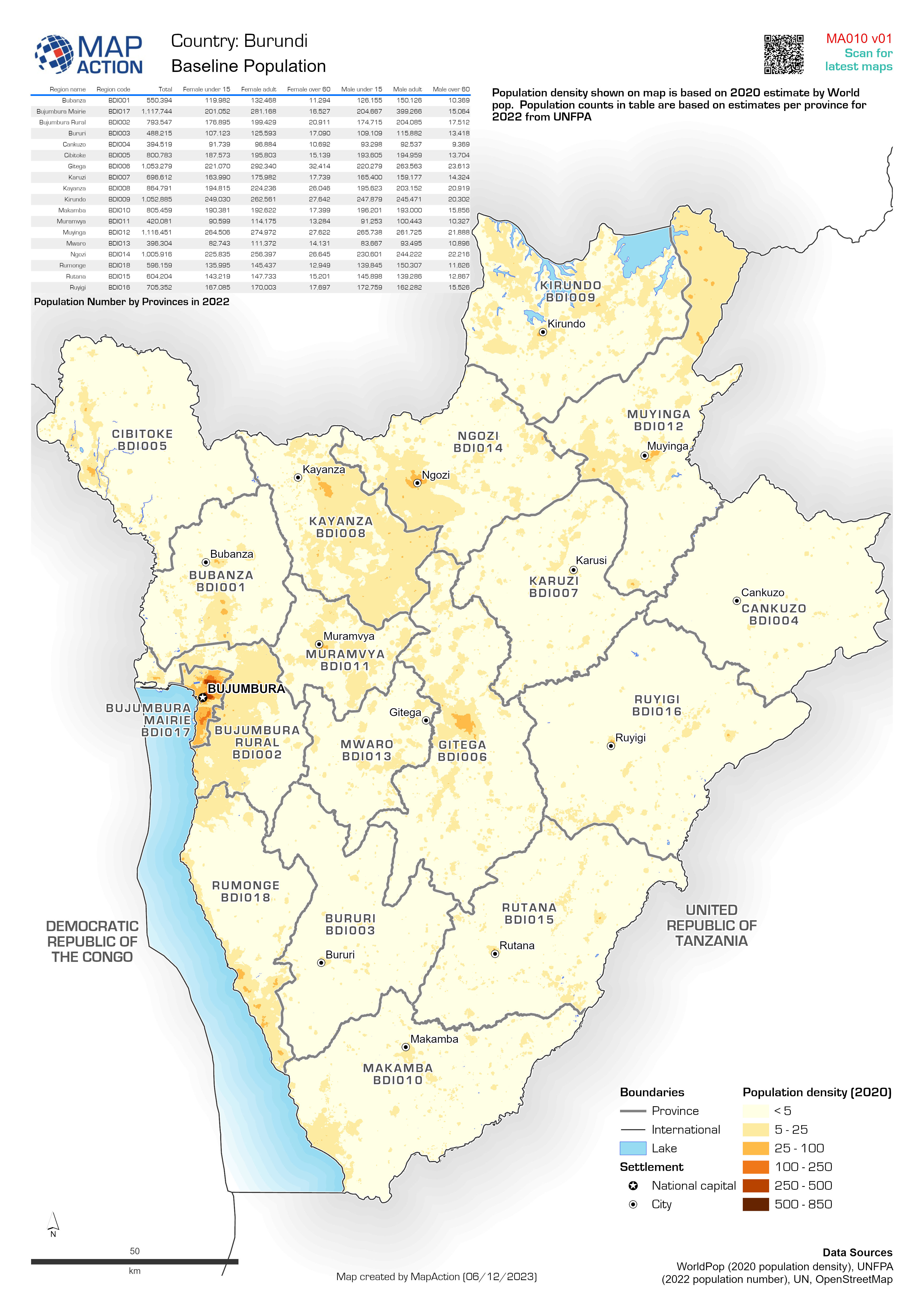
A map of population number (2022) and density (2020) by provinces.
Source: Baseline Population
Additional Information
| Field | Value |
|---|---|
| Data last updated | December 8, 2023 |
| Metadata last updated | December 8, 2023 |
| Created | December 8, 2023 |
| Format | JPEG |
| License | License not specified |
| Has views | True |
| Id | 7a942061-97e3-46c9-9da3-631caf857915 |
| Mimetype | image/jpeg |
| On same domain | True |
| Package id | 78a4b537-7681-4ce9-a2b5-7754ffac10fa |
| Position | 1 |
| Revision id | ffe68ffb-f3fe-4922-af36-bc9c627aa566 |
| Size | 1.6 MiB |
| State | active |
| Url type | upload |