MA021 - Sheet 2 - Lowe Sound
From the dataset abstract
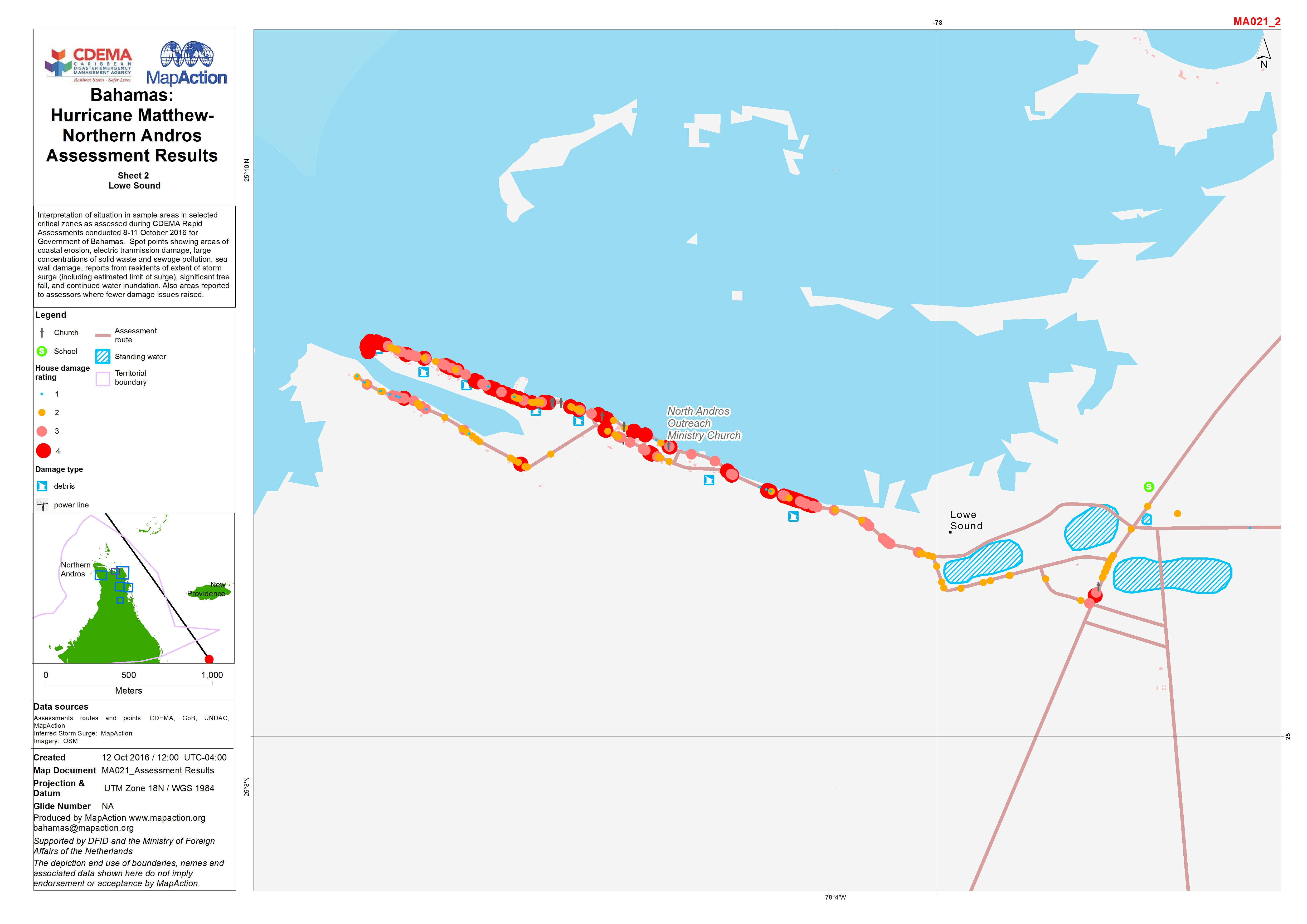
Interpretation of situation in sample areas in selected critical zones as assessed during CDEMA Rapid Assessments conducted 8-11 October 2016 for Government of Bahamas. Spot points...
Source: Bahamas: Hurricane Matthew - Northern Andros Assessment Results
Additional Information
| Field | Value |
|---|---|
| Data last updated | October 26, 2016 |
| Metadata last updated | October 26, 2016 |
| Created | October 26, 2016 |
| Format | JPEG |
| License | License not specified |
| Has views | True |
| Id | 48354495-7dbd-48e2-968d-78b4f4584786 |
| On same domain | True |
| Package id | f36430b4-1db8-46b4-9af9-c9bbc8d470c9 |
| Position | 2 |
| Revision id | 5c6e07c6-7993-4861-89f1-2d1c2eb25f6f |
| State | active |
| Url type | upload |