MA008_AssessmentResults_Page_1.jpg
From the dataset abstract
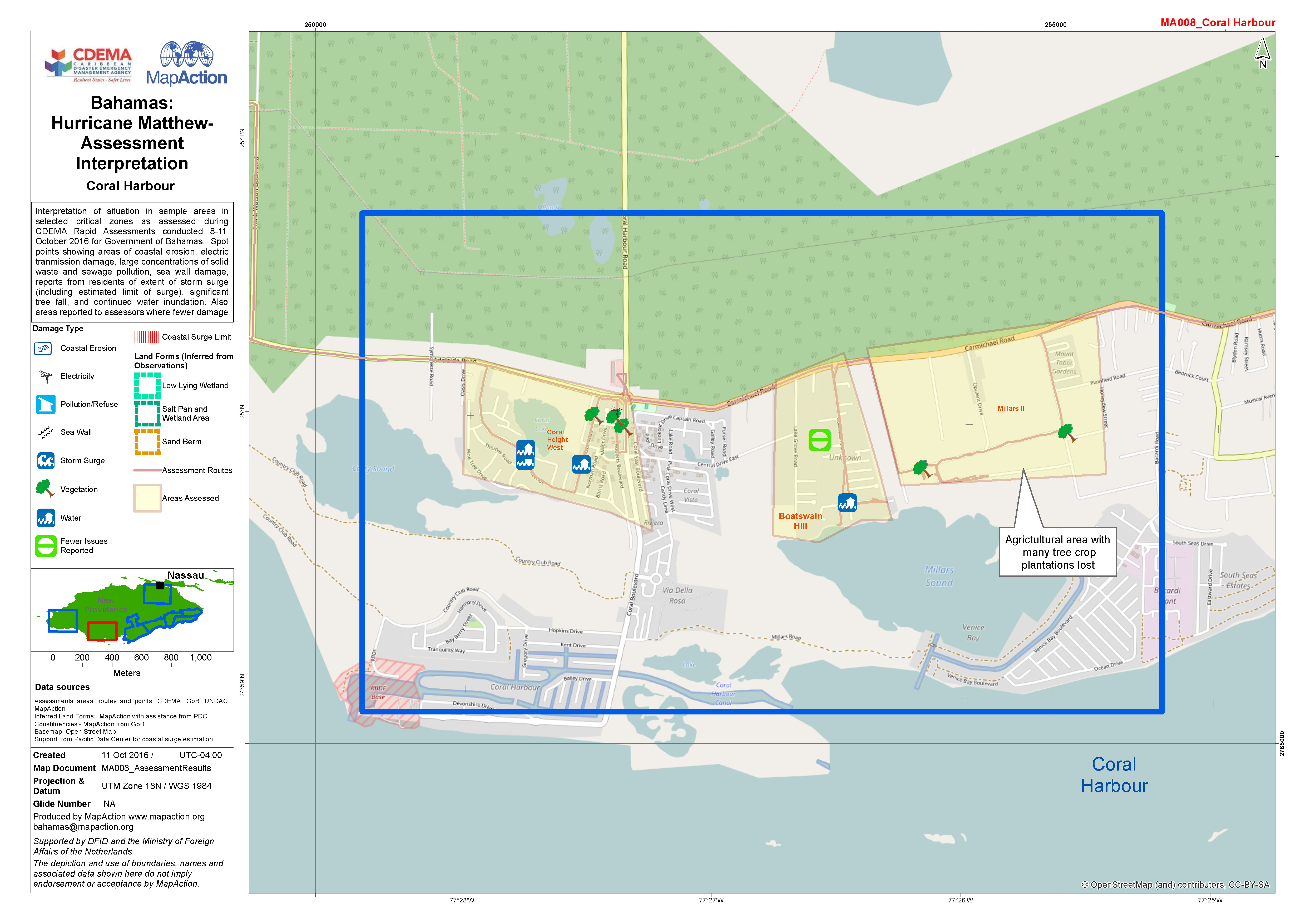
Interpretation of situation in sample areas in selected critical zones as assessed during CDEMA Rapid Assessments conducted 8-11 October 2016 for Government of Bahamas. Spot points...
Source: Bahamas: Hurricane Matthew- Assessment Interpretation
Additional Information
| Field | Value |
|---|---|
| Data last updated | October 24, 2016 |
| Metadata last updated | October 24, 2016 |
| Created | October 24, 2016 |
| Format | JPEG |
| License | License not specified |
| Has views | True |
| Id | 78332c01-3e35-4c82-86d5-dae63e26aa9d |
| On same domain | True |
| Package id | 620afde7-c751-4c5b-95ad-5b07ea371d43 |
| Position | 1 |
| Revision id | 0a71d022-90c0-481e-bbbc-c9c74f03fd72 |
| State | active |
| Url type | upload |